• Our booking engine at tickets.railforums.co.uk (powered by TrainSplit) helps support the running of the forum with every ticket purchase! Find out more and ask any questions/give us feedback in this thread!

Can UK public buses do real-time tracking?

Status
Not open for further replies.

Dai Corner

Established Member
Joined
20 Jul 2015
Messages
6,337
It should be possible to get an app that works for all buses in a particular region, if not the whole country, as is the case in Denmark, Switzerland and the Netherlands. There are nationwide real time apps such as UK Bus Checker which have real time info for some areas but in others it only shows scheduled timings, even where the operator does its own real time info, for example Stagecoach.

Google Maps?
 
Sponsor Post - registered members do not see these adverts; click here to register, or click here to log in
R

RailUK Forums

KGGXXXY

Member
Joined
4 Aug 2017
Messages
141
Location
Glasgow
Edinburgh has done real time tracking (at bus stops and online) for years, when I lived there Lothian (and subsidiaries) were the only buses that were live, however the system is operated by Edinburgh City Council and is open to other operators. http://www.mybustracker.co.uk/
 

Deerfold

Veteran Member
Joined
26 Nov 2009
Messages
12,618
Location
Yorkshire
Has London changed its system, as I know when it was starting to be rolled out it was based on passing beacons mounted on street furniture?

It has - I worked on both systems (at one point my job was working out where to put new beacons).

The original AVL system relied on buses contacting a central system every 30 seconds - they reported the last radio beacon they passed and how many metres they'd travelled since then from an on-bus odometer.

The main problem with this system was that we only knew exactly where the bus was as it passed a beacon - and if an unexpected diversion took the bus off route and it didn't pass any other beacons the system assumed it was passing down the normal route.

Other problems were that the system did not know anything about a bus until it left the first stand on the route (which in some cases was the first stop) - so predictions for early stops on a route were not much use; beacons either had internal batteries (about 90%) which needed replacing approx every 5 years - or were connected to a power supply. Beacons around Heathrow tended to fail regularly as signals from radar were similar to the signals from a bus, activating them frequently.

At the time the original system was introduced, GPS could only be used to calculate location within about 100m.

The new system (iBus) replaced this between 2007-2009. Initially a system converted the output to be the same as the old system to then feed into the old signs (there were about 1800). New signs (Countdown II) were rolled out - there are around 2600 (initially 5000 were planned, but budget cuts halved this - a few are funded by other means than the original budget - section 106 agreements etc).

The system also provided a new radio system and provision for On Bus Next Stop Signs aboard all buses.

The new system uses GPS, an odometer, a turn rate sensor and a gyroscope to provide an accuracy to within 10m every 30 seconds.
 

Dai Corner

Established Member
Joined
20 Jul 2015
Messages
6,337
Does that do real time information for Stagecoach services, not just scheduled times?

I don't know (hence the question mark) but the functionality is in the App and they are actively seeking operators who want to provide the data.

https://maps.google.com/help/maps/mapcontent/transit/live-updates.html

Live Transit Updates
What is Live Transit Updates for Google Maps?
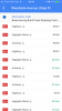
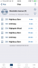
Live Transit Updates is a service providing real-time transit updates to users of Google Maps and Google Maps for mobile. These updates include live departure and arrival times to transit stations, as well as service alerts.


What does Live Transit Updates mean for you as a transit partner?
Providing transit updates in real-time to users greatly enhances their experience of your transit services. Providing up-to-date information about current arrival and departure times allows users to plan their trips even more smoothly. And, in case of an unfortunate delay, a rider would be relieved to know that they can stay home a little bit longer.

How does it work?
At this time, Live Transit Updates provide 2 types of real-time updates to users: live departure times and service alerts. These updates should be provided in feeds by transit partners. We created the GTFS-realtime feed format that complements the widely used GTFS format for static transit schedules. Your feed needs to be available on a location where we can fetch it periodically. The updates in the feed will be immediately processed as Live Transit Updates information.

I want to participate. Where do I start?
In order for Google to provide live updates on your fleet, we need to have your static schedule information available through Google Maps first. If you don’t provide your static schedule information yet, please follow the instructions to participate.

If your static transit information is available in Google Maps, please fill out the contact form. We will get back to you on how to create the appropriate feeds with real-time updates.

Useful resources
GTFS-realtime specification

GTFS specification
 

jon0844

Veteran Member
Joined
1 Feb 2009
Messages
28,041
Location
UK

When it works. HCC admit they have a number of issues some years on and the data isn't in a format that's open, so you won't get live data on the many apps (or Google Maps) making it a bit of a joke.

Their own app is awful and the websites terrible often having Google's own bus stop locations and secondary ones overlaid, that aren't even in the right position!

There is also no way for HCC to show a bus that's cancelled and the way things are shown you don't even know what bus it is that the time is for.

Finally their system still does some guesswork and can result in a bus showing as 9 minutes away then turning up in half that and making you miss it if you were silly enough to trust it.
 

Bantamzen

Established Member
Joined
4 Dec 2013
Messages
9,711
Location
Baildon, West Yorkshire
Some West Yorkshire TOCs have their own apps, but WY Metro have an overarching tracker that reports on most services:

http://yournextbus.wymetro.com/?requestType=route&query=

Either the unique bus stop number, or the service number can be used to search and once a stop is selected there is also a 'nearby stops' map that can be used. Additionally there are QR / NFC tags at bus stops that launch a mobile based site with the stop's live data. Generally speaking its not too bad, although some operators are more sketchy than others at ensuring that the GPS is active & updating the system with cancellations.

In all honesty it could do with some work, and the operators could do more to ensure data is accurate but its good enough to get by most times. One of the best systems I've seen in recent times was on Oahu of all of the places. The mobile app was great for getting around the island, was based on Google maps with their own overlay showing stops, services calling at them an even the approximate location of each bus. Very handy for maximising the time visiting places and getting in that extra Mai Tai...!! :D
 

bussnapperwm

Established Member
Joined
18 May 2014
Messages
1,509
Rotala's Diamond Bus, Diamond Bus North West and Hotel Hoppa have it on their websites
 

alchemy

Member
Joined
14 Jan 2013
Messages
135
Location
orkney
Lothian has it and the tfeapp.com/live shows all buses on the network including Tours, East Coast Buses And Airport Services
The mobile phone app will give you times at any bus stop and the vehicle fleet number of the due bus (also the next 2 0r 3)
 

dgl

Established Member
Joined
5 Oct 2014
Messages
2,405
Dorset have it through dorsetforyou.com/travel-Dorset .

Works well for the bus stops in Weymouth where I have used it although the real time data is no longer there for First buses (probably due to the new ticketr machines not being on the system yet) and I'm not sure if south west coaches have it for their wyke buses.
 

Andyh82

Established Member
Joined
19 May 2014
Messages
3,525
Go North East have real time on their new app, with a map that shows where all the buses are, theirs even shows the bus fleet numbers!
 

Jordan Adam

Established Member
Joined
12 Sep 2017
Messages
5,526
Location
Aberdeen
First Aberdeen has had it over 2 decades now. Stagecoach North Scotland started doing it too a few years back but with them it's more limited and only on certain buses (Generally buses 2014 or newer). In a case where a bus does not have it fitted the displays just show the same time as the timetable.

Some of the AVL discs on the B10BLEs here actually came off Atlanteans!
 

Hophead

Established Member
Joined
5 Apr 2013
Messages
1,193
Operations using Google Maps (times in green are real-time, at least on a PC):

  • TfL
  • Lothian
  • Arriva
  • Metrobus (but not all vehicles by any means)
  • Bluestar (also not all vehicles)

Are there more? There must be.

Brighton & Hove have a Google Map embedded on their website as well as an App. No idea why they can't make that available on the actual Google Maps.

Metrobus also have a website map.
 

Deerfold

Veteran Member
Joined
26 Nov 2009
Messages
12,618
Location
Yorkshire
Operations using Google Maps (times in green are real-time, at least on a PC):
  • TfL
  • Lothian
  • Arriva
  • Metrobus (but not all vehicles by any means)
  • Bluestar (also not all vehicles)

Are there more? There must be.
West Yorkshire times appear on Google. Most buses are fitted with the equipment.
I think all Transdev Yorkshire and Lancashire services do too.
 

Hophead

Established Member
Joined
5 Apr 2013
Messages
1,193
West Yorkshire times appear on Google. Most buses are fitted with the equipment.
I think all Transdev Yorkshire and Lancashire services do too.

I've just checked for Leeds - Arriva are there, but not First or Harrogate. We're talking real-time. Pretty much every scheduled departure throughout the UK can be found on Google.
 

SCH117X

Established Member
Joined
27 Nov 2015
Messages
1,556
Problem with RTT is when services get diverted; you still get told there will be a bus in x minutes from a stop that has not seen a bus all day. Some diversions are pretty standard so it should not be too difficult to set up diversionary data that can be activated simply so that the stops not being served gave out data to that effect.
 

The Ham

Established Member
Joined
6 Jul 2012
Messages
10,313
It has - I worked on both systems (at one point my job was working out where to put new beacons).

The original AVL system relied on buses contacting a central system every 30 seconds - they reported the last radio beacon they passed and how many metres they'd travelled since then from an on-bus odometer.

The main problem with this system was that we only knew exactly where the bus was as it passed a beacon - and if an unexpected diversion took the bus off route and it didn't pass any other beacons the system assumed it was passing down the normal route.

Other problems were that the system did not know anything about a bus until it left the first stand on the route (which in some cases was the first stop) - so predictions for early stops on a route were not much use; beacons either had internal batteries (about 90%) which needed replacing approx every 5 years - or were connected to a power supply. Beacons around Heathrow tended to fail regularly as signals from radar were similar to the signals from a bus, activating them frequently.

At the time the original system was introduced, GPS could only be used to calculate location within about 100m.

The new system (iBus) replaced this between 2007-2009. Initially a system converted the output to be the same as the old system to then feed into the old signs (there were about 1800). New signs (Countdown II) were rolled out - there are around 2600 (initially 5000 were planned, but budget cuts halved this - a few are funded by other means than the original budget - section 106 agreements etc).

The system also provided a new radio system and provision for On Bus Next Stop Signs aboard all buses.

The new system uses GPS, an odometer, a turn rate sensor and a gyroscope to provide an accuracy to within 10m every 30 seconds.

Thank you.

I was aware of some of the original Countdown system as I worked for a company that was contacted to survey some of the bus stops proposed to have it at the time.
 

JamesRowden

Established Member
Joined
31 Aug 2011
Messages
1,713
Location
Ilfracombe
By travelling to other place, found that some countries has made their buses real time tracking so the citizen there can know where and when the bus arrive.
Thought this is good project.
What do you think of this and if we do, how?
http://www.nextbuses.co.uk/
This data is also shown in the traveline apps which use GPS to know where you are and so can easily find live departures from stops (including railway stations) nearby, and it can suggest routes by public transport to get to a destination from your present location.
 

brompton rail

Member
Joined
28 Oct 2009
Messages
754
Location
Doncaster
In South Yorkshire real time bus times have been available for many years. First Bus’ app delivers their own services, but UK Bus Checker gives all operators at each bus stop, as well as rail departures if you click onto a station.

The App will show a location map with bus stops and a list of bus stops with service numbers. Bus routes are also shown.
 

jon0844

Veteran Member
Joined
1 Feb 2009
Messages
28,041
Location
UK
All buses should be visible on the likes of Google Maps, which has excellent multi modal route planning. It falls apart when it has to guess things and could show services that don't exist.
 

Dai Corner

Established Member
Joined
20 Jul 2015
Messages
6,337
All buses should be visible on the likes of Google Maps, which has excellent multi modal route planning. It falls apart when it has to guess things and could show services that don't exist.

What does Google Maps guess? It's presenting data from the operators so as far as I can see it would only show services that don't exist if they supply incorrect data.
 

route101

Established Member
Joined
16 May 2010
Messages
10,609
First Glasgow have it on there app but i think the only real time if the theres green icon and only shows i think within a timeframe otherwise time is in black . Last week before i left the house it said 8 minutes till bus due then jumped to 15 minutes once i got to bus stop , i dont know what happened there i live 15 mins from ther starting point .
It would very useful if you could see your bus on google maps and if every bus was shown as real time .
 

Deerfold

Veteran Member
Joined
26 Nov 2009
Messages
12,618
Location
Yorkshire
I've just checked for Leeds - Arriva are there, but not First or Harrogate. We're talking real-time. Pretty much every scheduled departure throughout the UK can be found on Google.

I know we're talking real time. I don't use First Leeds much, but see real-time on the X84 regularly and use First Halifax all the time. The 36 should be real time too. Most of my buses in Keighley work on it too. The system does seem to throw a wobbly every now and then and the realtime info doesn't get through - looks like it is now.
 

takno

Established Member
Joined
9 Jul 2016
Messages
5,060
What does Google Maps guess? It's presenting data from the operators so as far as I can see it would only show services that don't exist if they supply incorrect data.
As far as I can see it pretty much guesses everything. I wouldn't trust a journey I'd planned with it for anything much
 

ag51ruk

Member
Joined
29 Oct 2014
Messages
629
As far as I can see it pretty much guesses everything. I wouldn't trust a journey I'd planned with it for anything much
It doesn't guess, it uses the Traveline timetable data to show scheduled times, and real time info if provided by the operator. I've always found it accurate compared to the scheduled timetable.
 

Dai Corner

Established Member
Joined
20 Jul 2015
Messages
6,337
It doesn't guess, it uses the Traveline timetable data to show scheduled times, and real time info if provided by the operator. I've always found it accurate compared to the scheduled timetable.

I wonder if takno realises scheduled times are shown in black and real-time data in green?
 

Mojo

Forum Staff
Staff Member
Administrator
Joined
7 Aug 2005
Messages
20,387
Location
0035
What does Google Maps guess? It's presenting data from the operators so as far as I can see it would only show services that don't exist if they supply incorrect data.
Google Maps doesn’t seem to be accurate in London at all, certainly when I’ve used it. It mixes timetabled times and realtime, and the realtime info is often wrong. I had a much longer wait the other day than Google Maps suggested. When I checked the normal app that I use (London Live) which gets its data from TfL APIs the bus was due in a longer time period and the bus showed up when London Live said it was due.

Take the attached, not sure why it is giving a mixture of timetabled and realtime; the latter being slightly out (not as much as the other day!)
 

Attachments

  • 1A3760C9-16B2-4E32-B4FF-1F1D38EB7CD2.png
    1A3760C9-16B2-4E32-B4FF-1F1D38EB7CD2.png
    100 KB · Views: 9
  • 0B80238F-03E9-4238-A8AF-E959079CE79E.png
    0B80238F-03E9-4238-A8AF-E959079CE79E.png
    101.8 KB · Views: 7

takno

Established Member
Joined
9 Jul 2016
Messages
5,060
I wonder if takno realises scheduled times are shown in black and real-time data in green?
I can't even get useful schedule information out of it. The integrations that operators do with it are often a bit shoddy because they've got to go to the trouble of getting the data into google's special snowflake format, whereas all the local sites just use it in the format it's in. Possibly as a result of that it's quite regularly lacking important routes or transport methods in various cities for no very good reason. It's also often not that hot for giving sensible interchange times, and all the disadvantages of its flaky walking route engine apply. It is rarely a more practical option than using the operator site or a local site for the area you are in.
 

Dai Corner

Established Member
Joined
20 Jul 2015
Messages
6,337
I can't even get useful schedule information out of it. The integrations that operators do with it are often a bit shoddy because they've got to go to the trouble of getting the data into google's special snowflake format, whereas all the local sites just use it in the format it's in. Possibly as a result of that it's quite regularly lacking important routes or transport methods in various cities for no very good reason. It's also often not that hot for giving sensible interchange times, and all the disadvantages of its flaky walking route engine apply. It is rarely a more practical option than using the operator site or a local site for the area you are in.

I was talking about tracking buses in real time rather than schedule data, journey planning or the quality of data for other modes.

As ag51ruk says, Google take the schedule data from Traveline not direct from operators. How does the data quality compare between operators own sites, Traveline and Google Maps?
 
Status
Not open for further replies.

Top