• Our booking engine at tickets.railforums.co.uk (powered by TrainSplit) helps support the running of the forum with every ticket purchase! Find out more and ask any questions/give us feedback in this thread!

UK Rail Map Feedback

Status
Not open for further replies.

Mordac

Established Member
Joined
5 Mar 2016
Messages
2,308
Location
Birmingham
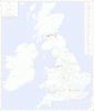
Some of you might be familiar with the maps published on this website: http://www.bueker.net/trainspotting/maps.php

Sadly, their author, Boris Chomenko, has not had time to update them for a while, and neither has the webmaster of the site had time to do much with it either. I had been keeping a copy of the UK map, and updating it as I found new information, although I'm sure I've missed a few things.

I contacted Mr. Chomenko a few days ago, and he kindly granted his permission for me to post the updated version here to ask for feedback: by which I mean, any thing I might have missed in terms of changes since the map had last been fully updated.

I'm 99.9% sure there are things I've missed, so please, do let me know. I'm posting a reduced thumbnail to fit the forum better, but you can just see a full size image by clicking on it.


Thanks in advance for any feedback.
 
Last edited:
Sponsor Post - registered members do not see these adverts; click here to register, or click here to log in
R

RailUK Forums

pdeaves

Established Member
Joined
14 Sep 2014
Messages
5,631
Location
Gateway to the South West
I'm 99.9% sure there are things I've missed, so please, do let me know. I'm posting a reduced thumbnail to fit the forum better, but you can just see a full size image by clicking on it.

Not an omission as such, but you might as well close up the electrification gap between Maidenhead and Reading as it will come into use in January.
 

Railsigns

Established Member
Joined
15 Feb 2010
Messages
2,503
The station near Dublin shown as 'Pace' is actually named 'M3 Parkway'.
 

Chrisyd

Member
Joined
16 May 2015
Messages
204
There are the electrified lines from Liverpool to Manchester, and Liverpool to Wigan which are still shown in Green, unfortunately I don’t have the knowledge to identify which exact ones they are!
 

snowball

Established Member
Joined
4 Mar 2013
Messages
7,732
Location
Leeds
There are the electrified lines from Liverpool to Manchester, and Liverpool to Wigan which are still shown in Green, unfortunately I don’t have the knowledge to identify which exact ones they are!
No, they're shown in blue. That was the first thing I checked when I first looked at it.
 

Bovverboy

Established Member
Joined
1 Dec 2013
Messages
1,933
Chrisyd said:
There are the electrified lines from Liverpool to Manchester, and Liverpool to Wigan which are still shown in Green, unfortunately I don’t have the knowledge to identify which exact ones they are!

No, they're shown in blue. That was the first thing I checked when I first looked at it.

It depends upon which map you look at.
 

Chrisyd

Member
Joined
16 May 2015
Messages
204
It depends upon which map you look at.
Looking at the version I looked at last night, they are now blue, whether this was me having a mental blip or very quick updating, I am not sure. To be clear I was looking at the large map, not the zoomed in one for the North West.
 

The Quincunx

Member
Joined
12 Dec 2011
Messages
133
Location
West Ealing
Looks nice. But if you are including the Republic of Ireland then it is more than a "U.K." rail map. (And please don't say "British Isles" either!)
 

AC47461

Member
Joined
13 Feb 2017
Messages
226
Location
RAYLEIGH, ESSEX
I'm not 100% sure but I don't think the line between Waterford and Rosslare in Ireland is technically closed. I seem to remember reading on an Irish forum, and from you tube videos that it's still used for the occasional stock transfer, weedkiller train and a few other misc turns.
 

DynamicSpirit

Established Member
Joined
12 Apr 2012
Messages
8,136
Location
SE London
Very nice map. Looks like a lot of work went into it.

Slightly shocked looking at it at just how little of the network is electrified. That map really brings out how many lines are still diesel-run (although I realise the electrified routes tend to be where the most frequent services are). Also surprised to see how sparse the rail network is in Ireland (although I guess in part that's because the population density is lower).

As a minor design point, showing freight-only lines in darker, more prominent, colours than passenger lines feels like the wrong way round.
 

itfcfan

Member
Joined
7 May 2011
Messages
327
These are very useful maps - it would be great if a group was able to start maintaining them again. Thanks for your efforts...

I was interested to find what had been changed since the original version from 2011, so I used online-image-comparison.com to compare them. I've attached the results (red lines/text show the changes).
 

Attachments

  • railmap_uk_bueker_2011_differences.gif
    railmap_uk_bueker_2011_differences.gif
    153.8 KB · Views: 68

Hornet

Member
Joined
16 Jul 2013
Messages
724
I'm not 100% sure but I don't think the line between Waterford and Rosslare in Ireland is technically closed. I seem to remember reading on an Irish forum, and from you tube videos that it's still used for the occasional stock transfer, weedkiller train and a few other misc turns.

It is still open. I believe it is classified as an "Engineers Siding". No stock transfers take place, but there are between three or four movements a year including the weedkiller train and the odd rail borne inspection vehicle.
 
Last edited:

GRALISTAIR

Established Member
Joined
11 Apr 2012
Messages
7,884
Location
Dalton GA USA & Preston Lancs
Very nice map. Looks like a lot of work went into it.

Slightly shocked looking at it at just how little of the network is electrified. That map really brings out how many lines are still diesel-run (although I realise the electrified routes tend to be where the most frequent services are).

Agreed but by end of 2018 with huge length of GWML electrified plus Manchester - Blackpool it should start looking a little better.
 

Mordac

Established Member
Joined
5 Mar 2016
Messages
2,308
Location
Birmingham
Not an omission as such, but you might as well close up the electrification gap between Maidenhead and Reading as it will come into use in January.

I'll close it when the switch has been flipped, so to speak.

The station near Dublin shown as 'Pace' is actually named 'M3 Parkway'.
I actually knew that, but couldn't be arsed changing it. Done now :P


You have Ormskirk as Orms. in the Key but O. on the actual map
Thanks, legend fixed.

Looks nice. But if you are including the Republic of Ireland then it is more than a "U.K." rail map. (And please don't say "British Isles" either!)

Fair enough. Can't change the title now though. Mods feel free!

I'm not 100% sure but I don't think the line between Waterford and Rosslare in Ireland is technically closed. I seem to remember reading on an Irish forum, and from you tube videos that it's still used for the occasional stock transfer, weedkiller train and a few other misc turns.
It is still open. I believe it is classified as an "Engineers Siding". No stock transfers take place, but there are between three or four movements a year including the weedkiller train and the odd rail borne inspection vehicle.
The Irish Rail Network Statement states on p. 10 "3.2.1 Limits A number of lines are currently not available for traffic, these being [...] Waterford–Rosslare Strand[.]" So even if it's used for departmental traffic, it's as good as closed, and that's how I'm treating it.

Very nice map. Looks like a lot of work went into it.

Slightly shocked looking at it at just how little of the network is electrified. That map really brings out how many lines are still diesel-run (although I realise the electrified routes tend to be where the most frequent services are). Also surprised to see how sparse the rail network is in Ireland (although I guess in part that's because the population density is lower).

As a minor design point, showing freight-only lines in darker, more prominent, colours than passenger lines feels like the wrong way round.

It definitely did, but most of it wasn't mine. ;) I'm just trying to keep it up to date. Hence the colour scheme ain't gonna be changed, it's just too much effort at this stage.

These are very useful maps - it would be great if a group was able to start maintaining them again. Thanks for your efforts...

I was interested to find what had been changed since the original version from 2011, so I used online-image-comparison.com to compare them. I've attached the results (red lines/text show the changes).

That website is great. Thanks for that, I've wanted something like that for ages. I too would like them to start being maintained again, and this is my humble start with the UK and Ireland map. :)

There are the electrified lines from Liverpool to Manchester, and Liverpool to Wigan which are still shown in Green, unfortunately I don’t have the knowledge to identify which exact ones they are!
Sorry, I didn't realise there was more than one.

There isn't. Well, other than the original pasted on the Trainspotting website....
 

Mordac

Established Member
Joined
5 Mar 2016
Messages
2,308
Location
Birmingham
Just bumping this because I've been doing some work on the London inset, but this is the area of the network I know least about, so could really use the feedback here.

 
Last edited:

30907

Veteran Member
Joined
30 Sep 2012
Messages
18,033
Location
Airedale
It doesnt enlarge well for me, but it looks as though Factory Jn-Longhedge Jn-Clapham Jn is still shown as freight only, which LOL would dispute. :)
AFAIK the only purely freight route in that area is Longhedge Jn-Latchmere Jn (plus the two normally unused Eurostar spurs).
 

Mordac

Established Member
Joined
5 Mar 2016
Messages
2,308
Location
Birmingham
It doesnt enlarge well for me, but it looks as though Factory Jn-Longhedge Jn-Clapham Jn is still shown as freight only, which LOL would dispute. :)
AFAIK the only purely freight route in that area is Longhedge Jn-Latchmere Jn (plus the two normally unused Eurostar spurs).
Thanks for letting me know it's not enlarging well. Can you try this link instead and see if it works better: https://i.imgur.com/1Cg4eiH.png

Also, thanks for letting me know about the missing updates, I'll upload an updated version after waiting a bit to see if someone else adds updates.
 

GRALISTAIR

Established Member
Joined
11 Apr 2012
Messages
7,884
Location
Dalton GA USA & Preston Lancs
Thanks for letting me know it's not enlarging well. Can you try this link instead and see if it works better: https://i.imgur.com/1Cg4eiH.png

Also, thanks for letting me know about the missing updates, I'll upload an updated version after waiting a bit to see if someone else adds updates.
Put your updates after the new year - strong chance chunks of GOBLIN will be electrified by then
 

hwl

Established Member
Joined
5 Feb 2012
Messages
7,396
Put your updates after the new year - strong chance chunks of GOBLIN will be electrified by then
All done and live apart from the ECML link which gets done over this extended weekend.
 

Mutant Lemming

Established Member
Joined
8 Aug 2011
Messages
3,194
Location
London
Looks nice. But if you are including the Republic of Ireland then it is more than a "U.K." rail map. (And please don't say "British Isles" either!)

That would depend if you are in Derry or Londonderry

- there are always TWO sides to every disagreement excluding one side doesn't mean they're wrong (or right)
 
Status
Not open for further replies.

Top