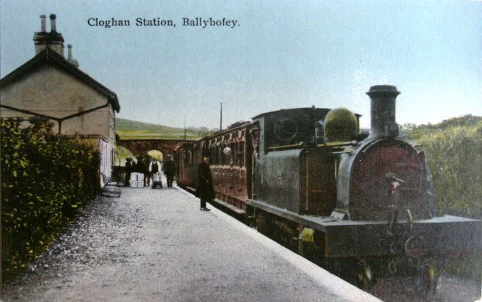
@rogerfarnworth: interesting as ever -- thank you. And as always, I find the photographs of the "County Donegal" in action, almost unbearably poignant.
Have always been fascinated by the set-up which there was at, and east of, Letterkenny: with the CDRJC line from Strabane coming up from the south-east, running for a while close by, to the south, the L&LSR line from Tooban Junction (opened a generation earlier than the Strabane & Letterkenny); then jinking round and getting via an overbridge, on to the north side of the "Swilly" 's line -- and so, lines closely parallel for the short way to their adjoining stations. (I find cause for regret that after the Strabane & Letterkenny line's opening, the county's two 3ft. gauge concerns did not find ways of collaborating with each other operationally.)
A small curiosity: I see that the Railway Clearing House map extract near the commencement of the linked item, has the lines-into-Letterkenny situation a bit wrong: it fails to show the S & L crossing over to the north side of the "Swilly" route -- has it as running south thereof, right the way into Letterkenny's station(s).
Jowett's Railway Atlas, which is apt to follow the RCH maps in rather a "monkey see, monkey do" fashion, does the identical thing. Tony Dewick's
Complete Atlas of Railway Station Names gets the basic idea more like right; but shows the "Donegal" crossing over to the north side of the "Swilly", a lot further east than was actually the case !