• Our booking engine at tickets.railforums.co.uk (powered by TrainSplit) helps support the running of the forum with every ticket purchase! Find out more and ask any questions/give us feedback in this thread!

Longest line of sight (UK)

johnnychips

Established Member
Joined
19 Nov 2011
Messages
3,679
Location
Sheffield
I was on the High Peak Trail above Carsington near Matlock today. To the east I could identify a line of hills clearly, with two peaks sticking out. I took bearings, and they turned out to be the Wrekin, and the line of hills near Church Stretton.

However, a puzzle: there were a distinct line of hills to the south-east, not particularly high, which I thought might be Cannock Chase, but on returning home I found this is the wrong direction. The bearing I took looked towards Swadlincote, but the land around there isn’t particularly high. Unfortunately my phone camera didn’t take good images; also the map I have to try and take bearings over a long distance doesn’t have contours. If anybody is interested in trying to work out where it was, the bearing was 165 degrees from Longcliffe, west of Matlock.

Now we can travel again, I hope we get some more contributions to one of the most interesting threads on the forum.
 
Sponsor Post - registered members do not see these adverts; click here to register, or click here to log in
R

RailUK Forums

route101

Established Member
Joined
16 May 2010
Messages
10,624
I was on the High Peak Trail above Carsington near Matlock today. To the east I could identify a line of hills clearly, with two peaks sticking out. I took bearings, and they turned out to be the Wrekin, and the line of hills near Church Stretton.

However, a puzzle: there were a distinct line of hills to the south-east, not particularly high, which I thought might be Cannock Chase, but on returning home I found this is the wrong direction. The bearing I took looked towards Swadlincote, but the land around there isn’t particularly high. Unfortunately my phone camera didn’t take good images; also the map I have to try and take bearings over a long distance doesn’t have contours. If anybody is interested in trying to work out where it was, the bearing was 165 degrees from Longcliffe, west of Matlock.

Now we can travel again, I hope we get some more contributions to one of the most interesting threads on the forum.
Beacon Hill near Loughborough perhaps?
 

eMeS

Member
Joined
12 Jun 2011
Messages
954
Location
Milton Keynes, UK
I was on the High Peak Trail above Carsington near Matlock today. To the east I could identify a line of hills clearly, with two peaks sticking out. I took bearings, and they turned out to be the Wrekin, and the line of hills near Church Stretton.

However, a puzzle: there were a distinct line of hills to the south-east, not particularly high, which I thought might be Cannock Chase, but on returning home I found this is the wrong direction. The bearing I took looked towards Swadlincote, but the land around there isn’t particularly high. Unfortunately my phone camera didn’t take good images; also the map I have to try and take bearings over a long distance doesn’t have contours. If anybody is interested in trying to work out where it was, the bearing was 165 degrees from Longcliffe, west of Matlock.

Now we can travel again, I hope we get some more contributions to one of the most interesting threads on the forum.
Surely the Wrekin and Church Stretton area is towards the west of Matlock...
 

Scotrail314209

Established Member
Joined
1 Feb 2017
Messages
2,355
Location
Edinburgh
I was on the High Peak Trail above Carsington near Matlock today. To the east I could identify a line of hills clearly, with two peaks sticking out. I took bearings, and they turned out to be the Wrekin, and the line of hills near Church Stretton.

However, a puzzle: there were a distinct line of hills to the south-east, not particularly high, which I thought might be Cannock Chase, but on returning home I found this is the wrong direction. The bearing I took looked towards Swadlincote, but the land around there isn’t particularly high. Unfortunately my phone camera didn’t take good images; also the map I have to try and take bearings over a long distance doesn’t have contours. If anybody is interested in trying to work out where it was, the bearing was 165 degrees from Longcliffe, west of Matlock.

Now we can travel again, I hope we get some more contributions to one of the most interesting threads on the forum.

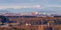
I'm not sure if the trail is on Viewfinder Panorama, but you'll get a definite answer by using that site.


johnnychips

Established Member
Joined
19 Nov 2011
Messages
3,679
Location
Sheffield
Thank you, I will have a look tomorrow. As I said, I can’t wait for more amazing photos!

Surely the Wrekin and Church Stretton area is towards the west of Matlock...
Sorry, perhaps I wasn’t clear. The Wrekin and Church Stratton are to the south-west, but the area I couldn’t identify was to the south-east.

edit - oops I did say ‘east‘ when I meant ‘west’. I won’t edit the post otherwise replies won‘t make sense. As a former geography teacher I will hang my head in shame and never eat Shredded Wheat again.

Anyway, I’m glad my favourite thread has been revived, and I will study Beacon Hill in Loughborough as a possibility for the view to the south-EAST tomorrow.
 
Last edited:

peteb

Member
Joined
30 Mar 2011
Messages
1,130
Are you sure it wasn't Bardon Hill (875 feet), which is near Coalville?
 

Altrincham

Member
Joined
22 Aug 2011
Messages
262
I was on the High Peak Trail above Carsington near Matlock today. To the east I could identify a line of hills clearly, with two peaks sticking out. I took bearings, and they turned out to be the Wrekin, and the line of hills near Church Stretton.

However, a puzzle: there were a distinct line of hills to the south-east, not particularly high, which I thought might be Cannock Chase, but on returning home I found this is the wrong direction. The bearing I took looked towards Swadlincote, but the land around there isn’t particularly high. Unfortunately my phone camera didn’t take good images; also the map I have to try and take bearings over a long distance doesn’t have contours. If anybody is interested in trying to work out where it was, the bearing was 165 degrees from Longcliffe, west of Matlock.

Now we can travel again, I hope we get some more contributions to one of the most interesting threads on the forum.

I'm not sure if the trail is on Viewfinder Panorama, but you'll get a definite answer by using that site.


The closest I can find on Viewfinder Panorama is the view from Crich Stand. This looks to be the best bet for determining the view that you saw from the High Peak Trail. Like Scotrail314209 says, it’s a great site for getting a definite answer.


Looking south east on that view, I think you saw the hills of Leicestershire, notably Bardon Hill or Beacon Hill (as noted by other replies).

It’s a range of hills that have quite a commanding presence when seen from certain angles. They’re not the type of hills that stand out as hills when seen at lower levels from a distance, but when seen from certain elevations they really do stand out. I always find it amazing that Leicestershire has high ground at 900-1000 feet, as it’s surrounded by such a flat expanse of Midland landscape.

Conversely, when looking at the view from Bardon Hill you can see quite how commanding a spot those hills are. The views are quite far-reaching and lines of site span from the Cotswolds and Shropshire/Welsh borders in the west and south-west, through to areas of Lincolnshire in the east. And the north/south lines of site from Bardon Hill stretches from Northamptonshire and North Oxfordshire in the south, through to Bleaklow and the area around Kinder Scout to the north.


I could look at this subject for hours. It never ceases to amaze me.
 

d9009alycidon

Member
Joined
22 Jun 2011
Messages
842
Location
Eaglesham
I was fortunate enough t visit the lighthouse at the Mull of Galloway on a remarkably clear day, everyone there was exited as it was possible to see Scotland, England, Northern Ireland, The Irish Republic, the Isle of Man and 133 miles away the vaguest outline of Snowdon in Wales!
 

Scotrail314209

Established Member
Joined
1 Feb 2017
Messages
2,355
Location
Edinburgh
I was fortunate enough t visit the lighthouse at the Mull of Galloway on a remarkably clear day, everyone there was exited as it was possible to see Scotland, England, Northern Ireland, The Irish Republic, the Isle of Man and 133 miles away the vaguest outline of Snowdon in Wales!

That must've been a sight to see surely?
 

route101

Established Member
Joined
16 May 2010
Messages
10,624
I was fortunate enough t visit the lighthouse at the Mull of Galloway on a remarkably clear day, everyone there was exited as it was possible to see Scotland, England, Northern Ireland, The Irish Republic, the Isle of Man and 133 miles away the vaguest outline of Snowdon in Wales!
I made it down there once. I didn't see Ireland or Wales, so you were lucky.
 

Altrincham

Member
Joined
22 Aug 2011
Messages
262
Here’s an incredible picture taken on Saturday from Crank Hill (between Wigan and St Helen’s).

It shows a line of sight that takes in Anfield (Liverpool FC) AND Carnedd Llewelyn in Snowdonia. I even think that might even be Snowdon peeping over the top.

This photo is on Twitter and was taken by a Merseyside photographer called Steve Samosa (on Twitter as @stevesamosa).

The hill in middle distance, to the right of Anfield, is the hill above Prestatyn that has various transmitters.
 

Attachments

  • 52AC6B27-0615-4FF8-B62C-E2FAFD6408E5.jpeg
    52AC6B27-0615-4FF8-B62C-E2FAFD6408E5.jpeg
    310.7 KB · Views: 118

Scotrail314209

Established Member
Joined
1 Feb 2017
Messages
2,355
Location
Edinburgh
When I was on the bus away from Glasgow, heading over the M8 I noticed a gap in the hills with a towering peak in the distance, this was looking in the general direction of Ayrshire. Would I have been correct in assuming it was most likely the top of Goatfell on Arran?
 

route101

Established Member
Joined
16 May 2010
Messages
10,624
When I was on the bus away from Glasgow, heading over the M8 I noticed a gap in the hills with a towering peak in the distance, this was looking in the general direction of Ayrshire. Would I have been correct in assuming it was most likely the top of Goatfell on Arran?
Where on the M8 was this?

I can see goatfell from near my house outside East Kilbride. And in other direction tinto and the pentland hills
 

Gonzoiku

Member
Joined
17 Jul 2016
Messages
192
At the M8 flyover at Glasgow Airport where the M8 towards Greenock and A737 towards Beith split.

This website suggests that it must be a hilltop on the mainland, SE of Culzean. The link is to svmap showing the visibility cloak from the M8 junction:


D6130

Established Member
Joined
12 Jan 2021
Messages
5,767
Location
West Yorkshire/Tuscany
From the summit of Snaefell on the Isle of Man on a clear day, you can see the Sellafield nuclear plant, Scafell Pike, Snowdon (Yr Wyddfa), the Wicklow Mountains and the mountains of Mourne. I was lucky enough to have had that view once....in September 1994.

From the promenade at Morecambe on a clear day, as well as the panorama of the Lakeland peaks across the bay, if you look inland to the East you can clearly see the distinctive flat-topped outline of Ingleborough.
 

Ianno87

Veteran Member
Joined
3 May 2015
Messages
15,215
Here’s an incredible picture taken on Saturday from Crank Hill (between Wigan and St Helen’s).

It shows a line of sight that takes in Anfield (Liverpool FC) AND Carnedd Llewelyn in Snowdonia. I even think that might even be Snowdon peeping over the top.

This photo is on Twitter and was taken by a Merseyside photographer called Steve Samosa (on Twitter as @stevesamosa).

The hill in middle distance, to the right of Anfield, is the hill above Prestatyn that has various transmitters.

You should track down the owners of that house in the foreground an sell them that photo!
 

route101

Established Member
Joined
16 May 2010
Messages
10,624
Travelled on the ECML last week. Noticed what seems like a rig or cranes in the North Sea to the North East Dunbar. Anyone know what it is? Cant find it on google maps.
 

najaB

Veteran Member
Joined
28 Aug 2011
Messages
30,826
Location
Scotland
Travelled on the ECML last week. Noticed what seems like a rig or cranes in the North Sea to the North East Dunbar. Anyone know what it is? Cant find it on google maps.
It more than likely was exactly that - either a rig in transit, or a platform for wind turbine work. It's almost certainly not a permanent feature.
 

Highlandspring

Established Member
Joined
14 Oct 2017
Messages
2,777
Travelled on the ECML last week. Noticed what seems like a rig or cranes in the North Sea to the North East Dunbar. Anyone know what it is? Cant find it on google maps.
It’s Saipem 7000 which has been constructing the Neart na Gaoithe offshore wind farm since last year.
 

nlogax

Established Member
Joined
29 May 2011
Messages
5,373
Location
Mostly Glasgow-ish. Mostly.
Over the weekend, looking at Dawlish Beach webcam, the moderator was claiming that a headland in the distance (at sea level) was Portland some 42 miles away. A record?
Wouldn't surprise me. It's possible to see the Devon coast from the top of New Road in Portland. Head towards the Olympic Rings and you'll be rewarded with an epic sweeping view of Chesil Beach back to the mainland. Only the haze limits your view west across Lyme Bay towards Torquay and Paignton.
 

d9009alycidon

Member
Joined
22 Jun 2011
Messages
842
Location
Eaglesham
Something that I didn't know before I moved to Troon is that the Mountains of the Isle of Jura are visible on a clear day. While walking the dogs I had noticed the outline of two peaks just to the north of Arran, I initially though thtat this must be on the Mull of Kintyre but was told by a local that they were indeed two of the three peaks known as the "Paps of Jura". On Google Maps these are 60 miles away. The Gaelic name for these mountains is "Sgurr Na Ciche", which some will recognise as the name bestowed to Class 60 number 60036

Edit - link to a rather nice photo https://www.flickr.com/photos/69735131@N06/19818234498
 

Scotrail314209

Established Member
Joined
1 Feb 2017
Messages
2,355
Location
Edinburgh
Something that I didn't know before I moved to Troon is that the Mountains of the Isle of Jura are visible on a clear day. While walking the dogs I had noticed the outline of two peaks just to the north of Arran, I initially though thtat this must be on the Mull of Kintyre but was told by a local that they were indeed two of the three peaks known as the "Paps of Jura". On Google Maps these are 60 miles away. The Gaelic name for these mountains is "Sgurr Na Ciche", which some will recognise as the name bestowed to Class 60 number 60036

Edit - link to a rather nice photo https://www.flickr.com/photos/69735131@N06/19818234498

The Paps can be visible from most parts of the Ayrshire Coast I believe. I've seen them from Saltcoats before.
 

Altrincham

Member
Joined
22 Aug 2011
Messages
262
There are some fairly lengthy lines of sight between the neighbouring countries of the UK and Ireland. The line of sight from Snowdon to Merrick at 144 miles still takes some beating, and out of curiosity I’ve been looking at the esteemed Viewfinder Panoramas to see what the greatest lines of sight are between neighbouring nations.

Starting clockwise from Scotland I can see the following distances are possible lines of sight:

  • Lochnagar to The Cheviot/Hedgehope Hill (Grampians to Northumberland at 112 miles)
  • Scafell Pike to Cadair Idris (Cumbria to southern Snowdonia, almost central Wales at 125 miles)
  • Aran Fawddwy to Blackstairs (southern Snowdonia to County Wexford/County Carlow at 132 miles)
  • Mount Leinster to Slieve Gullion (County Wexford/south-east Ireland to County Armagh/south-east Northern Ireland at 105 miles)
  • Knocklayd to Ben Nevis (Northern Ireland to Scottish highlands/western Grampians at 123 miles)
If I had plenty of time on my hands, along with a good camera and the perfect weather conditions, I would find it highly enjoyable to capture any lines of sight.
 

eMeS

Member
Joined
12 Jun 2011
Messages
954
Location
Milton Keynes, UK
There are some fairly lengthy lines of sight between the neighbouring countries of the UK and Ireland. The line of sight from Snowdon to Merrick at 144 miles still takes some beating, and out of curiosity I’ve been looking at the esteemed Viewfinder Panoramas to see what the greatest lines of sight are between neighbouring nations.

Starting clockwise from Scotland I can see the following distances are possible lines of sight:

  • Lochnagar to The Cheviot/Hedgehope Hill (Grampians to Northumberland at 112 miles)
  • Scafell Pike to Cadair Idris (Cumbria to southern Snowdonia, almost central Wales at 125 miles)
  • Aran Fawddwy to Blackstairs (southern Snowdonia to County Wexford/County Carlow at 132 miles)
  • Mount Leinster to Slieve Gullion (County Wexford/south-east Ireland to County Armagh/south-east Northern Ireland at 105 miles)
  • Knocklayd to Ben Nevis (Northern Ireland to Scottish highlands/western Grampians at 123 miles)
If I had plenty of time on my hands, along with a good camera and the perfect weather conditions, I would find it highly enjoyable to capture any lines of sight.
Thanks for the suggestions - I guess it's easier to get a "good camera" than the "perfect weather conditions".
What we need is a special (and affordable) GPS device which tells us not just where we are, but what we're looking at and the relief, at different ranges!
I have a Garmin GPSMAP 62S, and Canon's GP-E2 for use on some DSLRs, as well as the GPS in my Eos 7D MkII. I'm pretty sure that the compass directions have been wrong by several degrees due to my being on magnetic strata. (e.g. Views from Burton Dassett Country Park - old ironstone quarry!) Hopefully, being able to get out a bit more I'll be able to do some more checks on bearings etc.
 

adc82140

Established Member
Joined
10 May 2008
Messages
2,933
The current showery weather is creating some fantastic conditions for long views. From the A35 just after Dorchester I got a great view of Torbay at sunset. And although not a long one, North Devon from the M4 near Swansea last week looked like you could walk across.
 

Top