Looking at Google Maps, the civils interventions required to produce that map like-for-like would be complex and eyewateringly expensive. Mind you, with Ratcliffe PS due to close, a small slice of the land there could be used to build a flying junction (presumably from the Slows) to get west over the MML, the Soar, and probably Lockington Marshes too (which might make it a bit tricker to do).
Network Rail gave an indicative cost of between £175m and £375m; the price level isn't quoted, but the East Midlands Route Study was published in March 2016
The Route Study describes the new line as splitting as it approaches EMD (from Stenson) "to create a single connection-point via a grade separated junction (to the north) and a single connection point at grade to the south"
The area has changed a lot since March 2016; East Midlands Gateway has been built, the A453 has been made into a dual carriageway and is now named Remembrance Way, and there have been major roadworks altering the connection between the A50 and the M1 - I'm pretty sure the southbound connection at Junction 24A didn't exist back then.
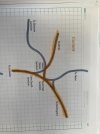
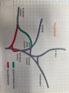
For those not familiar with the area, the Sheet Stores - Trent East curve is "new". When the Midland Counties built the triangular junction which connected the Derby - Leicester - Nottingham lines together, the north side followed the alignment of what is now Fields Farm Road; and when the Midland built the line up the Erewash Valley, that also had a triangular junction at its south end and as it started south of the point where the lines from Derby/Leicester joined to head towards Nottingham, it crossed the one from Derby on a flat crossing. Then Trent station was built, together with the present curve from Trent East to Sheet Stores (which takes its name from it being the location of the MR's works for making wagon sheets - a lot of it still stands north of the MML and east of the bridge over the Erewash Canal); finally, the original north side of the triangle was cut back and a sharp curve built to connect it to the north end of Trent station - this meant that some trains from Trent to Derby left at the south end and went via the present curve to Sheet Stores, others at the north end, round the sharp curve and then over the original alignment to a junction just east of Long Eaton station (which was called Sawley Junction until the original Long Eaton station on the Erewash Valley line closed in the late 1960s).
The area north of the Trent East - Sheet Stores curve and south of the original alignment is now built on, and east of the Trent South - Trent East (and on towards Nottingham) has been heavily quarried for sand and gravel; a lot of these have been flooded, and some form the Attenborough nature reserve. There's also a flooded quarry south of the Derby line just after passing under the M1 at Long Eaton.
Therefore, the scope for doing "something" to ease curves, etc, is very restricted, and I guess that ground conditions - a lot of sand and gravel - will present challenges for electrification teams when "planting" structures between the Red Hill Tunnels (just north of EMD), at least Beeston towards Nottingham, and Draycott towards Derby
"...Route Section 4 (RS4) – Sheet Stores Junction to Chaddesden Sidings (Derby) 15.7km
Route Section 6 (RS6) – Chaddesden Sidings (Derby) to Toadmoor Tunnel 16.7km..."
Wonder why they're going on about the route through Chadd Sdgs? The section between Spondon Jn and Derby North Jn closed as a through route in 1969. Much has been built on. Has someone been using an old database somewhere?
Seeing Chadd Sdgs in RS4 didn't surprise me as it is used to get trains between Etches Park and Derby station, but it did in RS6 - I would have thought that the latter should have been from the junction with the Chadd curve to Toadmoor Tunnel