-
Our booking engine at tickets.railforums.co.uk (powered by TrainSplit) helps support the running of the forum with every ticket purchase! Find out more and ask any questions/give us feedback in this thread!
You are using an out of date browser. It may not display this or other websites correctly.
You should upgrade or use an alternative browser.
You should upgrade or use an alternative browser.
New Railway Map Website
- Thread starter MatthewB
- Start date
- Status
- Not open for further replies.
Sponsor Post - registered members do not see these adverts; click here to register, or click here to log in
R
RailUK Forums
Hi maniacmartin,
the green lines around Nocton/Dunston are the Nocton Estate Rly. Quite an extensive narrow gauge network that mainly hauled potatoes and sugar beet.
There were quite a few small narrow gauge farm lines around the Lincolnshire area, many of which should also show up as green tracks (for instance around Holbeach). I believe some of the stock is at the North Ings Farm Museum (about 6 miles south of Dunston) and the Lincolnshire Coast Light Rly (near Skeggy).
Been through a few iterations for the interface. Interested in feedback on how it could be improved (or explained better).
Cheers
--- old post above --- --- new post below ---
Just added another feature that I think will be useful for all users. You can now link directly to a position in the website. For instance:
http://www.RailMapOnline.com/UKIEMap.php?lat=54.20562&lng=-4.70369
should take you to Knockaloe on the Isle of Man Rly.
You can generate these links automatically wherever you see the link symbol

You can do this using the marker from the Tools tab (to set the marker right click anywhere on the map, and then drag to position), or from the Info Box when you click on a track, station or other feature.
You could also type in the Lat & Long by hand (WGS84) as per the link above.
Hope this works for you and you can make use of this feature. As always, please let me know if you have any problems with it. You will probably have to refresh the page to make this work first time.
Thanks
the green lines around Nocton/Dunston are the Nocton Estate Rly. Quite an extensive narrow gauge network that mainly hauled potatoes and sugar beet.
There were quite a few small narrow gauge farm lines around the Lincolnshire area, many of which should also show up as green tracks (for instance around Holbeach). I believe some of the stock is at the North Ings Farm Museum (about 6 miles south of Dunston) and the Lincolnshire Coast Light Rly (near Skeggy).
Been through a few iterations for the interface. Interested in feedback on how it could be improved (or explained better).
Cheers
--- old post above --- --- new post below ---
Just added another feature that I think will be useful for all users. You can now link directly to a position in the website. For instance:
http://www.RailMapOnline.com/UKIEMap.php?lat=54.20562&lng=-4.70369
should take you to Knockaloe on the Isle of Man Rly.
You can generate these links automatically wherever you see the link symbol
You can do this using the marker from the Tools tab (to set the marker right click anywhere on the map, and then drag to position), or from the Info Box when you click on a track, station or other feature.
You could also type in the Lat & Long by hand (WGS84) as per the link above.
Hope this works for you and you can make use of this feature. As always, please let me know if you have any problems with it. You will probably have to refresh the page to make this work first time.
Thanks
oddiesjack
Member
Absolutely brilliant work there Matthew.
I noticed a slight deviation from the true path of the Peak Forest Tramway as it passes between Chapel-en-le-Frith and Barmoor Clough.
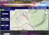
I have tried to mark the right route in a too-thick red line on the following attachment:
I noticed a slight deviation from the true path of the Peak Forest Tramway as it passes between Chapel-en-le-Frith and Barmoor Clough.
I have tried to mark the right route in a too-thick red line on the following attachment:
Attachments
Ben.A.98
Member
- Joined
- 13 Feb 2013
- Messages
- 227
Excellent resource! Absolutely ideal for researching the paths of the old railway lines!
Hi oddiesjack, I've update the Peak Forest Tramway and added a bit more detail at the western end:
http://www.RailMapOnline.com/UKIEMap.php?lat=53.32001&lng=-1.89960
Hi tsr, I've updated Betchworth Quarry, but without adding in all the individual sidings it doesn't look much different. Did the lines extend much further than this? I've also added in Brockham Limes Works which was missing:
http://www.RailMapOnline.com/UKIEMap.php?lat=51.24585&lng=-0.28406
You might have to refresh the webpage to see the latest maps, and for the new LatLng links to work.
Thanks again for your feedback - spotting these errors are exactly what I need to help make the map better!
Cheers
Hi maniacmartin,
the green lines around Nocton/Dunston are the Nocton Estate Rly. Quite an extensive narrow gauge network that mainly hauled potatoes and sugar beet.
There were quite a few small narrow gauge farm lines around the Lincolnshire area, many of which should also show up as green tracks (for instance around Holbeach). I believe some of the stock is at the North Ings Farm Museum (about 6 miles south of Dunston) and the Lincolnshire Coast Light Rly (near Skeggy).
Amazing. I spent nearly all of my childhood in Dunston and never knew!
"The Lincolnshire Potato Railways" by Stewart E Squires, Oakwood Press contains lots of detail about the various railways. There's about 30 pages on the Nocton Estate Railway, a map, rolling stock details and lots of pictures, including one of wagons in the piggery at Dunston! Well worth a read.
http://www.RailMapOnline.com/UKIEMap.php?lat=53.15408&lng=-0.41207
http://www.RailMapOnline.com/UKIEMap.php?lat=53.15408&lng=-0.41207
Dampflok
Member
Yes, this is quite brilliant and will be a great resource for many people.
I've just spent ages trying to find out something about the branch line from Astley Bridge Junction to Astley Bridge station via Halliwell Goods (Bolton area) and here it all is, though the actual site of Halliwell Goods is still a bit of a mystery...
The reason being that I have a couple of photos taken during an RCTS tour on 4th April 1959 that visited Halliwell Goods and was attempting to confirm the location.
I'm sure there will be many more instances where the maps will be of tremendous use!
Many thanks to MatthewB!
Cheers, Geoff
Many London area tracks have been updated, including more accurate routes for the deep level tubes and HS1. Stations north of the Thames have also been added (about 400 or them). Also added the Beacontree Housing Estate Railway
tsr
Established Member
Hi tsr, I've updated Betchworth Quarry, but without adding in all the individual sidings it doesn't look much different. Did the lines extend much further than this? I've also added in Brockham Limes Works which was missing:
http://www.RailMapOnline.com/UKIEMap.php?lat=51.24585&lng=-0.28406
Hi - it looks better and I am pleased to see the inclusion of the Brockham LW, which was economically important in its day - I will check the positions of the differently-gauged lines of Betchworth Quarry as soon as I can, and get back to you. The thing is that some sidings might be quite significant due to the variance of gauges within the quarry, but I will have a look, as I say! I just can't quite remember at the moment. Good work, though, so far!
")
I found this, but it's work-in-progress and my area isn't done yet.
http://www.geowiki.com/New_Adlestrop_Railway_Atlas.pdf
http://www.geowiki.com/New_Adlestrop_Railway_Atlas.pdf
Hasn't been touched in ages, that hasn't. It's dead as far as I can tell.I found this, but it's work-in-progress and my area isn't done yet.
http://www.geowiki.com/New_Adlestrop_Railway_Atlas.pdf
Hi Matthew B,
Love the website. For completion, I thought it might be worth mentioning the short lived Central Croydon branch:
http://en.wikipedia.org/wiki/Croydon_Central_railway_station
Love the website. For completion, I thought it might be worth mentioning the short lived Central Croydon branch:
http://en.wikipedia.org/wiki/Croydon_Central_railway_station
Yorksrob - thanks for spotting the Croydon Central branch. I'm hoping to push out an update to South London lines (including stations) this weekend, and will be sure to include the branch.
david_VI -I've considered adding in the ability to change view depending on era, including the railway companies, but it would require a major change to the way the maps are drawn and handled. If only I'd thought of it when I started
Muzer - I've tried to represent modern tramways/metros, historic interurban lines, industrial railways, and old tramroads/waggonways. I haven't attempted to include historic urban tramlines as there are just too many. However, if there is freely available information on some of the systems I might be able to include it in future updates. Can you advise on how large the Blackpool Tramway was?
I've had some really good feedback on various ommisions and corrections, and am slowly updating the maps. I'm also slowly expanding the list of stations represented. And I really must fix the company list/legend!
Thanks for all your support,
eastwestdivide
Established Member
Do you prefer feedback via the forum here, or via the email address on the site?
Muzer - I've tried to represent modern tramways/metros, historic interurban lines, industrial railways, and old tramroads/waggonways. I haven't attempted to include historic urban tramlines as there are just too many. However, if there is freely available information on some of the systems I might be able to include it in future updates. Can you advise on how large the Blackpool Tramway was?
All I know is what Wikipedia says - I was just curious at what your criteria were, thanks for the answer!
Hi eastwestdivide,
unless the feedback is off interest to other forum users, then I would suggest you just email it to the website feedback address - [email protected]
If you want to provide feedback on a particular location and want to include the position, you can click on the feature (a track, station or the marker) and select the link icon, which then allows you to send a feedback email with the Lat,Lng.
Cheers
Requeststop
Member
Hasn't been touched in ages, that hasn't. It's dead as far as I can tell.
Which is a great shame as it's one of the better one page maps of the rail system. the guys promised an update back in 2008 and since then nothing.
Tractionman
Member
This is brilliant - well done Matthew on putting it together.
I have posted the link through to the online map on another forum: http://www.rmweb.co.uk/community/index.php?/topic/74592-online-rail-map-of-uk-and-ireland/
and you'll see positive comments there too!
all the best,
Keith
I have posted the link through to the online map on another forum: http://www.rmweb.co.uk/community/index.php?/topic/74592-online-rail-map-of-uk-and-ireland/
and you'll see positive comments there too!
all the best,
Keith
Keith - thanks for spreading the word. I see there is already a comment about the Cannock Mineral Rlys for me to chase up.
Muzer - I've added in some of the old Blackpool tram routes, including the line to Lytham.
Also a few other updates, mostly from the excellent feedback and corrections received. I've corrected the Walton Summit Plateway, some of the tramways around Buckley, and some minor branches around Llantwit.
Also finally working on trying to get the legend (Companies list) to display properly.
Just a quick update to say the Legend is complete for the UK, and stations have been added for London, Essex, Hertfordshire and Suffolk.
You can also search for accident data at Railways Archive and see the position on Rail Map Online.
Had some excellent feedback with numerous updates and corrections - please keep them coming!
Enjoy,
You can also search for accident data at Railways Archive and see the position on Rail Map Online.
Had some excellent feedback with numerous updates and corrections - please keep them coming!
Enjoy,
PaulLothian
Member
Superb piece of work! I think that in my area, West Lothian, I may be able to suggest a few amendments in due course, once I find where my file of local notes went to in the course of tidying up! These relate to mineral lines, and would be to sort out connections, some of which changed at different times.
As a general point, I think that some of the mineral lines were not owned by the major local companies, but by the mine owners - almost an impossible job to differentiate on a map!
I would mention the Bangour Hospital Railway, which linked from the current Bathgate to Edinburgh line; though the junction area has disappeared under the motorway, there are still traces on the ground, and buildings within the abandoned hospital site.
Also the Winchburgh Electric Railway, connecting shale-oil mines to the processing works. Small sections still visible on the ground, if you know they are there.
Just a thought:
With regard to the Kent area, I wonder whether it might be worthwhile splitting it into it's constituent South Eastern Railway and London Chatham and Dover railway companies. These were two quite distinctive, competing entities which have had quite a profound effect on the physical development of the network right up until the present day.
With regard to the Kent area, I wonder whether it might be worthwhile splitting it into it's constituent South Eastern Railway and London Chatham and Dover railway companies. These were two quite distinctive, competing entities which have had quite a profound effect on the physical development of the network right up until the present day.
Hi Paul - thanks for the feedback. I've added in the missing railways, and updated a few of the mineral lines in the area. Never heard of the Winchburgh Electric Rly before - interesting operation!
For the moment the small mineral branches are all depicted as owning to the connecting railway company (i.e. NBR), but I'll update each line with a note if I find information that it was a private owner.
Yorksrob - I've gone for a pre-grouping legend (circa 1920), but it is reasonably arbitrary and a compromise to differentiate lines without each individual branch being a different colour. But it does lose detail in areas like Kent so I might have a rethink. I've also had to compromise on lines built after the grouping, or removed before, or small private owner lines (as above).
Thanks to you both - great to get this sort of feedback and discover new lines!
Karl
On Moderation
Had some excellent feedback with numerous updates and corrections - please keep them coming!
An excellent resource and thanks for all your efforts.
There's just a small error I spotted with the branch that was the Lostock Hall carriage sidings and shed. It terminated just before it reached Croston Road. On the map it shows an extra length running parallel with Croston Road and crossing the WCML. As far as I remember as a kid in the late 1960s this never existed.
Keep up the good work
Hi Karl,
good spot, think I miss-read an old OS map that appeared to have the line turn and follow Croston Rd. I've corrected the carriage sidings. Also added in a north link between the Farington Fork and Farington station that appears on early maps. I'll update the map later today.
Cheers,
good spot, think I miss-read an old OS map that appeared to have the line turn and follow Croston Rd. I've corrected the carriage sidings. Also added in a north link between the Farington Fork and Farington station that appears on early maps. I'll update the map later today.
Cheers,
PaulLothian
Member
Moderators - is this thread best placed where it is? It seems a shame to have this excellent resource hidden away!
Only Polmadie
New Member
From my point of view it's an excellent resource.
As a test there were three lines I looked for in particular. The Thornliebank goods line, the line into Dubs at Govanhill, and the Milngavie to Ellangowan Printworks. All are in the map.
Well done!
As a test there were three lines I looked for in particular. The Thornliebank goods line, the line into Dubs at Govanhill, and the Milngavie to Ellangowan Printworks. All are in the map.
Well done!
- Status
- Not open for further replies.