• Our booking engine at tickets.railforums.co.uk (powered by TrainSplit) helps support the running of the forum with every ticket purchase! Find out more and ask any questions/give us feedback in this thread!

TfL Maps

Status
Not open for further replies.

leytongabriel

Member
Joined
27 Jan 2013
Messages
590
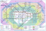
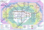
New Tfl Maps released today.

On the Tube map the Elizabeth Line is shown as a purple line with a white centre to distinguish it from tube line. The Barking Riverside extension is marked with a dashed line as 'opening soon' but it hasn't appeared on the Overground map yet. Thameslink lines are shown, including above ground routes in South London squashed in at the bottom with Shortlands and Bickley looking as more important interchanges than Bromley South and a bizarre wavy route around West Hampstead. The Finsbury Park to Moorgate line is not on.

The trend of bucking topology seemes to have continued, sadly in my view, with South Tottenham continuing being the wrong side of the Victoria line and now the relationship between the Cental Line and the Overground around Leytonstone has shifted. It's OK on the Tfl National Rail map with the Central line coming out at a different angle from Stratford.Why the difference / confusion?

Overall it looks pretty crowded and complicated and I wonder if it's the result of compromised teamwork or internees being let loose on it. Your reactions?

 
Sponsor Post - registered members do not see these adverts; click here to register, or click here to log in
R

RailUK Forums

rebmcr

Established Member
Joined
15 Nov 2011
Messages
3,851
Location
St Neots
Thameslink lines are shown, including above ground routes in South London squashed in at the bottom with Shortlands and Bickley looking as more important interchanges than Bromley South and a bizarre wavy route around West Hampstead.
That has already been the case on previous editions.
 

Bertone

Member
Joined
5 Nov 2021
Messages
184
Location
Hertfordshire
Whose bright idea was it that five IKEA locations are featured ?

I‘ve never seen anyone carrying a flat pack wardrobe on the tube !

On the next map issue, will we see B & Q, Homebase and Wickes added ?:rolleyes:
 
Last edited:

Hadders

Veteran Member
Associate Staff
Senior Fares Advisor
Joined
27 Apr 2011
Messages
13,191
Whose bright idea was it that five IKEA locations are featured ?

I‘ve never seen anyone carrying a flat pack wardrobe on the tube !

On the next map issue, will we see B & Q, Homebase and Wickes added ?:rolleyes:
IKEA are sponsoring the map and will have paid TfL a handsome sum to have their branding on the map.
 

Mojo

Forum Staff
Staff Member
Administrator
Joined
7 Aug 2005
Messages
20,397
Location
0035
Whose bright idea was it that five IKEA locations are featured ?

I‘ve never seen anyone carrying a flat pack wardrobe on the tube !
Who says you have to carry home a wardrobe on the train? Ikea are opening smaller shops with no immediate car parking outside (one at Hammersmith opened a few months ago and another is due to open at Oxford Circus). Half of the sales area of the average shop is the market hall which sells household goods like glasses, utensils, cushions, lamps, candles, vases and the like, which makes up the majority of these smaller shops also.
On the next map issue, will we see B & Q, Homebase and Wickes added ?:rolleyes:
If they want to pay for the advertising, then yes.
 

DerekC

Established Member
Joined
26 Oct 2015
Messages
2,115
Location
Hampshire (nearly a Hog)
If they (IKEA, B&Q, Homebase and Wickes) want to pay for the advertising, then yes.
But TfL needs to put a limit on it, otherwise it will clutter up the map and make it less fit for its proper purpose. IKEA has the advantage of not having many outlets. Imagine if it was Caffe Nero. I counted 43 on their map of the central area alone!
 

Mojo

Forum Staff
Staff Member
Administrator
Joined
7 Aug 2005
Messages
20,397
Location
0035
But TfL needs to put a limit on it, otherwise it will clutter up the map and make it less fit for its proper purpose. IKEA has the advantage of not having many outlets. Imagine if it was Caffe Nero. I counted 43 on their map of the central area alone!
I think they have put a limit on it? The deal is with Ikea which only had five shops at present in London.
 

James H

Member
Joined
25 Jun 2014
Messages
1,102
I‘ve never seen anyone carrying a flat pack wardrobe on the tube !
When I moved to my flat I transported a fair bit of Ikea furniture via Tramlink and Thameslink. That said my dining table still has the scars from sliding down the full length of the platform 1 stairs at Elephant & Castle.

I also shopped in-store to choose my larger furniture but had it delivered.
 

Bertone

Member
Joined
5 Nov 2021
Messages
184
Location
Hertfordshire
Who says you have to carry home a wardrobe on the train? Ikea are opening smaller shops with no immediate car parking outside (one at Hammersmith opened a few months ago and another is due to open at Oxford Circus). Half of the sales area of the average shop is the market hall which sells household goods like glasses, utensils, cushions, lamps, candles, vases and the like, which makes up the majority of these smaller shops also.

If they want to pay for the advertising, then yes.
Thank you for your considered response, I was actually joking re. flat pack wardrobes and living not too far from the London area, I am totally aware of what these IKEA outlets sell.

When I moved to my flat I transported a fair bit of Ikea furniture via Tramlink and Thameslink. That said my dining table still has the scars from sliding down the full length of the platform 1 stairs at Elephant & Castle.

I also shopped in-store to choose my larger furniture but had it delivered.
Blimey, I take my hat off to you. ;)
 
Last edited:

AM9

Veteran Member
Joined
13 May 2014
Messages
14,266
Location
St Albans
Why would TfL advertise a service they don’t operate?
So what! It's a map of services to help those travelling. Compartmentalising services based on who operates them is the antithesis of being part of a world-class city public transport system. Every service shown in the centre of Londonon that map is accessible to those using a travelcard that includes Zone1 validity, Oyster card of contactless card. The Thameslink core is every bit as valid in zone 1 as Crossrail is and to pretend otherwise based on who runs it (which is invisible to an ordinary passenger) has no value in presenting a coherent transport system.
 

thomalex

Member
Joined
25 Aug 2021
Messages
342
Location
Leeds
So what! It's a map of services to help those travelling. Compartmentalising services based on who operates them is the antithesis of being part of a world-class city public transport system. Every service shown in the centre of Londonon that map is accessible to those using a travelcard that includes Zone1 validity, Oyster card of contactless card. The Thameslink core is every bit as valid in zone 1 as Crossrail is and to pretend otherwise based on who runs it (which is invisible to an ordinary passenger) has no value in presenting a coherent transport system.
Do we have an explanation as to why the Northern City line isn't included?
 

AM9

Veteran Member
Joined
13 May 2014
Messages
14,266
Location
St Albans
Do we have an explanation as to why the Northern City line isn't included?
I doubt that tourists or other first time visitors would gain much by knowing that the London end of a metro service stops 800m further up the City Road before it exits central London. The Northen line does the same far more effectively. Comparing that to the utility of Thameslink in Zone 1 is nonsense.
 

thomalex

Member
Joined
25 Aug 2021
Messages
342
Location
Leeds
I doubt that tourists or other first time visitors would gain much by knowing that the London end of a metro service stops 800m further up the City Road before it exits central London. The Northen line does the same far more effectively. Comparing that to the utility of Thameslink in Zone 1 is nonsense.
Personally I think it should be included, it is after all an underground railway which runs in Zone 1 and an ex-Underground line at that. Not sure when it started but up to 1999 the Tube map had both Thameslink and Northern City (I also like how it only has the central section of Thameslink)

tube99.jpg
 

thomalex

Member
Joined
25 Aug 2021
Messages
342
Location
Leeds
Anyone know what going on with the connector blobs on the Piccadilly/District line? I see on the new map Barons Court now has them however Gloucester Road still doesn't even though it is an interchange. The below map from 1999 shows Gloucester Road with them.

tube99.jpg
 

Peter Sarf

Established Member
Joined
12 Oct 2010
Messages
5,699
Location
Croydon
So what! It's a map of services to help those travelling. Compartmentalising services based on who operates them is the antithesis of being part of a world-class city public transport system. Every service shown in the centre of Londonon that map is accessible to those using a travelcard that includes Zone1 validity, Oyster card of contactless card. The Thameslink core is every bit as valid in zone 1 as Crossrail is and to pretend otherwise based on who runs it (which is invisible to an ordinary passenger) has no value in presenting a coherent transport system.
My goodness, an integrated transport system !.
 

swt_passenger

Veteran Member
Joined
7 Apr 2010
Messages
31,434
So what! It's a map of services to help those travelling. Compartmentalising services based on who operates them is the antithesis of being part of a world-class city public transport system. Every service shown in the centre of Londonon that map is accessible to those using a travelcard that includes Zone1 validity, Oyster card of contactless card. The Thameslink core is every bit as valid in zone 1 as Crossrail is and to pretend otherwise based on who runs it (which is invisible to an ordinary passenger) has no value in presenting a coherent transport system.
Also before long TfL will be running the fares payment system for contactless PAYG over a much larger area, under DfT contract. It would be farcical if there wasn’t another map with that area fully covered. London Connections plus size…
 

dosxuk

Established Member
Joined
2 Jan 2011
Messages
1,765
Why would TfL advertise a service they don’t operate?
Tourists don't care who operates the service, they just want to know what the most efficient way to get between point a and point b is. Especially if those services are charged and ticketed in exactly the same manner.

Likewise, they don't care what "mode" TfL have categorised a line under. Crossrail isn't some new fangled system that behaves or operates differently for passengers. No normal passengers are going to be picking up on these subtleties of it being a slightly different drawing style, or having "line" stuck on the end of interchange descriptions.

TfL need to concentrate on making a map that serves passengers trying to navigate London rather than using it as an extension of their marketing department.
 

Dstock7080

Established Member
Joined
17 Feb 2010
Messages
2,768
Location
West London
Not sure when it started but up to 1999 the Tube map had both Thameslink and Northern City (I also like how it only has the central section of Thameslink)
Thameslink first appeared in orange 6/87 with "opens May 1988" alongside, removed from map 4/99.
 

Dstock7080

Established Member
Joined
17 Feb 2010
Messages
2,768
Location
West London
Anyone know what going on with the connector blobs on the Piccadilly/District line? I see on the new map Barons Court now has them however Gloucester Road still doesn't even though it is an interchange. The below map from 1999 shows Gloucester Road with them.
Gloucester Road isn't an easy interchange between Circle/District and Piccadilly or between westbound Circle to District, so is no longer shown.
 

coppercapped

Established Member
Joined
13 Sep 2015
Messages
3,099
Location
Reading
Why would TfL advertise a service they don’t operate?
How do you justify that position to a traveller who is not familiar with the London railway network and simply wants information on how to get around?

Traveller friendly, that isn't.
 

Acton1991

Member
Joined
20 Jan 2019
Messages
355
Anyone know what going on with the connector blobs on the Piccadilly/District line? I see on the new map Barons Court now has them however Gloucester Road still doesn't even though it is an interchange. The below map from 1999 shows Gloucester Road with them.

View attachment 115055
Ahhh the glory days when Acton Central was in Zone 2
 

BayPaul

Established Member
Joined
11 Jul 2019
Messages
1,226
Gloucester Road isn't an easy interchange between Circle/District and Piccadilly or between westbound Circle to District, so is no longer shown.
Wheras Barons Court is a very nice interchange, but quieter than Hammersmith, and even has toilets. Always my preference
 

bakerstreet

Member
Joined
29 Nov 2009
Messages
943
Location
-
I think this is the first tube map which has transitioned from New Johnston font to Johnston 100 font
 

345 050

Member
Joined
12 Aug 2021
Messages
237
Location
London
I particularly enjoy the squiggle of the Elizabeth Line in the Whitechapel area. That really adds to the artwork. <\sarcasm>
 

Enthusiast

Member
Joined
18 Mar 2019
Messages
1,116
There is also the anomaly that Acton (Main Line) is shown to the north of North Acton (Central Line) which is geographically incorrect. (I believe this was also shown on earlier versions). That area (which includes the Elizabeth Line, the Central Line and the North London Line) is very congested. To take the Elizabeth Line south of the Central Line would be very messy and it would only be until the Central Line terminates at Ealing Broadway anyway. But it is, of course, a diagram and not a map.
 

James H

Member
Joined
25 Jun 2014
Messages
1,102
The map gives the wrong web address for Thameslink for arranging assistance - thameslinkrailway.co.uk instead of .com
 
Status
Not open for further replies.

Top