• Our booking engine at tickets.railforums.co.uk (powered by TrainSplit) helps support the running of the forum with every ticket purchase! Find out more and ask any questions/give us feedback in this thread!

Walking and Rambling discussion

Non Multi

Member
Joined
11 Dec 2017
Messages
1,117
Although I did run into a film set in one of the woods for some historical drama which delayed me for around 10 minutes when they filmed two people having an argument.
You're not the only one to encounter a production crew on a walk. I've encountered 2 recently. The 2nd was through the neighbouring village with everything set up in the grounds of the Anglican church, the crew trucks parked up and open in the Pub car park across the street.

The only clues to what they were filming was fuschia coloured direction signage with a cleverly truncated production name. If you read it as an acronym it means nothing. However, reading it as a proper word gives you the answer...

NDVR

Series 8. Should be coming to the small screens this winter.
 
Sponsor Post - registered members do not see these adverts; click here to register, or click here to log in
R

RailUK Forums

Kite159

Veteran Member
Joined
27 Jan 2014
Messages
19,237
Location
West of Andover
You're not the only one to encounter a production crew on a walk. I've encountered 2 recently. The 2nd was through the neighbouring village with everything set up in the grounds of the Anglican church, the crew trucks parked up and open in the Pub car park across the street.

The only clues to what they were filming was fuschia coloured direction signage with a cleverly truncated production name. If you read it as an acronym it means nothing. However, reading it as a proper word gives you the answer...

NDVR

Series 8. Should be coming to the small screens this winter.

I didn't really take any notice of the crew, I saw them hanging around and just put some of them down as a group on a hike having a break for lunch.

I'm hoping the long range weather forecast for this coming weekend changes for the better, as it looks like it will be wet (and I think my boot has a leak somewhere)
 

Non Multi

Member
Joined
11 Dec 2017
Messages
1,117
I didn't really take any notice of the crew, I saw them hanging around and just put some of them down as a group on a hike having a break for lunch.

I'm hoping the long range weather forecast for this coming weekend changes for the better, as it looks like it will be wet (and I think my boot has a leak somewhere)
According to my go to weather app, Saturday morning looks wet and windy, but that's probably the worst of it.

Spare pair of socks in the bag is always a good idea for any long walk.
 

Kite159

Veteran Member
Joined
27 Jan 2014
Messages
19,237
Location
West of Andover
According to my go to weather app, Saturday morning looks wet and windy, but that's probably the worst of it.

Spare pair of socks in the bag is always a good idea for any long walk.
Which is normally what I take and swap over at the end of the walk.
 

Peter Mugridge

Veteran Member
Joined
8 Apr 2010
Messages
14,817
Location
Epsom
You're not the only one to encounter a production crew on a walk. I've encountered 2 recently. The 2nd was through the neighbouring village with everything set up in the grounds of the Anglican church, the crew trucks parked up and open in the Pub car park across the street.

The only clues to what they were filming was fuschia coloured direction signage with a cleverly truncated production name. If you read it as an acronym it means nothing. However, reading it as a proper word gives you the answer...

NDVR

Series 8. Should be coming to the small screens this winter.
Ah yes.... they tweeted a couple of weeks ago that they were finally able to start filming this. Looking forwards to watching it in due course.

I wonder if I'll encounter any film crews on any of my walks in the coming weeks / months, since so many seem to be getting encountered all of a sudden.
 

apk55

Member
Joined
7 Jul 2011
Messages
439
Location
Altrincham
A few years ago I came across a film crew filming in the Goyt valley. They had taken over Errwood hall car park with all their caravans etc. Found out later that it was an episode of Peaky Blinders filming a gypsy camp.
 

DerekC

Established Member
Joined
26 Oct 2015
Messages
2,114
Location
Hampshire (nearly a Hog)
One of my hats is volunteer warden for public rights of way in the parish where I live, which covers about 3000 acres in the Upper Meon Valley, Hampshire and has around 12 miles of footpaths, bridleways and byways. The South Downs Way runs along one boundary of the parish, which brings quite a few walkers into the area. My job is to keep an eye on the condition of the rights of way, fix waymarking, investigate and fix or report problems, cut back light vegetation, get landowners to fix problems like fallen trees and so on. I am also working on a couple of projects to reinstate paths which were left off the 1949 definitive map, by the deadline of 2026. I have a simple toolkit provided by the County Council and a local ranger to liaise with.

We get a few problems with people (particularly dog walkers) going off path but generally everyone I meet is friendly and well behaved - and even the landowners are mostly cooperative! I can recommend the job to anyone who has time to do it - I guess that other areas have similar roles.
 

S&CLER

Member
Joined
11 Jan 2020
Messages
785
Location
southport
I had another good shortish walk today, from Mills Hill station to Tandle Hill country park. Out of Mills Hill station, cross the road and take the path on the down side, then under the line, across the canal , past Chadderton Hall Park, Chadderton Fold and across the motorway to Cinder Hall farm and Hough; then along the south side of the wood to Lower Oozewood farm, where the path to the left is not signposted but goes through the yard (and is very wet). Head round the east and north sides of the country park by woodland paths to the obelisk which is the old Royton Borough war memorial, with superb views. From there go south down stone steps then reach a lower level path on your right, go through the gate to it, and turn back north to reach a nice J.W. Lees pub, the Tandle Hill tavern on Thurnham Lane. Then down hill to Slattocks top lock on the Rochdale canal, where I watched a narrow boat locking through (and saw the Drax biomass empties going west). There is another pub with tables on the canal bank here. Then back along the canal to Mills Hill station, where there is a third pub, accessible from the towpath, not far from the station. Sunday trains back to Southport via Man.Vic. at xx.11.
 

Iskra

Established Member
Joined
11 Jun 2014
Messages
7,902
Location
West Riding
Today I did Whernside and Ingleborough. Whernside was planned, Ingleborough was a spontaneous add-on. Arrived at Ribblehead at 0730 and found it quiet and surprisingly good weather. Much railway interest on the way up and Force Gill was in full flow due to the recent rain. The paths were high quality throughout. It was much busier when we got back to the car and on the way home down towards Skipton.

A brief video of Force Gill today:


Cowley

Forum Staff
Staff Member
Global Moderator
Joined
15 Apr 2016
Messages
15,766
Location
Devon
Today I did Whernside and Ingleborough. Whernside was planned, Ingleborough was a spontaneous add-on. Arrived at Ribblehead at 0730 and found it quiet and surprisingly good weather. Much railway interest on the way up and Force Gill was in full flow due to the recent rain. The paths were high quality throughout. It was much busier when we got back to the car and on the way home down towards Skipton.

A brief video of Force Gill today:


That’s lovely.
 

Peter Mugridge

Veteran Member
Joined
8 Apr 2010
Messages
14,817
Location
Epsom
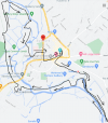
Yesterday a rather short walk; the poor weather precluded a long walk like the previous two weeks and my wife needed the Guildford to Tonbridge line for her rail atlas, so the plan was to do that and if the rain had stopped when we got to Tonbridge, we would do a local walk there. It did stop, so we did, and the result is below.

The slight V shaped diversion along a slightly longer footpath just happened to allow me to photograph 66 793... still made the same diversion on the way back, just in case anything had moved around in the interim ( it hadn't ).

1620597959210.png
 

Kite159

Veteran Member
Joined
27 Jan 2014
Messages
19,237
Location
West of Andover
Saturday I did 2 walks, as the rain ceased around half eleven:

St Albans Abbey towards Hatfield, pretty much following the old railway line. The old platforms are still there (although I didn't see the last one at the Hatfield end as I went up the wrong side of an old bridge). Pretty much all tarmac and mostly off-road until it reached Hatfield.

Welwyn North to Knebworth
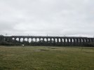
Wanting to head down the hill to photograph the Digswell/Welwyn viaduct, sadly the grey skies didn't help (the trains blended in), one to return to on a nicer day as I suspect that will make a big difference. PXL_20210508_134342556.jpg

Afterwards I followed several footpaths north and into the hilly bit above the railway tunnels, coming across a good place to photograph trains in the section between tunnels, although probably one for a camera with a decent zoom. A very woody area before carrying on north to reach the village of Oaklands before carrying on via the Mardley Heath Nature Reserve (woodlands in an old quarry area), before following the ECML (on an embankment) along an edge of a field to reach Knebworth, where I had an extra 30 minutes late due to a cancelled northbound train!

Sunday I returned to the Thames Path, although this time alighting at Cookham to head to Marlow cross-country (via a golf course and high ground at Cock Marsh & Winter Hill, before making use of a storm tunnel underneath the Marlow bypass to reach Marlow itself. Thames Path towards Bourne End, busy in parts, not the best for photos due to a lot of trees separating the path & the river, plus some muddy parts at kissing gates. At Bourne End I diverted to walk part of the old line (which continued to Wycombe), before returning to the Thames Path, crossing it at the Bourne End Railway Viaduct (has a footbridge attached to one side), and heading back towards Cookham itself on the path before heading back towards the station.
PXL_20210509_102416329.jpg
 

Iskra

Established Member
Joined
11 Jun 2014
Messages
7,902
Location
West Riding
Some interesting walks there guys :) ...although the areas are a little alien to me.
 

Non Multi

Member
Joined
11 Dec 2017
Messages
1,117
I had my usual long walk into the nearby town centre today, only to walk past none other than Cookham resident Timmy Mallett, wheeling his pushbike, and covered in dayglo cycle clothing.

With that dayglo gear on, you don't need to be "wide awake" to spot him!
 

Kite159

Veteran Member
Joined
27 Jan 2014
Messages
19,237
Location
West of Andover
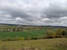
I was in Essex today and the weather cleared up long enough for me to walk from Wivenhoe station to Colchester (north) station, following the "Wivenhoe Trail", a path which followed the river Colne towards the Hythe area of Colchester, before carrying on along a riverside path towards a leisure park before I headed towards the station (via Asda). Quite scenic in places

PXL_20210515_143926869.jpg
 
Last edited:

Iskra

Established Member
Joined
11 Jun 2014
Messages
7,902
Location
West Riding
I’m at a holiday cottage this week in Carlton-in-Cleveland. Yesterday, I walked up Carlton Bank to Lord Stones country park and the trig point there. Then I took a longer route back down, walking first along the plateau and then down through some woods. Unfortunately the recent rain had washed away the forest path and felled many trees so it was something of an assault course and a challenge for me with the dog.

0AF70F63-D5F6-48EF-BB45-1E71E8F09C50.jpeg
 

S&CLER

Member
Joined
11 Jan 2020
Messages
785
Location
southport
I had a good walk today from the unlikely starting point of Swinton (GM) station. I made my way through an unavoidable built-up area and then a patch of woodland and open ground down to the Bolton line, passing under it just west of Pilkington's tile works. From there I followed the path between the back of the works and the river Irwell to the old aqueduct that used to carry the canal over the river. Heading north, I crossed the M62 on a footbridge (the westernmost of the 3 between Jns 16 and 17), then took the Outwood Trail, which is the old East Lancs line from Clifton Junction to Radcliffe and Bury. Masses of bluebells everywhere. Had lunch on the platform of Ringley Road station. Where the Irwell Sculpture Trail turns west, I turned east through Outwood Country Park, then a 10-minute trudge up Outwood Lane, a housing area, and east along Ringley Road to Outwood Gate. Crossing over near a radio mast, I headed SW past Clarke's Hill, a section with good open views, then back east on Copper Lane and mainly south along Old Hall Lane, and Philips Park road (all tracks rather than roads), to return to the footbridge over the motorway and then retrace my steps to Swinton. Another surprisingly rural enclave surrounded by built-up areas of Greater Manchester. Fine weather all day, until I was back at Swinton station for the 15:39 to Southport.
 

eMeS

Member
Joined
12 Jun 2011
Messages
954
Location
Milton Keynes, UK
Born in SE Lancashire, brought up in what's now Greater Manchester, and living in Milton Keynes I've nearly always found walks in England easy, pleasant and worth the effort. By easy I mean that there are marked field paths and normally it's not difficult getting off the roads. (OK some field paths near MK are somewhat overgrown...) Visiting relatives in central Wales is a very different experience. In the Brecons and Snowdonia the terrain and views are great, but away from the National Parks try finding a field path - they didn't seem to exist when I was fit enough to want one.

Using a compass
Walkers are always advised to carry a compass, and I normally have one with me, or I have my GPS - a Garmin GPSMap 62s. More recently, I've used a DSLR with built-in GPS and compass. Initially I trusted it but more recently, I've become aware that the compass directions are thrown out by magnetic material (eg ironstone) beneath my feet. A photograph of the easily recognised Malvern Hills from Burton Dassett has the recorded direction many degrees out. I'm now wondering what simple techniques there are for spotting these errors before getting lost, or choosing the wrong route off a mountain!
 
Last edited:

al78

Established Member
Joined
7 Jan 2013
Messages
2,421
Last walk I did was from Southease to Eastbourne along the South Downs Way, finishing with the Seven Sisters. Living where I do it is fairly easy to walk linear sections of the SDW between railway stations.
 

Kite159

Veteran Member
Joined
27 Jan 2014
Messages
19,237
Location
West of Andover
I had a good walk today from the unlikely starting point of Swinton (GM) station. I made my way through an unavoidable built-up area and then a patch of woodland and open ground down to the Bolton line, passing under it just west of Pilkington's tile works. From there I followed the path between the back of the works and the river Irwell to the old aqueduct that used to carry the canal over the river. Heading north, I crossed the M62 on a footbridge (the westernmost of the 3 between Jns 16 and 17), then took the Outwood Trail, which is the old East Lancs line from Clifton Junction to Radcliffe and Bury. Masses of bluebells everywhere. Had lunch on the platform of Ringley Road station. Where the Irwell Sculpture Trail turns west, I turned east through Outwood Country Park, then a 10-minute trudge up Outwood Lane, a housing area, and east along Ringley Road to Outwood Gate. Crossing over near a radio mast, I headed SW past Clarke's Hill, a section with good open views, then back east on Copper Lane and mainly south along Old Hall Lane, and Philips Park road (all tracks rather than roads), to return to the footbridge over the motorway and then retrace my steps to Swinton. Another surprisingly rural enclave surrounded by built-up areas of Greater Manchester. Fine weather all day, until I was back at Swinton station for the 15:39 to Southport.

That Outwood trail is on my list of things to do within Greater Manchester, probably starting from Salford and walking along the river
 

Mcr Warrior

Veteran Member
Joined
8 Jan 2009
Messages
11,753
Using a compass
Walkers are always advised to carry a compass, and I normally have one with me, or I have my GPS - a Garmin GPSMap 62s. More recently, I've used a DSLR with built-in GPS and compass. Initially I trusted it but more recently, I've become aware that the compass directions are thrown out by magnetic material (eg ironstone) beneath my feet. A photograph of the easily recognised Malvern Hills from Burton Dassett has the recorded direction many degrees out. I'm now wondering what simple techniques there are for spotting these errors before getting lost, or choosing the wrong route off a mountain!
Think a bit of local knowledge on this subject matter can often be useful. The Cuillin hills on Skye are notorious for magnetic variation, but it does vary from location to location.
 

apk55

Member
Joined
7 Jul 2011
Messages
439
Location
Altrincham
I had a good walk today from the unlikely starting point of Swinton (GM) station. I made my way through an unavoidable built-up area and then a patch of woodland and open ground down to the Bolton line, passing under it just west of Pilkington's tile works. From there I followed the path between the back of the works and the river Irwell to the old aqueduct that used to carry the canal over the river. Heading north, I crossed the M62 on a footbridge (the westernmost of the 3 between Jns 16 and 17), then took the Outwood Trail, which is the old East Lancs line from Clifton Junction to Radcliffe and Bury. Masses of bluebells everywhere. Had lunch on the platform of Ringley Road station. Where the Irwell Sculpture Trail turns west, I turned east through Outwood Country Park, then a 10-minute trudge up Outwood Lane, a housing area, and east along Ringley Road to Outwood Gate. Crossing over near a radio mast, I headed SW past Clarke's Hill, a section with good open views, then back east on Copper Lane and mainly south along Old Hall Lane, and Philips Park road (all tracks rather than roads), to return to the footbridge over the motorway and then retrace my steps to Swinton. Another surprisingly rural enclave surrounded by built-up areas of Greater Manchester. Fine weather all day, until I was back at Swinton station for the 15:39 to Southport.
There is some interesting walking in this part of the Irwell valley and I have been walking there several times. There is a wide green corridor all the way from Agecroft to Radcliffe or Moses Gate on the edge of Bolton. There is also interesting remains of the Manchester Bolton and Bury canal including 2 big aqueducts Knob end Locks and a famous crane. (Worth getting the towpath guide - look up Manchester Bolton and Bury canal society website). Also 3 other country parks (Clifton country park, Philips country park and Moses Gate country park) Other public transport options is to use Metrolink from Prestwich from which there is a good footpath via Philips park to the valley and there is the posibility of returning from Radcliffe.
I am organizing a walk in the area starting from Clifton country park for my local rambling club in June.
 

johnnychips

Established Member
Joined
19 Nov 2011
Messages
3,675
Location
Sheffield
I wonder how many members use public transport to do walks even if they have a car like me. Last Saturday, I took the Hulley’s once-a-week service from Sheffield to Alton Towers as far as Monyash, then had a great walk down Lathkill Dale and on to Matlock, then a couple of buses back. Of course, having the Derbyshire Wayfarer helps in cost (especially as I am 60 - haven’t got a free pass yet, but I can get the concessionary fare), but it would have been impossible to do in a car.
 

Jamesrob637

Established Member
Joined
12 Aug 2016
Messages
5,234
There is some interesting walking in this part of the Irwell valley and I have been walking there several times. There is a wide green corridor all the way from Agecroft to Radcliffe or Moses Gate on the edge of Bolton. There is also interesting remains of the Manchester Bolton and Bury canal including 2 big aqueducts Knob end Locks and a famous crane. (Worth getting the towpath guide - look up Manchester Bolton and Bury canal society website). Also 3 other country parks (Clifton country park, Philips country park and Moses Gate country park) Other public transport options is to use Metrolink from Prestwich from which there is a good footpath via Philips park to the valley and there is the posibility of returning from Radcliffe.
I am organizing a walk in the area starting from Clifton country park for my local rambling club in June.

Nob end is funny :D been there back in March before things started to reopen.
 

ChrisC

Established Member
Joined
7 Oct 2018
Messages
1,604
Location
Nottinghamshire
I wonder how many members use public transport to do walks even if they have a car like me. Last Saturday, I took the Hulley’s once-a-week service from Sheffield to Alton Towers as far as Monyash, then had a great walk down Lathkill Dale and on to Matlock, then a couple of buses back. Of course, having the Derbyshire Wayfarer helps in cost (especially as I am 60 - haven’t got a free pass yet, but I can get the concessionary fare), but it would have been impossible to do in a car.
It’s something I used to do regularly before Covid and really must start doing again. I’ve got into a bit of a habit of using my car all the time and not using public transport at all during the last year.

I find using public transport is really good when out walking because you do not have to plan circular walks to return to the car. It also, in areas where there is plenty of public transport options, allows more flexibility to deviate from your original plans by taking a different route, stopping short or even extending a planned walk. I’m also in that over 60’s group that doesn’t have a bus pass but can make use of the Derbyshire Wayfarer concessionary fare.

Unfortunately, as I live over the border in Nottinghamshire I have to use my car to travel into Derbyshire to park up and use this ticket. I try to leave my car at home and do the whole day by public transport but the bus service through my village is only every hour with a 2 hour gap on school days between 3pm and 5pm which is often, especially in winter, just the time I need to return. Therefore I do often use my car to park up in a village 3 miles away which has a much more regular bus service.
 

madannie77

Member
Joined
12 May 2009
Messages
404
Location
The Station Garden of Eden
I wonder how many members use public transport to do walks even if they have a car like me. Last Saturday, I took the Hulley’s once-a-week service from Sheffield to Alton Towers as far as Monyash, then had a great walk down Lathkill Dale and on to Matlock, then a couple of buses back. Of course, having the Derbyshire Wayfarer helps in cost (especially as I am 60 - haven’t got a free pass yet, but I can get the concessionary fare), but it would have been impossible to do in a car.

I have a self-imposed rule that I will not take my car into The Lake District for leisure purposes unless there is no public transport available. As I have no desire to add to the excessive number of cars in The Lake District this means I almost always take the bus and some parts don't get to see my walking boots very often.

From my home in Carlisle I can be in Borrowdale or Patterdale within an hour by car, but I choose to go by bus which can take much longer. As I enjoy bus travel it is not a problem for me. Taking the bus means I can partake of linear walks and also adds a bit of discipline in that I know I have a deadline to make at the end of a walk. It is quite easy, of course, because Stagecoach operates an excellent network of buses in the area. The only worry is that some of the connections can be a bit tight and heavy traffic can mess things up horrendously. For this reason I no longer wander off to Langdale, which involves 5 buses to get home.

I am also likely to use the bus for walking trips to other local areas where possible, but for much of the North Pennines I have to take the car as the bus service, which was always thin, is now non-existent in many places.
 

Peter Mugridge

Veteran Member
Joined
8 Apr 2010
Messages
14,817
Location
Epsom
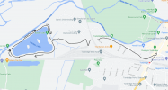
Sudbury this time... a 5 mile circular walk with roughly a third of it along the disused track bed where the line used to continue beyond Sudbury towards Melford.


1621730333615.png
 

yorksrob

Veteran Member
Joined
6 Aug 2009
Messages
38,954
Location
Yorks
A particular favourite that I've been doing for some years is the seaside walk between St Michael's Mount and Mousehole near Penzance. Takes in a causeway, stunning views, the fishing harbour at Newlyn and the Prom in Penzance.

Oh, and stunning views of Long Rock depot.
 

Cowley

Forum Staff
Staff Member
Global Moderator
Joined
15 Apr 2016
Messages
15,766
Location
Devon
A particular favourite that I've been doing for some years is the seaside walk between St Michael's Mount and Mousehole near Penzance. Takes in a causeway, stunning views, the fishing harbour at Newlyn and the Prom in Penzance.

Oh, and stunning views of Long Rock depot.

And the very moving ex Penlee lifeboat station which is always somewhere to pause for thought...
 

Top