Hamma52
Member
One of my favourite past times is hiking, so I'm glad I've found this thread!
I'm lucky enough to live in beautiful North Wales, with the heart of Eryri being a mere 20 minute bus ride.
My favourites? There's too many to pick! My favourite area would have to be the Carneddau range. I love the walk up to Carnedd Llewelyn from Idwal Cottage. The route up Pen yr Ole Wen is a lung buster, but the reward is about an hour and a half of easy walking above 3000 feet. It's a magical place that section from Pen yr Ole Wen - Carnedd Dafydd - Carnedd Llewelyn.
I'm also a big fan (pun intended) of Tal y Fan near Conwy, Elidir Fawr above Llanberis, and the ring of mountains surrounding Llyn Anafon, near Abergwyngregyn (Foel Dduarth, Drum, Foel Fras, Llwytmor).
I've lived in North Wales for 4 years now and I feel I've only just scratched the surface of this truly magical landscape. I've also recorded every peak I've bagged. More than happy to share routes if people would like!
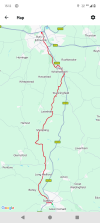


")