• Our new ticketing site is now live! Using either this or the original site (both powered by TrainSplit) helps support the running of the forum with every ticket purchase! Find out more and ask any questions/give us feedback in this thread!

Doncaster Station

Loadhaul60059

Member
Joined
3 Feb 2025
Messages
169
Location
Woking
Afternoon all,

I'm taking my Dad to York for a long weekend in July. We're booked on the Waverley railtour to Carlisle on the Sunday (70th birthday present for him as he's always wanted to travel on the Settle & Carlisle), and on our way up on the Friday we're going to spend a few hours on Doncaster Station.

I'm aware a fair bit of freight doesn't go through the station as it uses the line to/from Mexborough instead, but is it possible please to see the freight using this line from the end of the station? It's been a while since I was last there and I can't remember!

Many thanks.
 
Sponsor Post - registered members do not see these adverts; click here to register, or click here to log in
R

RailUK Forums

30907

Veteran Member
Joined
30 Sep 2012
Messages
20,786
Location
Airedale
There are two road overbridges between the station and the rail bridge :(
 

eastwestdivide

Established Member
Joined
17 Aug 2009
Messages
2,946
Location
S Yorks, usually
line to/from Mexborough
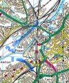
If you mean the south-to-west curve to the south of the station, that’s visible from the south end of the platforms, and loco numbers are more or less gettable with binocs/long lenses. Annotated 1 on the map extract below.
There’s also the avoiding line from the Humberside direction towards Mexborough, which crosses the ECML on a bridge to the north of the station, with probably less traffic using that. Not sure of visibility of that one. Annotated 2 on the map.
Annotated Ordnance Survey/Bing Maps snippet below. Station is the red dot!
IMG_0449.jpeg

(Edited to add map details, and to say have a good trip!)
 
Last edited:

Loadhaul60059

Member
Joined
3 Feb 2025
Messages
169
Location
Woking
If you mean the south-to-west curve to the south of the station, that’s visible from the south end of the platforms, and loco numbers are more or less gettable with binocs/long lenses. Annotated 1 on the map extract below.
There’s also the avoiding line from the Humberside direction towards Mexborough, which crosses the ECML on a bridge to the north of the station, with probably less traffic using that. Not sure of visibility of that one. Annotated 2 on the map.
Annotated Ordnance Survey/Bing Maps snippet below. Station is the red dot!
View attachment 182339

(Edited to add map details, and to say have a good trip!)
Thanks very much for this and for going to the trouble to find the map. It's the line annotated with the number 1 that I had in mind, so it's good to know the trains will be visible with binoculars/a telescope. I'll make sure my dad has his with him!

If we weren't going to be laden with luggage we might have been a bit more adventurous and ventured out to one of the road bridges south of the station to get a better view of the line, but so long as we can see what's using it from the station then that's all that matters really.

Thanks again!
 

Bob figgis

Member
Joined
11 Apr 2020
Messages
135
Location
Tinsley TMD
You can read the GBRF locos from the platforms with binos, the new cherry red DB liveried locos and Freightliner locos are a lot trickier. The growth on the bushes don’t make life any easier also. There are a lot less freights using the curve than a year or so ago as GBRF don’t use Hexthorpe Yard to run around the Iport intermodals anymore, these now take place at Down Decoy Yard.
If you want wagon numbers, look up Roberts Road on the map, you can stand at the fence at the entrance to the depot and read off the numbers. Depending you how agile you are it’s a 20 to 30 minute walk from the station.
 

Top