61653 HTAFC
Veteran Member
Just call it Cottingley, then it could be claimed that it's just a relocation like nearby Morley so there's no need for the closure procedures!Or how about "White Rose (for Cottingley)"?
Just call it Cottingley, then it could be claimed that it's just a relocation like nearby Morley so there's no need for the closure procedures!Or how about "White Rose (for Cottingley)"?
PDP-11-based time sharing system in, err, 1979 or possibly 1978, we had one at school and it was a bit more usable than the ICL 1901 we had donated the following year (which wasn't ever used "seriously" but was a good introduction to paper tape and punched cards).It's named after the business park. I still think we should have done a DLR and named it after something historical that no-one remembers... such as Systime
Yes, the main road is a much better location, especially as there is space around the trackbed for car parking, where at the Heely Mills site there is only the former DB car park space on the north side.Not sure why that was looked at as two different proposals... a station at Horbury Bridge would act as a railhead for Ossett anyway. I'm not sure where else you could put a station that would be any closer to Ossett. Maybe at the bridge that carries Storrs Hill Road over Healey Mills Yard, but your platforms would be a long way apart unless you diverted the main running lines through the middle of the yard rather than around opposite sides as they are today. The bridge carrying the main Huddersfield to Wakefield road would be a better location though.
It's named after the business park. I still think we should have done a DLR and named it after something historical that no-one remembers... such as Systime
Yes, considering only a station immediately adjacent to the shopping centre, on a tight curve with significant cant. Moving it to its present position removes those problems.in 2014, WYCA commissioned a study into 61 potential station sites in North and West Yorkshire, assessing potential passenger demand, construction feasibility and operational feasibility. White Rose Centre was ranked at no 57.
Possibly because it makes little difference for most current passengers. Only those living right next to the current station would be adversely affected.I'm surprised there has been so little local opposition to the effective closure of Cottingley station.
In 1840, when they opened the station, the Manchester and Leeds Railway kept their options open by naming the station Horbury and Ossett.It's not up to me, but I'd still brand it as "Horbury for Ossett" station as a marketing exercise.
I'd expected some sort of legal challenge from people who had just bought new build houses at a fair premium due to having a station "on the doorstep" (and more importantly being advertised as such) suddenly finding the value of their home falling because said station moved further away.Possibly because it makes little difference for most current passengers. Only those living right next to the current station would be adversely affected.
There are those who say that a railway station in an area of social housing is a benefit to the local community with low car ownership.I'd expected some sort of legal challenge from people who had just bought new build houses at a fair premium due to having a station "on the doorstep" (and more importantly being advertised as such) suddenly finding the value of their home falling because said station moved further away.
That said, I'm not a lawyer so have no idea if such a legal challenge would achieve anything.
The older housing on the Up (Manchester-bound) side is social housing, but the newer housing on the Down (Leeds-bound) side mostly isn't. Those in the social housing probably lack the resources to mount a legal challenge even if there's a sound basis for it.There are those who say that a railway station in an area of social housing is a benefit to the local community with low car ownership.
I imagine it would be very difficult to prove there had been significant loss of value due to the station moving at worst 15 minutes' walk away.I'd expected some sort of legal challenge from people who had just bought new build houses at a fair premium due to having a station "on the doorstep" (and more importantly being advertised as such) suddenly finding the value of their home falling because said station moved further away.
That said, I'm not a lawyer so have no idea if such a legal challenge would achieve anything.
In my (non-railway related) experience, people tend to object to the loss of a facility near them, even if they never use that facility and the reason that it's closing is that it is poorly used. Often the loudest objectors can be people who never use it, but like the idea that it's there just in case they might want to use it.Possibly because it makes little difference for most current passengers. Only those living right next to the current station would be adversely affected.
Quite. It's all a done deal, anyway - the closure has been ratified. (Ratification letter here and text below.) The "no failure or defect in the consultation" would make any legal challenge hard (whether or not you agree WYCA did a great job on that).I imagine it would be very difficult to prove there had been significant loss of value due to the station moving at worst 15 minutes' walk away.
More to the point, who do you bring the legal challenge against?
The housing developers? "Nothing to do with us, we gave you accurate information at the time of sale to the best of our knowledge, and it's the buyers responsibility to do a proper search."
WYCA / LCC? "We offered no guarantees to the developer that the station would stay where it is."
Closure Ratification Notice – Cottingley station
1. On 18 March 2022 West Yorkshire Combined Authority (WYCA) asked the Office of Rail and Road (ORR) to ratify the proposal to close Cottingley station.
2. Following an additional consultation undertaken by WYCA, it submitted an updated consultation outcome report to ORR on 22 November 2022.
3. Further to s32(8) of the Railways Act 2005 (the Act), I am satisfied that:
a) there has been no failure or defect in the consultation; andb) the proposal satisfies the criteria set out in the relevant part of the closure guidance issued under the Act.4. Having considered the overall proposal, I hereby ratify the closure of Cottingley station.
5. Under s33(2) of the Act, ORR may “impose such requirements relevant to the proposal as it considers appropriate”. I do not consider it appropriate to impose such requirements in this case.
6. Under ORR’s powers in s32(9)(b) of the Act, I require the operator of Cottingley station to display this notice at the station for a period of 4 weeks following the date of this notice.
7. In addition, I require the operators of the stations in the area affected by the closure – Leeds and Morley stations – to display this notice at those stations for the same period.
It's not a loss; it's a move. Not many people would object if a popular shop or the local doctor's surgery moved half a mile further away. And again, it's only the relatively few people who live immediately next to Cottingley station who will see any disbenefit.In my (non-railway related) experience, people tend to object to the loss of a facility near them, even if they never use that facility and the reason that it's closing is that it is poorly used. Often the loudest objectors can be people who never use it, but like the idea that it's there just in case they might want to use it.
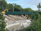
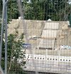
Well, at least with all that heavy construction the steps won't start sinking for a while!Batley - Former Adwalton line at Lady Anne crossing.
Rutland Road
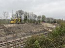
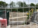
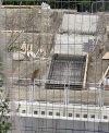
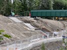
On the Adwalton embankment, the formwork for the stepped access is currently being built. For some reason I imagined the stepped access would be precast units interlocked and didn’t envisage it physically built from bottom to top with formwork and rebar. (These works are on the side of the Up Huddersfield line)
View attachment 135740View attachment 135741
I did see a diagram - possibly in Modern Railways - which had the new P3 (current P4) shown as a 'slow' platform, with fast eastbound trains calling at new P4 (current P8) as now. I was rather hoping that that was wrong, as new P3 would be straighter for the tunnels; but if it's correct then you do the crossover at Huddersfield. Obviously, I hope it's incorrect, and that the fast services take the southern pair all the way from Ravensthorpe to Huddersfield.You're introducing a lot of "mission creep" there. For an increase in services from Huddersfield (or beyond there from Bradford) you need to redouble some or all of the line between Huddersfield and Penistone, and you're removing the Huddersfield to Barnsley link. Then for services from Bradford you'd have to cross over the fast lines somewhere between Bradley and Springwood junctions. Making that route the principal one for Leeds to Sheffield probably isn't the best idea either, as slow as the Moorthorpe and Darton lines are they'll be quicker than going via Huddersfield even with the additional capacity and speed of TRU.
"Walk" is the key word here. And even if you assume everyone is able bodied, does that mean they won't have luggage, or be making transfers?Is the site of Sheffield Victoria really that inconvenient for the city or even for transferring to Midland or getting the Supertram? A lot of people keep saying this but it's hardly completely out of the city centre - a 15 minute walk to the area around the Crucible theatre,or a 20 minute walk to Midland isn't that bad.
Things may have been updated, but as far as I'm aware the plan is still for the current P1 & P4 to become the up and down fast platforms respectively and be numbered as platforms 2 & 3.I did see a diagram - possibly in Modern Railways - which had the new P3 (current P4) shown as a 'slow' platform, with fast eastbound trains calling at new P4 (current P8) as now. I was rather hoping that that was wrong, as new P3 would be straighter for the tunnels; but if it's correct then you do the crossover at Huddersfield. Obviously, I hope it's incorrect, and that the fast services take the southern pair all the way from Ravensthorpe to Huddersfield.
EuroBalises for the Power changeover when it gets down that far? (Pics for reference: https://en.wikipedia.org/wiki/Eurobalise)Noticed there a several yellow rectangular objects in the 4foot of all 4 lines between Church Fenton and past Ulleskelf. They seemed to be every 200m or so, but not uniformly that distance.
What would these be, and the purpose for them? They are not AWS magnets, by the way.
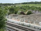
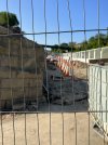
Thanks, that's good newsThe new Thorpe Park station between Leeds and Micklefield now confirmed to be four-track.
It's taken from the latest WYCA update on the station project so doesn't say how long the section will be. It won't be four track all the way to Cross Gates station as the bridge reconstruction at Austhorpe Lane is not four-track.Do you know how long the four-track section will be? Just platform loops?
Noticed myself the other day.Not been York way for a while, noticed there a several yellow rectangular objects in the 4foot of all 4 lines (assume they were on the line my train was on, too) between Church Fenton and past Ulleskelf. They seemed to be every 200m or so, but not uniformly that distance.
What would these be, and the purpose for them? They are not AWS magnets, by the way.
Are you sure? According to the plans submitted the existing abutments are being retained, just widened for the increased carriageway width and combined new footpath of 4m instead of separate road and pedestrian spans. The span length stays the same as now.It's taken from the latest WYCA update on the station project so doesn't say how long the section will be. It won't be four track all the way to Cross Gates station as the bridge reconstruction at Austhorpe Lane is not four-track.
Are you sure? According to the plans submitted the existing abutments are being retained, just widened for the increased carriageway width and combined new footpath of 4m instead of separate road and pedestrian spans. The span length stays the same as now.
It was originally built over a four-track formation although only two running lines were built beyond Cross Gates and the Wetherby Junction. The other lines here were loops/sidings on the Down side for use by Armstrong's armament factory. As far as I know, the four-track formation continues to just short of Garforth with all bridges spanning four tracks, but someone will correct me if I am wrong.
It is a grade 2 listed structure currently.
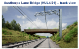
This is a visualisation which means someone has drawn it without knowing the topography. The actual cutting here is already four-tracks wide and much shorter than the visualisation implies. NR are not going to waste money unnecessarily constructing a cutting only two tracks wide. The plans say abutments, plural, are being retained.View attachment 136008
This is the visualisation of the proposed bridge. From the look of it the width of the superstructure may be enough for four tracks, but four-tracking would require widening of the cutting on the north side (left on the picture), probably by means of a retaining wall. If the north abutment is being reused then it depends whether it is founded on or below the cutting. If the former, then widening the cutting would remove support to the foundation and it would need to be underpinned or otherwise supported to allow the four-tracking.
One would hope that the bridge rebuilding is being done in such a way to enable future four-tracking.
