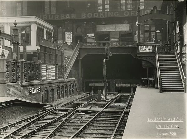
3.3 Queen Victoria Tunnel
Access to the QVT was not possible for the present work. Only Historical research has been conducted on the structure, although only very limited information was available to MOLA.
3.3.1 Background
The Queen Victoria Tunnel formerly known as Great Eastern Railway (GER) Connection Tunnel, was constructed to temporarily connect the Metropolitan line with the GER mainline station in 1870s. The Metropolitan Line extension was being delayed due to the difficulties in work at Liverpool Street, and was also delayed later on because of problems in obtaining delivery of the wrought iron roof girders for their own station at Liverpool Street (originally Bishopsgate). As a result the Metropolitan Railway had to open a temporary connection to the GER first, which was authorised in the company’s act in 1870 (Jackson 1986).
3.3.2 The tunnel Structue
The temporary connection tunnel was 3.5 chains (c 70m) in length and curved north, close to the west end of the future metropolitan station, meeting a GER connection. The tunnel diameter was approximately 7.8 m and it had a double track, which emerged at platforms 1 and 2 of the mainline station (Jackson 1986).
3.3.3 Usage
A single line track through the tunnel started functioning initially to remove spoil in October 1874. On the 1st of February 1875 Hammersmith & City trains ran through the tunnel to terminate at Liverpool Street GER station and GER and Metropolitan Railway Company were responsible for the cost of staffing and lighting on the two platforms where it emerged. The tunnel was in regular use for little more than 5 months until the opening of the Metropolitan Railway’s own station, Bishopsgate, on the 12th of July 1875. Despite of the station’s unfinished condition, all Metropolitan and Metropolitan District Railway (MDR) trains ran directly into it from that day, and the tunnel was never again used for regular traffic (Jackson 1986). Later, the Metropolitan Railway intended to run their trains through the tunnel to Walthamstow, but due to the initial dispute over the terms of working, the Metropolitan Railway and GER could not agree over the routes for a through service. The Metropolitan Railway wanted to run their trains through to South London via the East London Railway. But GER objected to this, as it would have involved crossing all the approach tracks at Liverpool Street on the level. GER suggested a service through the tunnel to the Chingford branch, or along the main line, and on to the Loughton branch. The two railway companies could not agree on the use of the tunnel, and after 1875 only occasional freight trains, specials or excursions used the connecting line. The tunnel tracks were used for the last time for a Metropolitan excursion from Aylesbury to Yarmouth in 1904. The junction was disconnected later in 1907 and the GER used its end for stock storage for few years. Later GER converted that end to use as a staff canteen and recreation space (Jackson 1986). In the 1970s the canteen was used by employees of various trades, City of London police, Westminster dustmen and street cleaners, even vagrants and was very busy at times in the early morning and shift changing hours. The canteen disappeared with the redevelopment of Broadgate, the building of the new substation, and the emergency exits that take one out to the shopping concourse through a series of passageways and rooms constructed in the old Queen Victoria Tunnel.