• Our new ticketing site is now live! Using either this or the original site (both powered by TrainSplit) helps support the running of the forum with every ticket purchase! Find out more and ask any questions/give us feedback in this thread!

Project Oval: How can the expansion of contactless be properly covered by better maps in the London & SouthEast area?

fandroid

Established Member
Joined
9 Nov 2014
Messages
1,985
Location
Hampshire
Moderator note: Split from https://www.railforums.co.uk/thread...ds-coming-to-contactless-payment-cards.231684
Post #532 has a Phase One map, if you're wondering.)
That map is so obviously issued by an organisation that feels no responsibilities for giving useful information to the ultimate customers. Why didn't they base it on a modification of the consultative map in post #1?

It's useless as information for most passengers, as it omits nearly all stations that currently take contactless.

Has TfL reissued it in a customer-friendly form? If not, then they should
 
Last edited by a moderator:
Sponsor Post - registered members do not see these adverts; click here to register, or click here to log in
R

RailUK Forums

Edvid

Established Member
Joined
7 Feb 2008
Messages
1,924
I don't think the stations will appear on any TfL maps until the extensions go live, though it wouldn't surprise me if they were already drafting associated changes to their Tube and Rail map.

== Doublepost prevention - post automatically merged: ==

Chiltern Railways are the first TOC to mention a specific date for their stations - 3 December 2023.

 
Last edited:

JaJaWa

Established Member
Joined
14 Feb 2013
Messages
1,713
Location
I don't think the stations will appear on any TfL maps until the extensions go live, though it wouldn't surprise me if they were already drafting associated changes to their Tube and Rail map.

== Doublepost prevention - post automatically merged: ==

Chiltern Railways are the first TOC to mention a specific date for their stations - 3 December 2023.


Sounds like that's the date for all of the Phase 1 stations:
Phase 1 of the project is due to go live on the 3 December 2023 and will see the extension of contactless PAYG technology to 53 stations in the London commuter belt.
 

hwl

Established Member
Joined
5 Feb 2012
Messages
7,704
That map is so obviously issued by an organisation that feels no responsibilities for giving useful information to the ultimate customers. Why didn't they base it on a modification of the consultative map in post #1?

It's useless as information for most passengers, as it omits nearly all stations that currently take contactless.

Has TfL reissued it in a customer-friendly form? If not, then they should
Because:
1. the consultative map is out of date with lots more stations added (all in phase 2)
2. It is incompatible to meaningfully shows the station names for all 53 in phase 1 so different format was/is needed.

But they could still have done far far better.
A map for phase 2 will be more challenging and lets hope more effort is put in.
 

matt_world2004

Established Member
Joined
5 Nov 2014
Messages
4,578
I think the london connections map needs to go back to only showing stations on oyster once the roll out of Project Oval is complete
 

Haywain

Veteran Member
Joined
3 Feb 2013
Messages
20,632
I think the london connections map needs to go back to only showing stations on oyster once the roll out of Project Oval is complete
In which case it won't be much of a "London connections" map as all the Project Oval stations are for contactless payment, not Oyster.
 

MrJeeves

Established Member
Associate Staff
Senior Fares Advisor
Joined
28 Aug 2015
Messages
3,505
Location
Burgess Hill
A combination of the current map and a revised "London and the South East" map would suffice, I would suppose?
 

matt_world2004

Established Member
Joined
5 Nov 2014
Messages
4,578
In which case it won't be much of a "London connections" map as all the Project Oval stations are for contactless payment, not Oyster.
The original london connections map only showed stations within Greater london and a few stations like Watford,Amersham and Epping outside Greater london . All project oval stations are outside Greater london showing all project oval stations on the london connections map is going to make it confusing and pointless.
 

mattdickinson

Member
Joined
14 Nov 2010
Messages
574
Location
Uxbridge
The original london connections map only showed stations within Greater london and a few stations like Watford,Amersham and Epping outside Greater london . All project oval stations are outside Greater london showing all project oval stations on the london connections map is going to make it confusing and pointless.
The Great Western branches aren't shown on the map even though they now accept contactless.
 

fandroid

Established Member
Joined
9 Nov 2014
Messages
1,985
Location
Hampshire
Whatever happens, it's important to clearly communicate where contactless is currently in operation. If that means issuing map updates fairly frequently, so be it. I don't know how otherwise you can effectively communicate this information. Just churning out lists of stations might inform a lot of people about their routine journeys but is hopeless at informing those people who are already using contactless and want to take new journeys.

There is a bear trap awaiting the latter. There is another thread discussing ticket checks at Stansted Airport where it seems a significant number of people assume contactless will work there and all they need to do re tickets is to tap in a central London. They then get a Penalty Fare Notice. I'm sure that scenario happens elsewhere too.

Good public information is essential in a rapidly changing ticketing environment
 

SynthD

Established Member
Joined
4 Apr 2020
Messages
1,619
Location
UK
The map should definitely be a diagram, but I was interested to make a geographical map. Bletchley, Gatwick and Welwyn Garden City are off the map. I won't be correcting errors, as this was just a silly effort.
NI9Y8AM.png
 

etr221

Established Member
Joined
10 Mar 2018
Messages
1,377
I don't think the stations will appear on any TfL maps until the extensions go live, though it wouldn't surprise me if they were already drafting associated changes to their Tube and Rail map.

== Doublepost prevention - post automatically merged: ==

Chiltern Railways are the first TOC to mention a specific date for their stations - 3 December 2023.

In fact - reading their web page - they don't.
They
  1. List six of their stations included in the PAYG extension project
  2. Gave a date for implementation of phase 1 of the project, covering 53 unspecified stations.
But they don't state that the six stations listed are included in the 53 for phase 1.
While it's a reasonable assumption that they are, and so PAYG can be used at them from the date quoted, they haven't actually said so...

== Doublepost prevention - post automatically merged: ==

Whatever happens, it's important to clearly communicate where contactless is currently in operation. If that means issuing map updates fairly frequently, so be it. I don't know how otherwise you can effectively communicate this information. Just churning out lists of stations might inform a lot of people about their routine journeys but is hopeless at informing those people who are already using contactless and want to take new journeys.

There is a bear trap awaiting the latter. There is another thread discussing ticket checks at Stansted Airport where it seems a significant number of people assume contactless will work there and all they need to do re tickets is to tap in a central London. They then get a Penalty Fare Notice. I'm sure that scenario happens elsewhere too.

Good public information is essential in a rapidly changing ticketing environment
There is already a bear trap, regarding journeys from Reading via Wokingham - either to SW stations like Feltham, or Southern stations reached via Redhill - where it is stated that contactles is available at both ends of the journey, and a fare is quoted, without there being any reference made to routing options or restrictions. If there is a PAYG fare quoted for (e.g.) Reading to Gatwick, and there is a direct train, the bear will say 'I can use PAYG on that train' - and why should he not? What says that he cannot?
 
Last edited:

JonathanH

Veteran Member
Joined
29 May 2011
Messages
21,413
If there is a PAYG fare quoted for (e.g.) Reading to Gatwick, and there is a direct train, the bear will say 'I can use PAYG on that train' - and why should he not? What says that he cannot?
There already is such a fare, but it is substantially more expensive than buying a paper ticket via Gomshall at peak times, and, while cheaper off peak than the fare via Gomshall, because of single leg pricing, not that much.

A sign at platforms 4 to 6 at Reading could be installed to make it clear. Announcements are made on trains when approaching the edge of the area.
 

Babybirdrobin

Member
Joined
3 Mar 2022
Messages
190
Location
The Crouch Valley
Sorry if this has been asked already but will this increase in area have travelcards for the month that they’re still available (December) and would these be within the zones, would there be like a zone 10 etc or would it be so that they’re using a different PAYG fare system? Also, does anyone know what’s going to happen with the London’s tube and rail services map, that could be quite interesting to see if/how they fit it all in
 

JonathanH

Veteran Member
Joined
29 May 2011
Messages
21,413
Sorry if this has been asked already but will this increase in area have travelcards for the month that they’re still available (December) and would these be within the zones, would there be like a zone 10 etc or would it be so that they’re using a different PAYG fare system?
The extension of PAYG coverage to non-TfL stations (and indeed TfL stations beyond West Drayton) has no impact on the validity area of Travelcards, nor does it create further concentric zones around London.

A outboundary Travelcard would remain valid for one journey from the relevant outboundary Station to London and unlimited travel inside Zones 1 to 6.

Where PAYG has previously been extended beyond the Oyster area, it certainly isn't advertised that travelling to, for example, Reading, allows unlimited travel to Luton Airport Parkway.

(I recognise that Watford High Street, Cheshunt and Brentwood got extra validity for their travelcards when TfL services were extended, as did Dartford and Swanley when they were brought within the outer Zones, but other extensions have not seen this.)
 
Last edited:

Babybirdrobin

Member
Joined
3 Mar 2022
Messages
190
Location
The Crouch Valley
The extension of PAYG coverage to non-TfL stations (and indeed TfL stations beyond West Drayton) has no impact on the validity area of Travelcards, nor does it create further concentric zones around London.

A outboundary Travelcard would remain valid for one journey from the relevant outboundary Station to London and unlimited travel inside Zones 1 to 6.

Where PAYG has previously been extended beyond the Oyster area, it certainly isn't advertised that travelling to, for example, Reading, allows unlimited travel to Luton Airport Parkway.

(I recognise that Watford High Street, Cheshunt and Brentwood got extra validity for their travelcards when TfL services were extended, as did Dartford and Swanley when they were brought within the outer Zones, but other extensions have not seen this.)
Ok, thank you!
 

MikeWh

Established Member
Associate Staff
Senior Fares Advisor
Joined
15 Jun 2010
Messages
8,109
Location
Crayford
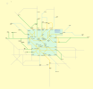
Very much a work in progress, but I wonder whether anyone has any comments so far. Orange lines are Oyster and contactless, green lines are contactless now, light blue lines are contactless later in 2025 and grey lines are still to come (or pointing outside the area).

Notes: Epsom and Cuffley really are in zone 9 for PAYG purposes, but there will be an explainer when the map is finished. If the map looks vaguely familiar, I did start with the Network Railcard Area map as a base to trace over.

paygmap.png
 

etr221

Established Member
Joined
10 Mar 2018
Messages
1,377
Very much a work in progress, but I wonder whether anyone has any comments so far. Orange lines are Oyster and contactless, green lines are contactless now, light blue lines are contactless later in 2025 and grey lines are still to come (or pointing outside the area).

Notes: Epsom and Cuffley really are in zone 9 for PAYG purposes, but there will be an explainer when the map is finished. If the map looks vaguely familiar, I did start with the Network Railcard Area map as a base to trace over.
My instant thought is - what are you trying to convey? Who are its audience? At present I don't feel I know enough about its intent, and what the finished version will look like to really judge (what is coming, but isn't there yet?). But at first glance, could lead to something good.

But, for practical purposes, I find the pay as you go with contactless map (https://assets.nationalrail.co.uk/e8xgegruud3g/4slOMGVrfJxLBhR1wZ3gO/fd67905c2e679aff913ed3faf5174b02/Pay_as_you_go_with_contactless_map_Feb_2025.pdf), available via the National Rail Pay As You Go with Contactless page quite ok, except that it a 'NR with Contactless' only (so no Oyster or non NR). But only once you've found it - it's not well publicised.
 

MikeWh

Established Member
Associate Staff
Senior Fares Advisor
Joined
15 Jun 2010
Messages
8,109
Location
Crayford
Audience is visitors to my website, in particular the under construction section focussing on South East Rail PAYG. It's intended to convey where contactless can and can't be used, especially where there are glaring holes in the coverage at the moment (esp Reading to Virginia Water). I'm working my way through adding in all the stations in the anticipated Oval rollout, outside zones 1-9, before going live. The National Rail map you've linked to is, as you say, ok. I definitely wanted to include details of Oyster coverage, and wanted to focus mainly on the area outside the zones. Thanks for your comments.
 

DelW

Established Member
Joined
15 Jan 2015
Messages
4,880
I think there's certainly a benefit in showing the Oyster validity area as well as contactless, as this seems frequently to catch out people who assume that the two are more or less equivalent.

My initial comment on the diagram itself is that I find it difficult to differentiate between the light blue and the grey until I've zoomed well in - unless you're holding back other colours for future layers, might a greater contrast be possible?

In passing, although it's obviously not geographically accurate, it's sufficiently close to geographic that it highlights some of the apparent anomalies in areas that are or aren't included in PAYG validity. It's hardly surprising that so many people are caught out by this.

(Edited to add) Probably something that will be coming anyway, but where a blue and a grey line diverge, it would help to name the junction station, e.g. Leatherhead and Hurst Green.
 
Last edited:

Richardr

Member
Joined
2 Jun 2009
Messages
526
Thanks for this, I certainly appreciate it.

One question that came to me, does it have both branches of the Elizabeth Line east of Liverpool Street, and should it have?
 

etr221

Established Member
Joined
10 Mar 2018
Messages
1,377
Personally, I don't find the grey and light blue too difficult to differentiate.

Coming from that though, is that light blue is for 'coming later this year' and grey is 'sometime or never'. Should the latter differentiate between 'expected at some time (maybe, and no idea when)' (which of these should be included, given the amount of speculation over Project Oval?) and 'no current plan or intention (i.e. never)'? Should lines in the latter category be shown where appropriate (they have links both ends, e.g. Tonbridge-Maidstone), or just have pointers as they leave the PAYG area? What happens when (as might well happen) there's an announcement that 'these stations are getting it at this date in 2025, these at this date in early 2026 (although for some we did 2025), and these later in 2026)'?

One question that came to me, does it have both branches of the Elizabeth Line east of Liverpool Street, and should it have?
There are a lot of lines (not just stations) - both NR & TfL (LU, LO, etc.) - within 'the zones' (inner greenish area) not shown, and this fact needs to be clearly stated - with a pointer as to where data can be found. Should there be a distinction between the inner zones (1-6, essentially Greater London) and the outer ones (7-9)?
 

MikeWh

Established Member
Associate Staff
Senior Fares Advisor
Joined
15 Jun 2010
Messages
8,109
Location
Crayford
Some good comments coming in, thanks for that, and keep them coming.
My initial comment on the diagram itself is that I find it difficult to differentiate between the light blue and the grey until I've zoomed well in - unless you're holding back other colours for future layers, might a greater contrast be possible?
I'll hold that thought if lots of people are affected. Neither have PAYG today so it's not disasterous if they are mixed up.
Probably something that will be coming anyway, but where a blue and a grey line diverge, it would help to name the junction station, e.g. Leatherhead and Hurst Green.
All stations outside zones 1-9 will be indicated when finished. The un-published version includes all of Essex and Kent, I'm working round clockwise.
One question that came to me, does it have both branches of the Elizabeth Line east of Liverpool Street, and should it have?
Personally I think not. There are a lot of lines, particularly in South London, not shown because the focus is on the beyond zone 9 area.
Coming from that though, is that light blue is for 'coming later this year' and grey is 'sometime or never'. Should the latter differentiate between 'expected at some time (maybe, and no idea when)' (which of these should be included, given the amount of speculation over Project Oval?) and 'no current plan or intention (i.e. never)'? Should lines in the latter category be shown where appropriate (they have links both ends, e.g. Tonbridge-Maidstone), or just have pointers as they leave the PAYG area? What happens when (as might well happen) there's an announcement that 'these stations are getting it at this date in 2025, these at this date in early 2026 (although for some we did 2025), and these later in 2026)'?
The map includes all lines shown on the 1st post of the main thread on here. As an when there is an announcement confirming new plans then I will look to incoprorate that announcement in the map. AFAIK the last announcement on gov.uk was end of January confirming those that went live on Feb 4th and those that would go live later in 2025. If there is a more recent official announcement then please let me know.
There are a lot of lines (not just stations) - both NR & TfL (LU, LO, etc.) - within 'the zones' (inner greenish area) not shown, and this fact needs to be clearly stated - with a pointer as to where data can be found.
Stations is clearly stated, I could also mention lines, will think about that. I'm also considering a within zones 1-9 full map and will link to it when it becomes a reality. The wider Southeast is currently my focus.
Should there be a distinction between the inner zones (1-6, essentially Greater London) and the outer ones (7-9)?
Possibly, though it will complicate matters a bit. It's filed in the potential enhancements box at the moment.
 

A S Leib

Established Member
Joined
9 Sep 2018
Messages
2,292
Of use to far fewer people, but would it be worth indicating that stations towards Huntingdon, Weymouth etc. can be used by KeyGo or Tap2Go?

The problem is that they can't be used on any non-GTR / South Western services (bar limited exceptions). I think the best way around that might be to use one colour line for each payment method, but that just leaves most of the map with two lines, no indication of TOCs and what would probably look like an incoherent mess to people less used to the network.
 

etr221

Established Member
Joined
10 Mar 2018
Messages
1,377
Of use to far fewer people, but would it be worth indicating that stations towards Huntingdon, Weymouth etc. can be used by KeyGo or Tap2Go?

The problem is that they can't be used on any non-GTR / South Western services (bar limited exceptions). I think the best way around that might be to use one colour line for each payment method, but that just leaves most of the map with two lines, no indication of TOCs and what would probably look like an incoherent mess to people less used to the network.
I certainly think that KeyGo and Tap2Go, and other PAYG offerings elsewhere on the railway, should be mentioned on the website, as part of 'the railway's' offerings - how much, if any, detail should be provided is a difficult question - probably do no more than say they exist, where (in broad terms) they can be used, and that they are different, not to be confused with Oyster/Contactless PAYG and not what the website is about.
I certainly wouldn't add them to the map - they will only add confusion, without value.
 

MikeWh

Established Member
Associate Staff
Senior Fares Advisor
Joined
15 Jun 2010
Messages
8,109
Location
Crayford
I certainly wouldn't add them to the map - they will only add confusion, without value.
100% agree. My site is entirely focussed on the specialties of the Oyster/contactless system.
 

Top