• Our new ticketing site is now live! Using either this or the original site (both powered by TrainSplit) helps support the running of the forum with every ticket purchase! Find out more and ask any questions/give us feedback in this thread!

Connex network map.

stadler

Established Member
Joined
5 Jun 2023
Messages
1,624
Location
Horsley
I do not suppose anyone has a Connex network map? Either a download or even just a photo that you took?

There used to be a Connex network map that was displayed on posters inside trains and on posters at stations. It showed the entire Connex South Central and Connex South Eastern networks and basically treated them as one combined train company. So it basically had the entirety of the current SE and SN networks. It was a Connex branded map.

I never managed to get a photo of one of these maps and have not found any online. I checked Andrew Smithers website (Project Mapping) as he has the biggest archive of old railway maps but there is nothing on there either.
 
Sponsor Post - registered members do not see these adverts; click here to register, or click here to log in
R

RailUK Forums

stadler

Established Member
Joined
5 Jun 2023
Messages
1,624
Location
Horsley
No unfortunately it was not that one. That is just the standard all operators South East England rail map with a Connex logo stuck on. This was a map that showed the Connex South Central and Connex South Eastern networks only. No other TOCs were shown. I remember seeing it all the time on posters inside the carriages and at stations. It was just branded as Connex on the map (without any mention of the "South Central" or "South Eastern" brands as the map treated the whole network as one) and i think the lines were blue and yellow. Either blue lines with yellow dots for stations or yellow lines with blue dots for stations. I forget which way round.
 

yorksrob

Veteran Member
Joined
6 Aug 2009
Messages
41,703
Location
Yorks
No unfortunately it was not that one. That is just the standard all operators South East England rail map with a Connex logo stuck on. This was a map that showed the Connex South Central and Connex South Eastern networks only. No other TOCs were shown. I remember seeing it all the time on posters inside the carriages and at stations. It was just branded as Connex on the map (without any mention of the "South Central" or "South Eastern" brands as the map treated the whole network as one) and i think the lines were blue and yellow. Either blue lines with yellow dots for stations or yellow lines with blue dots for stations. I forget which way round.

Also known as the Network SouthEast map.
 

GatwickDepress

Established Member
Joined
14 Jan 2013
Messages
2,516
Location
Leeds
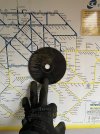
You can just about make out the map in the top left here, but I'm struggling to find anything clearer.


3448 n by Steve Thorpe, on Flickr

I have some Connex literature and none of them have the joint Central/Eastern maps in either - sometimes route-specific for individual timetables and the London Reconnections map, but not what you're looking for.
 

stadler

Established Member
Joined
5 Jun 2023
Messages
1,624
Location
Horsley
You can just about make out the map in the top left here, but I'm struggling to find anything clearer.


3448 n by Steve Thorpe, on Flickr

I have some Connex literature and none of them have the joint Central/Eastern maps in either - sometimes route-specific for individual timetables and the London Reconnections map, but not what you're looking for.
Thank you. Yes that is definitely the map that i am talking about. I remember it used to be in the ends of the carriages on all the old 4CEP and 4CIG and 4VEP units that Connex had. I am certain that i remember the 319 365 455 456 465 466 508 units all having this map too.

I also just asked a friend this afternoon who collects maps and he has sent me a tweet that he found and bookmarked on Twitter a while ago that contains part of the old map:


Unfortunately the edges are cut off of the photo and the centre is covered so only a small part of the map is visible. But this is the clearest i have found so far. I have tried doing a reverse image search on Google with that image but nothing comes up.

Fingers crossed a clearer photo comes up. I am just searching through Flickr now at interior photos. There are lots of old interior photos on Flickr so i am hoping that something comes up.
 

Chriso

Member
Joined
7 Dec 2006
Messages
435
I had a fold over card Connex metro map with all the Southern & South Eastern metro maps .
 

frankmoh

Member
Joined
7 May 2025
Messages
62
Location
London
View attachment 171935
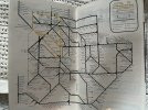
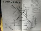
View attachment 171934Just in case it’s of interest, Connex SE map top - circa 2003. SouthCentral map above, circa 2001. It seems Connex didn’t put network maps in their 90s timetables
Apologies to reopen this dead thread but was there really a track going between Beckenham Junction and New Beckenham? I assume for the people who wanted to go to Waterloo or Cannon Street instead of Victoria.
(I do also miss Cannon Street services on the Hayes line nowadays)
 

stadler

Established Member
Joined
5 Jun 2023
Messages
1,624
Location
Horsley
Apologies to reopen this dead thread but was there really a track going between Beckenham Junction and New Beckenham? I assume for the people who wanted to go to Waterloo or Cannon Street instead of Victoria.
(I do also miss Cannon Street services on the Hayes line nowadays)
The track still exists. There are a couple Southeastern services a day that use it. I think it is just a few odd early morning and late evening services. It is also useful as a diversionary route during engineering works and disruption.
 

frankmoh

Member
Joined
7 May 2025
Messages
62
Location
London
The track still exists. There are a couple Southeastern services a day that use it. I think it is just a few odd early morning and late evening services. It is also useful as a diversionary route during engineering works and disruption.
Makes sense as to why I never knew about it. Do they divert because they do daily maintenance during the night/early morning?
 

frankmoh

Member
Joined
7 May 2025
Messages
62
Location
London
The track still exists. There are a couple Southeastern services a day that use it. I think it is just a few odd early morning and late evening services. It is also useful as a diversionary route during engineering works and disruption.
1746813111890.png
Yes the service is rare but this is an even sillier journey than trying to take a train from Catford Bridge to Catford. ESPECIALLY because there's a direct piece of track!
 

stadler

Established Member
Joined
5 Jun 2023
Messages
1,624
Location
Horsley
Makes sense as to why I never knew about it. Do they divert because they do daily maintenance during the night/early morning?
That is one of the reasons. Engineering work normally happens overnight. However the main reason is to maintain driver knowledge of the route for when diversions happen. Sometimes trains get diverted via this route all day during major engineering works or major disruption and they need to ensure that drivers maintain route knowledge of this route. So running a couple odd early morning and late evening services over this route is also an easy way to keep up route knowledge for drivers.
 

izvor

Member
Joined
11 Jun 2014
Messages
86
Location
on the SER
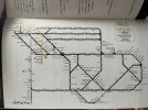
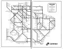
A bit late on the scene here, this is the map inside the combined Connex timetable book for 20 May 2001 (free, 480 pages!). Monochrome only, across 2 pages, I can't remember if they ever issued a colour version other than in poster format (and the line-specific ones as posted above). And if I do have one, it's buried deep at the moment!

Connex 2001-05-20.JPG
 

stadler

Established Member
Joined
5 Jun 2023
Messages
1,624
Location
Horsley
A bit late on the scene here, this is the map inside the combined Connex timetable book for 20 May 2001 (free, 480 pages!). Monochrome only, across 2 pages, I can't remember if they ever issued a colour version other than in poster format (and the line-specific ones as posted above). And if I do have one, it's buried deep at the moment!

View attachment 181124
Thank you very much. That is much appreciated. Now you post that i think i remember that version from the timetable books. I think all the timetable books had that. I really ought to dig out my old Connex timetables as i think i have a bunch stored in my loft.

It is interesting how that map shows the Lewes to Ringmer to Uckfield line as a continuation of the train line when it was in fact a bus route. Looking at that you would think it was a fully operational train line. The bus was operated by Connex (they used to operate dozens of bus routes in the Sussex area) but i find it funny how they have shown it as a train line.

I think the colour format was only on posters onboard their trains and at their stations. From what i can remember they always used black and white on their timetables. I suppose it makes it cheaper.

Someone sent me this link they found on Twitter which is the clearest photo i found:


20250601_163005.jpg

Looking closely at that i think the poster version is a slightly different version to the paper one in the timetable book that you have posted. This one also mentions Connex Metro stations and Connex Metro routes. I think those were routes and stations that had a higher frequency of service.
 

frankmoh

Member
Joined
7 May 2025
Messages
62
Location
London
The metro routes still exist today, see where the City Beams are. Aside from that fact that Southcentral isn't here for obvious reasons.

SE%20CityBeam%20route%20map.jpg


What I don't get is the stations on the metro routes that somehow are "other stations" as seen with the white dots. Why Catford isn't a metro stop but Catford Bridge is I have no clue.
 

frankmoh

Member
Joined
7 May 2025
Messages
62
Location
London
A bit late on the scene here, this is the map inside the combined Connex timetable book for 20 May 2001 (free, 480 pages!). Monochrome only, across 2 pages, I can't remember if they ever issued a colour version other than in poster format (and the line-specific ones as posted above). And if I do have one, it's buried deep at the moment!

View attachment 181124
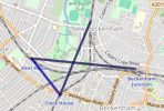
Given what the line between Beckenham Junction, Elmers End and Arena actually looks like, this map's Tramlink layout is horrifying.
 

izvor

Member
Joined
11 Jun 2014
Messages
86
Location
on the SER
Given what the line between Beckenham Junction, Elmers End and Arena actually looks like, this map's Tramlink layout is horrifying.
It's horrendous isn't it, looking very much to me like an afterthought, and sticks out even more as Tramlink is given greater prominence than the "other operators" lines. The whole map is a bit of a mess, with a mixture of curves and angles, poor spacing etc., definitely not a design classic.

But, thinking back to that time, the first Tramlink diagram was also pretty dire, and they started with a blank sheet and a simple network...
 

frankmoh

Member
Joined
7 May 2025
Messages
62
Location
London
It's horrendous isn't it, looking very much to me like an afterthought, and sticks out even more as Tramlink is given greater prominence than the "other operators" lines. The whole map is a bit of a mess, with a mixture of curves and angles, poor spacing etc., definitely not a design classic.

But, thinking back to that time, the first Tramlink diagram was also pretty dire, and they started with a blank sheet and a simple network...
They somehow condensed it all into meeting up at Sandilands and also made West Croydon on the same level as East.

Also, I do have to wonder why the modern Southeastern map doesn't show the line between New and Junction Beckenhams but the older (and worse) Connex one does. Did they run it more frequently back then?
 

Top