• Our booking engine at tickets.railforums.co.uk (powered by TrainSplit) helps support the running of the forum with every ticket purchase! Find out more and ask any questions/give us feedback in this thread!

Do Network Rail maintain Public Rights of Way?

Status
Not open for further replies.

Llanigraham

On Moderation
Joined
23 Mar 2013
Messages
6,103
Location
Powys
Thanks for the replies

It is my understanding that when British Rail rebuilt the station in 1987 planning permission was given on the understanding the footbridge would become a public right of way. I don't know any more than that and nor can I remember where I found this information.

Some years ago at some point after 2010, South West Trains applied for the station to be closed at night from 1:30am to 4am for the safety of staff working at the station. The diversion route marked up on the notices near the station said they were applying for this and the diversion route would be along Guildford Park Road, over the road bridge on Farnham Road and along Walnut Tree Close, from which the front entrance to the station is accessed.

This points to me that the footbridge is a public right of way, as why go to court and stick up notices? Why issue bridge passes?

So do Network Rail administer public rights of way? My understanding was they didn't but maybe someone else knows otherwise.

I intend to go back to the council to ask them to check with their public rights of way officer or person designated to undertake that statutory role.

According to the Definitive Map I have seen that route is no longer a PRoW and they did apply and were granted a Diversionary Order.

Away from stations, do footpaths / public rights of way that cross running lines at unmanned crossings not also have to be maintained by Network Rail? (I.e. the section of the PROW that's crossing railway property?)

Some do, some don't. It can go as far back to what was stated in the original Act for that line. Generally they are maintained however.

So I wonder who would keep a record of such paths as this? Or are they on original documents solely and over time the information gets forgotten about. I mean more generally.

All Public Rights of Way are recorded on the Definitive Map, held by the Councils Rights of Way Office, but you also might need to look at the "List of Streets" which is normally held by the Council Highways Dept. Surrey seem to be quite good and have combined their's in the public domain.

Having worked in the public sector, I'm aware that documents don't always last as long as they actually should. I'm sure it is the same in the private sector in large companies.

Many PRoW documents can go back 100's of years! And lots of them don't exist any more!

I was thinking more along the lines of who maintains the record of these rights of way, rather than who maintains then physically.

Councils are supposed to but lots have transferred them to the Kew.
Or in Wales, the National Library at Aberystwyth.

I've recently agreed to help research public rights of way across railway lines in West Sussex. This is for in use lines, disused lines, lines that were never finished and those given permission in parliament but never started. This is to ensure any public rights if aga not shown on the definitive map are recorded prior to 2025, when anything not on a definitive map will cease to be considered a public right of way. I've been told East Sussex has already been researched.

Good luck with that. When we were researching Vehicular Rights of Way we were going back to canal and railway Acts, and even Tithe records. I don't think they ever finished their research.


I've not studied the station redevelopment plans to see if they will deal with the bridge issue. Im not against it being dealt with, as long as people still have a route.

When they use to close it, it involved an extra walk. Alas at the time I didn't know one had some kind of right to use it.

See my comments above.
 
Last edited:
Sponsor Post - registered members do not see these adverts; click here to register, or click here to log in
R

RailUK Forums

infobleep

Veteran Member
Joined
27 Feb 2011
Messages
12,669
Cheers for all the replies. My understanding is that the footbridge is a public right of way, save between 1.30am and 4am. I probably photographed the notice when it was up but finding it might be interesting, amongst my hundreds of photos.
 

Llanigraham

On Moderation
Joined
23 Mar 2013
Messages
6,103
Location
Powys
Cheers for all the replies. My understanding is that the footbridge is a public right of way, save between 1.30am and 4am. I probably photographed the notice when it was up but finding it might be interesting, amongst my hundreds of photos.

No, that makes it a Permissive Path. Totally different.
 

DEFarnes

Member
Joined
31 Aug 2020
Messages
16
Location
Walthamstow
There is a copy of the definitive rights of way map in Guildford Library, in a big metal cabinet. (I add that detail as some librarians don't know where it is because no one asks to see them, or what I was looking for at the time, the GOAD maps).
 

infobleep

Veteran Member
Joined
27 Feb 2011
Messages
12,669
No, that makes it a Permissive Path. Totally different.
Thanks for clarification NG.
There is a copy of the definitive rights of way map in Guildford Library, in a big metal cabinet. (I add that detail as some librarians don't know where it is because no one asks to see them, or what I was looking for at the time, the GOAD maps).
Cheers for that.
 

pubby

Member
Joined
16 Feb 2011
Messages
8
Location
Braintree
A path can become a right of way if you can prove regular public use as such for a decently long period of time. I don’t know whether that could happen to a footbridge, though if the station is ever closed I think that might stop it happening?? Does the station and footbridge close at night, on Christmas Day, or suchlike?
However, s. 57 of the British Transport Commission Act 1949 prevents a right of way being acquired by prescription on land owned by the BTC (now NR) and giving access to a station or goods yard.
 

slicedbread

Member
Joined
11 Oct 2012
Messages
33
Came across an old BBC report about the Guildford footbridge being closed between 01:30 and 03:30 back in 2010.

BBC News - Guildford station bridge to shut for two hours a night

The interesting bit is it reports:

”The council agreed the bridge should be closed from 0130 to 0330 GMT ."

I'm assuming that's Guildford council rather than Surrey and that does suggest the it's not just up to SWR (SWT back in 2010 of course), but the council's permission is needed. I guess that would fit in with the suggestion that bridge access had been a condition of planning approval.
 

infobleep

Veteran Member
Joined
27 Feb 2011
Messages
12,669
Came across an old BBC report about the Guildford footbridge being closed between 01:30 and 03:30 back in 2010.

BBC News - Guildford station bridge to shut for two hours a night

The interesting bit is it reports:

”The council agreed the bridge should be closed from 0130 to 0330 GMT ."

I'm assuming that's Guildford council rather than Surrey and that does suggest the it's not just up to SWR (SWT back in 2010 of course), but the council's permission is needed. I guess that would fit in with the suggestion that bridge access had been a condition of planning approval.
That long ago. Now time flies. If I took a photo of the notices it would be with an older camera and not so easy to locate currently.

Interestingly around that time I tried to look up need articles on the station entrance between closed in around 2003 on Sundays and after 10 pm on week day nights but could find nothing. It was as if that issue never reached the news
 

Gloster

Established Member
Joined
4 Sep 2020
Messages
8,443
Location
Up the creek
I worked at Guildford in 1978 when the bridge was still known as the Passimeter, which suggests that at some time there had been a barrier. Just beyond the steps to Platforms 7 and 8 there was a booth with a ticket collector. I think, but am not certain as I was on permanent earlys, that the exit to Park Road was closed at night.
 

higthomas

Member
Joined
27 Nov 2012
Messages
1,132
I've recently agreed to help research public rights of way across railway lines in West Sussex. This is for in use lines, disused lines, lines that were never finished and those given permission in parliament but never started. This is to ensure any public rights if aga not shown on the definitive map are recorded prior to 2025, when anything not on a definitive map will cease to be considered a public right of way. I've been told East Sussex has already been researched.

Hopefully other people are covering other parts of the UK.

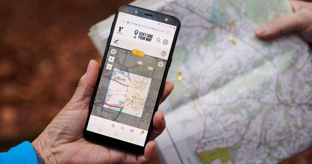
The ramblers associations "Don't lose your way campaign is largely doing that:


Our paths are one of our most precious assets, hidden in plain sight, and often taken for granted.

Shaped by our ancestors over centuries, they tell the stories of our landscape, our history and our heritage, they describe how generations before us travelled to the pub, field or shops, and they allow everyone to enjoy the countryside, both on our doorstep and across Britain’s iconic landscapes.

But an estimated 10,000 miles of paths across England and Wales are at risk of being lost forever, unless we come together to save them.


Also, this network rail study includes the quote:
A public right of way exists across the footbridge

 
Last edited:
Status
Not open for further replies.

Top