richieb1971
Established Member
- Joined
- 28 Jan 2013
- Messages
- 2,020
He meant Kempston Hardwick brickworks which closed early 80s. The park is on that land not that of Stewartby. As for the rest....
Well, with so many errors it's hard to work out what he/she ment to be honest.He meant Kempston Hardwick brickworks which closed early 80s. The park is on that land not that of Stewartby. As for the rest....
Our role will be to respond to the statutory consultation(s) on the final proposals put forward by EWR Co, which we now expect to start in June. Until we receive their actual proposals, we cannot determine our own position. However, with regard to your questions 1 – 4, I would respond as follows:
I am happy that Ford end road bridge is fit for purpose, looking at it the angle seems a bit off for 2 tracks but it does seem like it could work. If Bromham road bridge goes to 6 tracks it will mean a very steep incline for cyclists on the road bridge and the previous build did not provision for cyclists at all, even though it was lobbied.
- We do not currently anticipate that the southern bridge (Ford End Road) will need to be altered, based on the route put forward by EWR in their Route Update Announcement. The northern (Bromham Road) bridge will not need any further works unless EWR insist on six tracks through the Poets area. As you know, we oppose this and believe that four tracks can do the job.
- EWR Co are proposing that the stabling capacity currently available in the Jowett Sidings is relocated to the area currently occupied by the breakers’ yard between the Cauldwell Sidings and the MML slow lines. This will involve trains running north into Bedford Midland at the start of service, but this would actually be less of a shunting move than they undertake from Jowett now.
- EWR Co have not yet produced their final car parking solution for Bedford Midland, but I understand that they agree with you and are seeking to provide more spaces than are currently available.
- The creation of a “Tamworth-style” station at the Wixams does not appear possible now that the land to the north of the station has the B&M warehouse in situ plus planning permission having been granted for a similar facility for Aldi. The current BFARe proposal runs further north than the site of the proposed Wixams station on the MML.


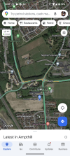
Have you looked at a map between Ampthill and Flitwick? They are essentially one town now, with only a (busy) roundabout separating them. There is nowhere, other than underground, to put a railway without causing mass destruction of homes and businesses.Forget Bedford. I say that EWR should run from Ridgemont to Letchworth, crossing the MML between Ampthill and Flitwick. 15 miles as the crow flies. Add a third platform at Letchworth to allow 2-4 tph Thameslink trains to terminate without conflicts to release capacity on the line from Hitchin to Cambridge South (and with skip stopping at the minor stations or additional passing loops if necessary).
Unless Google Maps is out of date, there seems to be a 200m wide gap between the built up areas. Plenty of space to run a modern concrete beam viaduct with trough sections to act as sound barriers.Have you looked at a map between Ampthill and Flitwick? They are essentially one town now, with only a (busy) roundabout separating them. There is nowhere, other than underground, to put a railway without causing mass destruction of homes and businesses.
this is one route where you could put the viaduct, using spans of 32m (and one of 24m). These are the standard lengths used on China's high speed lines.Where is this 200m gap?

The trouble with google maps is that it only shows 2 dimensions when you need to think in 3.Unless Google Maps is out of date, there seems to be a 200m wide gap between the built up areas. Plenty of space to run a modern concrete beam viaduct with trough sections to act as sound barriers.
So? You avoid the steep northern escarpment if you head over towards Ridgmont. The line will need a cutting, where the A507 label is, to get under the road anyway.The trouble with google maps is that it only shows 2 dimensions when you need to think in 3.
In particular pay attention to the fact that the WCML, the MML and the old Bedford-Hitchin line all pass through the Greensand ridge in tunnels.
The northern face of the ridge is steep, as anyone who has been to Ampthill Park will know.
Next time you travel on the train to London, take a look out of the window between Bedford and Flitwick.


Cambridge Delivery Group: Establishing a Growth Company
Published 26 March 2024
- Leading development: through large scale land assembly, major infrastructure projects, and ensuring maximum recovery including through planning contributions.
The operation of the Growth Company will continue to be underpinned by cross-department governance which brings together relevant departments to consider key issues, including maximising the benefits of East-West Rail.
The Case for Cambridge March 2024
Deliver East West Rail, radically improving connectivity to other innovation and economic centres in Bedford, Milton Keynes and Oxford, and making sure we bring the full benefits of this new line to the city of Cambridge.