It tends to be in midsummer from the Cliffs around The Cabin & Bispham, when the sun sets behind the Isle of Man.Whenever I’ve been to Blackpool in recent years I now always look out for the Lakes, Isle of Man, and Snowdonia.
I’d never thought to look for the lengthy views from the promenade, until one year when I couldn’t believe my eyes when I could see the outline of the Isle of Man.
-
Our booking engine at tickets.railforums.co.uk (powered by TrainSplit) helps support the running of the forum with every ticket purchase! Find out more and ask any questions/give us feedback in this thread!
You are using an out of date browser. It may not display this or other websites correctly.
You should upgrade or use an alternative browser.
You should upgrade or use an alternative browser.
Longest line of sight (UK)
- Thread starter Altrincham
- Start date
Sponsor Post - registered members do not see these adverts; click here to register, or click here to log in
R
RailUK Forums
Trainguy34
Member
Not that far, but you can often see Southend from Whitstable on a clear day, around 20 miles.
TheHSRailFan
Member
- Joined
- 16 Jun 2018
- Messages
- 245
almost the same distance as the straight of DoverNot that far, but you can often see Southend from Whitstable on a clear day, around 20 miles.
thinks that's impressive... take a look at the rest of this thread!That’s crazy, I had no idea you could see the Shard from the Isle of Sheppey.
Altrincham
Member
- Joined
- 22 Aug 2011
- Messages
- 262
Looking at the viewfinder panorama for Blackpool Tower, I can see that Shining Tor is a line of sight.
I would imagine that, in incredible conditions, from Shining Tor it might just be possible to make out the top of Blackpool Tower, but this wouldn’t be as easily spotted as viewing Shining Tor from the top of Blackpool Tower.
Shining Tor is just on the border of Cheshire and Derbyshire, and it set me thinking about whether this could possibly be the longest line of sight to a landlocked county from a location directly on the coast (assuming that the Derbyshire part of Shining Tor was visible from Blackpool Tower).
Looking at the viewfinder panorama for Blackpool Tower, I can see that Shining Tor is a line of sight.
I would imagine that, in incredible conditions, from Shining Tor it might just be possible to make out the top of Blackpool Tower, but this wouldn’t be as easily spotted as viewing Shining Tor from the top of Blackpool Tower.
Shining Tor is just on the border of Cheshire and Derbyshire, and it set me thinking about whether this could possibly be the longest line of sight to a landlocked county from a location directly on the coast (assuming that the Derbyshire part of Shining Tor was visible from Blackpool Tower).
I once stood atop Shining Tor, and although the view was great, I don’t remember being able to see Blackpool Tower. Although I was hampered by a Grade 3 hangover collected from a wedding the previous evening.
ChiefPlanner
Established Member
A4069 - the road from Brynamman to Llangadog via the Black Mountain. Even Mr J Clarkson rates is a "must drive road.
On a (rare) clear day - from the summit - you can see right down to the Mumbles on Swansea Bay , (and even towards North Devon) and northwards a great vista over the green desert that is Mid Wales.
On a (rare) clear day - from the summit - you can see right down to the Mumbles on Swansea Bay , (and even towards North Devon) and northwards a great vista over the green desert that is Mid Wales.
Altrincham
Member
- Joined
- 22 Aug 2011
- Messages
- 262
The power station will be Fiddlers Ferry on the banks of the Mersey. I’m going to miss seeing the cooling towers from long distances as they’ve been quite a feature on the horizon from all directions for as long as I can remember.I was on the A58 heading west down towards Littleborough and could see Manchester and beyond what looked like a Power station and hills beyond that. Perhaps the hills of North Wales.
Peter Mugridge
Veteran Member
Wouldn't the lights on Blackpool Tower, which include the top, help the visibility from that distance?Looking at the viewfinder panorama for Blackpool Tower, I can see that Shining Tor is a line of sight.
I would imagine that, in incredible conditions, from Shining Tor it might just be possible to make out the top of Blackpool Tower, but this wouldn’t be as easily spotted as viewing Shining Tor from the top of Blackpool Tower.
TheHSRailFan
Member
- Joined
- 16 Jun 2018
- Messages
- 245
I mean, if the atmosphere is in the right condition for atmospheric refraction then it's possible. On the idea on what you said on your last line, it could be, but more testing a research would have to go in in my opinion to decide if it is.Looking at the viewfinder panorama for Blackpool Tower, I can see that Shining Tor is a line of sight.
I would imagine that, in incredible conditions, from Shining Tor it might just be possible to make out the top of Blackpool Tower, but this wouldn’t be as easily spotted as viewing Shining Tor from the top of Blackpool Tower.
Shining Tor is just on the border of Cheshire and Derbyshire, and it set me thinking about whether this could possibly be the longest line of sight to a landlocked county from a location directly on the coast (assuming that the Derbyshire part of Shining Tor was visible from Blackpool Tower).
That will most likely be Carrington Power Station and you probably did have a lucky day where you saw north wales.I was on the A58 heading west down towards Littleborough and could see Manchester and beyond what looked like a Power station and hills beyond that. Perhaps the hills of North Wales.
D6130
Established Member
I thought that Carrington Power Station had been closed and demolished?That will most likely be Carrington Power Station and you probably did have a lucky day where you saw north wales.
xotGD
Established Member
- Joined
- 4 Feb 2017
- Messages
- 6,089
There's now a CCGT at Carrington.I thought that Carrington Power Station had been closed and demolished?
Altrincham
Member
- Joined
- 22 Aug 2011
- Messages
- 262
There is still a power station at Carrington, which is now gas-powered.I thought that Carrington Power Station had been closed and demolished?
Carrington Power Station doesn’t have the prominence to be spotted from the hills around Greater Manchester (it’s fairly low-lying and not a huge presence from a distance), so it’s more likely to be Fiddlers Ferry that’s seen from the A58 around Littleborough.
On an extremely clear and crisp night with some good binoculars this should be a possibility.Wouldn't the lights on Blackpool Tower, which include the top, help the visibility from that distance?
DelW
Established Member
- Joined
- 15 Jan 2015
- Messages
- 3,883
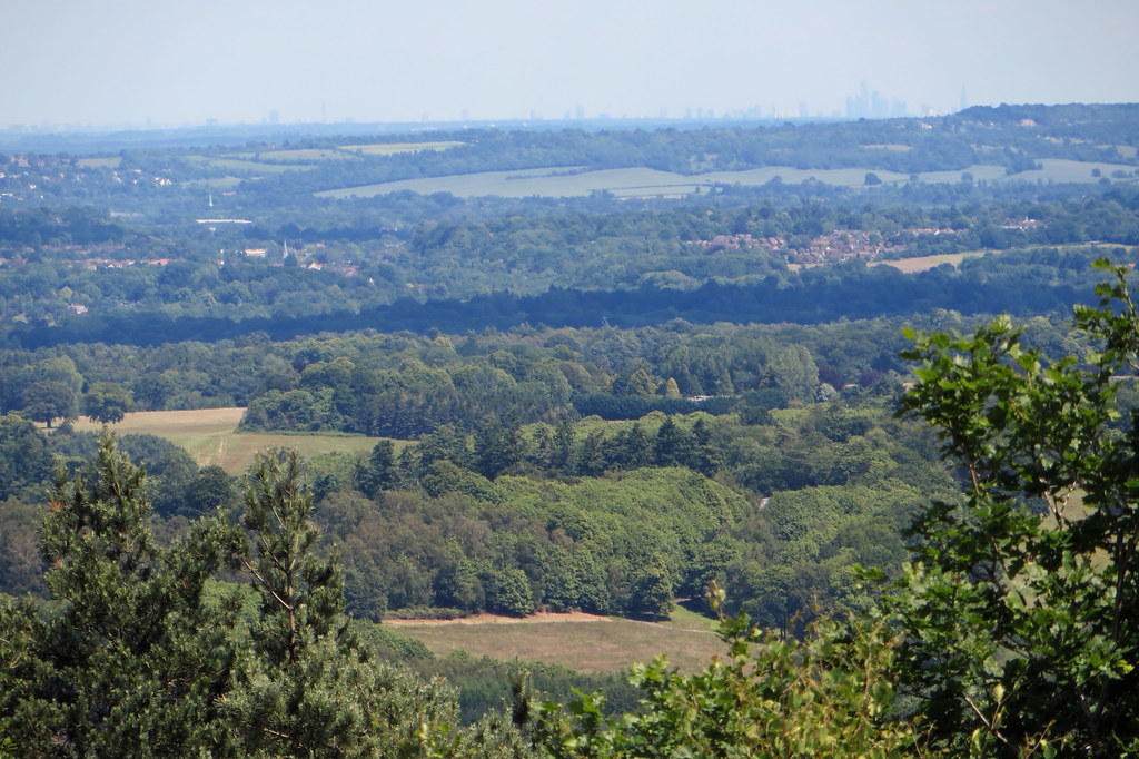
For many years I've lived within about a dozen miles of Caesar's Camp near Aldershot, but I'd never visited it, assuming really that it was just another bare-heathland military training ground. But having read the comments about it earlier in this thread (and seen the one photo with them), I thought I ought to investigate it sometime.
Well, "sometime" came up today, with a (fairly) clear blue sky and clear air. Unfortunately when I went to pick up my usual DSLR its battery was down to one bar, so instead I dug out its predecessor, put in some AA batteries and fitted a 200mm lens, and took that. My unfamiliarity with it, and its relatively small 6Mp sensor, probably meant that my photos weren't as good as I'd hoped.
However the place itself amazed me, far more interesting landscape than I'd expected, and the panorama to north and east is wonderful. The woodland and the rings of defensive banks add interest, and there's the oddity of a pool, indeed almost a lake, at nearly the highest point, with the ground dropping away on all sides (apart from the immediate surrounding bank, that is). Apparently it's an old gravel pit, but it's quite surprising that it holds water, since most of the area is sandy ground. I also saw a (very) short length of 2' gauge railway track that might need further investigation, there was no sign of what age it might be or what purpose it might have had.
I shall go back and explore further on another "sometime", possibly with a superzoom compact next time, which might be better suited to the view (and lighter to carry).
For what they're worth, these are two of today's pictures.


PS: from Google Maps, the Shard is 35.65 miles away, and Canary Wharf just over 38 miles.
Well, "sometime" came up today, with a (fairly) clear blue sky and clear air. Unfortunately when I went to pick up my usual DSLR its battery was down to one bar, so instead I dug out its predecessor, put in some AA batteries and fitted a 200mm lens, and took that. My unfamiliarity with it, and its relatively small 6Mp sensor, probably meant that my photos weren't as good as I'd hoped.
However the place itself amazed me, far more interesting landscape than I'd expected, and the panorama to north and east is wonderful. The woodland and the rings of defensive banks add interest, and there's the oddity of a pool, indeed almost a lake, at nearly the highest point, with the ground dropping away on all sides (apart from the immediate surrounding bank, that is). Apparently it's an old gravel pit, but it's quite surprising that it holds water, since most of the area is sandy ground. I also saw a (very) short length of 2' gauge railway track that might need further investigation, there was no sign of what age it might be or what purpose it might have had.
I shall go back and explore further on another "sometime", possibly with a superzoom compact next time, which might be better suited to the view (and lighter to carry).
For what they're worth, these are two of today's pictures.
- the first looks roughly ENE and shows the tower blocks by the station at Woking to the right, the Shard middle left with (I think) Canary Wharf to its right and the City to its left
- the second is aimed to the right of the first, more nearly east, Woking is just out of shot to the left, and I assume that the tower blocks must be Croydon
PS: from Google Maps, the Shard is 35.65 miles away, and Canary Wharf just over 38 miles.
Last edited:
Great pics
I, too, spent many years living within a dozen miles of Caesar’s Camo, and didn’t even know if it’s existence until this thread.
In your first pic, the towers immediately to the right of the Shard are those on / around the South Bank near Vauxhall. The larger group further right (just right of centre of the pic) is Canary Wharf.
DelW
Established Member
- Joined
- 15 Jan 2015
- Messages
- 3,883
Yes, I was puzzled by the two separate groups to the right of the Shard, but drawing the line from my viewpoint to the Shard on Google maps does indeed confirm that the Vauxhall and Nine Elms development would be just to the right of it, with Canary Wharf further right.Great pics
I, too, spent many years living within a dozen miles of Caesar’s Camo, and didn’t even know if it’s existence until this thread.
In your first pic, the towers immediately to the right of the Shard are those on / around the South Bank near Vauxhall. The larger group further right (just right of centre of the pic) is Canary Wharf.
I've also subsequently spotted that on the second photo, the Crystal Palace mast is visible close to the left edge, which I hadn't seen when I was looking in real life.
Another visit with a longer zoom is definitely needed, but not in tomorrow's weather!
Great pics
I, too, spent many years living within a dozen miles of Caesar’s Camo, and didn’t even know if it’s existence until this thread.
In your first pic, the towers immediately to the right of the Shard are those on / around the South Bank near Vauxhall. The larger group further right (just right of centre of the pic) is Canary Wharf.
The same with me, in the 80s I lived somewhere not too far south of Farnham and Guildford.
As it was close to a bus route (the Farnham town service) I "could" have visited Caesar's Camp as long ago as 1987 (that's when I was allowed to do day trips by bus on my own: even though I was allowed to visit stations for rail enthusiast purposes in 1983, I wasn't allowed to go on bus trips until 1987) but never did until November 2014, and then, I arrived too late and it was semi-dark so didn't really get to see the view.
I think I also assumed it was "just another" MOD-owned heath, and while I have something of a fondness for these MOD-owned heaths, there were others further south which were more accessible.
I’ve yet to spend a leisurely time at Caesars camp , I’ve only ever been there whilst doing runs with the Army, quite a few years back. Not enough time to stop and take in the views ! I’d like to go and have a look there , although I’m not sure where exactly the view point is ?
My dad was based in the Aldershot area in the 80s, but back then the London skyline was very different. Only the BT tower and Nat west tower would have been seen from a long distance ?
My dad was based in the Aldershot area in the 80s, but back then the London skyline was very different. Only the BT tower and Nat west tower would have been seen from a long distance ?
St Paul's as well. That's visible from up at Hindhead.My dad was based in the Aldershot area in the 80s, but back then the London skyline was very different. Only the BT tower and Nat west tower would have been seen from a long distance ?
D6130
Established Member
What are the views like from Telegraph Hill near Haslemere, which I believe is the second highest point in the Surrey Weald after Leith Hill? I never made it up there when I lived in the area back in the 'seventies, but I believe that it's quite thickly wooded.St Paul's as well. That's visible from up at Hindhead.
DelW
Established Member
- Joined
- 15 Jan 2015
- Messages
- 3,883
I parked in a rather unofficial layby opposite the Shell garage on the A287 north of Farnham. From there the main viewpoint is around a mile away, almost due north-eastwards. There's something of a maze of paths and tracks, but basically if you head north-east and avoid going down hill, you'll get there! There are several benches to sit on and take in the panorama.I’ve yet to spend a leisurely time at Caesars camp , I’ve only ever been there whilst doing runs with the Army, quite a few years back. Not enough time to stop and take in the views ! I’d like to go and have a look there , although I’m not sure where exactly the view point is ?
Edit: automerged addendum
(I wish I could prevent it doing that when it's really a separate post
The only Telegraph Hill I can see on the OS 1:25000 of that area is south-west of Fernhurst. It seems to be wooded and the only close approach is via a private drive. It's only 207m high though. The map marks a viewpoint about 1/4 mile south at Woolbeding Common.What are the views like from Telegraph Hill near Haslemere, which I believe is the second highest point in the Surrey Weald after Leith Hill? I never made it up there when I lived in the area back in the 'seventies, but I believe that it's quite thickly wooded.
I believe Haste Hill just south-east of Haslemere centre was the next semaphore station towards London. It also seems to be thickly wooded and a similar elevation.
North from there the next semaphore station was at Banacle Hill near Brook. There are good views from nearby but nothing particularly spectacular or unusual.
The two highest points I know of in the area are Blackdown - south east of Haslemere at 280m max; and Gibbet Hill - east of Hindhead at 272m. The former has views south and east to the South Downs, the latter has views north and east to the North Downs and Greensand ridge. @Taunton said above that St Paul's is visible from Hindhead - I've never seen that far myself but maybe I'll try to get up there with a long zoom and binoculars next time we have a clear day.
Last edited:
We discussed this one previously and someone found this excellent shot from Gibbet Hill, Hindhead - in the group in The City, 22 Bishopsgate is the tallest, NatWest Tower is the leftmost of the group, and St Pauls is the dumpy one to the left of that. Should be visible from Farnham as well, as that benefits from being on the extended line which is an official protected view from Richmond Hill to the cathedral. All those hills in the Farnham-Hindhead Surrey Downs area are visible from the London Eye as you go over the top, so the reverse ought to be true.The two highest points I know of in the area are Blackdown - south east of Haslemere at 280m max; and Gibbet Hill - east of Hindhead at 272m. The former has views south and east to the South Downs, the latter has views north and east to the North Downs and Greensand ridge. @Taunton said above that St Paul's is visible from Hindhead - I've never seen that far myself but maybe I'll try to get up there with a long zoom and binoculars next time we have a clear day.

What a whopper 22 Bishopsgate is - the only one Central London one visible over the rooftops from our house in Canary Wharf.
Last edited:
DelW
Established Member
- Joined
- 15 Jan 2015
- Messages
- 3,883
Thanks, definitely worth another trip up there then, as well as revisiting Caesar's Camp!We discussed this one previously and someone found this excellent shot from Gibbet Hill, Hindhead - in the group in The City, 22 Bishopsgate is the tallest, NatWest Tower is the leftmost of the group, and St Pauls is the dumpy one to the left of that.
What a whopper 22 Bishopsgate is - the only one Central London one visible over the rooftops from our house in Canary Wharf.
The distance stated to the City on there is about the same as to Canary Wharf for my Caesar's Camp shot above.
D6130
Established Member
The only Telegraph Hill I can see on the OS 1:25000 of that area is south-west of Fernhurst.
Apologies....it was Blackdown that I was thinking of. It's a long time since I lived in the area - 45 years to be precise!The two highest points I know of in the area are Blackdown - south east of Haslemere at 280m max; and Gibbet Hill - east of Hindhead at 272m.
DelW
Established Member
- Joined
- 15 Jan 2015
- Messages
- 3,883
No apology needed ... it led me into finding out more about the semaphore route south of Guildford, which I hadn't known much about. (I knew a bit about the route north of Guildford from visiting Chatley Heath tower many years ago).Apologies....it was Blackdown that I was thinking of. It's a long time since I lived in the area - 45 years to be precise!
I've got few places noted to explore down that way now
DerekC
Established Member
Advice needed. I frequently walk up Pilsdon Pen in West Dorset. The "PeakVisor" app says I should be able to see Pen y Van in the Brecon Beacons at 79 miles away. Does that sound feasible? I haven't been able to pick it out even on what seemed like a very clear day. The app gives a height of 886m and a "proportional prominence" of 670m. Is that the apparent height above the horizon?
Altrincham
Member
- Joined
- 22 Aug 2011
- Messages
- 262
I paid a visit to Prestatyn mountain on Sunday, the day of Rhyl air show. Stopped off at the viewpoint at Gwaenysgor. It’s an impressive vista from the car park, and due west I could make out Anglesey, whilst in a north easterly direction I could see Blackpool Tower sat on the horizon. That’s a first for me to see both Blackpool and Anglesey from a single spot
Through binoculars it was possible to make out low-lying buildings on the Fylde coast, with visibility mostly helped by Blackpool being bathed in sunshine whilst North Wales was quite cloudy.
Times like that I wished I had a good camera lens.
Through binoculars it was possible to make out low-lying buildings on the Fylde coast, with visibility mostly helped by Blackpool being bathed in sunshine whilst North Wales was quite cloudy.
Times like that I wished I had a good camera lens.