-
Our new ticketing site is now live! Using either this or the original site (both powered by TrainSplit) helps support the running of the forum with every ticket purchase! Find out more and ask any questions/give us feedback in this thread!
You are using an out of date browser. It may not display this or other websites correctly.
You should upgrade or use an alternative browser.
You should upgrade or use an alternative browser.
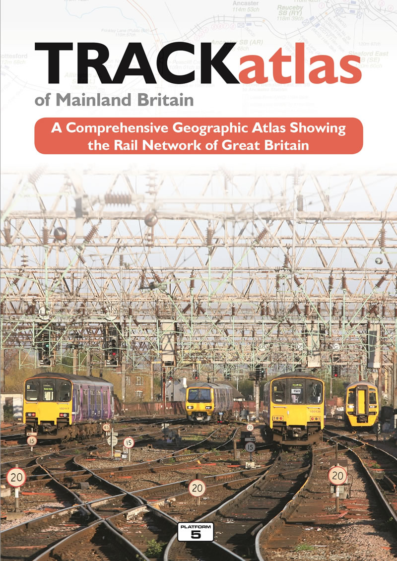
Track Atlas of Mainland Britain
- Thread starter Inversnecky
- Start date
- Status
- Not open for further replies.

Sponsor Post - registered members do not see these adverts; click here to register, or click here to log in
R
RailUK Forums
swt_passenger
Veteran Member
- Joined
- 7 Apr 2010
- Messages
- 33,070
I have a 2009 edition, I’d say it was roughly equivalent to having all the “Quail” type maps in one book, but at slightly less detail. It‘s geographically much more correct, which of course ordinary Quail volumes are not. Mine has 133 pages of maps and 24 for the index. Dense areas of track have larger scale separate maps as you’d expect.
Let me know which area of Scotland you’re in and I could scan the page for you? (Although the link now provided in post #5 will give you the general idea anyway.)
Let me know which area of Scotland you’re in and I could scan the page for you? (Although the link now provided in post #5 will give you the general idea anyway.)
Last edited:
Mcr Warrior
Veteran Member
- Joined
- 8 Jan 2009
- Messages
- 15,023
A tad expensive at £27.95 but the 3rd edition is a useful publication IMHO. Also includes map inset details for many major town and city stations and local networks, overlay maps of most GB tram and light rail networks (e.g. London Tramlink, Midland Metro, Manchester Metrolink and Sheffield Supertram) and a comprehensive place name index.
higthomas
Member
- Joined
- 27 Nov 2012
- Messages
- 1,181
The other images shown on the website give a good indication of what it looks like inside.
 www.trackmaps.co.uk
TRACKatlas of Mainland Britain - TRACKmaps
The second edition includes: An Index Map showing the page layout An specific Index Map for the London area A Key and list of Abbreviations 104 pages of schematic maps covering the country followed by 36 pages of larger scale maps covering congested areas such as London, Manchester...
www.trackmaps.co.uk
Inversnecky
Member
Thanks, I didn’t realise there was an associated website.The other images shown on the website give a good indication of what it looks like inside.
TRACKatlas of Mainland Britain - TRACKmaps
The second edition includes: An Index Map showing the page layout An specific Index Map for the London area A Key and list of Abbreviations 104 pages of schematic maps covering the country followed by 36 pages of larger scale maps covering congested areas such as London, Manchester...
Mcr Warrior
Veteran Member
- Joined
- 8 Jan 2009
- Messages
- 15,023
Looks more like the publisher's online book listing.Thanks, I didn’t realise there was an associated website.
Inversnecky
Member
Sorry, I missed this before, that’s very kind of you indeed. It would be interesting to see Inverness or Edinburgh Waverley.I have a 2009 edition, I’d say it was roughly equivalent to having all the “Quail” type maps in one book, but at slightly less detail. It‘s geographically much more correct, which of course ordinary Quail volumes are not. Mine has 133 pages of maps and 24 for the index. Dense areas of track have larger scale separate maps as you’d expect.
Let me know which area of Scotland you’re in and I could scan the page for you? (Although the link now provided in post #5 will give you the general idea anyway.)
I have just ordered the book below. Presumably it has much the same thing?
Railway Track Diagrams, Book 1 – Scotland & Isle of Man: Amazon.co.uk: Martyn Brailsford, Martyn Brailsford: 9780954986698: Books
Buy Railway Track Diagrams, Book 1 – Scotland & Isle of Man 6th Revised edition by Martyn Brailsford, Martyn Brailsford (ISBN: 9780954986698) from Amazon's Book Store. Everyday low prices and free delivery on eligible orders.
www.amazon.co.uk
swt_passenger
Veteran Member
- Joined
- 7 Apr 2010
- Messages
- 33,070
That’s what’s usually referred to as a “Quail” book, as others have mentioned, there’s the set of 6 that cover the country. What I do is to have the up to date vol 5 (“Southern Region” and LU) for its higher level of detail, (£15.95 last time) and use the Atlas to give me an overview of the rest of the country. Here’s the Inverness page.Sorry, I missed this before, that’s very kind of you indeed. It would be interesting to see Inverness or Edinburgh Waverley.
I have just ordered the book below. Presumably it has much the same thing?
Railway Track Diagrams, Book 1 – Scotland & Isle of Man: Amazon.co.uk: Martyn Brailsford, Martyn Brailsford: 9780954986698: Books
Buy Railway Track Diagrams, Book 1 – Scotland & Isle of Man 6th Revised edition by Martyn Brailsford, Martyn Brailsford (ISBN: 9780954986698) from Amazon's Book Store. Everyday low prices and free delivery on eligible orders.www.amazon.co.uk

Mcr Warrior
Veteran Member
- Joined
- 8 Jan 2009
- Messages
- 15,023
That's the Inverness area page from the £27.95 "TrackAtlas" book, isn't it?
P.S. I have the "Quail" booklets as being in 5 volumes. Is there now a 6th?
P.S. I have the "Quail" booklets as being in 5 volumes. Is there now a 6th?
swt_passenger
Veteran Member
- Joined
- 7 Apr 2010
- Messages
- 33,070
Yes it is the Atlas, it’s in response to my offer in post #2 and reply in post #8...That's the Inverness area page from the £27.95 "TrackAtlas" book, isn't it?
P.S. I have the "Quail" booklets as being in 5 volumes. Is there now a 6th?
I expect the whole 6 book set includes the Ireland book, and maybe not too many people have that one.
Last edited:
Mcr Warrior
Veteran Member
- Joined
- 8 Jan 2009
- Messages
- 15,023
Thanks for clarifying. Don't already have a copy of the one for Ireland. On checking, I believe that a revised new edition of this Volume 6 "Quail" booklet for Ireland is actually planned to be due out in 2021, so might get one then.I expect the whole 6 book set includes the Ireland book, and maybe not too many people have that one.
Killingworth
Established Member
I have a 3rd Edition 2017. I find it useful to better understand some of the threads on here which dive off into unknown territory. So often a simple missing connection makes an otherwise apparently easy movement far more complex. Subsequent reference to OS and historical maps usually shows why that connection would be very difficult to make, or restore.
Inversnecky
Member
Thanks for that. I'll have to read the glossary when mine arrives. What does, for example 0m 39ch signify? If this miles and a radio channel number? RETB?That’s what’s usually referred to as a “Quail” book, as others have mentioned, there’s the set of 6 that cover the country. What I do is to have the up to date vol 5 (“Southern Region” and LU) for its higher level of detail, (£15.95 last time) and use the Atlas to give me an overview of the rest of the country. Here’s the Inverness page.
View attachment 88399
Mcr Warrior
Veteran Member
- Joined
- 8 Jan 2009
- Messages
- 15,023
Distance in miles and chains.
One mile = 80 chains.
One mile = 80 chains.
- Status
- Not open for further replies.