There is more than one Holy Island in the UK, and at least one has no railways. So it needed to be disambiguated as the one at Holyhead.I did mention Holy Island.
I would never have thought of Inchgarvie though.
-
Our booking engine at tickets.railforums.co.uk (powered by TrainSplit) helps support the running of the forum with every ticket purchase! Find out more and ask any questions/give us feedback in this thread!
You are using an out of date browser. It may not display this or other websites correctly.
You should upgrade or use an alternative browser.
You should upgrade or use an alternative browser.
Trivia: Over how many islands does the Network Rail system currently exist?
- Thread starter Cambus731
- Start date
- Status
- Not open for further replies.
Sponsor Post - registered members do not see these adverts; click here to register, or click here to log in
R
RailUK Forums
Dai Corner
Established Member
- Joined
- 20 Jul 2015
- Messages
- 6,371
If we're discounting man-made structures, should we regard Barry Island as an island as it was artificially joined to the mainland by infilling the intervening sea?It's man made and doesn't reach the sea, so it hardly makes an island of the marsh. If we did include it, we'd have to include the islands formed by canals like the Kennet and Avon, or the Trent and Mersey.
Difficult one, because it's arguably an acceleration of the natural silting process (that did for the Isles of Thanet and Grain).If we're discounting man-made structures, should we regard Barry Island as an island as it was artificially joined to the mainland by infilling the intervening sea?
61653 HTAFC
Veteran Member
I knew a bloke from Portsmouth who used to joke that Portsea was "The Mainland" and Great Britain was the subsidiary offshoot, on the basis of the Royal Navy headquarters!
jfowkes
Member
- Joined
- 20 Jul 2017
- Messages
- 901
If we're doing that, a lot of places in the Fens also count.If we're discounting man-made structures, should we regard Barry Island as an island as it was artificially joined to the mainland by infilling the intervening sea?
Cambus731
Member
- Joined
- 19 Jul 2013
- Messages
- 1,123
Yes, you're quite right. I apologise. I did if course nean Holy Island adjacent to Anglesey, but I didn't make thar absolutely clear.There is more than one Holy Island in the UK, and at least one has no railways. So it needed to be disambiguated as the one at Holyhead.
High Dyke
Established Member
The ancient Isle of Axholme in North Lincolnshire.
61653 HTAFC
Veteran Member
What about Isleworth? Or Burntisland?
Or even Carlisle?")
Or even Carlisle?
Spartacus
Established Member
- Joined
- 25 Aug 2009
- Messages
- 2,957
Am I right in thinking there's a section of Workington near the rugby and football grounds that's essentially an island, formed by the Derwent and a little stream that branches off near Stainburn and rejoins at the quay, and the railway crosses it? No idea if it has a name or not.
CEN60
Member
- Joined
- 17 Dec 2018
- Messages
- 268
Perth - Moncreiffe Island (Line to Dundee)
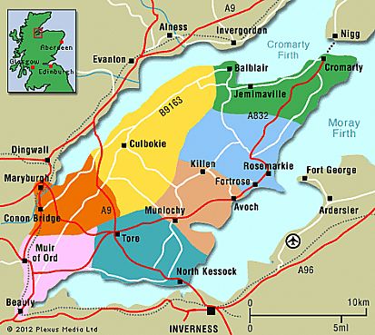
and if you want to push the definition - "The Black Isle" which is in no way an island - but Beauly, Muir of Ord & Connon Bridge stations are all withn "The Black Isle"
and if you want to push the definition - "The Black Isle" which is in no way an island - but Beauly, Muir of Ord & Connon Bridge stations are all withn "The Black Isle"
Is this similar to the Isles of Thanet, Grain and Purbeck - in that they haven't been islands for at least 500 years?and if you want to push the definition - "The Black Isle" which is in no way an island - but Beauly, Muir of Ord & Connon Bridge stations are all withn "The Black Isle"
CEN60
Member
- Joined
- 17 Dec 2018
- Messages
- 268
No - its part of the mainland North East of Inverness known as "The Black Isle" - I have no idea why though!Is this similar to the Isles of Thanet, Grain and Purbeck - in that they haven't been islands for at least 500 years?
Whisky Papa
Member
- Joined
- 8 Aug 2019
- Messages
- 398
This may be really pushing be the definition, but Trafford Park, Humphrey Park, Urmston, Chassen Road and Flixton lie in an area bounded by the River Mersey to the S, the Manchester Ship Canal which covers the NW quadrant and the Bridgewater Canal to the E, with the the CLC line crossing the two canals.
waverley47
Member
- Joined
- 17 Apr 2015
- Messages
- 501
No - its part of the mainland North East of Inverness known as "The Black Isle" - I have no idea why though!
Traditional thinking says that "black" comes from the colour of the soil.
The 'isle' part is more nebulous. In years past, the Connon and Beauly rivers would have been larger, with a marshy hinterland. Combined, this would have virtually cut off the peninsula from the mainland with a marshy 'neck'.
Also remember that prior to Mr Wade, and his road building campaigns, it would have been far, far quicker to take a ferry across the Beauly Firth at Kessock, and another across the Cromarty Firth at Invergordon, than try the road via Muir of Ord.
Mcr Warrior
Veteran Member
- Joined
- 8 Jan 2009
- Messages
- 11,964
Think it's the English translation of the Scottish Gaelic "An t-Eilean Dubh (= The Black isle - or island). Usually, 'Eilean' means island, but it can apparently also mean a piece of raised up ground surrounded by a marsh.No - its part of the mainland North East of Inverness known as "The Black Isle" - I have no idea why though!
Cambus731
Member
- Joined
- 19 Jul 2013
- Messages
- 1,123
I did mention Moncreiffe Island in the first post. I probably misspelt it thoughPerth - Moncreiffe Island (Line to Dundee)
and if you want to push the definition - "The Black Isle" which is in no way an island - but Beauly, Muir of Ord & Connon Bridge stations are all withn "The Black Isle"
I was wondering about Leeds Station. Deep below the platforms there is a meander of the Aire. Also nearby there is the eastern end on the Leeds & Liverpool Canal and some wharves.
Isnt there a weir down there somewhere? A weir means a waterwheel, and that needs a leat from the weir to the mill.
Anyone know whats down there? And is there an island?
THere is an overflow from the cut to the river in Kirkstall. That will make the land between the cut and the river an island. But not a full time one.
Leeds must like building public transport stuff over watercourses. The bus station has Lady Beck under it.
Surely that's General Wade to us folkTraditional thinking says that "black" comes from the colour of the soil.
The 'isle' part is more nebulous. In years past, the Connon and Beauly rivers would have been larger, with a marshy hinterland. Combined, this would have virtually cut off the peninsula from the mainland with a marshy 'neck'.
Also remember that prior to Mr Wade, and his road building campaigns, it would have been far, far quicker to take a ferry across the Beauly Firth at Kessock, and another across the Cromarty Firth at Invergordon, than try the road via Muir of Ord.
I suspect that it is - neither look man-made, although both are man-managed. Rivers will naturally cut lots of new channels in the various flood cycles in the lower river, although normally the old courses dry up but the navigation work probably helps keep these two both flowing. You can see lots of other old courses of the trent on the island as well.It's always hard to tell on a navigable river but is the island between the two branches of the Trent at Newark natural?
If it is then Newark Castle is another station on an island.
Sean Emmett
Member
- Joined
- 9 Mar 2015
- Messages
- 498
Also Baths Island in the Thames at Windsor crossed by the Slough - W&E Central branch.Guards Club Island at Maidenhead.
Black Potts Ait near Datchet.
I suspect that it is - neither look man-made, although both are man-managed. Rivers will naturally cut lots of new channels in the various flood cycles in the lower river, although normally the old courses dry up but the navigation work probably helps keep these two both flowing. You can see lots of other old courses of the trent on the island as well.
Looking at the map, a large area including the station, and to the north west of it, is an island.
And there also appears to be another much much smaller island that the line passes across immediately to the west of the Newark level crossing
Cambus731
Member
- Joined
- 19 Jul 2013
- Messages
- 1,123
Looks like I seriously under estimated the amount of islands the rail system traverses. And I completely forgot about the islands ceeated by the construction of the Jubilee river.
And I over looked the river islands in the Trent. Whenever I go over the Trent on the ECML, which I usually do about 5 or 6 times a year, I've always wondered about the two channels. I just assumed one was artificial. Obviously I was completely wrong about that.
Thank you everyone fir the fascinating replies.
From the train it'd be quite hard to tell the navigation channel isn't artificial - only the history really gives it away. You need the aerial shot to see the much more wiggly course.And I over looked the river islands in the Trent. Whenever I go over the Trent on the ECML, which I usually do about 5 or 6 times a year, I've always wondered about the two channels. I just assumed one was artificial. Obviously I was completely wrong about that.
HamworthyGoods
Established Member
- Joined
- 15 Jan 2019
- Messages
- 3,963
Apologies if this had been covered in a thread before, but I was wondering about this. I can think of:
Great Britain (obviously)
Isle of Wight
Portsea Island
Isle of Sheppey
Anglesey
Holy Island
Monicreiffe Island (in Perth)
Any others?
Is the Isle of Wight actually Network Rail? Isn’t the TOC actually also the infrastructure provider?
Peter Mugridge
Veteran Member
I think SWR leases the infrastructure from Network Rail, so it probably counts by means of ownership?Is the Isle of Wight actually Network Rail? Isn’t the TOC actually also the infrastructure provider?
swt_passenger
Veteran Member
- Joined
- 7 Apr 2010
- Messages
- 31,506
It’s some sort of split responsibility, but hard to pin down the exact demarcation. I expect there’s definitely certain upper limits to SWR’s financial responsibility. I know from previous discussions SWR employ the signallers, and possibly the regular day to day track maintainers, but don’t NR remain responsible for major capital works, such as the current renewals on the pier?Is the Isle of Wight actually Network Rail? Isn’t the TOC actually also the infrastructure provider?
NR own it but SWR have the responsibility for operation and upkeep. NR do certain bits like final upload of the timetable.Is the Isle of Wight actually Network Rail? Isn’t the TOC actually also the infrastructure provider?
I think SWR leases the infrastructure from Network Rail, so it probably counts by means of ownership?
From the 2024 Network Statement:It’s some sort of split responsibility, but hard to pin down the exact demarcation. I expect there’s definitely certain upper limits to SWR’s financial responsibility. I know from previous discussions SWR employ the signallers, and possibly the regular day to day track maintainers, but don’t NR remain responsible for major capital works, such as the current renewals on the pier?
So I'd imagine that capital works beyond the scope of SWR's lease would be NR's responsibility but day-to-day upkeep Island Line's.We are also the owner of rail infrastructure and assets on the Isle of Wight, but we have leased them to First MTR South Western Trains Limited (although the Island Line brand has been retained) the entire railway land, infrastructure and assets on the island for a cumulative period of 45 years, commencing 1 April 1994. This is a vertically integrated railway: Island Line is responsible for all railway operations and maintenance of the infrastructure.
...
Where Network Rail owns network (e.g. in a freight depot), but has leased it to another party (e.g. a FOC) that manages that network, then the other party will be the operator and the facility is no longer part of the main rail network (for the purpose of this Network Statement).
- Status
- Not open for further replies.