greaterangrier
Member

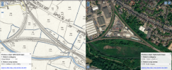
Here's a screengrab from the National Library of Scotland map comparison page.
I'm interested in the meaning of S.P. - I understand this means signal post. What did this mean contextually, on a 1900s map?
What were the likely signalling systems in use at the time? What would I see at this point? How comprehensive are these markings? An old forum post suggests signal boxes weren't always accurately marked, but presumably coverage of signal posts was even more patchy.
I'm also surprised to learn there were 2 signal boxes within around 300m of each other!
