• Our booking engine at tickets.railforums.co.uk (powered by TrainSplit) helps support the running of the forum with every ticket purchase! Find out more and ask any questions/give us feedback in this thread!

Wirral trip reports

Status
Not open for further replies.

Green Lane

Member
Joined
5 Apr 2010
Messages
332
Location
Birkenhead, Merseyside
Hello again,

As forum member ChiefPlanner enquired in this thread about trip reports from the Wirral, I decided it was a great idea and very easy for me to do (being based here), so here goes:-

Earlier this week, I worked out that to cover as much as possible, I would split my coverage of the Wirral Peninsula in to three conveniently separated daytrips.

Daytrip 1:- Merseytravel zone "B1" - This is the trip I have done today. The entire trip was done at effectively no cost, using my aforementioned annual Merseytravel Zones B1/C1 Trio ticket.

Daytrip 2:- Merseytravel zone "B2" - This will require an "Area B" Merseytravel "Saveaway" ticket.

Daytrip 3:- That southern part of the geographical Wirral Peninsula which is in Cheshire and therefore outside the usual Merseytravel area. This can in fact still be done using a Merseytravel "All Zones" Saveaway ticket (which allows rail-only travel onto the "Cheshire part" of the Wirral Line), in conjunction with either a walk or a relatively cheap return ticket from Neston to Heswall.

I plan to do the remaining two trips sometime later this year, and if I do them then I'll post them in this very same thread.

To my surprise, perhaps due to my familiarity with the area, I covered so much in Daytrip 1, that I'll have to split this first trip report into to multiple parts, writing the first part now and the other parts sometime later.

Daytrip 1, Part 1 - Birkenhead

The bit covered on this daytrip is marked on this Merseytravel map as zone B1:-
http://www.merseytravel.gov.uk/Site Images/Travel-zones-map.jpg
(may need to click on that map to enlarge it)

In short it's the north-eastern portion of the Wirral peninsula, that includes (most of) the town of Birkenhead, all of Wallasey and some immediately adjacent areas.

Having a very hectic Friday, when I arose at 06:50am on Saturday morning eager to do the trip, I still had no concrete plan.

So I fired up the laptop and mapped out my itinerary. It was soon pretty clear that I would be out until approximately the early evening. I found it quite amusing that I happened to be preparing a packed lunch for a journey in which I would travel no more than five miles away from home during the entire trip! I guess it would have been just as easy to come back home for a lunch break, but I decided to stick to my usual Saturday routine i.e. I tend to go out for the whole day and this trip would be no exception.

I decided just to use my cheap and cheerful Canon compact camera today, which as can be seen has quite a soft focus, but its main advantage is that it copes really well on dull days, giving reasonably bright pictures.

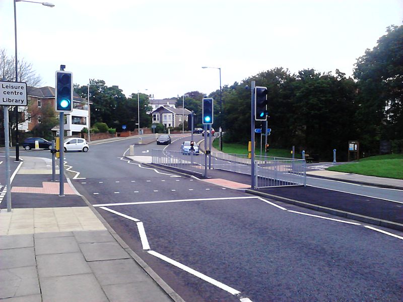
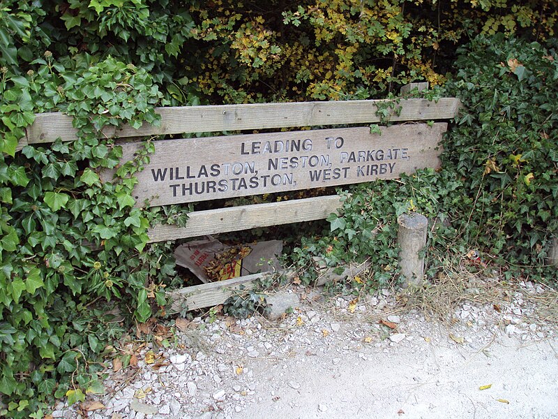
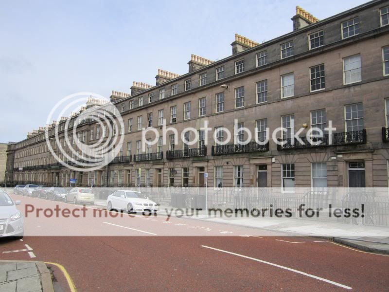
I eventually made it out the door at 08:30, where my first port of call (two minutes walk away) was a street of terraced houses, namely Maybank Road in Tranmere:-


Maybank Road and the adjacent Aspendale Road are just like many other roads in the area apart from the fact they are both "L-shaped", at first glance with no obvious reason. All other surrounding roads from that era are straight. The image above shows houses right on the corner of the "L".

I recently read that this is because many years ago, there was a curved section of land behind those houses, protected for future use by the railways. This would have been the so-called "Bidston cut-off" railway line. My understanding is it would have diverged to the right of the existing Wirral Line at Birkenhead Central, before going through a tunnel under Higher Tranmere. There would have been a station near the above houses on the main A552 Borough Road. The track would have then continued through the suburb of Prenton before joining what is now the Borderlands Line in the vicinity of the A552 railway bridge near what is now the A552/M53 Woodchurch Interchange.

This would have allowed "Borderlands Line" trains from North Wales to take a far more direct route towards the Mersey rail tunnel. I'd imagine this would shave something like ten minutes off the journey to Liverpool by avoiding the current circuitous route via Bidston and Birkenhead North.

I only learnt about this thanks to the "Local History" section on a local website called "Wiki Wirral". In the event, the line was never built, but it would have also served places nearer the middle of the general Birkenhead conurbation, whereas the situation we have now is that most of the stations skirt around the edges of the town, as can be seen very clearly on Google maps for example.

From the above location, the nearest station is Green Lane (as per my avatar), so I walked there:-


I descended on to the Liverpool-bound platform:-


I'd just missed a train, but at least this was handy for taking more photos! As can be seen, the station is only half covered, which does let daylight in. The Chester/Ellesmere Port platform is sheltered under brick arches, but the Liverpool-bound platform is exposed to the elements. Although there is a perspex shelter on the Liverpool-bound platform (out of shot) to make up for this:-


Green Lane has always seemed an apt name for this station, particularly as the walls are mostly covered in green moss. "Lairdside" refers to the Cammell Laird shipbuilding site and surrounding businesses:-


507011 arrives on a Chester-bound service


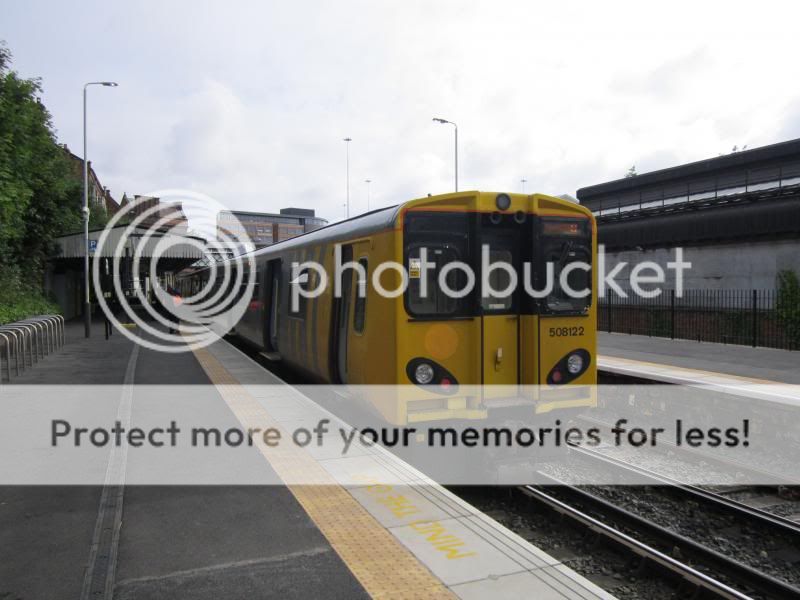
My first train of the day, 508122 then took me one stop from Green Lane to Birkenhead Central, where there was a crew change and I alighted:-


View outside Birkenhead Central:-


This door is for rail employees only. Crew changes are routinely done at Birkenhead Central (also at Birkenhead North):-


This is a view looking towards the station from the other side of the A552/Borough Road. The flyover provides quick access to the toll booths of the Queensway tunnel (Birkenhead tunnel). It's one of two originally in the town centre. The second one on the A553 Conway Street was demolished a few years back. They are now generally regarded as eyesores. Also, it appears that the volume of traffic no longer justifies their existence since the opening of the Kingsway Tunnel (Wallasey tunnel) in 1971 profoundly reduced Liverpool-bound traffic in Birkenhead itself.


Next was a quick walk through part of Birkenhead's shopping precinct:-


Whereupon I arrived at the bus station. Birkenhead bus station is quite modest, having ten stands, in a "horseshoe" arrangement. I understand it won a design award:-


I then entered the doors shown in the left of the above photo and bought a couple of "Area B" Saveaway tickets for future trips from the small Merseytravel travel centre within the bus station. At £3.60 each they're quite a good bargain.

Next I would naturally pass Conway Park railway station (although I did not enter the station on this occasion), so I took some photos, like this one:-


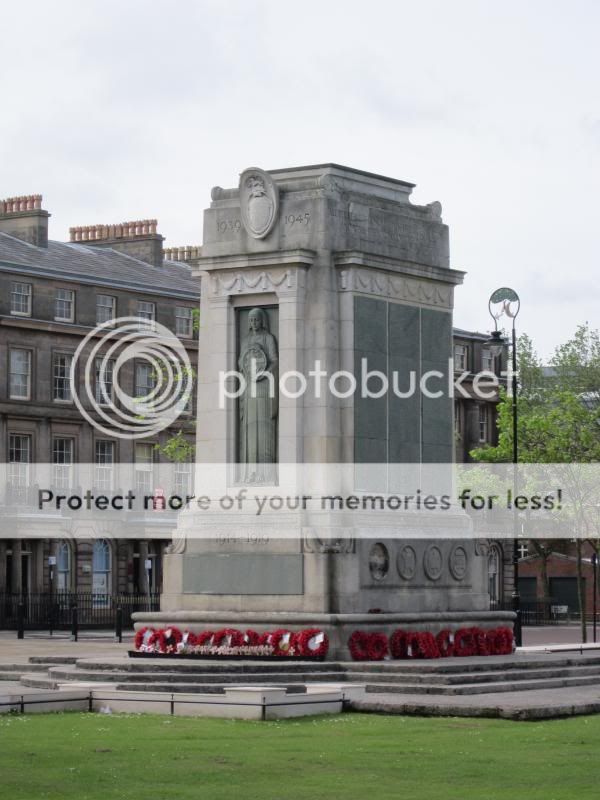
From Conway Park, it's a very short walk to Hamilton Square. This is the former Birkenhead Town Hall at Hamilton Square, with the town's cenotaph in front of it. (Looks a bit dark, due to an unfavourable sun angle, I have learnt that this scene looks a lot better when photographed in the late afternoon):-


The centrepiece of Hamilton Square, the town's memorial to Queen Victoria. This one was apparently inspired by the Queen's wedding cake and is itself sometimes known locally as "The wedding cake":-


Close-up of the Victoria memorial "She wrought her people lasting good":-


The Birkenhead Cenotaph:-


Hamilton Square is surrounded by buildings like this (the north side):-


There are 63 Grade I listed buildings in the square itself and the former town hall is Grade II* listed. Other surrounding buildings are Grade II listed. I understand it is second only to Trafalgar Square in having so many Grade I listed buildings in one place.

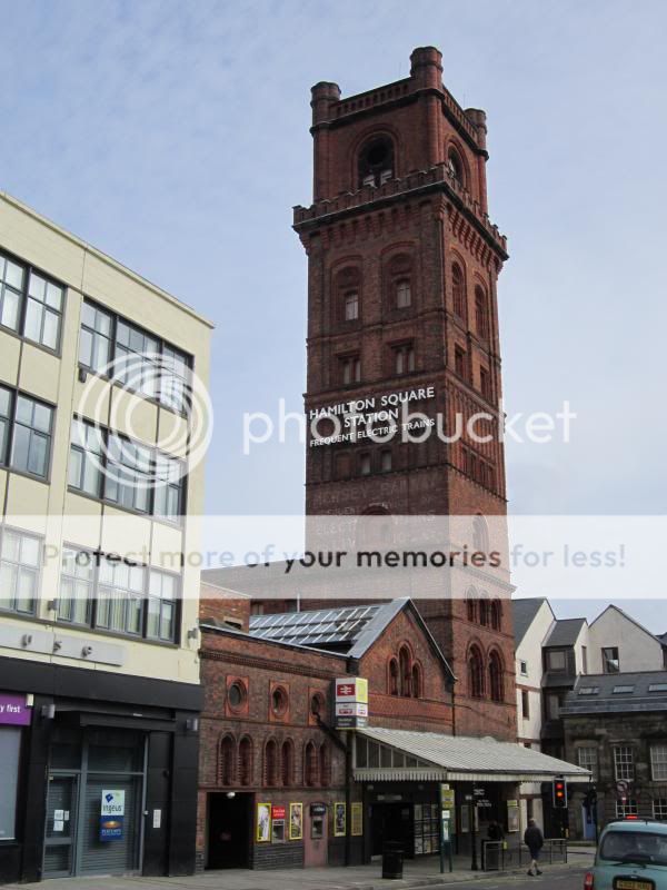
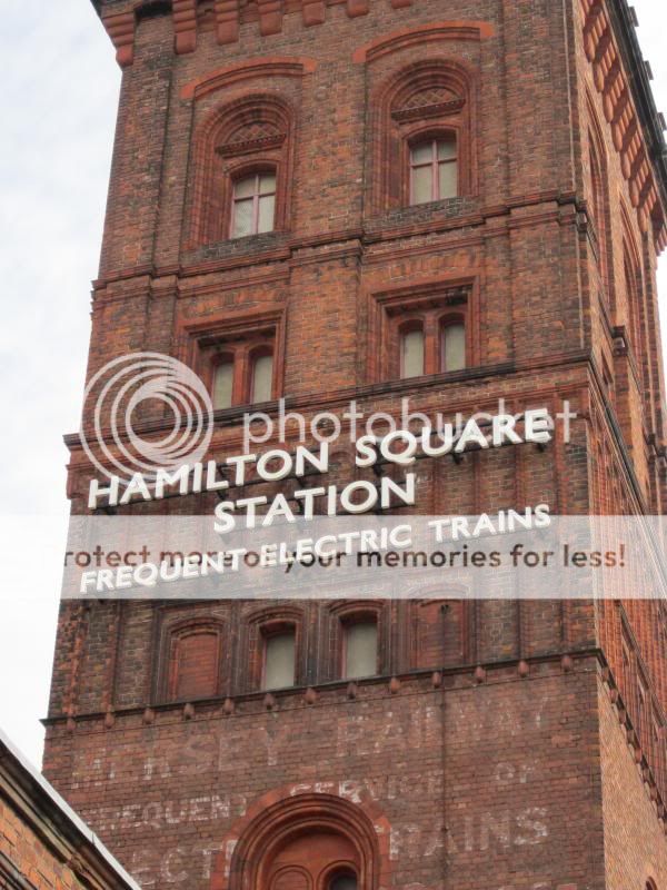
I then approached Hamilton Square station:-


Although, I did not immediately enter the station. Hamilton Square is in the vicinity of a locality of Birkenhead, known as Woodside. Woodside has got a bit of history and so it's well worth a look around. First here is the Shore Road Pumping Station. This houses the "Giant Grasshopper", a steam pump originally used to pump water out of the Mersey rail tunnel:-


Next up is the Birkenhead Heritage Tramway. Here is the tram-line running along Shore Road. No trams today, but in the distance is a heritage bus in the original "Birkenhead Corporation" blue livery. The big event here is usually the "Wirral Bus & Tram show" in October. (Next one is meant to be 6th October 2013, awaiting confirmation) I always go to it, with buses from all over the country and likewise trams from all over the place (they have one from Portugal). This vestigal tram line itself is not very long, and there are sporadic mentions of it being extended, but it is an enjoyable run from the Woodside ferry terminal to the Taylor Street transport museum.


A replica of the Resurgam, an early submarine built and launched in Birkenhead in 1879:


A visit to Woodside would not be complete without a shot across the Mersey of the Liverpool Waterfront. A little bit hazy today and this photo shows only a small section of the Liverpool skyline, but from left to right we have, the former Royal & Sun Alliance building, locally known as "The Sandcastle Building" (left-hand side slightly cut off), then the "Unity Building" (topped by a rectangular structure). Then we have "Atlantic Tower". To the right of that, St Nicholas Church (The seaman's church) can just about be seen. To the right of that is what has become known as the "Three Graces", namely the Royal Liver Building, with the Liver Birds on top, the Cunard Building (Pier Head ferry terminal in front of it), and the "Port of Liverpool building". To the right of that is the new "Museum of Liverpool" (Right-hand side cut-off in this shot).


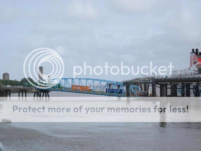
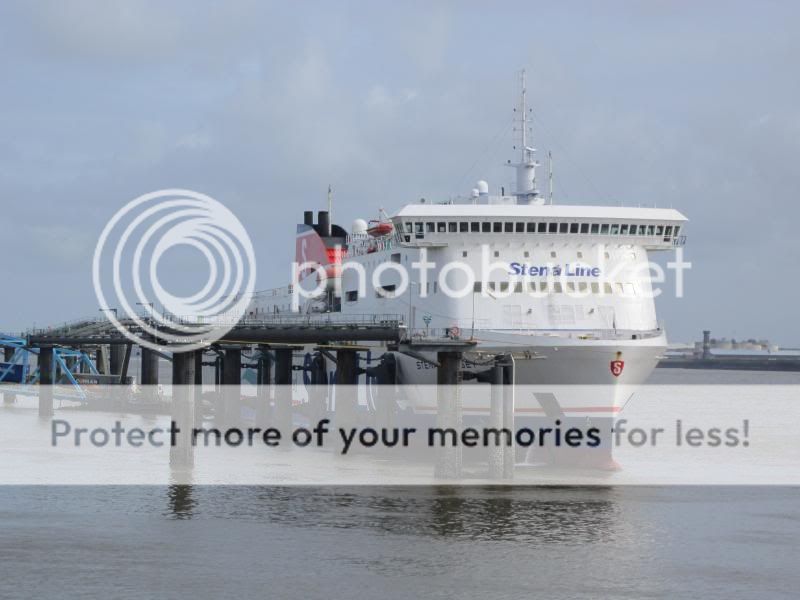
Next up is the nearby "Twelve Quays Ferry Terminal" from which ro-ro ferries operate on the Birkenhead-Belfast route. Here HGVs can be seen being driven down the ramp to the landing stage. The landing stage can take up to two ro-ro ferries at the same time (one on each side). Although, there's usually just one there as it was this morning:-


This is the Pacific Road ventilation shaft for the Queensway Road tunnel. It's one of the most prominent buildings on the Birkenhead skyline, when viewed from the Liverpool waterfront. There are quite a few similar structures in Birkenhead including ventilation shafts for the now disused Dock Branch of the Road tunnel:-


This is the landing stage of the Woodside ferry terminal (for the "ferry across the Mersey"). Woodside used to be a bustling transport hub, with the ferry terminal, the bus station and the former mainline railway station all in the same place. It's now a very quiet area and the ferry service has been reduced to a relatively infrequent (one an hour) tourist service, with a "commuter service" remaining in the weekday peaks only.


Inside Woodside Ferry Terminal building:-


Continuing the submarine theme, this is a shot through the outside glass looking towards part of the U-534 U-boat, a local tourist attraction marketed as "The U-boat story" and announced on Merseyrail Wirral Line services. A good shot of this would probably require entrance to the attraction itself.


And this is the nearby Woodside bus station. The decline in services here has been remarkable in recent years. Caused mainly I assume by the opening of the Birkenhead Bus station which is more convenient for the town centre. Woodside bus station used to be the hub for buses in Birkenhead. Pretty much every route used to call here. Now it's fair to say that a single bus stop would probably suffice as a replacement for this structure. I did see one passenger there today though, and a small number of routes still do visit. An Arriva bus depot is next to this bus station, on the site of the former Woodside railway station:-


And that's it for this evening, as my time is up. Coming up next will be "Daytrip 1, part 2" as soon as I have time to type it up. In that part, I will be showing the site of the former Woodside railway station and I hope also to get up to the bit where I travel by train out of Birkenhead. :D

Thanks for reading!
 
Last edited:
Sponsor Post - registered members do not see these adverts; click here to register, or click here to log in
R

RailUK Forums

Green Lane

Member
Joined
5 Apr 2010
Messages
332
Location
Birkenhead, Merseyside
Thank you very much Paul for the encouraging reply!

The journey continues:-

Daytrip 1, Part 2 - Birkenhead continued & Poulton

Next to Woodside bus station is an Arriva bus facility. I'm not sure if it's correct to call it a "depot" or not (The main depot is in Laird Street, Birkenhead), as no buses get serviced here as far as I know, it's more like a car park for buses and cars. I guess you could call it a "bus park", but that doesn't seem right either! Anyway it occupies the exact piece of land that was formerly occupied by Birkenhead Woodside railway station. (Further info here and here)

This station was a GWR terminus offering direct services to Paddington, although I've heard that journey used to take something like seven hours. The station was lost to the Beeching Axe, closing in 1967 , but I have to say the impact of the loss (in practical terms) has seemingly been minimal in the great scheme of things. With Hamilton Square station less than 200 yards away offering a train every few minutes taking 7 minutes to Liverpool Lime Street Low Level (Or 36 minutes to Chester), followed by a London-bound train typically taking as little as 2 hours 8 minutes from Liverpool or a similar time from Chester, it could be argued that Journey times from Birkenhead to London have never been so good. Likewise for many other destinations. Not to mention that similar journey times apply to other Merseyrail stations across the Wirral.

Anyway, what was once a bustling mainline railway station became quite a busy parking area for buses. I remember well in the mid 1980s, the area was jam-packed with double-decker buses and they were constantly queueing to get in and out of this parking area. But, after the declining importance of Woodside, we now have this typical scene - just a solitary single-decker Arriva bus:-


The wall just visible to the left in the above photo was a wall of the original railway station.

That was the view looking east from the Church Street bridge. This following picture shows the view looking west. This is the entrance to the half-mile long railway tunnel which provided access to the Woodside terminus and ran mostly under the A41 Chester Street.:-


Close-up of tunnel mouth:-


This view shows the northern wall of the cutting, and looking at this, you just imagine the trains running through here. It's somewhat evocative of the Lime Street mainline approach, albeit on a much smaller scale.


Next up, I walked back in the general direction of Hamilton Square station again and this next photo shows the Waterloo Buildings, directly opposite the station. These buildings were filmed in an episode of "Bill Oddie Goes Wild" showing Peregrine Falcons which had nested on the roof (I think that was before the building was renovated):-


Also near the station is the Pier Hotel, sadly abandoned since 2006. An office block was built right around and above this pub, without altering the pub itself:-


On nearby Canning Street is the "Cheshire Lines Building", full text along the top reads "Great Northern Great Central and Midland Railways". It has since been used by Littlewoods Pools and as council offices:-


Other notable things I did not get around to seeing in Birkenhead on this particular trip were the 12th century Birkenhead Priory (Grade I listed) which is the oldest standing building on Merseyside. Also the "antiques triangle" and the "bank buildings" (more listed buildings). Also is the Cammell Laird ship-building hall which is a pretty large building. Not to mention Birkenhead Park, which inspired the design of New York's Central Park. There are also the sites of the former Monks Ferry and Birkenhead Town stations. There's much more other stuff, but I guess it's beyond the scope of this particular trip to try to fit everything in!

So, I next entered Hamilton Square station and walked across the bridge:-


View from platform 2:-


Here's a sign showing available destinations from platform 2. The limited service to Helsby is mentioned:-


I wanted platform 3 though. The line from platform 3 goes towards Conway Park, but it first runs beneath the two tracks leading towards Birkenhead Central. This is exactly the same principal of a flyover, except it's a "burrow-under" and allows a high service frequency due to the avoidance of conflicting movements:-


After a two minute wait, 507007 en-route to New Brighton arrived at platform 3 (sorry about the blur on this one):-


I travelled three stops to Birkenhead North:-


On exiting the station you see an area of the town which has mostly been demolished, but large areas still have not been built on again yet, for various reasons:-


All surrounding houses have been demolished, but this house is a well known "landmark" in the area as the occupant has chosen to remain living there (for quite some years now). Houses on either side have been left up to preserve the structural integrity of the middle house. I always see lots of pigeons on the end houses. These houses are just behind Birkenhead North station and can be seen when passing through on the train:-


Many of the streets have been completely demolished but it was so long ago that there are trees growing there now. One of the streets was featured in a television documentary during the economic recession of the early 1980s about the problems faced by people living there (this is on youtube). The decision was eventually taken to demolish the entire area:-


Next up is the nearby Beaufort Road and a look at the disused Birkenhead Dock Branch. This branch connected Bidston Dock to Rock Ferry, via Birkenhead Town Centre. Here the trains used to run right alongside the road:-


Disused level crossing of the Birkenhead Dock Branch on Wallasey Bridge Road:-


Next up is the Penny Bridge also known as the Poulton Bridge or Wallasey Bridge. Originally this went over the exit of the Bidston Dock, but the Bidston Dock was flled in some time ago. However, the bridge is still needed as Bidston Moss is really boggy and underneath the bridge remains a pool of water. The area is prone to flooding in heavy rain and it's not uncommon for this route to be closed due to adverse weather:-


Much of the Birkenhead Dock system is still in use though and to the east of the bridge is the West Float Dock, where a ship or two is usually observed:-


The docks divide the towns of Birkenhead and Wallasey, so having now crossed the bridge, I exit Birkenhead for the first time in the trip and find myself in Poulton, which is an area of Wallasey. This is St Luke's, Poulton. The name Poulton is derived from the word "pool" meaning inlet and on the Wirral Peninsula we are not short of places with "pool" in the name:-


And now my reason for visiting Poulton, this is the former site of Liscard and Poulton railway station.The cutting of the former "Seacombe branch" of the Wirral railway is now used by the Kingsway tunnel link road which links the M53 mid-wirral motorway directly to the Wallasey tunnel. Looking west from Mill Lane towards the former station site:-.


View east from Mill Lane along the route of the former Seacombe branch:-


From here I could have walked onwards towards Wallasey Village railway station, but in fact some parts of Wallasey are nearer to Birkenhead North, so back to Birkenhead North I walked. On the way back I passed the old sidings that were alongside the former Bidston Dock:-


This is the completely in-filled Bidston Dock:-


As I approached Birkenhead North, this time from the western side, I walked past the entrance to Birkenhead North TMD, although nothing can really be seen from the street-level entrance:-


This is the new Birkenhead North station car park. It was built earlier this year:-


I returned to Birkenhead North, where I awaited the next West Kirby train as I intended to go to Moreton (Merseyside) next:-


To be continued in part 3!

--- old post above --- --- new post below ---

Just a couple of side notes:-

Well it seems my crystal ball is working well! I just checked the local "Wiki Wirral" forum for the first time in some days and it appears to be a total coincidence that someone has just posted that Woodside bus station is about to be torn down and replaced with three standard bus shelters. Work starting in the next couple of weeks, so with my suggestion that it could be "replaced with a bus stop" I wasn't far wrong. I guess with the current level of service such a move was inevitable. Glad I photographed it now though!

Also I forgot to mention the site of the former Mollington Street depot in Birkenhead, which was a pretty sizeable rail yard. I think technically it is closed off to the public in any case, although people have made gaps in some of the surrounding fences, I wouldn't want to trespass. It might be possible to get some sort of shots from outside the fences though.

Anyway, back to Saturday's trip!

Daytrip 1, Part 3 - onwards to Moreton & Upton

I continued to wait at Birkenhead North:-


508120 departed on a New Brighton service:-


And shortly thereafter, the Liverpool-bound 507028 departed:-


Next, 507005 took me to Moreton, train photographed here at Moreton. Moreton is the last station in zone B1 on the West Kirby branch, so I cannot go any further on this ticket:-


Moreton is a town to the south-west of Wallasey. Back in the days before the formation of the Metropolitan Borough of Wirral, it was incorporated into Wallasey (evidenced by old "Wallasey Borough" signs that can still be seen in Moreton). However, in present-day Wirral, it is generally considered to be a separate settlement. As can be seen on the sign to the right, this is the place to alight for the North Wirral coastal walk. Also for Leasowe Lighthouse, which is the oldest brick-built lighthouse in Britain.:-


Moreton:-


Street-level entrance to the south of Moreton station. I exited here because I wanted to walk south from the station into the centre of Moreton. This avoids walking up the steps to the main pedestrian entrance by the ticket office. I might do the Leasowe Lighthouse walk as part of my future "B2 zone" journey, in that case, I would instead cross the bridge over the tracks and walk northwards from the station:-


The Morton Arms. This pub must have closed quite recently as I'm pretty sure it was still open last time I walked past. The name is peculiar as it is spelt "Morton", whereas absolutely everything else in Moreton is spelt with the 'e'.


Next I walked in to Moreton itself. This is the roundabout known locally as "Moreton Cross", in the centre of the town. It's the junction of the A551 and A553 main roads.


Shops next to the Coach & Horses at Moreton Cross:-


Moreton cross, from the other direction. Showing the clock:-


Christ Church, Moreton:-


This is the Moreton spur road for the M53 motorway. This road in conjunction with the nearby Upton bypass cut right through woodland known as "The Overchurch Woods". No doubt these roads are necessary, but I remember well playing in the woods as a small child, as we had relatives on the nearby Overchurch estate. The woods are still there, but much smaller now and split into two halves:-


As I continue to walk south past the M53 spur road, I now enter Upton, which is classed as a village. The Overchurch estate is considered to be part of Upton, and I walked past the edge of it. This is typical housing on the estate:-


Analogous to Moreton above, Upton is immediately to the west of Birkenhead and was previously incorporated into Birkenhead. However since the formation of the Metropolitan borough of Wirral, it is now considered to be a separate settlement. The most notable building in Upton is probably Upton Manor (Grade II listed):-


Upton Manor is so secluded and hidden behind stone walls and tall trees that you would never have any idea that it is there. It is now in use as a care home.

Onwards I walked, through the centre of Upton Village:-


Eagle & Crown, Upton:-


Upton post office & shops:-


St Mary's church, Upton


Upton war memorial, outside the library:-


The art deco Upton library:-


Next, I crossed the bridge over the main M53 mid-Wirral motorway at Upton. There's a story behind the M53 motorway, probably too involved to go into here, but suffice it to say that it's a motorway of two distinct halves. The northern half pictured here was engineered to impeccable standards (it's often described as over-engineered for the volume of traffic it carries). The southern half was originally meant to be a spur, but became part of the main motorway and it's just an upgraded Hooton industrial road. In any case, anyone who has travelled on the northern stretch of the Borderlands Line will know that it runs right alongside the M53 motorway for a while. In this photo, the railway line is concealed behind the row of trees to the left:-


And just past the motorway, I arrived at Upton (Merseyside) station:-


Upton station is the only station in zone B1 which isn't part of Merseyrail's Wirral Line. Heswall is also in Merseyside, but in zone B2. Bidston is in zone B1, but is a Merseyrail-managed station on the Wirral Line.

I walked down the ramp onto the Bidston-bound platform:-


These signs have had a bit of a battering with an air gun or similar:-


The 12:21 was running merely 2 minutes late. I had a little under half an hour to kill. Quite lucky really as I knew I was going to arrive at this station at some completely random time, and it's an hourly service here. It would usually be quicker to take a 437 bus back into Birkenhead from outside the station (run every 10 mins), but I wanted to travel by rail (or at least walk) on this journey wherever possible and so after a quick catch up on my phone and eating half of my lunch at this early time, before I knew it, the train was about to arrive:-


Another shot of Upton station:-


This is indeed Arriva Trains Wales territory!


The wait at the station was memorable though as I didn't see a single soul all the time I was there. This is unusual for me, but then again I don't usually use this station at this time of day, I normally walk straight here from home to catch the 07:33 or 08:33 for a day trip to North Wales. In any event, 150242 arrived at 12:23, to take me to Bidston, which I will describe in the next part:-


Looks like I will need more than three parts to complete this trip report! :D
 
Last edited:

D841 Roebuck

Established Member
Joined
16 Mar 2012
Messages
1,919
Location
Rochdale
A most enjoyable and informative read - thank you.

A trip to Birkenhead to "bash" the trams has been on my to-do list for a while. With the added attraction of a u-boat to visit, it has moved up the list!
 

ChiefPlanner

Established Member
Joined
6 Sep 2011
Messages
7,787
Location
Herts
Very smart work indeed - thank you for an interesting photo log of the area - some very grand 19thC and later structures , but some fall off of economic activity. I once went to New Brighton (just killing a few hours) , and was much taken by how once it must have been a very smart place to live when Liverpool was the greatest sea port in the British Empire (!) , lots of grand houses and impressive churches. The Birkenhead rail infrastructure has certainly shrunk - difficult to think that there was - post 1948 - a sleeper service from Paddington , though I am informed it was one car attached to the overnight parcels / mail train. (probably there for the intermediate stations)
 

Green Lane

Member
Joined
5 Apr 2010
Messages
332
Location
Birkenhead, Merseyside
Thanks very much all for the further informative and encouraging replies!

In the wider area, the biggest attractions are undoubtedly the cities of Liverpool and Chester. Both have lots to offer and in either case, no trip report could do anything more than scratch the surface. I have been keenly photographing both cities and their suburbs for some years now and something like 20,000 photographs later and there's still much I haven't covered! :D

The Merseyrail Liverpool-Chester service (a journey of 40 to 45 minutes) is often busy with tourists, particularly on summer weekends.

The Wirral is between the two and whilst many people simply pass through I would recommend stopping off to supplement a visit to Liverpool and/or Chester, particularly if you have an interest in transport and 19th century architecture, which indeed does reflect the historical period of the area's peak prosperity.

It is very true that the rail network here is a shadow of what it used to be. Even as recently as 1970, an aerial survey of Cheshire (of which Birkenhead was then officially a part of) shows the area around the docks and the rail yards to be absolutely packed with sidings and freight trains. (This aerial survey is freely viewable on the Internet). We now have zero rail freight here and most freight sidings have been lifted or left to nature.

There's so much more to the Wirral though as I hope to reveal when I eventually get around to doing the other planned trips in the other zones sometime later this year. West Wirral and the beaches around the banks of the River Dee have a very relaxed feel all of their own and are a world away from the more built-up eastern side of the peninsula.

Meanwhile, I hope to post part 4 of this initial zone B1 daytrip a bit later today. Glad to see New Brighton was mentioned above as it will feature in the next part of this trip report.

I didn't initially realise how long this first trip report would be, but it's enjoyable writing it up and I've started so I'll finish, cheers!
 
Last edited:

Requeststop

Member
Joined
21 Jan 2012
Messages
945
Location
Port Moresby, Papua New Guinea
I remember a trip to Moreton, maybe in 1960/61 to visit a great aunt and uncle who lived between a brick factory with an overhead cable railway pulling small containers of clay, and the chocolate factory on the other side of the road. I distinctly remember going to the factory to buy some broken chocolate biscuits for next to nothing. For a long while I thought Moreton (Dorset) must be the same and longed to go there as it was far closer to home. I also remembered the lighthouse which was a derelict and unimpressive structure, nothing like the lighthouse at Godrevy which at least was on an island and worked. I don't recall Moreton from any of your photo's unfortunately but I have to say I have enjoyed reading your log so far and looking at your photo's too! Thank You.

By the way, it's the first time I've seen the word "Analogous" in any post on this site. Congratulations. :)
 
Last edited:

Green Lane

Member
Joined
5 Apr 2010
Messages
332
Location
Birkenhead, Merseyside
Daytrip 1, Part 4 - Upton to New Brighton

As I boarded 150242 at Upton, I was astonished (and certainly encouraged) to find that I had to stand up on this service. I did board the rear carriage and so it's possible that the front carriage might have had a seat or two available, but the carriage I was in was full with quite a few people already standing. I just had a bit of space by the door.

I have to say I have never before seen such high usage on this service. Typically the stretch between Gwersyllt to Wrexham General is the busiest on the line with the bit between Upton and Bidston only seeing perhaps a dozen people or less per carriage on a typical journey.

Then again, I never normally travel on this route around lunch time as my pattern is normally to go out in early morning and come back in the evening.

I was happy to stand up as it is only one stop to Bidston where the service terminates:-


I'm not sure of the exact terminology but here's a picture looking the other way towards the signal with the indicator showing the points set for the Borderlands Line.


A similar picture looking west from the station, showing the Borderlands line diverging to the left from the electrified Wirral Line. In the vicinity of Bidston station, only the left hand track of the Borderlands Line sees regular use. There's a crossover 100 yards down the Borderlands Line (out of shot to the left) where all northbound trains switch onto this track.


Station sign:-


There's some major renovation going on at Bidston. I was not aware of it until I arrived on Saturday. As a result, there's not as much platform space available and most passengers from the full Borderlands train walked down to the eastern end of the platform where there's a bit more space:-


The Borderlands train never hangs around too long on the Wirral Line and pretty rapidly trundled off back around the bend:-


One good thing about the bend is that when waiting for a Borderlands train at Bidston, you can always hear the screeching long before you can see the train!


After what seemed like no time at all, Liverpool-bound 507025 arrived on the other platform. Due to the station renovation it took some considerable time for all passengers to walk from the eastern end of the platform to board the train. The guard was instructing people to walk further down the platform to use doors other than the front-most ones, as a queue of passengers initially formed around one set of doors. Even so the train was held at Bidston for a few minutes before we moved on again, which is atypical for the Merseyrail network:-


I went just the one stop, which returned me back to Birkenhead North:-


Birkenhead North is a station allowing interchange between the West Kirby and New Brighton branches, although the only access to the Liverpool-bound platform is via the footbridge so wheelchair users would instead need to change at Birkenhead Park, one stop further along the line. This was my one time of crossing the Birkenhead North footbridge during this daytrip, so I took a quick snap from this vantage point:-


Previously there was a connection on the triangular junction between Bidston and Wallasey Village, however this has not been used in regular service for many years and it was chopped back to a siding some years ago. The only way to physically get from Bidston to Wallasey Village nowadays would be by a reversal at Birkenhead North (or in practice by changing trains at Birkenhead North).

So, I then boarded 508120 for a trip two stops up the New Brighton branch to Wallasey Grove Road:-


508120 departs Wallasey Grove Road:-


I slipped out of the side-entrance on the western side of the station, so did not go past the main station building on this occasion:-


St Nicholas, Wallasey, a prominent church near the station:-


I then walked towards the seafront. The grassed area here is known locally as "The Dips", because it dips down below the surrounding ground level. This was the site of "The Wirral Show", held annually every June. This used to be a quite large event consisting of travelling fairgrounds, stalls and a makeshift arena with motorcycle stunts & dog shows etc, not to mention aircraft displays. This is the location where I first saw an Airbus A380 during a demonstration flight. Sadly, after 33 years the show was indefinitely cancelled a couple of years back. I think it became a victim of its own success. The event became so big in terms of visitor numbers that it eventually became problematic to organise. Merseyrail used to put 6-car trains on the New Brighton branch all weekend during the event:-


Next I reach the seafront near New Brighton. New Brighton is a seaside resort and also an area of Wallasey. This is the beach at what is known as the "Harrison Drive end". This is about a mile west from the main part of the New Brighton resort. The beach is always quiet at this end. Looking towards the groynes, and beyond that Liverpool Bay which is part of the Irish Sea.


View of promenade, looking east. I'm on my way walking towards the main part of New Brighton.


Steps down to the beach:-


Tucked away behind the railings, I noticed the sign for the free bus service which runs along the promenade at weekends:-


And now I enter the main part of New Brighton, passing "The Pierrot" on the A554 King's Parade, or as it's known more commonly, the "New Brighton clown":-


This is the free bus service. It's the first time I've seen it this year. This is because I almost always walk in New Brighton during the mornings, but the place doesn't really get going until noon, and that's when the bus service also starts. I noticed that it says "Stagecoach in Cumbria" on the side of the bus, I wonder which town it's from?:-


Electronic traffic sign, mentioning the shuttle bus:-


In recent years New Brighton has been redeveloped and as a result the place has started become more popular again. On Saturday it was still relatively quiet though as the weather had been pretty overcast all day. In the afternoon though, the sun just about started to break through. This promenade walk is part of the recent redevelopment:-


A Travelodge (part of the recent redevelopment):-


There was some sort of event going on at New Brighton, with a few stalls and stuff:-


Again, showing more of the recent redevelopments, the Sea Horse pub:-


"The Light" cinema:-


Lieutenant Commander Ian Fraser from Wallasey commanded a Midget submarine in World War II in a successful mission against a Japanese heavy cruiser in Singapore and was awarded the Victoria Cross. This section of promenade has been named after him:-


The marine lake at New Brighton:-


This is New Brighton lighthouse:-


Looking towards the Napoleonic era Fort Perch Rock. Grade II* listed, built in the 1820s to defend the port of Liverpool. Now a museum and venue for musical performances:-


This is the New Palace Amusement Arcade, New Brighton. There's also a small fairground here:-


Entrance to the arcade. Even as recently as the 1980s, there were at least half-a-dozen arcades scattered around the New Brighton seafront but currently there are only two remaining I think and this one is the bigger of the two:-


These shots show the usual seaside arcade selections of video games, penny pushers and grabbers:-


Another shot of the free bus at the pick-up point, where I've just noticed it says "The Lakeland Experience" on the side:-


The Floral Pavilion Theatre, New Brighton. This was completely rebuilt a few years back as part of the main redevelopment plan. Ken Dodd had the honour of performing the final show in the previous theatre and he was invited back to "Christen" the new theatre by performing the first show in it, which he duly did. I believe "Mr T" from the A-team was also here not too long ago!:-


Outside the Floral Pavilion is the statue commemorating the foundation of the Guide Dogs for the Blind association at New Brighton in 1931:-


Next up is Virginia Road, New Brighton. Apart from the red brick wall in the background, this place has changed beyond recognition since the mid 1980s. Back then this street was the main bus terminus for New Brighton, with stops all along the road used by numerous bus routes serving all parts of Wirral. It was constantly buzzing with activity as buses queued along the road to pick people up. All bus stops have been completely removed and it's now reverted to a quiet back street. Bus services have now been completely merged/rationalised etc.. so that there's now just a small number of routes serving a couple of bus stops on the main promenade instead. Conversely, you can get a bus from New Brighton to Liverpool now, whereas you never could before 1986 as there were no cross-river bus services before deregulation:-


A quick shot towards the window of the local tourist information centre. This shows a model of the former New Brighton Tower which existed from 1900 to 1921. The area where the tower used to stand is now a small park, known as "Tower Gardens". Also ferries from Liverpool served New Brighton until 1971 when they ceased after the opening of the Wallasey road tunnel:-


Next I approached New Brighton railway station, where I would again catch the train for the next leg of the daytrip:-


To be continued in part 5!
 
Last edited:

Green Lane

Member
Joined
5 Apr 2010
Messages
332
Location
Birkenhead, Merseyside
Great report and great photos, these are my kind of trip reports, well done.

I remember a trip to Moreton, maybe in 1960/61 to visit a great aunt and uncle who lived between a brick factory with an overhead cable railway pulling small containers of clay, and the chocolate factory on the other side of the road. I distinctly remember going to the factory to buy some broken chocolate biscuits for next to nothing. For a long while I thought Moreton (Dorset) must be the same and longed to go there as it was far closer to home. I also remembered the lighthouse which was a derelict and unimpressive structure, nothing like the lighthouse at Godrevy which at least was on an island and worked. I don't recall Moreton from any of your photo's unfortunately but I have to say I have enjoyed reading your log so far and looking at your photo's too! Thank You.

By the way, it's the first time I've seen the word "Analogous" in any post on this site. Congratulations. :)

Thank you very much both for the replies!

Yes Moreton (Merseyside) is indeed the site of a Cadbury's chocolate biscuit factory and one of my aunties used to work there. It is situated just to the north of Moreton station. (There's also an entrance on Reeds lane adjacent to Leasowe station - it's quite a big site). When I do the "Merseytravel zone B2" trip, I'm planning on starting at Moreton but walking north from the station instead of south as I did on this trip. I should hopefully be able to get some shots of the factory on that occasion. I think it's known as a "Burton's" factory now, although they still do make chocolate biscuits. There's also the Typhoo Tea factory next door.

Yes, Leasowe Lighthouse has been non-operational since 1908 and was left in a derelict state for some years. Although it has been restored in recent times and is now used as a base for the North Wirral coast ranger service. They do open it to the public on occasions although I have not been inside it myself. I hope to get some photos of it on the next daytrip. :)

Godrevy does indeed look spectacular. I haven't been to Cornwall since the year 2000, I really must go back at some point!

So that's what happened to the Berlin Wall.

Haha yes, I should chip a piece off and sell it on e-bay. :D

--- old post above --- --- new post below ---

Before I move on from the subject of New Brighton just a brief mention of some of the things I did not visit in this area:-

That would be most of Wallasey including Vale Park, Central Park, the main shopping centre in Liscard and also Liscard Battery Gateway. Then there's Wallasey town hall which is the current town hall and administrative centre of Wirral Borough Council. Also there's the whole stretch of Promenade along the western bank of the River Mersey. Also Seacombe ferry terminal and the "spaceport" visitor attraction. The reason I did not visit most of the above is that the railway stations in Wallasey are very much on the western fringes of the town. Although I should say that there are various bus routes available throughout.

So after a pleasant stroll through New Brighton, back on to the trains it was... :D

Daytrip 1, Part 5 - New Brighton to Spital and Port Sunlight

I entered New Brighton station where the train was already in (it almost always is when the 15 minute frequency is running). Incidentally New Brighton is the only Wirral Line terminus I can visit on this ticket, being the only one located in zone B1. The New Brighton branch is also the shortest of the four Wirral Line branches.:-


I next wanted to travel to Spital which is the southernmost station in Merseytravel zone B1, on the Ellesmere Port/Chester line. 508120 was the train which would take me as far as Hamilton Square:-


I arrived onto the New Brighton platforms at precisely 14:00, but the train wasn't due out until 14:08, so with 8 minutes to kill, a few further photographs were in order. Station sign:-


New Brighton is one of several Wirral Line stations where units can be stabled. As in the case of 508123 here. It could be said that once you've seen one 507/508 unit, you've seen them all. Well a few of them on Merseyrail do have different livery promoting various things, but Saturday did not seem to be a day for spotting any of them!:-


The front cab of 508120 prior to the imminent arrival of the driver:-


The modern-day New Brighton might only have two platforms, but it does have five tracks, which might just about be apparent from this shot. By now it really was quite sunny. There is a commonly recurring weather pattern in Wirral where the northernmost point of the peninsula seems to get the most sun. As you go further south, more often then not you run in to cloud again. I don't know why this is exactly, but if you live here for any length of time you can't help but notice it. So I enjoyed the sun for a couple more minutes knowing I'd quite likely be taking a trip back in to the cloud!:-


508120 took me the six stops back to Hamilton Square, this being my second visit of the day. This is a photo I did not get on the first visit of the lifts, although I did not use them, instead crossing the bridge for the second time, but this time to get to platform 2:-


The Ellesmere Port-bound 507009 arrives on platform two, which I boarded. It's always nice to get an Ellesmere Port train as they are invariably less busy than the Chester trains and so you are virtually guaranteed a seat. The Chester trains are now twice as frequent than the Ellesmere Port trains during normal hours though, so it's now less likely that you will catch an Ellesmere Port train merely by chance:-


I got off at Spital, the furthest my ticket allows me to travel on this line. Here is 507009 departing Spital:-


Some general shots of Spital railway station:-


I exited Spital station and in fact there were still a few sunny spells around, although it did indeed cloud over a bit later on in the day:-


Spital is a place in between the towns of Bebington and Bromborough. The station serves a nearby housing estate called "Poulton Lancelyn", which is also known locally just as "Poulton". Again this name ultimately derives from "pool" meaning "inlet", but I should mention that this place is in no way related to the area of Wallasey also called Poulton which I visited earlier in the day. The two places are five miles apart. I crossed over the main Spital Road at the crossing outside the station and entered the Poulton Lancelyn estate. I've walked though here many times and I always find it to be a very quiet place. This is typical housing:-


My purpose in entering the estate was to get in to the Dibbinsdale Local Nature Reserve which is always a nice quiet and peaceful place to walk through:-


I walked as far as the River Dibbin which is a tributary of the River Mersey. It is said that when the Vikings arrived in the Wirral Peninsula in the 10th century, they arrived via the River Dibbin:-


This tunnel goes under the embankment carrying the Wirral Line through the nature reserve:-


The brick-lined tunnel allows both the River Dibbin and a footpath to pass under the railway embankment:-


This unmarked small gap between trees is in fact a path out of the nature reserve which ultimately emerges adjacent to Spital railway station car park. Blink and you'd miss it:-


Spital station car park as seen from the wooded path:-


Back across the main road and I re-enter Spital station for the next leg of the journey:-


508117 arrives which I board and my destination this time is merely one stop northbound to the self-contained model village of Port Sunlight:-


508117 departs Port Sunlight:-


A couple of shots taken from the Liverpool-bound platform at Port Sunlight:-


The underpass at Port Sunlight railway station:-


Sign indicating the Chester/Ellesmere Port-bound platform:-


Port Sunlight booking hall complete with skylights and hanging baskets:-


Alas as I concentrated on crossing the reasonably busy road outside the station, it transpires that I completely forget to photograph the exterior of the station (doh!) :D

As model villages go, Port Sunlight is a reasonably large one and my route today only took me past a selected portion of the village. Things I did not see on this trip include the Gladstone theatre, The Bridge Inn Hotel, Christ Church (Port Sunlight) and Poet's corner amongst other things. Port Sunlight is one of the most commonly visited tourist attractions in Wirral. The village was built by the Lever brothers starting in 1888, custom made for workers in their Sunlight Soap factory. The factory is now part of the modern-day Unilever complex.

Typical Port Sunlight houses:-


Lever House (from a distance):-


"The Dell", Port Sunlight:-


More houses:-


The Lyceum:-


Bridge Cottage:-


Hulme Hall:-


As war memorials go, the one at Port Sunlight is pretty imposing:-


The centrepiece of Port Sunlight's road layout, Queen Mary's drive runs along the left-hand side and King George's drive along the right:-


The fountain with the Lady Lever art gallery in the background. I highly recommend visiting the art gallery. It contains some famous paintings such as "The Scapegoat" amongst numerous others:-


Close-up of the fountain:-


Port Sunlight Museum:-


More shots of the Lady Lever art gallery and the statues outside it:-


(sorry about the dark pictures, it really did start to go a bit dull!)


Next, I exited the north-western end of Port Sunlight Village and came out on to Old Chester Road in nearby Bebington, which has a completely different look to the village:-


Bebington station is nearby and I would be going there momentarily to continue the final stages of the daytrip.

To be continued in part 6, which will be the concluding part of the trip report!

--- old post above --- --- new post below ---

Just before moving on to the final leg of the daytrip, I should again mention some of the things I didn't visit in the previous part:-

There's Bromborough Pool Village which can also be visited from Port Sunlight railway station (although some bus routes do go much nearer). It's on the other side of the main A41 road, and south-east from Port Sunlight. This is another model village built in 1854 for the workers of Price's candle factory. It's nowhere as near as big as the better-known Port Sunlight village and some of the houses there have been demolished, but the remaining streets are worth a quick look. The village is completely surrounded by industrial premises and has a peculiar, isolated feel about the place.

Bebington is itself a town immediately to the south of Birkenhead. It is mainly a residential suburb, although it has the Oval (Bebington) sports ground where the running track was used in the film "Chariots of Fire".

Daytrip 1, Part 6 - Bebington to Rock Ferry, Prenton then home

I approached Bebington station on Old Chester Road. This photo was taken at an acute angle as I decided to avoid crossing over the main road and back again:-


Bebington station, shots from the Liverpool-bound platform:-


After a wait of a few minutes, 507011 arrived to take me one stop up the line to Rock Ferry:-


Rock Ferry is an area of Birkenhead. This station has quite a bit of history. It was originally a terminus of the Mersey Railway and the thus the end of the electrified line. GWR trains out of Birkenhead Woodside would also stop here to allow Liverpool passengers to interchange here. Also, it is where the southern end of the aforementioned Birkenhead Dock branch joins the main line. This is a shot looking towards the bay platforms where the Merseyrail services formerly terminated. There usually is a unit or two stabled here, so I was a little surprised to see no trains on this occasion:-


I went to school at Rock Ferry High, and although I usually used the bus, I did sometimes use the train, particularly if going to the shops on the way home. This was back in the mid to late eighties. Back then I remember well seeing diesel locomotive-hauled trains passing through the station on the dock branch as we awaited for the Merseyrail train.

The bay platforms are still used for starting early morning services. Back in the eighties, there also used to be extra evening peak services starting here and we often used to board at the bay platforms on our way home from school.

Going back even a bit further, I'm just old enough to remember having to change trains here from the electric Merseyrail trains onto the DMU services, which at the time ran regularly from Rock Ferry to Chester and Helsby.

Liverpool-bound 507011 departs as Chester-bound 508117 arrives:-


508117 at Rock Ferry:-


Looking towards the Chester/Ellesmere Port bound platform - the point of interest is the area behind the fencing (between the fencing and the houses). This is completely closed off to passengers, but it used to be where two lines of the Birkenhead Dock Branch passed through the station. I really don't know the current state of the track there, whether it has been lifted, or maybe simply overgrown, but I think a train went up it as recently as the 1990s, if not perhaps even more recently? I should do some research on this!


Closer shot of the buffers at the bay platforms and the ticket office behind them:-


Outside the station:-


I now came out onto Bedford Road, Rock Ferry. Back in my school days, this road was a bustling area of shoppers and people generally going about their daily business. I haven't been down this way for a while though and I was immediately struck by the eerie quietness of the area and the fact that almost all of the shops had the shutters down:-


It had by now just passed 4pm but I was not quite ready to go home yet, as there was one more point of interest for me to visit on this trip. For that, I had to venture to a place which has no railway station, namely Prenton. Prenton is a suburb of Birkenhead and a "post town" in its own right.
For this journey, I had made the somewhat heretical decision to use a bus to take me part-way there. The bus I was after was the Arriva 418 service, which is a sort of outer-orbital service of Birkenhead. As such, it's a bus I never normally use, so it was a bit of a novelty for me to travel on it.

Due to my faded memories of bus stop locations in the Rock Ferry area, I first waited at a stop quite near to the station, hoping to catch this bus, before realising I was at the completely wrong stop! I had forgotton that the bus I needed first turned out from a side road (that would be Old Chester Road again) before coming on to the main Bedford Avenue. In short it dawned upon me that I had to walk a quarter of a mile up the road to the next stop to get the 418 bus which I duly did, arriving there at 16:09 (funny how I can remember that, three days later :D ). In this shot, I have just passed the road the bus turns out from (where the traffic lights are). Rock Ferry railway station is in the extreme distance, down the hill a quarter of a mile away:-


Luckily, the bus was due in about six minutes, and they are only every half an hour on this route. The bus turned up bang on time. I did not photograph it, due to speedily sticking my hand out as it swung round the nearby corner. I was on the bus for maybe ten minutes and stayed on as far as I could go into Prenton. On this route, the last stop in zone B1 happens to be on the A552/Woodchurch Road next to an ordinary residential street called Osmaston Road:-


Although, the target of my visit was about four further stops down the road, into "zone B2" territory! I duly walked onwards - this one is two stops later - firmly in zone B2. The reason I mention about the zones here is that this is an area where the Merseytravel zone boundaries are not a straight line. Here, zone B2 takes a sizeable "bite" out of zone B1 :D:-


These irregular zone boundaries are inconsequential to most travellers, apart from people like me who hold Zone B1 season tickets. For example to visit the main hospital on the Wirral (Arrowe Park Hospital), on this ticket I'm not permitted to get a direct bus from where I live, as it would enter zone B2. But I can instead take two buses going around the far side of the hospital and coming back into it from the other end (one stop away at least). It also takes about half an hour longer. It's quite a peculiar situation. :D

Onwards I walked towards the fringes of Prenton where the Borderlands line crosses the A552 Woodchrch road on a bridge. This bridge is between Upton and Heswall stations:-


And just at the other side of this bridge, I reach the final target of my daytrip, where it feels appropriate to look towards a possible future. This is the place which has been proposed for a new station if the Borderlands Line is ever to be electrified:-


Here, the Borderlands Line embankment runs through a piece of land in between Prenton and the Woodchurch housing estate currently used for nothing much. There's a public footpath running through it and nearby football fields, but that's about it. A place called the "Solly recreation ground" is on the other side of the track. Such a station crops up on "Fantasy maps" of the Merseyrail network, often labelled as "Woodchurch" or ""Prenton". Maybe it is a fantasy, as we know initial efforts to third-rail the Borderlands Line so far came to nothing, but who knows what might happen in the future!

Nearby is also the M53/A552 junction aka "Woodchurch interchange", so such a station has potential for a park and ride type set-up:-


Anyway after photographing the above, it was time for me to finally turn back for home. I walked back under the railway bridge and made my way back to Birkenhead on foot:-


Three miles to go according to that sign, but all distances in Birkenhead are historically measured from the Woodside ferry terminal. As it happens, I only live 2 miles from this sign.

Four bus stops later and I'm back in zone B1, whereupon I could have taken a bus straight back home. However, I still had a bit of energy left so decided to walk back.

Just some final pics on the way back through Prenton and then Oxton:-

Oxton fields:-


The rose garden at "The Arno, Oxton". The Arno was originally a local quarry that was opened to the public as a park back in 1912. As far as Birkenhead goes, Oxton is one of the relatively affluent suburbs, and I live just on the other side of it so very often pass through on my way to and from places:-


Finally, as I did on the East Didsbury trip, I walked past a so called "Narrow street", I often enjoy photographing these. Spring Villas is in Oxton Village:-


Incidentally, these places are nowhere near a railway station, so much of the "interior" of Birkenhead can only be explored via walking and/or road transport.

And from taking that last photo it was a mere ten minute walk back home, where I arrived back at around 5:30pm, having been out for a mere 9 hours on this very local trip.

Stats for this day trip were:-

10 trains and 1 bus used.

15.2 miles walked on foot
20.7 miles travelled by train
1.7 miles by bus

Total mileage travelled was 37.6 miles, which was pretty amazing considering the furthest distance I got from home (as the crow flies) was 4.16 miles at the moment I photographed Fort Perch Rock at New Brighton.

Well, if you are still reading this after this ridiculously long trip report, then congratulations, I salute you! :D I just hope you enjoyed reading it as much as I enjoyed writing it!

I will hopefully return at some point (I don't yet know when) after I have done "Daytrip 2: Merseytravel zone B2".

Thank you and good night!
 
Last edited:

ChiefPlanner

Established Member
Joined
6 Sep 2011
Messages
7,787
Location
Herts
If I send you a tenner or so - can you cover the lines out to Southport / Kirkby etc - as you have made such a great job of these photo excursions ? Seriously....

(I was responsible for a while for the Van den Burghs traffic of hot oil to Bromborough from Purfleet - excellent traffic flow - and this has reminded me of my only excursion - bar once to New Brighton - of this part of the world) - we sweated over the "just in time" nature of this traffic , but it ran like clockwork for 99.5% of the time. Had the train been delayed - the "hot oils" would have solidified in the 100 Ton tankers !!!
 

Green Lane

Member
Joined
5 Apr 2010
Messages
332
Location
Birkenhead, Merseyside
If I send you a tenner or so - can you cover the lines out to Southport / Kirkby etc - as you have made such a great job of these photo excursions ? Seriously....

(I was responsible for a while for the Van den Burghs traffic of hot oil to Bromborough from Purfleet - excellent traffic flow - and this has reminded me of my only excursion - bar once to New Brighton - of this part of the world) - we sweated over the "just in time" nature of this traffic , but it ran like clockwork for 99.5% of the time. Had the train been delayed - the "hot oils" would have solidified in the 100 Ton tankers !!!

Thanks for the reply. That's a great anecdote about the "hot oil" trains!

It's OK, I would never need any money for fares etc.. as I always have a few Merseytravel "All Zones" saveaways in the house and also some money always set aside for rail journeys, but thanks anyway for the offer - I appreciate the sentiment. :)

As it happens, I've already covered most of what is now the Merseyrail Northern Line, during various day-trips over the last few years. My goal at the time was to upload them to Wikipedia (or more accurately, Wikimedia Commons), which I've now done, although unfortunately I didn't have any time to write up most of these trips here on the rail forums. So it's unlikely I'll be visiting the same stations again soon.

However, I did write one up here - where I visited Kirkby and went to Wigan via the Kirkby branch Line:-
http://railforums.co.uk/showthread.php?t=65103

Although, it's quite possible you may have already seen it. I've since visited Kirkby (the town centre) about three more times since then. I've also had numerous journeys on the lines to Ormskirk, Southport & Hunts Cross. I still have all of the photos from these trips.

What I first thought I could do, was put together a selection of my photos from the Merseyrail Northern Line into a thread, although my memory has faded somewhat of the minor details of many of the trips that I like to include. Such a post wouldn't really be a trip report, so it doesn't seem like such a useful idea. Also, the other thing is after I started writing that previous trip report above, although it was enjoyable, it ballooned to a size far bigger than I'd initially realised, so I've now lost a bit of momentum and I think with hindsight that I'm a slightly "trip-report fatigued" this week! :D Of course I won't rule out any further future trip-reports though, as I'll probably feel ready to do some more again no doubt in the distant future!

But in the meantime, what possibly might be of some interest is if you have a browse through this link on Wikimedia Commons:-
http://commons.wikimedia.org/wiki/Category:Photos_uploaded_by_Rept0n1x

(My username over there is Rept0n1x - and it used to be "Green Lane" :))

The pages indexed from that link contain all of the photos I have uploaded to Wikimedia Commons since September 2011 - all under a free license. They're a right mixture of Rail/tram/bus and non-transport photos all mixed together and contain many taken in and around the stations & lines you mention above. If you just look at the first page alone, and scroll down a bit, you can see many rail pics and they all have some sort of basic descriptions attached. In fact come to think of it many of the stations in Wirral are also featured there.

So in lieu of a further full blown trip report, I hope instead that is of some interest. Cheers!
 
Last edited:

Andymccabe13

Member
Joined
8 Jan 2012
Messages
12
508 123 is more speacial than you may think, It is the only unit on the network to ever carry Arriva trains livery and the Speacial Merseyrail livery, it is also made up of 2 trains (508118 I think???)
 

Green Lane

Member
Joined
5 Apr 2010
Messages
332
Location
Birkenhead, Merseyside
Terrific stuff - excellent , many thanks ..

508 123 is more speacial than you may think, It is the only unit on the network to ever carry Arriva trains livery and the Speacial Merseyrail livery, it is also made up of 2 trains (508118 I think???)

Thanks very much both for the replies. Interesting history 508123 has then! I always learn a lot on these forums, Cheers!
 

Green Lane

Member
Joined
5 Apr 2010
Messages
332
Location
Birkenhead, Merseyside
Daytrip 2 - Merseytravel Zone B2

Hello again all!

After several weeks since the previous trip, I'm glad to say that today was the day I was finally able to get around to doing the second of the three intended rail trips around the Wirral Peninsula.

Again focussed on a small area, today's "daytrip 2" covered Merseytravel zone B2 which is defined on this Merseytravel map. (click on map to enlarge).

Considering rail lines strictly within Wirral, zone B1 contains the "core" of the peninsula's rail network. That, coupled with the fact that I live in zone B1 means I necessarily visit some B1 stations stations on this trip, which I also mention here for completeness. In this daytrip, I also covered that section of the lifted West Kirby to Hooton branch line which lies within zone B2. As with previous trips, I also do a bit of hiking in addition to the rail travel, which I tend to include. Again, I'll split it into multiple parts like the previous daytrip, with just part 1 written up this evening.

Daytrip 2, Part 1 - Birkenhead to Hoylake Manor Road

Pulling the curtains back at 06:50 revealed undoubtedly the most dull and rainy morning in perhaps the last six months, and a certain sort of grey bleakness pervaded the Birkenhead sky. Fortunately after so much recent sun and heat, it was the sort of day I was really looking forward to going out in. And to be honest I had read the weather forecast from the night before which had predicted that it would clear up later, which in fact is exactly what happened.

Start of the trip was a bit of a fiasco as I had somehow misplaced my stash of Saveaway tickets. After finally finding them and also preparing everything for the daytrip, I finally made it out of the house at a leisurely 08:45am. Whereupon, I also managed to walk the wrong way as my legs got ahead of my brain and decided to walk a route I had being doing frequently in recent weeks. Fortunately, I soon realised this and got back on to the correct route again with a mere five minutes lost!

The saveaway ticket, scratched off:-


My destination on foot was Birkenhead Park railway station, and the journey took me past The Williamson Art Gallery and Museum in the Oxton area of Birkenhead:-


This museum houses items such as these, mainly concerning local and maritime history and also things like pottery etc.. The museum and art gallery always seems really quiet when I visit, in fact it often seems I have the whole place to myself, certainly I often find I have a whole room to myself which is great for photography at least. The place perhaps suffers due to its location, nowhere near a railway station and in what is essentially a suburban residential area. One easy way of getting there via public transport is to take the number 98 bus from Liverpool City Centre which would get you right to the museum in about seventeen minutes or so.

Onwards I walked, through Birkenhead Park as the rain continued unabated:-


Entering Duke Street:-


which is where Birkenhead Park station is located:-


Arrived on the island platform at 09:10:-


Liverpool Central-bound 507017 departing:-


Some sculptures have been fitted at the station:-


The first train on my platform was a New Brighton-bound one, so I could have just stayed another five minutes and waited for my intended West Kirby train, but I just got on the New Brighton train one stop to Birkenhead North. I had already covered Birkenhead North in Daytrip 1, but a couple of pics anyway:-

508130 departing towards Liverpool:-


West-Kirby bound 508112 arrived:-


which took me to Moreton, the final station within zone B1:-


Liverpool-bound 508122 departs Moreton:-


I had covered Moreton in daytrip 1, but on that occasion I exited the station to the south, towards Moreton town centre. Today, I would instead be going north towards the coast and therefore up the stairs in order to cross the tracks via the road bridge outside the station. The adjacent pedestrian bridge within the station was undergoing renovation:-


Ideally, I would have liked to cross over the road to get a less acute angle on this shot of the front of Moreton station, but with barriers along the pavements on both sides of the road for quite some length, it would have involved a long walk around them. Time was of the essence with lots to fit in, so I settled for just a quick shot from the near side of the road:-


On exiting Moreton station, I was immediately confronted with the strong sea breeze coming straight in from Liverpool Bay. It made using an umbrella whilst taking photos a bit of a challenge, but fortunately the now-sideways rain was not quite as heavy as it had been earlier. Looking towards Moreton station from the road bridge:-


I took a few shots of the Burtons biscuit and Typhoo factory right next to the station. The factory grounds extend roughly from Moreton to Leasowe railway stations in length - it's a reasonably-sized site:-


Next I would pass over the River Birket, a small tributary ultimately flowing into the Mersey via the Birkenhead dock system:-


I now arrived at the intended public footpath which would take me straight to Leasowe lighthouse, only to find the path had been blocked off with a temporary closure order placed on it:-


Although after spotting numerous cycle tracks in the somewhat flattened obstruction I surmised the path would probably be OK to walk along. I could have walked a longer way round, but in the interests of keeping to schedule, I decided to risk the direct footpath. It then became apparent that it's in the process of being resurfaced, although being Saturday thankfully no-one was working on it today:-


From this path, I got my first glimpse of Leasowe lighthouse in the distance:-


arriving at the lighthouse a few moments later:-


Onwards I walked, in the general direction of Meols, but also getting nearer to the north Wirral coast, where you can look out towards Liverpool Bay in the Irish Sea. The tide was quite a way out this morning:-


but it must come in sometimes:-


Looking out towards the wind farm:-


Then past HM Coastguard, Hoylake (which is in fact in Meols):-


and through the boatyard:-


towards the public toilets at Meols, which alas have apparently been closed for some years now. (I've never seen them open in recent times):-


And then I turned back inland, through a few residential streets leading to Meols station, which is the first station of this trip located within zone B2:-


View from the road bridge of the Wirral Line to the west of Meols station:-


Views of Meols station:-


Meols on the Wirral is pronounced "Mells" as opposed to "Meols Cop" in Southport which is pronounced "Meels".


Behind the West Kirby-bound platform is a fishing pond belonging to the Birkenhead Angling Club. I usually see some swans on the pond, but not today. Perhaps the weather had put them off!:-


Liverpool-bound 508122 arriving at Meols:-


508112 arrived at Meols, which I would take just one stop to Manor Road:-


508122 departs Manor Road:-


Views of Manor Road station:-


Manor Road station is one of two stations within the town of Hoylake, just under half a mile north-east of Hoylake station. I exited the station and proceeded to walk up Manor Road itself, which is a residential side-road:-


Sign at the end of the road, visible from the main A553 road which runs through Hoylake:-


I then walked south-west along the A553 road (Birkenhead Road at this particular point, then shortly becoming Market Street):-


This would take me through Hoylake town centre and on towards Hoylake station...

To be continued in part 2, which I will write up at next available opportunity. Again, thanks for reading! :D

--- old post above --- --- new post below ---

Daytrip 2, part 2 - Hoylake to Thurstaston

Onwards I walked, through Market Street in Hoylake, past the library:-


Punch Bowl pub, now closed:-


Shops along Market Street:-


I eventually arrived at Hoylake railway station:-


Liverpool-bound 508112 again, approaching Hoylake:-


The rain had by now stopped and the sky really started to brighten up again. It's at that point going through my photos I realised I'd inadvertently left my camera on a positive exposure bias all day! I had done this initially to compensate for the very dull morning, but some of the photos from later in the day have inevitably come out a tad overexposed. Bit of a cock-up on my part. Oh well, at least they are not too dark! :D

508112 at Hoylake:-


508112 departs Hoylake:-


Signal on West Kirby-bound platform and looking towards the footbridge:-


Hoylake is a good example of a 3rd rail electrified site which has a level crossing. As can be seen, there is a sizeable gap in the electrification where the road is - making it completely safe. The Merseyrail EMUs are completely unaffected by this gap. My own thinking is this is because they have pickup shoes both on the front and rear coaches, so there should always be at least one or the other on the 3rd rail most of the time, provided the gap is shorter than the distance between them:-


And just to be completely safe, there are also wooden boards protecting those sections of the 3rd rail where they are nearest to the crossing:-


General view of the station:-


After a few minutes, 508134 arrived to take me one stop to the end of the line at West Kirby:-


General shots of West Kirby railway station:-


508134 at West Kirby:-


The "ticket hall" area:-


And now, the obligatory shot outside the station of "The Crescent", West Kirby:-


I noticed the same photo on this very forum before - it's the first thing you see when exiting West Kirby railway station, and makes for quite a nice photo.

Traditionally, I would walk from Birkenhead to West Kirby and back early on Christmas Eve morning (round trip 15 miles). There's always a long queue of people at that time along the crescent for the traditional butchers shop, where they get their turkey:-


West Kirby station building, from outside the front:-


In the vicinity of West Kirby station is the "West Kirby Concourse" a combined swimming baths/leisure centre and library etc..


The concourse was built on ex-railway land. All the land in the picture used to be part of the previously much larger West Kirby station complex. In terms of size at least, the station is now a shadow of its former self.

One photo I did forget to take on yesterday's trip was a shot of the main A540 road outside the concourse. Here instead is the intended shot, which I happened to take on my mobile phone back in September 2012:-
800px-West_Kirby_%2816%29.jpg


Somewhere in the vicinity of the pedestrian crossing in the above photo, I believe there used to be a railway bridge crossing the road. I can see it on the c1970 photos of the Cheshire aerial survey. This would have carried the Hooton branch line over the main road here. Second thing of note is the information sign on the grass verge on the right-hand side of the photo. That marks the start of the "Wirral Way", which is the modern-day footpath and cycle path which uses the trackbed of the closed branch line, so we know the track would have been roughly in that location.

Right next to West Kirby station, there are public toilets, and they are normally open from 10am, but on this occasion, I found them to be locked:-


Fortunately, it's the nearby Morrisons to the rescue:-


Only thing missing here is a Metrolink stop. :D Or what I should say on Merseyside is that it does have a nearby Merseyrail station (as does the New Brighton store amongst others no doubt!).

Next I walked past West Kirby Marine Lake. It's quite a sizeable artificial lake, and is sometimes used to host international yachting competitions. Just a few weeks back I photographed the New York Yachting Club competing here:-


These flats are opposite the marine lake and are clearly visible from Talacre Beach in North Wales, five miles across the mouth of the River Dee. They stand out because of their light colour. (Incidentally, from Talacre you can also see the top of St John's Beacon in Liverpool city centre protruding over the mid-Wirral sandstone ridge, although binoculars might be needed):-


Noon approached and I started to feel a bit hungry, so I needed to find somewhere to sit for ten minutes or so to eat a couple of sandwiches. All of the benches along the promenade were wet, thanks to the morning's downpour, so I strolled into Victoria Gardens, where I happen to know there is some handy covered seating available:-


I next passed through the nearby Coronation Gardens, which have recently been done up:-


There's also a handy Welsh café there, although I usually tend to bring my own food with me on daytrips.

Anyway, back to the rail mission, and my next port of call was the the site of the former Kirby Park railway station on Sandy Lane, West Kirby. This photo shows Sandy Lane. The hump in the road is the road bridge across the former rail line:-


Looking down from the road bridge, there are no obvious traces of the station remaining, just the line of the former trackbed, now followed by the Wirral Way:-


Before going down to the track level though, I first decided to a take a little detour of a few hundred yards for a quick couple of snaps of the eponymous road, which is a quiet residential road:-


Back towards the site of the former Kirby Park station and this shop on Sandy Lane is very close to the station's location:-


I can't help but think if extra trade might have benefited this shop if the railway station remained open. :D

Next, I went down to the site of of the former station on the Wirral Way itself. Again, no tangible remains of the station in sight. Although the undergrowth to the side of the footpath is so thick it's difficult to tell if there is anything underneath it:-


There is something that looks like an electrical substation on the former station site:-


Next I simply followed the Wirral Way footpath southbound for a further three quarters of a mile, reaching the car park at Croft Drive in Caldy. This car park according at least to geodata on the Wikipedia article is approximately the site of the former Caldy railway station:-


Again, no obvious evidence of the former station is immediately apparent at this site.

However, on the nearby Croft Drive, we do have the brick supports of the former railway bridge which has been dismantled:-


From Caldy, I continued to follow the Wirral Way southbound a further 1.3 miles or so:-


Eventually reaching the former Thurstaston railway station. This one still has both platforms in place. The northbound platform is in generally neat and tidy condition, albeit modified to suit the Wirral country park and now with a rough surface:-


The southbound platform is quite overgrown:-


Looking back northbound towards the Station Road bridge, from the northbound platform:-


Nearby is the Thurstaston visitor centre with good facilities, so I stopped off there for a little while:-


Before getting back onto the Wirral Way and continuing my journey, the subsequent leg would be towards Heswall:-


To be continued in part 3. :D
 
Last edited:

Requeststop

Member
Joined
21 Jan 2012
Messages
945
Location
Port Moresby, Papua New Guinea
Well I do like a person who keeps their promises and indeed you have with your report and photo's of Moreton Station and chocolate factory and the lighthouse.

Again a wonderful report (even if I am the only one to say so) and good photography although I think the weather let you down a bit. Good to see Moreton Station getting some attention and I'd hope some of the other stations get the same treatment, as by the looks it of the they need it.

In my minds eye and admittedly it's 50 years or so back, at the top of the station at Moreton there was a shop/stall selling newspapers, cigarettes and sweets. Is that still there? Also, I can visualize a sort of canal or water barrier within the Cadbury's factory along the roadside approach to the Liverpool platform.

I have spoken to a cousin from the Cheshire side of my family and I am told that my Grandfather lived in Tarren Way, again on the Liverpool side of the line just over the road from Cadbury's and right in the corner to the brickworks, again I do remember the overhead cable hauled containers of clay heading to and fro into the brick factory. Is that still there? I have tried a Google on this factory and come up with nothing.

I remember the lighthouse but I don't think it was painted, but as you said earlier it has changed hands and it use has changed too.

I don't recall West Kirby but I know I travelled there 50 years back. it looks really nice and not the sort of Merseyside I think off. Hoylake is strange to my eyes. I only know Hoylake from the Open Golf Championships and it doesn't look like the sort of place for such an event. The course is fantastic but the "town?" not so.

The photo's of the Wirral Coastal pathway are lovely, and I can imagine what it would have been like to have travelled down the line to Hooton. I am hoping to be at Hooton in October as I plan to cover the Ellesmere Port - Helsby line for the first time, thus covering a red section of my all line map with a smallish streak of blue.

Another thing I remember, though not railway related, is that I was so disappointed that my grandfathers TV could not receive TWW ( the Wales and West ITV region then) as in Penwith in Cornwall, up on the moors we could get a very light signal at night, and I wanted to see a good signal from Moel-y-Park, just over the Dee from Heswall/Chester.

Once again, thanks for your report and your photo's. For this rapidly aging chap, you have brought back some memories of my Merseyside/Deeside side of my family, and some places I have not been to for a very long time.

Oh yes, it did cross my mind. Are all Merseyrail trains 3 coaches these days? I seem to remember 6 coaches way back when. Is the frequency of trains the same as say 5 years back? Does the "new loop" restrict the size of trains to 3 coaches?

Cheers!
 
Last edited:

Green Lane

Member
Joined
5 Apr 2010
Messages
332
Location
Birkenhead, Merseyside
Well I do like a person who keeps their promises and indeed you have with your report and photo's of Moreton Station and chocolate factory and the lighthouse.

Again a wonderful report (even if I am the only one to say so) and good photography although I think the weather let you down a bit. Good to see Moreton Station getting some attention and I'd hope some of the other stations get the same treatment, as by the looks it of the they need it.

Thanks very much for the reply and for the kind words! So far this is only half of the "Daytrip 2" trip report written up. I'm really looking forward to writing up the second half of it later this week. I'm off work all this week, but I have daytrips planned almost every day. I'm off to Ponterfract Baghill tomorrow, and again I'll be out all day. But, I should get a chance to write up the rest of this Wirral trip report on here, hopefully sometime before the end of the week.

The good thing is, I went on to the Disused Stations website yesterday and there I found out things I had missed like the original station entrance gate at Kirby Park and the booking office retaining wall at Heswall - both of which remain in place as the only surviving remnants of the respective stations. I was using another area B saveaway ticket today, thanks to the annual Hoylake lifeboat open day - which I always go to. So I managed to also photograph both of the above today, I will have to upload those additional photos later in the week.

You are right about the weather - as can be seen, it wasn't too favourable on the Saturday when I did the initial trip - but it was sunny all day here today if a little bit hazy.

In my minds eye and admittedly it's 50 years or so back, at the top of the station at Moreton there was a shop/stall selling newspapers, cigarettes and sweets. Is that still there? Also, I can visualize a sort of canal or water barrier within the Cadbury's factory along the roadside approach to the Liverpool platform.

No, alas the shop isn't there any more at Moreton station, it's just a small booking hall with the staffed ticket office. There's a photo of the modern-day booking hall here on the National Rail website.

Yes, you are indeed correct about the water barrier along the roadside approach to the Liverpool-bound platform. Going back through my photos from Saturday, I find that I have inadvertently photographed it in these two photos below:-


You can't see much of it in those photos, due to the angle, but you should be able to make it out near the bottom of the photo, in the foreground.

I have spoken to a cousin from the Cheshire side of my family and I am told that my Grandfather lived in Tarren Way, again on the Liverpool side of the line just over the road from Cadbury's and right in the corner to the brickworks, again I do remember the overhead cable hauled containers of clay heading to and fro into the brick factory. Is that still there? I have tried a Google on this factory and come up with nothing.

Although I've walked through what is now known as the Tarran Industrial Estate on a few occasions over the last five years, I do not recall seeing that particular factory. I have taken a few photos of some of the buildings there. However, I have only scratched the surface of what is there i.e. there are still some roads there I haven't walked down yet. So I can't definitively answer your question. Next time I happen to go there, I will certainly look around a bit more and see what I can find. I can virtually guarantee though there will be someone on the Wiki Wirral forums who will know 100% about this factory and would be happy to answer this question. The local knowledge of some of the folks on there is extraordinary. They know a lot more than I do, particularly about local history. I am 40, but some of the people I have chatted to on there are in their 70s and older and so have much greater knowledge.

I remember the lighthouse but I don't think it was painted, but as you said earlier it has changed hands and it use has changed too.

Yes, I took some photos of it several years back and the paint job on it was in slightly better condition then. I guess it'll be due for another re-paint at some point.

I don't recall West Kirby but I know I travelled there 50 years back. it looks really nice and not the sort of Merseyside I think off. Hoylake is strange to my eyes. I only know Hoylake from the Open Golf Championships and it doesn't look like the sort of place for such an event. The course is fantastic but the "town?" not so.
My own personal opinion is that all towns along the River Dee Coast of the Metropolitan Borough of Wirral, from West Kirby down to Heswall, have a distinctive feeling of "Cheshire" about them rather than Merseyside. Apart from the different-looking bus stop-flags, street signs and wheelie bins, they seem pretty much indistinguishable from the rest of Cheshire. Conversely, Birkenhead and the eastern side of the Wirral (and also Ellesmere Port in Cheshire for that matter) have always to me felt very much like Merseyside.

The Royal Liverpool Golf Course, which did host the British open a few years back is indeed officially known as "Hoylake" as the club house is in Hoylake. Although the course as a whole seems split between Hoylake and West Kirby - being between the two towns. As for Tiger Woods, he did stay overnight on the Wirral, but not in Hoylake, he chose the Hillbark Hotel in Frankby. He used a helicopter for the 60-second flight from the hotel to the golf course!

The photo's of the Wirral Coastal pathway are lovely, and I can imagine what it would have been like to have travelled down the line to Hooton. I am hoping to be at Hooton in October as I plan to cover the Ellesmere Port - Helsby line for the first time, thus covering a red section of my all line map with a smallish streak of blue.
Thanks very much - I have taken far more photos of the pathway than shown in this thread. Out of necessity I'm only showing approx 10% of the photos I have taken during the trip as to not flood it with photos too much. For example there were several more bridges on the route not shown here.

Hope you enjoy the Ellesmere Port-Helsby line as much as I did, it's only five miles of straight track passing through the Stanlow oil refinery, but it has become my favourite local line of late. I particularly enjoy catching the train from Ince & Elton - perhaps this is because I always wondered about that exotic station on the Merseyrail map from a young age, but never got to go there for the first time until I was about 37 years old! :D

Another thing I remember, though not railway related, is that I was so disappointed that my grandfathers TV could not receive TWW ( the Wales and West ITV region then) as in Penwith in Cornwall, up on the moors we could get a very light signal at night, and I wanted to see a good signal from Moel-y-Park, just over the Dee from Heswall/Chester.
Family members who live around St Helens (Thatto Heath to be precise) with their almost perfect picture could not understand why I could not receive Welsh TV channels here in Birkenhead - despite being much nearer to Moel-y-Parc. Many in Birkenhead can receive it (in fact most of Wirral can). Being more inland, Thatto Heath is at a higher elevation than Birkenhead and I happen to live in a bit of a dip. The Welsh signal in the analogue days was shielded by the hill of nearby Oxton. I could pick it up just about, but the picture was too poor to enjoy watching. However, since the Digital Switch over, we can receive all Welsh channels here fine with a signal booster, using our standard Winter Hill aerial. Not that I watch much TV nowadays. I also lived in Bristol for a few years and back then I could also get the Welsh channels perfectly!

Once again, thanks for your report and your photo's. For this rapidly aging chap, you have brought back some memories of my Merseyside/Deeside side of my family, and some places I have not been to for a very long time.
Well I've really had some fun doing the trip and writing up the first part so far, so thanks again for the interesting points raised!

Oh yes, it did cross my mind. Are all Merseyrail trains 3 coaches these days? I seem to remember 6 coaches way back when. Is the frequency of trains the same as say 5 years back? Does the "new loop" restrict the size of trains to 3 coaches?

Cheers!

No, 6-coach trains do run sometimes, although they are more prevalent on the busier Northern Line than the Wirral Line. Stock is completely interchangeable between both lines nowadays though.

Again, there'll be people on here who know far more about this than me and I certainly welcome any corrections, but simply put, there are 6-car strengthening services on the Wirral Line during weekday peak times - mainly the Chester service I think. The Chester service is the busiest service of the Wirral Line. There might be some West Kirby ones too, as they can get quite full when the Borderlands Line passengers pile on.

In fact I boarded a 6-car train on Sunday morning at Birkenhead North, which had many Welsh passengers on it. This will be because on days of special events like Liverpool's International Music festival (held this weekend just gone), Merseyrail sometimes run 6-car trains on some lines all day.

I understand though that on the network as a whole, the Southport line is by far the busiest and this sees the most 6-car services. e.g. 6 car trains all day during summer weekends etc..

But as far as the Wirral Line is concerned, no restrictions due to the loop line, but the majority of Wirral Line trains being 3-car seems to reflect demand, or perhaps rolling stock availability.

I'm happy to say that he service frequency has increased since five years ago on the Chester line at least. I think West Kirby, New Brighton & Ellesmere Port lines are pretty much the same. But, the Chester Line now sees 4 trains per hour on Monday-Saturday daytimes only. So at those times we see 6 trains per hour going through the likes of Birkenhead Central towards Liverpool, and that's not counting some additional Hooton-bound trains at peak times only. So I've personally not known it so good in recent memory. I'll be back on the thread, hopefully later in the week - Cheers!
 
Last edited:

harry42

Member
Joined
10 Jun 2013
Messages
561
Location
Nottingham
Fantastic trip reports! Don't think I would have the patience to write all that up! All my credit goes to you!

One question for you (and others) How do you put photos up like you do. I have only worked out how to attach them at the bottom?! :oops:
 
Last edited:

Green Lane

Member
Joined
5 Apr 2010
Messages
332
Location
Birkenhead, Merseyside
Fantastic trip reports! Don't think I would have the patience to write all that up! All my credit goes to you!

Thanks very much for the encouraging reply! :)

One question for you (and others) How do you put photos up like you do. I have only worked out how to attach them at the bottom?! :oops:

I've got a free account on Photobucket. So I upload all photos there instead of directly to this forum. Photobucket also auto-generates the BBCODE for the image links, so you can just copy and paste the links into any web-based forum.

I do it this way for two reasons. First is that I also post on several other web forums and some of those forums don't allow any local image uploads at all, so I can use Photobucket for all forums I go on - which makes things simpler for me. I tend to organise my photos in to separate albums on Photobucket, depending on topic e.g. rail-related pics etc..

Second reason is that casual browsers of the various forums I use, who may not have an account, or might just not be logged in can still see the images.

There are other free image hosting services out there, and I can't endorse any one particular service over the others, it just happens that I set up my account on photobucket quite a few years ago and it has suited my needs since then.
 
Last edited:

harry42

Member
Joined
10 Jun 2013
Messages
561
Location
Nottingham
Thanks very much for the encouraging reply! :)


I've got a free account on Photobucket. So I upload all photos there instead of directly to this forum. Photobucket also auto-generates the BBCODE for the image links, so you can just copy and paste the links into any web-based forum.

I do it this way for two reasons. First is that I also post on several other web forums and some of those forums don't allow any local image uploads at all, so I can use Photobucket for all forums I go on - which makes things simpler for me. I tend to organise my photos in to separate albums on Photobucket, depending on topic e.g. rail-related pics etc..

Second reason is that casual browsers of the various forums I use, who may not have an account, or might just not be logged in can still see the images.

There are other free image hosting services out there, and I can't endorse any one particular service over the others, it just happens that I set up my account on photobucket quite a few years ago and it has suited my needs since then.

Oookkkkayyy...Will have a go with that when I'm feeling a little braver!
 

Green Lane

Member
Joined
5 Apr 2010
Messages
332
Location
Birkenhead, Merseyside
Oookkkkayyy...Will have a go with that when I'm feeling a little braver!

It's quite easy really, probably much simpler than I perhaps made it sound!

Also, I should mention, there's no doubt an even simpler way to upload your photos directly to this forum and lay them out how you wish ("insert image" icon?), but it's not the way I happen to do it. So, perhaps someone here who uploads their images that way may be able to advise you on that. Cheers!
 

harry42

Member
Joined
10 Jun 2013
Messages
561
Location
Nottingham
It's quite easy really, probably much simpler than I perhaps made it sound!

Also, I should mention, there's no doubt an even simpler way to upload your photos directly to this forum and lay them out how you wish ("insert image" icon?), but it's not the way I happen to do it. So, perhaps someone here who uploads their images that way may be able to advise you on that. Cheers!

Cheers! Will try that button next time!
 

Green Lane

Member
Joined
5 Apr 2010
Messages
332
Location
Birkenhead, Merseyside
Cheers! Will try that button next time!

Good stuff, hope it works for you!

Just some additions to the previous Part 2 of the current trip report, as I was a bit pressed for time when I originally wrote it up. Thankfully got a bit of spare time today!

I had also meant to post this picture of Thustaston beach, which I took in July 2011. One of of my favourite walking spots. Just like almost anywhere else, the Wirral tends to look better when the weather is nicer!:-
800px-Thurstaston_beach_-_IMG_0859.JPG


The former Thurstaston station would have been very handy for this beach as the railway line did run pretty near to the coast. There is a present-day bus service (22 West Kirby - Chester I think), but it runs along the main A540 road which is a little under a mile inland, so nowhere near as convenient.
On the other hand the bus service is more useful for the communities that are based more inland so it's swings and roundabouts! For me it doesn't matter too much as I often like to do long walks. I sometimes walk down to this beach and back from my home in Birkenhead at six and a half miles each way, it's slightly closer even than West Kirby and I can typically be there and back in time for lunch!


Some more pics of the former rail alignment - all taken between Kirby Park and Thurstaston:-


Here looking along a side path leading towards the River Dee in the background:-


The sign at Thurstaston showing more or less the destinations served by the former branch line:-


EDIT: almost forgot, also here is the photo I took on Monday of the original entrance gate to the former Kirkby Park railway station:-

450px-Original_gate_of_the_former_Kirby_Park_railway_station%2C_West_Kirby.JPG


It's apparently the only surviving remnant of the station. As can be seen, it is almost completely overgrown.

There's a far better photo of it here on the Disused Stations website, taken by John Fogg in April 2005, before it was overgrown.

Coming up next, part 3 which I hope will be later today!
 
Last edited:

185

Established Member
Joined
29 Aug 2010
Messages
5,013
Lot of places there close to my heart :P
 

Green Lane

Member
Joined
5 Apr 2010
Messages
332
Location
Birkenhead, Merseyside
Daytrip 2, Part 3 - Heswall's two stations then onwards to Hooton

Onwards I walked along the former trackbed. Since Caldy, the alignment has been in a more south-easterly direction than south.

I now pass the traditional parish boundary from Thurstaston in to Heswall:-


This boundary no longer has any administrative function as the entire Metropolitan Borough of Wirral has remained a completely unparished area since the local government changes of 1974.

Another view, looking over fields towards the River Dee:-


I then continued walking along the former alignment in Heswall:-


Eventually the back gardens of some houses appearing on my left-hand side:-


Some of them have gates at the bottom of the garden opening straight out on to the Wirral Way path - quite handy for taking the dog for a walk!

The track formerly continued in a straight line for a bit further here:-


I found myself in an area where there weren't that many other walkers around. I always find on the Wirral Way, you can tell when you are getting close to a car park as you start seeing a lot more people, but in the places further away from the entry points, it can get really quiet.

Next I walked past this house to my left. Since we were talking about broadcast reception earlier, I might as well point out that I noticed a horizontally polarised VHF aerial on the roof. :)


Next I found myself getting nearer to the actual town of Heswall, and so more bridges appeared.

Delavor Road bridge I think:-


Parr Hall Drive bridge:-


And next I got to the point where this northern section of the Wirral Way path abruptly ends and comes out on to a residential road:-


The road is Davenport Road:-


Davenport Road and part of its continuation (Riverbank Road) form a gap of just under half a mile between the two separated sections of the Wirral Way. The reason for this is that the former trackbed has been built over with housing on this stretch. Even walkers who wish to walk the entire length of the Wirral Way from West Kirby to Hooton have no choice but to come off the path here and walk down these roads before rejoining.

Helpful welcome sign that is reassuring to walkers going the other way that they are now about to rejoin the Wirral Way.


Davenport Road, Heswall. The former trackbed was to the left of the road:-


These bungalows sit atop the former trackbed:-


But there are still some fields on the right of the road, with nothing built on them!:-


Bromley Close, off Davenport Road was built right across the former trackbed:-


Next at the T-junction with Station Road, Davenport Road becomes Riverbank Road. The houses behind this fence are exactly on the site of the former Heswall railway station.


Station Road, Heswall, The fence on the right is where the street-level entrance to the booking hall used to be:-


I did not realise until the day after this trip that a retaining wall from the station booking hall still survives to this day. Apparently, the only surviving remnant of the station. So, I returned on Monday and went in to Riverbank Close, which is behind the fence shown above. I then took some pictures of this wall.

The wall is just to the right of the house shown here at the northern end of Riverbank Close:-


I walked nearer to the house, and took this closer shot of the wall which is near to the adjacent house. It looks like it had to be kept in place to prevent the higher land from slipping down to the lower ground below:-


Back to the original Saturday photographs and my next goal was to reach the modern-day Heswall railway station. Formerly known as "Heswall Hills" which is approx 1.6 miles away on foot and quite a way out from the centre of Heswall. It's also the only Borderlands Line station residing in Merseytravel zone B2. (I also covered this station previously in this thread).

It would have been nice to walk through Heswall Town Centre for some pics, but in the interests of sticking to the schedule, I took the quickest route between the former and current stations, which would take me through an area known as Gayton:-


The above pub is the Glegg Arms next to a roundabout which is sometimes known as the Glegg Arms roundabout. Although people often call it the Clegg Arms by mistake.

By the roundabout is a main junction, with the A551 to Barnston on the left, and the road I wanted, the A5137 Brimstage Road on the right:-


A few minutes walk down the A5137 and I eventually get to the shops across the road from Heswall station:-


The modern-day station is not directly off the main road, rather it's off a small close, Pullman Close:-


I approached the station:-


Some more general shots of Heswall station:-


I should mention that I pretty much knew right from the beginning of the 1.6-mile walk (taking approx 25 minutes) that I would arrive at the modern-day Heswall station a few minutes late - the Borderlands train was due in at 14:15, and they are only one an hour. But, I had pretty good confidence that the service would be running around five minutes late, as the two trains on the route tend to build up a cumulative delay throughout the course of a day. I therefore had a feeling I would still easily catch the train. In the event, the train was precisely five minutes late and although I arrived at Heswall at 14:18, I easily caught the delayed 14:15 which arrived at 14:20. I knew right away I was OK when I saw two people waiting on the northbound platform.

From Heswall station, it's only a three and a half mile walk down the A5137/B5137 roads through the village of Brimstage and on to Spital, a station on the southern branch of the Wirral Line (previously covered in Daytrip 1). I have done the walk before but it's also a main route to junction 4 of the M53 motorway, significant stretches of the road have no pavement and it's a national speed limit road in places. In short, it's not my idea of an enjoyable walk. Also, Hooton station is only a little over four and a half miles away from Heswall station as the crow files. However, I would be taking the train back through zone B1 and back out again to the south-eastern portion of B2, to Hooton which is a rail journey of almost 16 miles, including a change at Hamilton Square. So I would ultimately get to Hooton by train, although I decided to break my journey through Birkenhead as described below, so I did not quite travel the full 16 miles on this occasion.

150230 arrived at Heswall (thankfully) delayed by five minutes:-


Which would take me to Bidston, back in zone B1 (previously covered in daytrip 1):-


Renovation at Bidston continues:-


Liverpool-bound 508122 arrived at Bidston:-


to take me to Conway Park railway station in Birkenhead town centre (apologies for the slight blur - again incorrect camera settings - entirely my fault!):-


I was drinking quite a lot of water due to the miles of walking, so a second quick toilet break was needed in Birkenhead Market (which is sort of situated near the short walk between Conway Park and Birkenhead Central stations).


Now I could enjoy the entire rest of the day's trip without worrying about having to stop off somewhere again!

Again I briefly cut through part of Birkenhead shopping Centre. It's that time of year again, there was a bit of a queue for school uniforms!:-


And on to nearby Birkenhead Central station (avoiding Hamilton Square altogether on this occasion):-


I heard a train come in, so over the bridge I hurried (whilst still taking a snap :D):-


I could take any southbound train, so I jumped on this one:-


I was fortunate it turned out to be an Ellesmere Port service (1 in 3 chance), so a good choice of window seats were available.

I found out when I alighted at Hooton (The last station in zone B2) that the unit was 508110:-


Which set me up great for the final leg of the zone B2 Odyssey. :D

Hope you enjoyed that part, I will return again for the fourth and final part of Daytrip 2.

Cheers!

Lot of places there close to my heart :P

Glad to hear it, and thank you for reading!

--- old post above --- --- new post below ---

Might as well get this trip report completely finished today as to not lose my momentum :D, so here goes:-

Daytrip 2, Part 4 - From Hooton, back to Birkenhead

As mentioned, Hooton is the southernmost station in the Merseytravel B2 zone and (as with Hough Green to the west of Widnes) is a station that's slightly outside Merseyside in Cheshire. However, they were always included in the original "Merseytravel core areas" (i.e. areas A,B, C & D). So even before the advent of rail-only areas F & G (when travel on a saveaway ticket was restricted to the core areas), Hooton was the furthest you could go even on an All Zones Saveaway back then.

We also know it was a larger station in the old days, having more platforms than now, including for the now lifted West Kirby branch.

In fact, one glaring omission from this daytrip was that I'd completely forgotten to photograph the start of the Wirral Way path at the Hooton end and also the now abandoned platforms.

So, here is a photo I took of an abandoned platform, back in September 2009:-
800px-Wirral_Way%2C_Hooton_8.JPG

At that point the Wirral Way runs across the top of the platform past a disused station building.

Also from September 2009, this sign is at the start of the Wirral Way, right next to Hooton station:-
800px-Wirral_Way%2C_Hooton_4.JPG


And this fence separates the Wirral Way from that part of the station which remains open:-
450px-Wirral_Way%2C_Hooton_7.JPG


Back again to the photos from Saturday's trip and in the open part of the station I sat down on a bench to finish off the remainder of my packed lunch and noticed that the sun had come out and it still felt really hot. Even though it's late August, I still felt like I was getting a bit sunburnt!

Whilst there, I took a few general shots of the station:-


507023 at Hooton:-


The station is pretty well kept:-


Here's a banner commemorating 150 years of the Hooton-Helsby line. As most on here will know, Hooton to Helsby now requires a change of train onto the limited DMU service at Ellesmere Port. I well remember though the days in the interim period when electrification ended at Hooton, and a regular DMU shuttle ran from Helsby to Chester and back, reversing at Hooton.


I exited the station, and took a quick shot of the nearby pub, The Hooton.


I then crossed Hooton Road to take a quick peak at the road called "Railway Cottages" although it seems to me that the cottages have long gone, having been replaced with an industrial site:-


Promatic International Ltd, Hooton, Cheshire:-


I then started walking east along Hooton Road:-


My target was Eastham Rake railway station, just across the county boundary, back in Merseyside. The direct roads between the two stations are fast country lanes, again with no pavement. I will walk down these types of roads if necessary, but fortunately, in this case there's a completely alternative off-road walking route. First I turned into Dale Hey (a residential street, still in Cheshire):-


Then at the end of Dale Hey is what I would describe as a sort of "no-mans land" between Cheshire and Merseyside, consisting of some fields and also a completely undeveloped, wild-flower area. There is a public footpath through it:-


which ultimately leads to a pedestrian tunnel underneath the M53 motorway. The mouth of this tunnel as shown in this photo is at the boundary of Cheshire and Merseyside, since the boundary runs along the south-western edge of the motorway:-


A very long story but there was meant to be an extension of the M53 near this point and there was a motorway flyover/bridge partially built, but later demolished after the scheme was cancelled. The outline shape of the bridge still exists though in the form of the existing boundary between Merseyside and Cheshire. So there's a nearby field, mainly in Cheshire which for no currently practical reason now has motorway slip-road shaped rectangle of Merseyside protruding in to it. (can be seen on Google Earth etc..)

Back in Merseyside now :D:-


At the other end of the tunnel is the Mill Park estate in Eastham where a few part-subsidised bus routes terminate by virtue of the fact it is the last estate in the Merseytravel bus area:-


Typical houses on the Mill Park estate:-


I briefly cut westwards through the southern extremity of the housing estate and come out onto the road "Eastham Rake" itself, where there is a pipeline next to the station:-


Not sure exactly what pipeline it is. The word "Rake" as found in numerous local places (e.g. Bromborough Rake etc..) supposedly dates from the 10th century Viking arrival in Wirral and derives from "to drive" as in herding sheep etc, So the roads themselves are known as "Eastham Rake", "Bromborough Rake" etc.. and the Merseyrail stations are simply named after the roads they are situated on.

and so I found myself outside Eastham Rake station:-


where it occurred to me that although I've walked past both Eastham Rake and Bromborough stations before, and passed through them countless times by train, they are the only two remaining stations on the Wirral Line I had never used before in my life until the day of this trip!

Something that wasn't here last time I walked by. On the Eastham Rake railway bridge, posters of some people who were in the news related to Wikileaks:-


A view of the ticket office:-


I entered the station via a ramp which I found to be unexpectedly long:-


Eventually reaching the platforms, the station itself was completely deserted:-


I don't know what the annual usage figures are but I've always had the impression it's one of the lesser-used Merseyrail stations overall. Also as can be seen it's a relatively recently built station and again I can well remember the times before Eastham Rake (and Bromborough Rake and Conway Park) stations existed.

The passenger information screens were also in some sort of test mode:-


General views:-


eventually, 507025 arrived to take me one stop up the line to Bromborough station:-


507025 departs Bromborough:-


General station views of Bromborough:-


Bromborough booking hall:-


I exited the station:-


Outside the station is a road bridge crossing the tracks, but it only has enough room for one pavement next to the road, so an adjacent footbridge was constructed to allow people to walk along the other side of the road without having to cross over:-


View of the Wirral Line from the above bridge:-


Next up was a brief walk through Bromborough itself, onwards to Bromborough Rake station. Bromborough is one possible site of the historic Battle of Brunanburh. This photo shows shops on Allport Road, near Bromborough station:-


The Merebrook pub, near Bromborough station:-


Passing through a residential area in Bromborough, with some more local amenities:-


This is "The Avenue" in Bromborough:-


Showing typical housing of the locality:-


I arrived at Bromborough Rake station:-


507030 departs Bromborough Rake southbound:-


General views of the station:-


The station is right on the fringe of the wooded Dibbinsdale Nature reserve (which I visited in daytrip 1) and the platforms are surrounded by trees on both sides creating a pleasant environment, feeling like you are still in the woods.

Eventually Liverpool-bound 507033 arrived to take me home. In this shot, the camera focussed on the moving train, blurring the background. It wasn't intentional, but I kind of like the effect :D :-


The next stop up the line is Spital, which as previously mentioned is on the B1/B2 boundary and I covered it in the first daytrip. As such I stayed on the above train until Green Lane, where I alighted:-


From there it's a relatively short walk for me back home, completing daytrip 2.

And that is the state of rail travel in Merseytravel zone B2 in 2013. :D

Daytrip 2 Journey stats:-

Mileage walked on foot: 16.3 miles
Mileage by train: 25.3 miles
Total mileage covered: 41.6 miles
Number of trains used: 9
No buses were used
Furthest point from home (as the crow flies): 6.3 miles - Hooton railway station

I have one final Wirral-related day-trip planned as mentioned in the very first post of this thread. That will cover the "Cheshire part" of the geographical Wirral peninsula and in fact I will be going to the ends of the Merseyrail lines at Ellesmere Port and Chester. Can't say yet when this might be - (might even be next year) - but whenever I do it, I will post it here.

Thanks again all for reading!
 
Last edited:

D841 Roebuck

Established Member
Joined
16 Mar 2012
Messages
1,919
Location
Rochdale
An interesting read, as ever.

I vaguely remember a TV programme years ago about Brunanburh, in which the popular archeologist/historian Michael Wood revealed a possible site of the battle at Tinsley marshalling yards, in Sheffield! Bromborough sounds more likely to me, as it would be easier of access to the Dublin-based element of the vikings, who formed part of the losing army.
 

Green Lane

Member
Joined
5 Apr 2010
Messages
332
Location
Birkenhead, Merseyside
An interesting read, as ever.

I vaguely remember a TV programme years ago about Brunanburh, in which the popular archeologist/historian Michael Wood revealed a possible site of the battle at Tinsley marshalling yards, in Sheffield! Bromborough sounds more likely to me, as it would be easier of access to the Dublin-based element of the vikings, who formed part of the losing army.

Thanks for the reply!

Yes, I understand that the Bromborough site is currently the leading candidate for location of the battle (well at least according to Wikipedia anyway :D )

Although without any completely conclusive evidence it still remains an open question.

I also note on Wikipedia mentions of Brackenwood Golf Course near Bromborough for the possible location of the site, in fact that particular site is nearer to Port Sunlight and Spital stations than Bromborough and I would not strictly class it is Bromborough, more like Bebington or Clatterbridge I would think.

I should also have mentioned that I did not show Bromborough town centre itself e.g. Bromborough Cross, Bromborough library and the main shopping street in the town (Allport Lane). I really just skirted the western fringe of the town - as does the railway line, so there's a lot more to the place than I showed in the above photos.

EDIT: Also just noticed I had accidentally posted duplicate shots of 507025 departing Bromborough - I've now removed the duplicate photo from the above post.
 
Last edited:
Status
Not open for further replies.

Top