• Our booking engine at tickets.railforums.co.uk (powered by TrainSplit) helps support the running of the forum with every ticket purchase! Find out more and ask any questions/give us feedback in this thread!

Transport for Strathclyde – A New Public Transport Network

Status
Not open for further replies.

Mrwerdna1

Member
Joined
18 Jul 2018
Messages
61
Location
The Continent
Sounds like the sort of expenditure that is some way off in Glasgow
Yeah, I expect so... However, if there are long-term plans for a light-rail in Greater Glasgow, then an orbital route of some sort should be heavily considered, or at least a line that links a certain number of Scotrail commuter lines. I suppose the Clyde Metro is a nod in that direction, though not really what I mean. Similarly to Glasgow, Copenhagen got rid of its trams in the second half of the 20th century and its first tram/light-rail line since then will be the orbital ringline I mentioned.

All very familiar, 40 years ago.
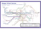
Well... yes and it makes complete sense in my view, it should have never been let to disintegrate in the way that it was. On a side note (don't know if this has been discussed elsewhere), but why have Scotrail not introduced a kind of s-train numbering system for Glasgow's (relatively extensive) commuter rail network? Doesn't even have to be numbers, the equivalent s-tog system in Copenhagen uses letters. Either way, it might make for a more intuitive system, especially on maps. In fact, more intuitive maps is a general thing I hope greater integration might bring about. This is what a numbered rail map might look like (graphics by Adam Gripton):

Glasgow S-train map Adam Gripton.jpeg

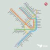
Although numbering is the most wide-spread form across continental Europe, there are also some systems (like Copenhagen and Paris) which use letters, something I personally quite like too:

tumblr_lvx7by9XGc1r54c4oo1_1280.jpeg
 
Last edited:
Sponsor Post - registered members do not see these adverts; click here to register, or click here to log in
R

RailUK Forums

tbtc

Veteran Member
Joined
16 Dec 2008
Messages
17,882
Location
Reston City Centre
The idea is that you use a combination of routes to get from A to B. You can't get a critical mass of passengers to make a single direct bus viable unless it goes to a city centre or hospital or other major destination. Hence my last question to @Mrwerdna1. If people are willing to change vehicles then the number of potential journey opportunities increases dramatically. If you assume that only a direct bus is worth using, then you are basically stuck with the existing situation with buses totally out of the market for all trips other than those to the city centre, with cars used for all other trips.

This is one of the great contradictions of RailUK Forums - the "rail" side sees people demanding direct links even between places hundreds of miles apart ("it's vital that this town has through trains to London", the entire economic strength of northern England relies upon everywhere having direct trains to Manchester Airport, we need to put Liverpool/ Portsmouth/ Brighton etc on the Cross Country map and run trains between every pair of cities, it's intolerable to remove direct trains from Liverpool to Norwich... if I had a pound for every time I saw someone point out that "passengers don't like to change trains" I'd be a richer man)... look at any thread on branch lines and you'll see people suggesting/demanding that shuttles on the branch are extended to avoid people changing at the junction

...but the "bus" side tends to have people suggesting chopping up long established routes, making people change.

But even if we are going to have a world where all passengers can transfer onto "orbital" services at no extra cost (which will be the case for most passengers in Scotland given the free travel for under 22s and over 60s - as well as a lot of 23-59 year olds who have weekly tickets), what orbital links are there that people want to be introduced?

Taking Glasgow or any UK city, what feasible "orbital" routes are lacking?

I'm just asking as this thread seems to be a few people saying that "it'd be nice if we had orbital routes" but I'm not seeing examples. e.g. Cambusland and Tollcross are just a couple of miles apart, both have frequent "radial" routes into the city centre but right now (given that there's a long wait until the next hourly 64) Google Maps is suggesting I take a 263 and change to a 61 at Argyle Street - a fifty two minute journey - so should we have a shuttle between them? Clarkston to Pollock? Milngavie to Drumchapel? Or do we accept that just because two suburban high streets are a couple of miles apart that doesn't mean there's much demand to get between them?

Well, in the case of Glasgow, I wouldn't be great at providing specifics, I'll openly admit that. I think what is key though is that orbital routes are integrated with radial routes and upgraded to high-frequency and high-capacity transport over time. It's bad enough that buses aren't properly integrated with Scotrail services and the underground, but that's made worse by the fact that they're sometimes slow or infrequent as well.

Setting that aside, it's interesting that you should mention shopping centres, because in Zurich the refurbishment of a big shopping centre on the outskirts of the city, which, I believe, is still the busiest in Switzerland, was planned in conjunction with the opening of a new orbital tram/light-rail line 10 years ago. Yes, a lot of people still drive to the shopping centre, but there's now a lot who use the tram too, seeing there's the option. The tram/light-rail (it uses trams as rolling stock, but is entirely segregated) links a number of the suburbs, several commuter rail lines and the airport.

Any UK city then - I don't know Copenhagen/Zurich - but I know the buses in most UK cities, so can discuss what "orbital" links you think we should be focussing on

Regarding Cumbernauld - Airdrie, there is the SPT subsidised 147/247 routes that run from Kilsyth (Mon - Sat evenings and all day Sundays as the 147) and Kirkintilloch (247, Mon - Sat daytime. This used to start back from Milngavie Station via Torrance) to Monklands Hospital, as this is the closest hospital to the New Town of Cumbernauld in the NHS Lanarkshire area. Monklands is due to be relocated to the Wester Moffat area of Airdrie, which I believe is also tied in with the eastern link road that is proposed to be built. It is also planned for Cumbernauld to have a "treatment centre" rather than an ordinary hospital as well in the future.

The present day Dalmuir-Glasgow Central Low Level-Blantyre-Motherwell-Cumbernauld trains date back to the second half of the 1990s when the electric trains terminated at Coatbridge Central with there being a diesel shuttle Motherwell - Cumbernauld. The cynic in me is that it was most likely to make the former Cumbernauld and Kilsyth District Council (before 1975, Cumbernauld was in Dunbartonshire and also had the Development Corporation (which should be brought back, being as North Lanarkshire Council do very little), with Kilsyth formerly being in Stirlingshire) feel a part of the present day North Lanarkshire Council being as their headquarters are based in Motherwell. Also, the present day trains along the Cumbernauld - Coatbridge Central - Motherwell section do not connect well at Motherwell into and out of the trains heading towards Carlisle and points south.

Cumbernauld to Airdrie is the kind of link that, if there was no direct service, we'd have people suggesting that it would be a vital link and very important to have - linking large towns without the need to go into central Glasgow - however the reality is that it's nothing more than a tendered service every hour

another key issue is the decline of the high street; tough enough in those city centres but even more pronounced in those secondary locations that used to be able to justify some sort of high street pull. Thinking of spots like Clydebank

Yeah, that's a good point - big cities are still a "draw" but (in an era where a lot of people can have much of their shopping/ entertainment from home and "working from home" is becoming the norm for lots more people, trying to get someone to spend four quid on a return journey from their house to the town centre in somewhere like Rotherham is a big ask!
 

scotraildriver

Established Member
Joined
15 Jun 2009
Messages
1,629
Yeah, I expect so... However, if there are long-term plans for a light-rail in Greater Glasgow, then an orbital route of some sort should be heavily considered, or at least a line that links a certain number of Scotrail commuter lines. I suppose the Clyde Metro is a nod in that direction, though not really what I mean. Similarly to Glasgow, Copenhagen got rid of its trams in the second half of the 20th century and its first tram/light-rail line since then will be the orbital ringline I mentioned.


Well... yes and it makes complete sense in my view, it should have never been let to disintegrate in the way that it did. On a side note (don't know if this has been discussed elsewhere), but why have Scotrail not introduced a kind of s-train numbering system for Glasgow's (relatively extensive) commuter rail network? Doesn't even have to be numbers, the equivalent s-tog system in Copenhagen uses letters. Either way, it might make for a more intuitive system, especially on maps. In fact, more intuitive maps is a general thing I hope greater integration might bring about. This is what a numbered rail map might look like (graphics by Adam Gripton):

View attachment 110509

Although numbering is the most wide-spread form across continental Europe, there are also some systems (like Copenhagen and Paris) which use letters, something I personally quite like too:

View attachment 110510
Again, a route numbering system was used way back in the 1970s but dropped in favour of just destination.


johncrossley

Established Member
Joined
30 Mar 2021
Messages
3,011
Location
London
...but the "bus" side tends to have people suggesting chopping up long established routes, making people change.

I think there is resistance to changing on both modes on this forum. People don't want to split long standing rail routes, like you say. And whenever people mention using buses as feeders and the like, similarly people express their disapproval.


But even if we are going to have a world where all passengers can transfer onto "orbital" services at no extra cost (which will be the case for most passengers in Scotland given the free travel for under 22s and over 60s - as well as a lot of 23-59 year olds who have weekly tickets), what orbital links are there that people want to be introduced?

Taking Glasgow or any UK city, what feasible "orbital" routes are lacking?

I'm just asking as this thread seems to be a few people saying that "it'd be nice if we had orbital routes" but I'm not seeing examples. e.g. Cambusland and Tollcross are just a couple of miles apart, both have frequent "radial" routes into the city centre but right now (given that there's a long wait until the next hourly 64) Google Maps is suggesting I take a 263 and change to a 61 at Argyle Street - a fifty two minute journey - so should we have a shuttle between them? Clarkston to Pollock? Milngavie to Drumchapel? Or do we accept that just because two suburban high streets are a couple of miles apart that doesn't mean there's much demand to get between them?

What they seem to do in other countries when I've looked at maps (for example when I looked at the Copenhagen map earlier because @Mrwerdna1 has good knowledge of it and is using it as an example on this thread) is to join up major transport nodes, for example rail stations. Take a look at the diagram below. If you have radial routes in black, with major transport nodes at E, F and G (for example if they are key metro/rail stations) then a route from E-F-G is the sort of route you might expect in somewhere like Copenhagen or other city with integrated transport. This makes some journeys which would otherwise require a long detour via the city centre a lot shorter, with the added bonus of creating direct orbital links.

1645381451615.png

I've got no special academic insight here, just an observation from studying transport maps and also travelling abroad. I like travelling around strange cities for fun and looking at routes which seem interesting. In the past when I've travelled I've seen routes like the one above. I probably would have wondered, why does this route exist? There's no obvious traffic objective here (when looking at route E-F-G in isolation) other than the fact they connect stations. But when I actually go on it, I notice a lot of people actually changing at points E, F and G, so the idea must have some legs. If nobody was using it, they would have scrapped the route.

I suppose in London you can normally expect two or three nearby stations to be connected by a direct bus route like in the example above, but you don't really notice it because the bus network is so dense anyway.
 

Mrwerdna1

Member
Joined
18 Jul 2018
Messages
61
Location
The Continent
Precisely! In some cases it might be about the demand for orbital routes per se, but most of the time that is just an added bonus and what is instead created is a grid or web like system of integrated (preferably high-frequency) routes, so people can more easily get from A to B with fewer detours.

I think the direct vs. non-direct argument is, whilst to a certain extent a matter of personal preference, also just a question of scale. I suppose most people will be inclined to agree that a metro is a pretty nifty way of getting around a big city, though not out of any expectation to get anywhere directly at all costs, but rather, as quickly or efficiently as possible, even if that requires changing lines once or twice.

This is also why high frequencies are so important, because it means people can travel (almost) without sticking to a fixed timetable. Happen to miss your train/metro/tram/bus? No problem, there'll be another one along in 5 minutes. On the other hand, if we're talking about intercity routes, that's usually not the case.

Now, in Switzerland, partially owing to the sheer density of the network, you'll still quite commonly have to change trains to get from A to B, even on longer journeys. However, that is because the Swiss system is in the very fortunate position of having 1) an entirely integrated timetable and 2) excellent punctuality, not really something that can be said about most rail networks in Europe. This is not helped by the fact that keeping intercity trains on time becomes progressively more difficult the longer and more intertwined a certain route is, with only limited scope of regaining any time that was lost.

As such, if your initial train is late (even by just a few minutes) and you're now stranded at a transfer station with no connecting train for another hour or so, that's a very frustrating position to be in. If, to prevent this from happening in the first place, the transfer time is simply made longer, then even if things do go smoothly, it will not be the same "slick" experience as on the underground. In such situations then, direct trains can be a great convenience to long-distance passengers and convenience sells.

Again, a route numbering system was used way back in the 1970s but dropped in favour of just destination.

Ah, I didn't know that. It's a shame really, let's hope it might get revived at some point!
 
Last edited:

TheGrandWazoo

Veteran Member
Joined
18 Feb 2013
Messages
20,088
Location
Somerset with international travel (e.g. across th
I've got no special academic insight here, just an observation from studying transport maps and also travelling abroad. I like travelling around strange cities for fun and looking at routes which seem interesting. In the past when I've travelled I've seen routes like the one above. I probably would have wondered, why does this route exist? There's no obvious traffic objective here (when looking at route E-F-G in isolation) other than the fact they connect stations. But when I actually go on it, I notice a lot of people actually changing at points E, F and G, so the idea must have some legs. If nobody was using it, they would have scrapped the route.

Precisely! In some cases it might be about the demand for orbital routes per se, but most of the time that is just an added bonus and what is instead created is a grid or web like system of integrated (preferably high-frequency) routes, so people can more easily get from A to B with fewer detours.

I think the direct vs. non-direct argument is, whilst to a certain extent a matter of personal preference, also just a question of scale. I suppose most people will be inclined to agree that a metro is a pretty nifty way of getting around a big city, though not out of any expectation to get anywhere directly at all costs, but rather, as quickly or efficiently as possible, even if that requires changing lines once or twice.

This is also why high frequencies are so important, because it means people can travel (almost) without sticking to a fixed timetable. Happen to miss your train/metro/tram/bus? No problem, there'll be another one along in 5 minutes. On the other hand, if we're talking about intercity routes, that's usually not the case.
I don't think it's that people don't understand the concept of orbital routes. I think a number of us seasoned travellers are well versed in such routes in places such as Berlin where various S Bahn and U Bahn routes do operate and there are hubs or nodes where interchange is enabled.

Perhaps the issue in cities such as Glasgow is that the rail and bus network is predominantly on a hub and spoke basis. There are some orbital routes but they operate at a low frequency and sadly, neither the current patronage nor external funding will enable this to be addressed. That there's a demand and a requirement is not in dispute; just whether there is the funding available to make that change is highly questionable. In a way, you'd suggest that if you were going to have a public transport network of the type in Berlin or Copenhagen, you'd not start from the position that Glasgow has. Moreover, there are perhaps greater challenges in Glasgow, not least the car centric policies that have seen major motorway extensions into the very heart of the city; the M74 was extended only in 2011. There have also been other extensions in the last 30 years, notably with the M80 and the M77.

I don't know Glasgow that well in terms of its orbital bus services. However, the route pattern and services like the 90 are not unlike other major UK cities. Bristol is one I know very well. Especially in the northern half of the city, there were a number of routes that made their way around linking places like Fishponds with Filton, or Kingswood with Bristol Parkway. There are interchange points, such as Parkway, University of West of England, Southmead Hospital and Cribbs Causeway and yet, those routes continue to decline. Those that are commercially operated have been rationalised but many were council tenders anyway and as budgetary constraints have increased, so the provision of service has declined. In other aspects, as in Glasgow, a trunk route will proceed on a spoke, and then assume a radial type pattern; the 7/7A is an example in Glasgow. As you say, the issue is that often, there is a low overall frequency (hourly or half hourly) and that simply just doesn't appeal for interchanging; waiting in some collection of bus shelters for more than 10 mins is just not attractive. I frankly struggle to see how the finances will permit that to change given the challenges for public transport in the post Covid era.
 

tbtc

Veteran Member
Joined
16 Dec 2008
Messages
17,882
Location
Reston City Centre
I think there is resistance to changing on both modes on this forum. People don't want to split long standing rail routes, like you say. And whenever people mention using buses as feeders and the like, similarly people express their disapproval.


What they seem to do in other countries when I've looked at maps (for example when I looked at the Copenhagen map earlier because @Mrwerdna1 has good knowledge of it and is using it as an example on this thread) is to join up major transport nodes, for example rail stations. Take a look at the diagram below. If you have radial routes in black, with major transport nodes at E, F and G (for example if they are key metro/rail stations) then a route from E-F-G is the sort of route you might expect in somewhere like Copenhagen or other city with integrated transport. This makes some journeys which would otherwise require a long detour via the city centre a lot shorter, with the added bonus of creating direct orbital links.

View attachment 110528

I've got no special academic insight here, just an observation from studying transport maps and also travelling abroad. I like travelling around strange cities for fun and looking at routes which seem interesting. In the past when I've travelled I've seen routes like the one above. I probably would have wondered, why does this route exist? There's no obvious traffic objective here (when looking at route E-F-G in isolation) other than the fact they connect stations. But when I actually go on it, I notice a lot of people actually changing at points E, F and G, so the idea must have some legs. If nobody was using it, they would have scrapped the route.

I suppose in London you can normally expect two or three nearby stations to be connected by a direct bus route like in the example above, but you don't really notice it because the bus network is so dense anyway.

Precisely! In some cases it might be about the demand for orbital routes per se, but most of the time that is just an added bonus and what is instead created is a grid like system of integrated (preferably high-frequency) public transport, so people can more easily get from A to B with fewer detours

It all sounds fine in theory, but... it's just theory unless anyone is going to come up with some UK examples

I can see the logic in a shuttle service from E-F-G (based on the example above), I'd find it useful to have more choice of services so I didn't need to go into the city centre, I'm not against any of this - it's just that it's all very abstract on the thread, nobody is even suggesting any UK routes that they'd want to link with an orbital service

For example, since we are talking about Glasgow, you could point out that a shuttle bus from Corkerhill to Nitshill would allow someone to travel from stations on the Paisley Canal line to places in Ayrshire, but are there many people doing that kind of journey? Would we get more passengers from Paisley to Kilmarnock if they could take a shuttle bus rather than going into the city centre? Would you have cheaper tickets for journeys that avoided going into central Glasgow? Or are 95% of people on both lines just doing simple journeys into Central and wouldn't benefit from any orbital services?

That's the kind of thing I'm talking about - maybe a shuttle bus from Rutherglen to Carntyne? Otherwise it's all just abstract discussion about "nodes" and "grids" and bears no relationship to examples of "missing links" in UK cities
 

Mrwerdna1

Member
Joined
18 Jul 2018
Messages
61
Location
The Continent
Perhaps the issue in cities such as Glasgow is that the rail and bus network is predominantly on a hub and spoke basis. There are some orbital routes but they operate at a low frequency and sadly, neither the current patronage nor external funding will enable this to be addressed. That there's a demand and a requirement is not in dispute; just whether there is the funding available to make that change is highly questionable. In a way, you'd suggest that if you were going to have a public transport network of the type in Berlin or Copenhagen, you'd not start from the position that Glasgow has. Moreover, there are perhaps greater challenges in Glasgow, not least the car centric policies that have seen major motorway extensions into the very heart of the city; the M74 was extended only in 2011. There have also been other extensions in the last 30 years, notably with the M80 and the M77.
That's all very true and to imagine that merely integrating transport will resolve these issues over night is of course laughable. That said, perhaps a combination of:

1) Progressively moving away from car-centric policies and planning principles.
2) Increasing funding streams for higher frequencies and new projects (heavy rail extensions or capacity upgrades, light-rail, BRT etc.). Public transport needs to become a national priority. I don't how that would be achieved, but it's worth dreaming about (one thing is clear, the SNP needs a rocket up their a***).
3) Integrating all public transport, especially in terms of ticketing, first on a regional basis, then perhaps across the whole of Scotland.

At that point, Greater Glasgow's public transport network might actually start to look rather respectable. There's still a lot do and many deep-seated issues remain, some of which are tricky to reverse, but I suppose in the UK there are still many cities that offer a worse foundation to build upon than Glasgow, so I choose to remain optimistic.
 
Last edited:

TheGrandWazoo

Veteran Member
Joined
18 Feb 2013
Messages
20,088
Location
Somerset with international travel (e.g. across th
It all sounds fine in theory, but... it's just theory unless anyone is going to come up with some UK examples

I can see the logic in a shuttle service from E-F-G (based on the example above), I'd find it useful to have more choice of services so I didn't need to go into the city centre, I'm not against any of this - it's just that it's all very abstract on the thread, nobody is even suggesting any UK routes that they'd want to link with an orbital service
Absolutely. I mean, the concept isn't new or radical. Going back to Bristol, the main radial routes (M-F headway in brackets) are:

10 Avonmouth - Westbury - Southmead Hospital - Bristol Parkway - Thornbury (60)
11 Avonmouth - Shirehampton - Southmead Hospital - Bristol Parkway (60)
3 Cribbs Causeway - Henbury - Avonmouth - Shirehampton then continues to city centre (30)
4 Cribbs Causeway - Henbury - Lawrence Weston - Shirehampton then continues to city centre (30)
17 Southmead Hospital - Fishponds - Kingswood (30) - Keynsham (60)
19 Bath - Kingswood - UWE - Bristol Parkway - Cribbs Causeway (60)
12 Bristol Parkway - Cribbs Causeway - Severn Beach (60)
622 Yate - Thornbury - Cribbs Causeway (60)

96 Brislington - Broadwalk - Hengrove Park (120)
505 Long Ashton - Clifton - Southmead Hospital (30)
511 Stockwood - Hengrove Park - Hartcliffe (60)
55 Hengrove Park - Hartcliffe - Bristol Airport

I think that with the exception of the 3/4, and possibly the 17 and maybe bits of the 19, all the rest are tendered by local authorities. You see many common points where they do intersect with rail (Bristol Parkway) or major trunk bus routes. However, this is almost a subsistence network and it's under threat.

Getting back to Glasgow, you will see similar routes but I just fail to see how the funds will enable it to happen, and that's the issue. There's clearly a need, and it's desirable on many levels. However, when you've major routes now under threat of going to 15 min headways and losing the turn up and travel concept, I'm not optimistic about similar headways on these lesser, radial routes.

That's all very true and to imagine that merely integrating transport will resolve these issues over night is of course laughable. That said, perhaps a combination of:

1) Progressively moving away from car-centric policies and planning principles.
2) Increasing funding streams for higher frequencies and new projects (heavy rail extensions or capacity upgrades, light-rail, BRT etc.). Public transport needs to become a national priority. I don't how that would be achieved, but it's worth dreaming about (one thing is clear, the SNP needs a rocket up their a***).
3) Integrating all public transport, especially in terms of ticketing, first on a regional basis, then perhaps across the whole of Scotland.

At that point, Greater Glasgow's public transport network might actually start to look rather respectable. There's still a lot do and many deep-seated issues remain, some of which are tricky to reverse, but I suppose in the UK there are still many cities that offer a worse foundation to build upon than Glasgow, so I choose to remain optimistic.
Indeed, at least Strathclyde has some sort of base and they can do things to really even things up a bit. However, I'm not certain that there's the political will to do it sadly.
 
Joined
31 Dec 2021
Messages
809
Location
Glasgow
In Glasgow, we should really see Primary, Secondary & Orbital structure.

Primary: 61 & 2 for example.

Secondary: 60 operating only Clydebank - Easterhouse like it only every did, but now only every 15 mins, Milngavie section completely separated from the current 60/60A regime, it never did that when the 40 was such a thing and worked fine.

Orbital routes should “NOT” be sacrificed at the expense of the “profit makers”.

The 8 & 90 could both be upped to every 20 minutes if you had to cut back on both the 2 to every 10 minutes & the 6; Clydebank to East Kilbride to every 20 minutes(short working 10min frequency between Kilbride & Glasgow City Centre, of course), x4 removed in favour of the 44 again, routes like the 1C & 1D operated at peak only.

Much more could be done, privatisation and that, going after what makes money.
 

daodao

Established Member
Joined
6 Feb 2016
Messages
2,976
Location
Dunham/Bowdon
It all sounds fine in theory, but... it's just theory unless anyone is going to come up with some UK examples
In general I agree, but there is one UK example in Greater Manchester, where the key (ex tram) routes linking the ring of towns around Greater Manchester operate to a reasonably high Mon-Sat daytime frequency (at least every 10 minutes) and provide reasonable connections at the bus stations in these towns. The routes are:
  • 330 Stockport-Hyde-Ashton
  • 409 Ashton-Oldham-Rochdale
  • 471 Rochdale-Bury-Bolton
Sadly, the direct through bus service from Altrincham to Stockport (route 11A) is now only hourly.
 

johncrossley

Established Member
Joined
30 Mar 2021
Messages
3,011
Location
London
In general I agree, but there is one UK example in Greater Manchester, where the key (ex tram) routes linking the ring of towns around Greater Manchester operate to a reasonably high Mon-Sat daytime frequency (at least every 10 minutes) and provide reasonable connections at the bus stations in these towns. The routes are:
  • 330 Stockport-Hyde-Ashton
  • 409 Ashton-Oldham-Rochdale
  • 471 Rochdale-Bury-Bolton
Sadly, the direct through bus service from Altrincham to Stockport (route 11A) is now only hourly.

I suppose those are natural direct bus routes to be provided anyway, as they connect major centres. Non-radial routes closer to the city centre are less common and where they exist are sometimes low frequency. For example you might think that a bus from Chorlton to Levenshulme would be useful, and one exists, but it is only half hourly and hourly evening and Sundays. As well as connecting those tram/rail stations, it also intersects major radial bus routes.
 

megabusser

Member
Joined
30 Sep 2019
Messages
51
Location
Edinburgh
In terms of orbital routes, crossing the Clyde is an issue.

What about a Bishopton to Kilpatrick (or Dalmuir?) and/or a Cardonald to Partick, using the Erskine Bridge and Clyde Tunnel respectively.

Either option could reduce many journey times (eg between Greenock and Clydebank or Paisley and Partick).
 
Last edited:

TheGrandWazoo

Veteran Member
Joined
18 Feb 2013
Messages
20,088
Location
Somerset with international travel (e.g. across th
I suppose those are natural direct bus routes to be provided anyway, as they connect major centres. Non-radial routes closer to the city centre are less common and where they exist are sometimes low frequency. For example you might think that a bus from Chorlton to Levenshulme would be useful, and one exists, but it is only half hourly and hourly evening and Sundays. As well as connecting those tram/rail stations, it also intersects major radial bus routes.
More pertinently, Manchester's famed service 53 used to operate every 4 minutes in its heyday and has declined over the years to be half hourly. It links with major arterial bus routes and several Metrolink stations. The reasons cited have been the loss of a number of major industries and employers en route, changes to land use as terraced housing was removed to be replaced by lower density housing, and declines in what were significant traffic objectives. Pendleton Shopping Centre ain't much different to Clydebank's.
In terms of orbital routes, crossing the Clyde is an issue.

What about a Bishopton to Kilpatrick (or Dalmuir?) and/or a Cardonald to Partick, using the Erskine Bridge and Clyde Tunnel respectively.

Either option could reduce many journey times (eg between Greenock and Clydebank or Paisley and the Patrick).
Perhaps this is a key point. These were places that, by dint of their geography, weren't linked and so traffic flows weren't naturally there. Build a bridge or tunnel, and suddenly it's much easier but by car!
 

sannox

Member
Joined
1 Mar 2016
Messages
406
In terms of orbital routes, crossing the Clyde is an issue.

What about a Bishopton to Kilpatrick (or Dalmuir?) and/or a Cardonald to Partick, using the Erskine Bridge and Clyde Tunnel respectively.

Either option could reduce many journey times (eg between Greenock and Clydebank or Paisley and Partick).
I mean these links both exist or have just been pulled recently - McGill's X22 and McGill's 17. The 17 was every 10 minutes but has been getting cut and cut and with lack of uni students is now back to the QUE Hospital.
 

PaulMc7

Established Member
Joined
9 Jul 2019
Messages
4,029
I do miss the days of the likes of the 42/44 etc but if the 1C/X4 were to disappear again or be made peak only you'd be throwing passengers away now. The other issue is that the "peak" isn't as straightforward to gauge now due to Covid changing work patterns. Even pre-covid the 1C stayed busy after 7pm unlike a lot of other services by comparison. The X4 isn't great but the problem is Knightswood isn't great for bus use anyway so changing again may not even do anything positive. The 94 is a SPT service and isn't always busy and the M4 which was brought in to cover the Kelvindale part of the 4A when that was cut to Broomhill is pretty much the same.

New routes could maybe bring in some extra passengers but they'd need to be direct and reliable which unfortunately is a struggle in Glasgow with the issues of congestion and driver shortages.
 

tbtc

Veteran Member
Joined
16 Dec 2008
Messages
17,882
Location
Reston City Centre
Absolutely. I mean, the concept isn't new or radical. Going back to Bristol, the main radial routes (M-F headway in brackets) are:

10 Avonmouth - Westbury - Southmead Hospital - Bristol Parkway - Thornbury (60)
11 Avonmouth - Shirehampton - Southmead Hospital - Bristol Parkway (60)
3 Cribbs Causeway - Henbury - Avonmouth - Shirehampton then continues to city centre (30)
4 Cribbs Causeway - Henbury - Lawrence Weston - Shirehampton then continues to city centre (30)
17 Southmead Hospital - Fishponds - Kingswood (30) - Keynsham (60)
19 Bath - Kingswood - UWE - Bristol Parkway - Cribbs Causeway (60)
12 Bristol Parkway - Cribbs Causeway - Severn Beach (60)
622 Yate - Thornbury - Cribbs Causeway (60)

96 Brislington - Broadwalk - Hengrove Park (120)
505 Long Ashton - Clifton - Southmead Hospital (30)
511 Stockwood - Hengrove Park - Hartcliffe (60)
55 Hengrove Park - Hartcliffe - Bristol Airport

I think that with the exception of the 3/4, and possibly the 17 and maybe bits of the 19, all the rest are tendered by local authorities. You see many common points where they do intersect with rail (Bristol Parkway) or major trunk bus routes. However, this is almost a subsistence network and it's under threat.

Getting back to Glasgow, you will see similar routes but I just fail to see how the funds will enable it to happen, and that's the issue. There's clearly a need, and it's desirable on many levels. However, when you've major routes now under threat of going to 15 min headways and losing the turn up and travel concept, I'm not optimistic about similar headways on these lesser, radial routes.


Indeed, at least Strathclyde has some sort of base and they can do things to really even things up a bit. However, I'm not certain that there's the political will to do it sadly.

In Glasgow, we should really see Primary, Secondary & Orbital structure.

Primary: 61 & 2 for example.

Secondary: 60 operating only Clydebank - Easterhouse like it only every did, but now only every 15 mins, Milngavie section completely separated from the current 60/60A regime, it never did that when the 40 was such a thing and worked fine.

Orbital routes should “NOT” be sacrificed at the expense of the “profit makers”.

The 8 & 90 could both be upped to every 20 minutes if you had to cut back on both the 2 to every 10 minutes & the 6; Clydebank to East Kilbride to every 20 minutes(short working 10min frequency between Kilbride & Glasgow City Centre, of course), x4 removed in favour of the 44 again, routes like the 1C & 1D operated at peak only.

Much more could be done, privatisation and that, going after what makes money.

In general I agree, but there is one UK example in Greater Manchester, where the key (ex tram) routes linking the ring of towns around Greater Manchester operate to a reasonably high Mon-Sat daytime frequency (at least every 10 minutes) and provide reasonable connections at the bus stations in these towns. The routes are:
  • 330 Stockport-Hyde-Ashton
  • 409 Ashton-Oldham-Rochdale
  • 471 Rochdale-Bury-Bolton
Sadly, the direct through bus service from Altrincham to Stockport (route 11A) is now only hourly.

These three posts are great responses, interesting examples of "orbital" routes that used to work/ still work/ could work

It's too easy for other people to keep suggesting that Something Must Be Done and that we must stop route maps being just radial routes and become more of a grid-like network, without ever finding suggestions for UK cities - it feels a bit like threads when people argue we should take a "holistic approach", which sounds worthy/ complicated/ sincere without actually offering anything substantial in terms of actual solutions

In answer to some of the above:

@TheGrandWazoo - it feels significant that most of the routes which are at least partly orbital have to be subsidised and/or involve major destinations (Southmead Hospital/ Bristol Parkway/ Cribbs Causeway/ UWE/ Bristol Airport) rather than just linking suburbs (in the way that Glasgow has routes which provide orbital links, but generally only if they link things like Hospitals/ University)

@Trnsprt4Sctlnd - the 8/90 are frustrating routes, in that it feels like there could be a high frequency corridor from the QE Hospital - Partick - Byers Road - Maryhill - Springburn but once they spread out at Maryhill Road and feel like more "box tickers" than direct routes between any two major places

@daodao I'm always impressed with the frequencies in Greater Manchester - I didn't know that the Stockport - Altrincham route had been downgraded so much though - wasn't it every ten minutes too? Or is it that demand on the south/west side of the M60 is spread too thinly between destinations than having one major town centre on the arc between Stockport and Bolton?
 

daodao

Established Member
Joined
6 Feb 2016
Messages
2,976
Location
Dunham/Bowdon
@daodao I'm always impressed with the frequencies in Greater Manchester - I didn't know that the Stockport - Altrincham route had been downgraded so much though - wasn't it every ten minutes too? Or is it that demand on the south/west side of the M60 is spread too thinly between destinations than having one major town centre on the arc between Stockport and Bolton?
Frequencies of many of the surviving key routes in Greater Manchester are quite good, but other key routes have disappeared completely in the last 50 years and some main roads that were formerly tram routes such as Seymour Grove have a skeleton bus service or none at all.

Historically, the Stockport-Altrincham bus service was not especially frequent; see Timetable World for further details at https://timetableworld.com/ttw-viewer.php?token=6c375afc-07d1-4088-8d69-c816580a01e1. The direct route 11A via Gatley was formerly North West Road Car Company (NWRCC) route 71 that ran half-hourly in 1967. NWRCC ran another route (80) between the 2 towns via Didsbury, that ran every 20 minutes in 1967, and whose last vestiges (currently hourly route 288 between Altrincham and Didsbury only) will shortly disappear.
 

TheGrandWazoo

Veteran Member
Joined
18 Feb 2013
Messages
20,088
Location
Somerset with international travel (e.g. across th
In answer to some of the above:

@TheGrandWazoo - it feels significant that most of the routes which are at least partly orbital have to be subsidised and/or involve major destinations (Southmead Hospital/ Bristol Parkway/ Cribbs Causeway/ UWE/ Bristol Airport) rather than just linking suburbs (in the way that Glasgow has routes which provide orbital links, but generally only if they link things like Hospitals/ University)
The reality is that bus services work to meet demand... wanting to go from somewhere to somewhere and that means areas with a residential base, and a population who wish to travel to a traffic objective. In the past, that could have been where people lived, and heading to a large employer or to a local retail centre.

That has changed over recent years. The bus to the shops is now less necessary - a pattern started by the sale of cheap fridges in the 1950s and continued on with the rise of out of town centres and, more recently, the decline of high streets/rise of local discount supermarkets in neighbourhoods. Likewise, the large employer in a single location is no longer what it was.

There have been some changes for the better such as the centralisation of health services in key flagship hospitals or regional health centres, the growth of bespoke student accommodation etc.

Don't get me wrong - interchanging between buses, and between modes, could and should be improved. Getting people out of cars and onto public transport is more challenging with these orbital or tertiary routes.
 

GusB

Established Member
Associate Staff
Buses & Coaches
Joined
9 Jul 2016
Messages
6,651
Location
Elginshire
Please remember that we are primarily discussing transport in the Strathclyde area. Comparisons with other areas are inevitable and they're perfectly valid, but be careful not to let the thread go off at a tangent.
 

megabusser

Member
Joined
30 Sep 2019
Messages
51
Location
Edinburgh
I mean these links both exist or have just been pulled recently - McGill's X22 and McGill's 17. The 17 was every 10 minutes but has been getting cut and cut and with lack of uni students is now back to the QUE Hospital.

But not integrated into the train system in terms of fares, being on the National Rail journey planner or timetables.

I’m suggesting a regular ScotRail (or TransClyde?!) branded shuttle service between the stations, much like the Glasgow Central to Queen Street bus.
 

Man of Kent

Member
Joined
5 Jul 2018
Messages
603
But not integrated into the train system in terms of fares, being on the National Rail journey planner or timetables.

I’m suggesting a regular ScotRail (or TransClyde?!) branded shuttle service between the stations, much like the Glasgow Central to Queen Street bus.
Getting the Glasgow Subway integrated and advertised in this way would be a start. For buses, while it is possible to accept rail tickets, it is next to impossible to issue tickets on a bus that are valid to a variety of rail destinations (though it is possible in some areas e.g. West Midlands, to buy multi-modal rover tickets on board). I think some areas experimented with issuing a flat rate ticket on bus that could be exchanged at railway booking offices (but possibly not with conductors) as part payment to a rail destination. But this didn't offer any discount or time saving over buying each, and I'm not aware of it still being offered anywhere.

A problem with liverying a bus as a train is that people do not then always realise it is a normal bus, and think it is reserved to passengers holding rail tickets.

However, there is at least one example in Scotland of buses, with through fares from rail, on the National Rail journey planner, which is St Andrews. (And if I recall correctly, St Andrews bus station has a monitor showing train departures from Leuchars). Glasgow does have a PlusBus ticket, but this cannot be purchased from within the zone that it is valid e.g. it can't be bought at Bearsden for a multi-modal trip to Braehead. Oh, and a quick look at the website indicates that SPT have failed to require acceptance of PlusBus tickets on contracted services.

Meantime should I also express incredulity at Glasgow City Council, which is reported as seeking a 30% reduction in car mileage (https://www.transportxtra.com/publi...ce-car-vehicle-kilom?etid=3869054&artid=70640 - article is a bit too long to paste), is currently offering all day parking for £8 in some of its central area car parks?
 

Stan Drews

Established Member
Joined
5 Jun 2013
Messages
1,584
It is entirely possible to programme ticket machines on buses to issue tickets to rail destinations. The problem is the rail industry doesn’t have the ability/willingness to accept them!
 

johncrossley

Established Member
Joined
30 Mar 2021
Messages
3,011
Location
London
Pretending to extend the rail network by adding bus only served destinations to ticket destinations is really a sticking plaster to try and get around the lack of integrated ticketing. The normal procedure for integrated ticketing in metropolitan areas is to have tickets from zone to zone, allowing unlimited interchange within a certain time period, rather than having tickets from one specific stop to another specific stop.
 
Joined
31 Dec 2021
Messages
809
Location
Glasgow
I simply don’t think integrated Bus crossing Train journeys will be any cheaper than it would currently be, nor do I see the point in this.

Especially if it’s concerning the Glasgow area.

A separate Scotrail around the outskirts of Edinburgh together with Lothian buses seems to work ok.

Plus I thought that in the SPT area you can buy an SPT ZoneCard which works across several modes of public transport?
 

Mrwerdna1

Member
Joined
18 Jul 2018
Messages
61
Location
The Continent
The normal procedure for integrated ticketing in metropolitan areas is to have tickets from zone to zone, allowing unlimited interchange within a certain time period, rather than having tickets from one specific stop to another specific stop.
Indeed, though presumably that would be one of the most important goals of "Transport for Strathclyde" (should it manage to get off the ground at some point). At the moment, there seem to be a lot of voices saying "pie in the sky" and "it'll never happen", but presuming it does, what kind of timeframe are we looking at? What's happening at the moment? SPT proposed it, but what is the status of political support on the ground? I know that at a national level it seems voluntary partnerships are being pushed for more heavily than integrated public regulation and over in England, I believe there were several councils or combined authorities that decided against re-regulating buses and integrated ticketing in favour of more partnership agreements. Makes me wonder if the most common response to this proposal by the majority of relevant political actors and councils in the Strathclyde area will be "thank you, but no thank you".

Plus I thought that in the SPT area you can buy an SPT ZoneCard which works across several modes of public transport?
Yeah, but it's seasonal only and you're essentially stuck with the zones that you pick. There's no single-journey version of it as such and the day ticket equivalent (daytripper) was unfortunately scrapped. What I would instead like to see happen, is for the SPT Subway Smartcard to be gradually expanded to include Scotrail services and then buses (and perhaps ferries) too.
 
Last edited:

GLC

Member
Joined
21 Nov 2018
Messages
298
The Subway smart card already (partially) works on Scotrail. You’ve been able to load Scotrail season tickets onto a subway card for years now. Although in my experience, most ticket inspectors were bemused when I produced a Subway card for them to scan rather than a Scotrail card (all pre covid anyway…)
 

TheGrandWazoo

Veteran Member
Joined
18 Feb 2013
Messages
20,088
Location
Somerset with international travel (e.g. across th
Indeed, though presumably that would be one of the most important goals of "Transport for Strathclyde" (should it manage to get off the ground at some point). At the moment, there seem to be a lot of voices saying "pie in the sky" and "it'll never happen", but presuming it does, what kind of timeframe are we looking at? What's happening at the moment? SPT proposed it, but what is the status of political support on the ground? I know that at a national level it seems voluntary partnerships are being pushed for more heavily than integrated public regulation and over in England, I believe there were several councils or combined authorities that decided against re-regulating buses and integrated ticketing in favour of more partnership agreements. Makes me wonder if the most common response to this proposal by the majority of relevant political actors and councils in the Strathclyde area will be "thank you, but no thank you".
I think you just have to look at London and see some of the challenges in terms of funding etc. Do local bodies want to accept the responsibility and then be carrying the can if/when the money supply is threatened.

In terms of Strathclyde, criticism is to be laid at the doors of many parties. Depending on how you view your history, you can have public bodies that didn't serve the area well, whether that is the main competitive activity at de-reg being from the publicly owned Scottish Bus Group against the publicly owned Strathclyde Buses, but also the SBG companies being particularly affected by conservative approaches and archaic practices. You can point to privatisation and the subsequent sale to First, with insufficient investment in fleet and some of the cuts being wielded to achieve unrealistic margin returns.

The biggest issue is simply that Glasgow, much more than other areas, pursued a very car centric policy for the last 50 years. Whilst other cities rushed to have some major road developments (e.g. M32 in Bristol, Mancunian Way and M602 in Manchester, Central Motorway A167(M) in Newcastle), I can't think of anything that has rivalled Glasgow's approach, plus the sheer amount of roadside parking in the city centre. Therefore, you have national policies that have made car ownership and running cheaper, whilst local policies have made it so much easier to drive and park.
 

Falcon1200

Established Member
Joined
14 Jun 2021
Messages
3,699
Location
Neilston, East Renfrewshire
The biggest issue is simply that Glasgow, much more than other areas, pursued a very car centric policy for the last 50 years.

Not sure I would entirely agree with that; Car-centric in the 60s perhaps, with the M8 being carved through the city, but since then we have had the Argyle Line re-opening, Paisley Canal closure and re-opening (!), passenger services restored on the lines to Whifflet, Anniesland via Maryhill, and Hamilton-Larkhall rebuilt. And there is a degree of integration, albeit far from perfect; For example, McGills 395 East Kilbride/Uplawmoor bus still, 60 years after the Neilston-Uplawmoor railway closed, runs via Neilston station rather than the direct route via the main bus stop in Neilston village centre. Scotrail's website however makes no mention of the connection, and most bizarrely Travelline Scotland's Journey Planner recommends travelling from Glasgow to Uplawmoor via train to Barrhead and a 24 minute walk through Barrhead to pick up the 395 there, instead of a 2 minute walk at Neilston ! Definitely much room for improvement.
 
Status
Not open for further replies.

Top