323235
Established Member
Hi
In recent years I have taken an interest in the old line which operated from Bredbury - Cheadle Junction / East Didsbury and have investigated the different parts of the formation.
I've noted the embankment at Mersey Vale Nature Park , The way many of the car dealerships are simply build on top of the formation in a way that they could easily disappear again if the money and will was there.
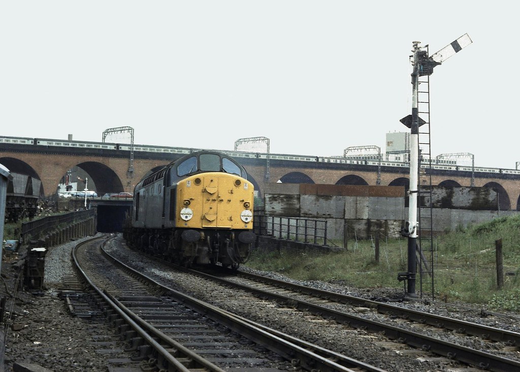
St Georges Tunnel has been dealt with in a way that the tunnel shape and path underground is still intact protected underground despite the addition of a road and pavement which skirt around and over it.
Brinnington Tunnel is fairly well cared for although it was leaking internally last time I walked through it.
Yesterday I found the way into Crookiley Wood nature reserve and was able to access the formation of the line from the bridge under Morrisons to where the bridge has been removed over the M60 (Does anyone know when this occurred as the bridge must have been fairly young in age? Pictures?). A single track formation of the trackbed was completely clear save for a few bits of plant and well ballasted too and overall was free of nature. Contrary to popular believe the slip road from Bredbury roundabout has not not taken any of the formation.
When walking over the A6 bridge recently I noted that the formation over Stockport Redrock seems to have been cleared at some point recently, as it was a forrest but now most of the trees are to the side of the trackbed and you can see the bed which looks in fairly good condition (for a disused trackbed).
The fairly new Porshe garage next to Tesco Portwood in Stockport has been built in such a way and angle that a bridge could be accommodated where the arches once existed.
Was some survey work done in connection with a bid for the restoring your railway fund bid and are some of these sections protected from major development?
Who now owns the parts of the trackbed which are not in use?
In recent years I have taken an interest in the old line which operated from Bredbury - Cheadle Junction / East Didsbury and have investigated the different parts of the formation.
I've noted the embankment at Mersey Vale Nature Park , The way many of the car dealerships are simply build on top of the formation in a way that they could easily disappear again if the money and will was there.
St Georges Tunnel has been dealt with in a way that the tunnel shape and path underground is still intact protected underground despite the addition of a road and pavement which skirt around and over it.
Brinnington Tunnel is fairly well cared for although it was leaking internally last time I walked through it.
Yesterday I found the way into Crookiley Wood nature reserve and was able to access the formation of the line from the bridge under Morrisons to where the bridge has been removed over the M60 (Does anyone know when this occurred as the bridge must have been fairly young in age? Pictures?). A single track formation of the trackbed was completely clear save for a few bits of plant and well ballasted too and overall was free of nature. Contrary to popular believe the slip road from Bredbury roundabout has not not taken any of the formation.
When walking over the A6 bridge recently I noted that the formation over Stockport Redrock seems to have been cleared at some point recently, as it was a forrest but now most of the trees are to the side of the trackbed and you can see the bed which looks in fairly good condition (for a disused trackbed).
The fairly new Porshe garage next to Tesco Portwood in Stockport has been built in such a way and angle that a bridge could be accommodated where the arches once existed.
Was some survey work done in connection with a bid for the restoring your railway fund bid and are some of these sections protected from major development?
Who now owns the parts of the trackbed which are not in use?