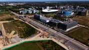
I believe it's set by GPS, but an experiment is probably in order. The filename on the 2 car DMU photo agrees with the meta data suggesting it was taken 2024-09-01 15:13:10 (BST).@neill Is the clock on your drone about 10 minutes fast? That would make everything match up, and makes the GN service in the photo 2C43.
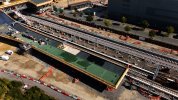
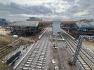
Here is a zoom of the original. I assumed it was a network rail test train, but google doesn't seem to have any thing that looks like a likely candidate.

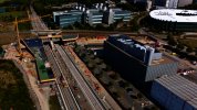
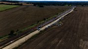
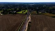
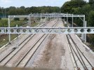
This is southbound taken at approx 15:07:34, so I think this is 2C43. The 1 car DMU comes through 2min 2second after this so must be 2Q10. I have video of the DMU heading towards Liverpool St at the junction.

The 2 car DMU comes through 2 minutes (give or take 10 seconds) later:


.jpeg")