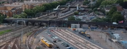
One of the questions is about the maps they released and the lack of detail on them, according to the lady this has been updated and on the east west website, i cannot see any difference except grey bits for houses or built up areas, there are still no road numbers or any other details added ?It takes an 8 car from memory. There is only one siding the rest was swamped by the car park.
Even if you go north the 6 track formation will take all the room that would be available on the east side.
== Doublepost prevention - post automatically merged: ==
I got these at 4pm today via email -
- Q+A part 1
- Q+A part 2
- Questions at the Bedford event
Notable comments - Aylesbury not dropped, OHLE on hold in favouring up and coming new technologies that are more suitable, Marston Vale line decreased speed to facilitate the level crossings (although I think it means it just stays the same). Northern approach at Bedford due to the town centre and flood planes in the south east of the town requiring viaducting for miles. EWR have identified 2 freight paths that can use EWR.
EDIT, I see there are now maps at the bottom of the web page with more detail. Much better, road numbers would be good though.
Last edited:


