• Our booking engine at tickets.railforums.co.uk (powered by TrainSplit) helps support the running of the forum with every ticket purchase! Find out more and ask any questions/give us feedback in this thread!

Huntingdon to Peterborough - 2, 3 or 4 tracks ?

Status
Not open for further replies.

PhilipW

Member
Joined
6 Feb 2008
Messages
756
Location
Fareham, Hants
I know that it is often recorded that it was a mistake to reduce the number of tracks in places between Huntingdon and Peterborough from 4 to 2 or 3.

Could someone describe the current track layout, whether 2, 3 or 4 between these two places for me. Would it be difficult to re-instate 4 tracks all the way?

I believe also there is still continuous 4 tracking from Hitchin Junction to Huntingdon. Is that true ?
 
Sponsor Post - registered members do not see these adverts; click here to register, or click here to log in
R

RailUK Forums

A-driver

Established Member
Joined
9 May 2011
Messages
4,482
4 track all the way from Hitchin to Huntingdon. From Huntingdon the down side has a fast and slow line until Holme crossing when it goes down to just 1 down line as far as fletton where it goes back to 4 track.

On the up side is just an up main from fletton all the way to Huntingdon where the slow starts with a shortish (2 signal sections) loop at connington. Like anywhere you could increase to 4 all the way but needs a fair bit of work-the Stilton fen bank would need widening etc.
 

Mike C

Member
Joined
18 Nov 2011
Messages
161
Leaving Huntingdon going north, the tracks are (from west to east):

Down slow - down fast - up fast - up slow.

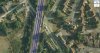
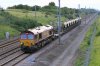
North of the station, under the A14 there is a crossover from the down slow to down fast, but the down slow continues. About 300yds north of this is where the up slow merges with (or forks from, depending on your viewpoint) the up fast. From this point about 500 yds north of Huntingdon station it is 3 tracks (Down slow - Down Fast and Up fast) all the way to just south of Holme level crossing where the down slow merges into the down fast and it is standard 2 track from there to Fletton in Peterborough (where the spur to the Nene Valley joins) where it becomes the same 4 track layout as in Huntingdon. There is also a short section of 4 track (a freight passing loop basically) on the fens near Church End at the site of the old yard.

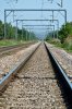
It is continuous 4 track from Huntingdon south all the way to Woolmer Green, south of Knebworth before the infamous Welwyn bottle-neck.

Reinstating the 4 tracks to Peterborough would be possible as in many places there is still visible track bed, but the OLE masts are often placed right where you'd need the 4-foot. There are also a few new bridges in the yaxley/south Peterborough area that would need widening. The fen stretch between Conington and Yaxley would be difficult from a construction point of view. The ground there isn't the easiest to build on. There is a 100mph limit on this stretch anyway - So like all things, it's possible if you throw enough money at it.

Benefits wise - it would help relieve congestion in the morning peak in particular around 7am to 8am when you have a lot of trains fighting for paths over the fens into London.
 

Zoe

Established Member
Joined
22 Aug 2008
Messages
5,905
Reinstating the 4 tracks to Peterborough would be possible as in many places there is still visible track bed
I'm not sure it was ever all four track. The 1960 sectional appendix shows three tracks Huntingdon to Stukeley, then four to Connington and then two to Fletton Junction.
 
Last edited:

amcluesent

Member
Joined
19 Dec 2010
Messages
877
Travelling to PBO on FCC, it's always galling to think 'nearly there' just when the train comes to a halt to let some EC sets thunderpast before FCC is allowed to trundle out onto the only northbound track
 

Mike C

Member
Joined
18 Nov 2011
Messages
161
I'm not sure it was ever all four track. The 1960 sectional appendix shows three tracks Huntingdon to Stuckley, then four to Connington then two to Fletton Junction.

Over the fens it has always been 2 track as far as I know. The 4th track bed is clearly visible from Stukeley all the way to Conington (one "n"). So if you want to word it correctly then, "Reinstate 4 tracks where it was, and build the extra 2 over the fens".
--- old post above --- --- new post below ---
Travelling to PBO on FCC, it's always galling to think 'nearly there' just when the train comes to a halt to let some EC sets thunderpast before FCC is allowed to trundle out onto the only northbound track

Even more annoying when said EC train is "thundering" past at the same 100mph as the 365's can do on that same stretch at Holme.
 

PhilipW

Member
Joined
6 Feb 2008
Messages
756
Location
Fareham, Hants
Thanks for all the information. Interesting.

So, in effect, the only track that was removed during electrification was the Up Slow from Conington (from the end of the existing loop) to Stuckley.

Is that correct ? If so, it is less than I thought.
 

Mike C

Member
Joined
18 Nov 2011
Messages
161
"Stukeley" (pronounced stook-ley). Yes, that and some between Yaxley and Fletton. Basically the fen stretch between Yaxley and Holme has always been 2 track - the rest of it 4.
 

Zoe

Established Member
Joined
22 Aug 2008
Messages
5,905
"Stukeley" (pronounced stook-ley). Yes, that and some between Yaxley and Fletton. Basically the fen stretch between Yaxley and Holme has always been 2 track - the rest of it 4.
I'm not sure about Huntingdon to Stukeley though, the 1960 sectional appendix is showing that as only three tracks. Yaxley to Fletton is also showing as three tracks.
 

Mike C

Member
Joined
18 Nov 2011
Messages
161
I'm not sure about Huntingdon to Stukeley though, the 1960 sectional appendix is showing that as only three tracks. Yaxley to Fletton is also showing as three tracks.

I'm not sure about the sectional appendix, but I'm going by what I see as I live in the area.

Have a look at this Google Earth grab showing a bridge north of Huntingdon station where there are currently only 3 tracks remaining (indicated by the blue lines). There has clearly been, at one point, a 4th track in place. The track bed that carried it is visible way north of the town too.
 

Attachments

  • Ermine st bridge.jpg
    Ermine st bridge.jpg
    119.6 KB · Views: 69

philjo

Established Member
Joined
9 Jun 2009
Messages
2,884
Maybe for the stretches where putting 4 tracks in would cost too much (moving OHLE masts and strengthening the embankments etc) 3 tracks would suffice if the middle track was bi-directional and run as a peak tidal flow -i.e. mainly used southbound in the morning and northbound in the evenings to separate the FCC & EC services
 

LE Greys

Established Member
Joined
6 Mar 2010
Messages
5,389
Location
Hitchin
"Stukeley" (pronounced stook-ley). Yes, that and some between Yaxley and Fletton. Basically the fen stretch between Yaxley and Holme has always been 2 track - the rest of it 4.

I've seen pictures of Yaxley, and they were 2-track. I also think that the approach to Peterborough from the south used to be main/relief instead of fast/slow. The mains went over the old bridge on the east side and almost directly into what is now Platforms 2 and 3 (which used to have a roof). The reliefs went through where the current fast lines are, then one of them crossed over to access New England along with the line from the GE section. The up slow only appeared north of New England, and there used to be a down slow running all the way to Helpston.

One great advantage of four tracks would be the ability to reopen Holme or Yaxley. There has been a lot of development south of Peterborough, and more is planned, so getting commuters to avoid the main station by providing a southern one with lots of car parking sounds like a good idea.
 

Mike C

Member
Joined
18 Nov 2011
Messages
161
Here is a photo of the stretch between Huntingdon and Conington - taken at Abbots Ripton. There is clearly space here for another track subject to OLE structure alterations.
 

Attachments

  • EWS Lafarge.jpg
    EWS Lafarge.jpg
    1.2 MB · Views: 75

Zoe

Established Member
Joined
22 Aug 2008
Messages
5,905
Here is a photo of the stretch between Huntingdon and Conington - taken at Abbots Ripton. There is clearly space here for another track subject to OLE structure alterations.
Yes, there is no doubt the section from Stukeley to Connington was four tracks.
 

GNER 91128

Member
Joined
13 Jan 2011
Messages
292
Location
Peterborough
Over the fens it has always been 2 track as far as I know. The 4th track bed is clearly visible from Stukeley all the way to Conington (one "n"). So if you want to word it correctly then, "Reinstate 4 tracks where it was, and build the extra 2 over the fens".
--- old post above --- --- new post below ---


Even more annoying when said EC train is "thundering" past at the same 100mph as the 365's can do on that same stretch at Holme.

But always wondered why this is when it seems like it's perfectly capable of having trains manage 125mph.
 

jopsuk

Veteran Member
Joined
13 May 2008
Messages
12,771
On the stretch over the Fens, it could well be that the track bed is not quite stable enough to take 125mph running.
 

jon0844

Veteran Member
Joined
1 Feb 2009
Messages
28,013
Location
UK
Here is a photo of the stretch between Huntingdon and Conington - taken at Abbots Ripton. There is clearly space here for another track subject to OLE structure alterations.

Wow, those metal thieves have done a great job of covering their tracks!
 

DaveNewcastle

Established Member
Joined
21 Dec 2007
Messages
7,387
Location
Newcastle (unless I'm out)
On the stretch over the Fens, it could well be that the track bed is not quite stable enough to take 125mph running.
That has been my assumption for a long time, based on what I've read about this extraordinary area, partly below sea level due to the falling and contacting peat. I understand that the original trackbed was similar to the equally extraordinary Rannoch Moor, with the peat preserving the integrity of underlying timbers. This is also why I find these proposals alarming:
There has been a lot of development south of Peterborough, and more is planned, so getting commuters to avoid the main station by providing a southern one with lots of car parking sounds like a good idea.
We really shouldn't be building anything on land that is at or below sea level!

As a piece of ECML trivia. Some of you will know that the stepest gradient on the ECML is right here, in the climb from the low fens to the bridge over the Nene. It climbs at 1 in 100. Not for far, admittedly, its a short 300 meters or so, but very visible as you turn to line up with the river bridge.
 

GNER 91128

Member
Joined
13 Jan 2011
Messages
292
Location
Peterborough
That has been my assumption for a long time, based on what I've read about this extraordinary area, partly below sea level due to the falling and contacting peat. I understand that the original trackbed was similar to the equally extraordinary Rannoch Moor, with the peat preserving the integrity of underlying timbers. This is also why I find these proposals alarming:We really shouldn't be building anything on land that is at or below sea level!

Many people believe that the Tesco Extra (visible from the ECML) and the surrounding homes in Hampton are sinking.
 

TheBigD

Established Member
Joined
19 Nov 2008
Messages
1,991
Many people believe that the Tesco Extra (visible from the ECML) and the surrounding homes in Hampton are sinking.

Not 100% true. I have friends who live there. As a lot of the houses are built on "rigging" or similar structures to stop them sinking. The General consensus is that the surrounding garden, roads, paths etc are sinking, not the houses.
--- old post above --- --- new post below ---
...We really shouldn't be building anything on land that is at or below sea level!...

You're way too late. Were I work is already below sea level.

http://www.floodmap.net/

The amount of housing etc on flood planes/fen below sea level is already great. Depending on sea level rises Spalding and Boston could become the new Atlantis!
 
Last edited:

A-driver

Established Member
Joined
9 May 2011
Messages
4,482
The 100 limit over Stilton fen is due to movement when it rains etc due to it being fenland. The OHLE on that stretch is on adjustable stilts so it can be raised/lowered to keep in line with the embankment.
 

Mike C

Member
Joined
18 Nov 2011
Messages
161
The 100 limit over Stilton fen is due to movement when it rains etc due to it being fenland. The OHLE on that stretch is on adjustable stilts so it can be raised/lowered to keep in line with the embankment.

The OLE masts are also linked at the top in this area - the only place on the ECML where this is the case - also due to the nature of the ground they are installed on.
 

Attachments

  • ECML straight.jpg
    ECML straight.jpg
    842.5 KB · Views: 59

LE Greys

Established Member
Joined
6 Mar 2010
Messages
5,389
Location
Hitchin
That has been my assumption for a long time, based on what I've read about this extraordinary area, partly below sea level due to the falling and contacting peat. I understand that the original trackbed was similar to the equally extraordinary Rannoch Moor, with the peat preserving the integrity of underlying timbers. This is also why I find these proposals alarming:We really shouldn't be building anything on land that is at or below sea level!

As a piece of ECML trivia. Some of you will know that the stepest gradient on the ECML is right here, in the climb from the low fens to the bridge over the Nene. It climbs at 1 in 100. Not for far, admittedly, its a short 300 meters or so, but very visible as you turn to line up with the river bridge.

Interesting, I always thought it was Belle Isle (1 in 107). Nice to learn something new about my home line for a change.

And I agree with you about the flood plain.
 

GNER 91128

Member
Joined
13 Jan 2011
Messages
292
Location
Peterborough
Would like to know the Gradient from the station up to Helpston as you do climb slightly, but it is much more visible when in a car traveling down Lincoln road in Werrington.
 

DaveNewcastle

Established Member
Joined
21 Dec 2007
Messages
7,387
Location
Newcastle (unless I'm out)
. . . the Gradient from the station up to Helpston . . .
I couldn't begin to answer that from knowledge. But I have been able to look up the gradients from the past for you (and not much changes in railway gradients over time!).

Travelling northwards from Peterborough:
The station is on a 1:237 descent.
Half a mile out is an incline at 1:270 for 1 mile
Level for half a mile
Descent at 1:320 for just over a mile
level for a mile
Descent at 1:550 for 3/4 mile
Ascent at 1:330 for 3/4 mile
and then continuing for 2 miles through Helpston at an ascent of 1:550
 

GNER 91128

Member
Joined
13 Jan 2011
Messages
292
Location
Peterborough
I couldn't begin to answer that from knowledge. But I have been able to look up the gradients from the past for you (and not much changes in railway gradients over time!).

Travelling northwards from Peterborough:
The station is on a 1:237 descent.
Half a mile out is an incline at 1:270 for 1 mile
Level for half a mile
Descent at 1:320 for just over a mile
level for a mile
Descent at 1:550 for 3/4 mile
Ascent at 1:330 for 3/4 mile
and then continuing for 2 miles through Helpston at an ascent of 1:550

Thanks for that! That's very detailed.
 

jopsuk

Veteran Member
Joined
13 May 2008
Messages
12,771
Presumably the ECML fen section isn't in as bad a state as the "Fen Line" from Ely to Kings Lynn is? posters at Cambridge explaining that the drying land is causing the OHL to become out of alignment, thus speed restrictions.
 

A-driver

Established Member
Joined
9 May 2011
Messages
4,482
Presumably the ECML fen section isn't in as bad a state as the "Fen Line" from Ely to Kings Lynn is? posters at Cambridge explaining that the drying land is causing the OHL to become out of alignment, thus speed restrictions.

The fen line is covered in TSR's where as the ECML currently dosnt have any south of Peterborough (except at shepreth branch junction but that isn't on the fens. )

I would guess they maintain the mainline more than the fen as it sees more traffic and on a double track section like that any speed restrictions could cause serious delays up the entire length of the ECML which would cause knock on effects to other traffic.
 

boing_uk

Member
Joined
18 May 2009
Messages
619
Location
Blackburn
When I worked at LCC I did a levelling job out in the sticks for a potential resurfacing scheme, on the proviso that the length had to be re-surveyed prior to work starting as it is known for the ground to swell and contract in height by over a metre over the course of the year, which is why many of the local fen roads are very "uppy downy".

There is one section of road somewhere near Boston (forgive me its nigh on 15 years since I last went down that way so cannot remember exactly where) that was fairly level during the winter months and like a roller coaster in the summer.

Suffice it to say, I found many of the roads much more fun to drive in the summer ;)
 
Status
Not open for further replies.

Top