michael769
Established Member
- Joined
- 9 Oct 2005
- Messages
- 2,006
The only advice that can be given is to keep an eye on the ToC websites for reduced timetables or cancellations. These may be issued at short notice so do check before you travel.
Cheds and Dad are booked from Newcastle to London at 1128 on Monday, which might not turn out to be the best timing ever!
Any EastCoast specialists who could provide info nearer the time or Monday morning will be thanked...
And take care all those out and about if this is really difficult.
Cheds and Dad are booked from Newcastle to London at 1128 on Monday, which might not turn out to be the best timing ever!
Any EastCoast specialists who could provide info nearer the time or Monday morning will be thanked...
And take care all those out and about if this is really difficult.
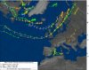
Just starting to hit South Devon, Rains not too heavy at the mo, but the gusts are pretty frequent. Wouldn't be surprised if there's some slippage at Dawlish later.
Whilst not usual it is also not out of the ordinary for this time of year. Although i do appreciate that being in the south it will lead to vast wailing and gnashing of teeth")
Yes, but not the usual headcodes (with 1S for services to Edinburgh, 1D to Leeds, etc.). That timetable has added an hour to everything between York and London, notably including the 11:00 departure of the northbound Chieftan - an hour ahead of its usual 12:00 noon departure.An East Coast pdf timetable? With headcodes?!
Any advice for Monday because if its this bad, I am travelling from Didcot Parkway to Newcastle via Birmingham New Steet and Doncaster, what problems will affect me??
Glad I'm off from 1400 Sunday afternoon, for a week and a half!!
--- old post above --- --- new post below ---
Well, a good chunk of that journey is under the wires, and, as has been mentioned somewhere else, the overhead 'knitting' is pretty bad on the ECML, and not much better on the WCML!! Could be touch and go!! Best of luck with that.
Various TOCs in the South are/may be running a revised timetable on Monday.
It seems odd that they've got revised timetables given that nobody knows what might happen and more importantly where it might happen.
Thanks to jnjkerbin and ushawk for east coast timetable changes, appreciated very much.
What happens if the train for which someone has an advance ticket is no longer timetabled? Reasonableness all round or are there rules?
I don't know what everyone's worried about! Sit back, relax and let chaos commence!
It seems odd that they've got revised timetables given that nobody knows what might happen and more importantly where it might happen.
I have a feeling this might also have an impact on the ECML wires!