• Our booking engine at tickets.railforums.co.uk (powered by TrainSplit) helps support the running of the forum with every ticket purchase! Find out more and ask any questions/give us feedback in this thread!

Carto Metro London 4.1 map now online.

Status
Not open for further replies.

Rogmi

Member
Joined
7 Nov 2013
Messages
89
Franklin has just uploaded v4.1 of the London CartoMetro map.
(240422 edit - now re-uploaded as v4.2)

Main changes:
All of Crossrail / TfL is now the purple Elizabeth line, with a now solid line showing passenger services between Paddinton and Abbey Wood (also from Paddington to the Crossrail depot).
Updated layout at Northfields and Ruislip depots
Updated layout for South Harrow sidings (under construction)

view online - click on the platform for further options - next departure, view on maps
or
download the PDF version (recommended)

 
Last edited:
Sponsor Post - registered members do not see these adverts; click here to register, or click here to log in
R

RailUK Forums

boiledbeans2

Member
Joined
15 Oct 2020
Messages
515
Location
UK
Excellent! I see V4.2 is the one available for download now.
This is my favourite map
 

MikeWh

Established Member
Associate Staff
Senior Fares Advisor
Joined
15 Jun 2010
Messages
7,873
Location
Crayford
Hi @Rogmi,

Immediate comment having travelled over the new line several times today is that the junction east of Whitechapel is almost certainly grade separated. The Abbey Wood bound track appeared to dive downwards shortly after leaving Whitechapel so I'd assume that the westbound line from Stratford goes over it.
 

Rogmi

Member
Joined
7 Nov 2013
Messages
89
Excellent! I see V4.2 is the one available for download now.
This is my favourite map
Franklin reuploaded 4.1 to 4.2 with a minor update on the same day after my post :D
I've now edited my original post.

4.2 includes the changed layout at South Harrow sidings
It also shows the EL platforms at Bond St as not in use

Hi @Rogmi,

Immediate comment having travelled over the new line several times today is that the junction east of Whitechapel is almost certainly grade separated. The Abbey Wood bound track appeared to dive downwards shortly after leaving Whitechapel so I'd assume that the westbound line from Stratford goes over it.
Thanks
I'll pass that on to Franklin.
 

DPQ

Member
Joined
4 Feb 2017
Messages
83
Not a big one, but the flyover from Heathrow branch to the relief lines (in up direction), is shown as purple when it should be purple and black like the rest of the branch (and relief lines)
 

Taunton

Established Member
Joined
1 Aug 2013
Messages
10,102
Hi @Rogmi,

Immediate comment having travelled over the new line several times today is that the junction east of Whitechapel is almost certainly grade separated. The Abbey Wood bound track appeared to dive downwards shortly after leaving Whitechapel so I'd assume that the westbound line from Stratford goes over it.
I guess you, like myself, noticed it's a very prominent dive down eastwards. Is it classic, old Underground-style, one direction on top of the other?
 

Rogmi

Member
Joined
7 Nov 2013
Messages
89
Hi @Rogmi,

Immediate comment having travelled over the new line several times today is that the junction east of Whitechapel is almost certainly grade separated. The Abbey Wood bound track appeared to dive downwards shortly after leaving Whitechapel so I'd assume that the westbound line from Stratford goes over it.
Did a hunt around, and have cropped this exerpt (taken from a detailed signal diagram) which shows the diveunder at Stepney Green Junction.
 

Attachments

  • CRsigdiagSGJct-part.PNG
    CRsigdiagSGJct-part.PNG
    1.4 MB · Views: 106

Goldfish62

Established Member
Joined
14 Feb 2010
Messages
10,081
It really is an excellent map, although it's missed out Feltham depot altogether, which opened last year.
 

Rogmi

Member
Joined
7 Nov 2013
Messages
89
It really is an excellent map, although it's missed out Feltham depot altogether, which opened last year.
Thanks. I hadn't heard about that. I'm sure that Franklin will now include that in the next map version :D

Thanks also to other members who have posted re items that need to be changed / added. Franklin welcomes all feedback. Feedback can also be given direct to Franklin via the CartoMetro email address on the map web page. One advantage where lots of people look at the map, it is easier for changes to be picked up that Franklin may be unaware of, or we have missed in proofreading.
 

Basil Jet

On Moderation
Joined
23 Apr 2022
Messages
986
Location
London
It really is an excellent map, although it's missed out Feltham depot altogether, which opened last year.
Looking at Google, it appears to have the water main which runs from Hanworth to East Finchley cutting north-south across the middle... presumably they have built bridges to carry every track over it, since you can't build on it?
 

Taunton

Established Member
Joined
1 Aug 2013
Messages
10,102
I'd be surprised if there was a flat junction on a deep tube anywhere in the world.
Hamilton Square on Merseyrail was a longstanding one, deep beneath the river. Westbound was grade separated in 1978.
 

DanNCL

Established Member
Joined
17 Jul 2017
Messages
4,296
Location
County Durham
I'd be surprised if there was a flat junction on a deep tube anywhere in the world.
Not on the deep tube however there are several flat junctions in tunnels on the sub surface lines in London. Baker Street, Praed Street and Aldgate to name a few.

The main reason for building flat junctions on the surface or on viaducts is cost. A flat junction doesn’t have the same cost advantage over a grade separated junction in deep tubes which is why they’re rare. With a Tunnel Boring Machine it’s relatively easy to dive under or fly over another running tunnel instead of intercepting it.
 

AlbertBeale

Established Member
Joined
16 Jun 2019
Messages
2,758
Location
London
Not on the deep tube however there are several flat junctions in tunnels on the sub surface lines in London. Baker Street, Praed Street and Aldgate to name a few.

Several at Aldgate alone! And others on the Circle - between Gloucester Rd and Earls Court, and between High St Ken and Earls Court, both of which are I think are at least partly in tunnel.


The main reason for building flat junctions on the surface or on viaducts is cost. A flat junction doesn’t have the same cost advantage over a grade separated junction in deep tubes which is why they’re rare. With a Tunnel Boring Machine it’s relatively easy to dive under or fly over another running tunnel instead of intercepting it.

Though adding flying junctions on deep bored tubes after the initial lines have been built leads to some wonderfully convoluted weaving of tunnels - viz south of Camden Town on the LU Northern Line.
 

Mojo

Forum Staff
Staff Member
Administrator
Joined
7 Aug 2005
Messages
20,404
Location
0035
Several at Aldgate alone! And others on the Circle - between Gloucester Rd and Earls Court, and between High St Ken and Earls Court, both of which are I think are at least partly in tunnel.
Outer rail Circle line trains conflict with Eastbound District trains at Gloucester Rd and similarly District line trains ex-Edgware Rd conflict with Outer Rail Circle line trains at High Street, although the other end at the Earls Ct end is grade separated.

Trains toward Olympia also conflict with Eastbound trains ex-West Kensington on a diamond crossing.

All these pieces of point work are in the open however.
 

AlbertBeale

Established Member
Joined
16 Jun 2019
Messages
2,758
Location
London
Outer rail Circle line trains conflict with Eastbound District trains at Gloucester Rd and similarly District line trains ex-Edgware Rd conflict with Outer Rail Circle line trains at High Street, although the other end at the Earls Ct end is grade separated.

Trains toward Olympia also conflict with Eastbound trains ex-West Kensington on a diamond crossing.

All these pieces of point work are in the open however.

Ah - right - I was trying to picture those junctions, in terms of whether they were in the open air at those points... (and I'd anyway overlooked the at-grade westbound to Olympia).

So that means that besides there being no crossings with potential conflicting movement anywhere in the deep tube system, even on the SSL the only ones in tunnel / under cover are the ones mentioned earlier (Praed Street, Baker Street, and the triple set at Aldgate).
 

Bemined

Member
Joined
28 May 2022
Messages
71
Location
Rotterdam, Netherlands
I think the closest thing to a flat junction in the deep tube would be the movement from Waterloo to London Road Depot, according to the working timetable there are a few trains per day making this move during service hours.
 

Basil Jet

On Moderation
Joined
23 Apr 2022
Messages
986
Location
London
Actually the scissor junctions at Brixton, Moorgate (Northern City) and loads of other places are a sort of flat junction. The third tunnel to grade separate them doesn't seem like it would be that expensive in comparison to everything else in a new tube line, so the fact that they never seem to do it suggests that it wouldn't increase the line capacity, although it seems like it should.
 

Rogmi

Member
Joined
7 Nov 2013
Messages
89
Actually the scissor junctions at Brixton, Moorgate (Northern City) and loads of other places are a sort of flat junction. The third tunnel to grade separate them doesn't seem like it would be that expensive in comparison to everything else in a new tube line, so the fact that they never seem to do it suggests that it wouldn't increase the line capacity, although it seems like it should.
Perhaps termini are seen as not so important. At Brixton, a train waiting in the tunnel for a train to cross in front of it would probably be entering the same platform that the train had just departed from, so the delay would be caused by having to wait for an empty platform. A graded scissors crossover would make no difference.

In the past, a flat scissors junction for a terminus would be a lot cheaper to build, rather than have potentially four step-plate junctions or whatever. The scissors crossover for a terminus with island platforms was often built in the station tunnel, I.e the station tunnel was extended past the end of the platforms to accommodate the crossover. This was especially so in the case of the City and South London Stockwell terminus (the fast, single crossover now occupies the site of the original platform and scissors crossover), Euston, Angel, and Clapham Common.

When part of a running line, subject to any constrictions, it’s relatively easy to route a tunnel as you want. This gives a lot of flexibility and is ideal for graded junctions, where the benefits of separation in this way far outweigh the additional cost.
 
Last edited:

AlbertBeale

Established Member
Joined
16 Jun 2019
Messages
2,758
Location
London
I think the closest thing to a flat junction in the deep tube would be the movement from Waterloo to London Road Depot, according to the working timetable there are a few trains per day making this move during service hours.

There's a diamond crossing between the lines (ie two intersecting crossovers) just north of Lambeth North station (as is common leading into a terminus - which Lambeth North once was I think; and it can operate as one now if there's a problem at E&C, both LN platforms being bi-directional). But coming from Waterloo to get to the depot trains use that crossing to join the northbound line and run south on it for a short distance, and then there's the junction leading up to the depot. So it's not actually a crossing with conflicting movements, but two sets of points in succession. (Though, conceptually, I take your point!)

And there are other places in deep tube where short distance "wrong way" running can happen in traffic hours. One that immediately springs to mind is the Piccadilly at Kings Cross, where engineering trains arriving N/bound (nominally E/bound I think) into the platform then reverse the short distance to the link line to the Northern.

And of course Piccs turning short there run wrong way to the crossover beyond that. And similar elsewhere for intermediate terminators where there isn't a siding to go into before reversing - eg Northern ChX branch, where servces from the north can reverse there in the southbound platform.
 
Last edited:

pyxbiz

Member
Joined
29 May 2022
Messages
20
Location
US
I have a question about the Carto Metro map: Why is Waterloo East not named or depicted? The map seems so detailed and precise in every way, aside from this one elision. Other rail-only stations are named and shown (like Wadnsworth Town and Deptford, etc.), but not Waterloo East. Is there a reason for this?
 

rebmcr

Established Member
Joined
15 Nov 2011
Messages
3,851
Location
St Neots
I have a question about the Carto Metro map: Why is Waterloo East not named or depicted? The map seems so detailed and precise in every way, aside from this one elision. Other rail-only stations are named and shown (like Wadnsworth Town and Deptford, etc.), but not Waterloo East. Is there a reason for this?
None of the mainline routes are shown in detail within (approximately) Zone 1.
 

Rogmi

Member
Joined
7 Nov 2013
Messages
89
I have a question about the Carto Metro map: Why is Waterloo East not named or depicted? The map seems so detailed and precise in every way, aside from this one elision. Other rail-only stations are named and shown (like Wadnsworth Town and Deptford, etc.), but not Waterloo East. Is there a reason for this?
I think that the main reason the termini are not shown on the map is due to the potential lack of space in some areas where the map may be 'busy'. especially at large termini where the track layout covers a wide area (one option would be to have these termini shown in a separate inset). As there was space, the main line was extended further towards Paddington (from it's previous ending at Ladbroke Grove junction) in order to include Crossrail, so it's possible that some lines could be extended a bit further.

The track for Waterloo East and Charing Cross comes from London Bridge, however the main lines stop short of London Bridge and so these stations are not shown.
 

pyxbiz

Member
Joined
29 May 2022
Messages
20
Location
US
None of the mainline routes are shown in detail within (approximately) Zone 1.
I think that the main reason the termini are not shown on the map is due to the potential lack of space in some areas where the map may be 'busy'. especially at large termini where the track layout covers a wide area (one option would be to have these termini shown in a separate inset). As there was space, the main line was extended further towards Paddington (from it's previous ending at Ladbroke Grove junction) in order to include Crossrail, so it's possible that some lines could be extended a bit further.

The track for Waterloo East and Charing Cross comes from London Bridge, however the main lines stop short of London Bridge and so these stations are not shown.
Ah, that explains it. Thanks.

Thinking about it, though, the absence of these termini in Zone 1 kind of undermines the reliability of, and hence the usefulness of, these otherwise amazing and wonderful maps. I know they're just one guy's pet project, and he should be praised to the sky for creating them in the first place, but if I had a suggestion, it would be to at least sketch in, even if rudimentarily, ALL existing stations and tracks, even if just using tiny fonts and thin lines. In many places on the map the most obscure and trivial place-names are included, often in small font, which doesn't add too much busy-ness. I'd do the same for places like Waterloo East and the tracks to Charing Cross, etc.

For example, he includes the text "Old W&C track to Armstrong hoist" in the exact place where "Waterloo East" should be. What's more significant and deserving of map-space -- a short section of disused track a few yards long, or an entire major rail station? It'd be great if BOTH were included!
 

rebmcr

Established Member
Joined
15 Nov 2011
Messages
3,851
Location
St Neots
Ah, that explains it. Thanks.

Thinking about it, though, the absence of these termini in Zone 1 kind of undermines the reliability of, and hence the usefulness of, these otherwise amazing and wonderful maps. I know they're just one guy's pet project, and he should be praised to the sky for creating them in the first place, but if I had a suggestion, it would be to at least sketch in, even if rudimentarily, ALL existing stations and tracks, even if just using tiny fonts and thin lines. In many places on the map the most obscure and trivial place-names are included, often in small font, which doesn't add too much busy-ness. I'd do the same for places like Waterloo East and the tracks to Charing Cross, etc.

For example, he includes the text "Old W&C track to Armstrong hoist" in the exact place where "Waterloo East" should be. What's more significant and deserving of map-space -- a short section of disused track a few yards long, or an entire major rail station? It'd be great if BOTH were included!
There are already faint grey lines showing the location of all the omitted mainline tracks. Perhaps your screen's contrast/brightness settings make it look the same as the white background?
 

stuu

Established Member
Joined
2 Sep 2011
Messages
2,771
Ah, that explains it. Thanks.

Thinking about it, though, the absence of these termini in Zone 1 kind of undermines the reliability of, and hence the usefulness of, these otherwise amazing and wonderful maps. I know they're just one guy's pet project, and he should be praised to the sky for creating them in the first place, but if I had a suggestion, it would be to at least sketch in, even if rudimentarily, ALL existing stations and tracks, even if just using tiny fonts and thin lines. In many places on the map the most obscure and trivial place-names are included, often in small font, which doesn't add too much busy-ness. I'd do the same for places like Waterloo East and the tracks to Charing Cross, etc.

For example, he includes the text "Old W&C track to Armstrong hoist" in the exact place where "Waterloo East" should be. What's more significant and deserving of map-space -- a short section of disused track a few yards long, or an entire major rail station? It'd be great if BOTH were included!
The fundamental purpose of all these maps is that they are of metros, not main line railways. I don't see how you could ever possibly show the main lines as well at major stations such as Waterloo, on the same map
 

Rogmi

Member
Joined
7 Nov 2013
Messages
89
The fundamental purpose of all these maps is that they are of metros, not main line railways. I don't see how you could ever possibly show the main lines as well at major stations such as Waterloo, on the same m
Ah, that explains it. Thanks.

Thinking about it, though, the absence of these termini in Zone 1 kind of undermines the reliability of, and hence the usefulness of, these otherwise amazing and wonderful maps. I know they're just one guy's pet project, and he should be praised to the sky for creating them in the first place, but if I had a suggestion, it would be to at least sketch in, even if rudimentarily, ALL existing stations and tracks, even if just using tiny fonts and thin lines. In many places on the map the most obscure and trivial place-names are included, often in small font, which doesn't add too much busy-ness. I'd do the same for places like Waterloo East and the tracks to Charing Cross, etc.

For example, he includes the text "Old W&C track to Armstrong hoist" in the exact place where "Waterloo East" should be. What's more significant and deserving of map-space -- a short section of disused track a few yards long, or an entire major rail station? It'd be great if BOTH were included!

Looking back, the filename date for the first map, v1.0, is February 2011 (it may have been uploaded just before that). The map looks rather bare:D. This showed the original tube lines only. Over the years, this was gradually expanded to include the main lines in the area of the map, most of which are effectively the suburban main lines.

Where possible (and when verified details were available), further information was added, such as disused tracks etc. These often gave a historical insight into an area, such as a station where there had been layout changes over the years. One example of this are the stations on the Barnet Branch between East Finchley and High Barnet which were originally mainline stations, complete with goods / coal yards and additional sidings and track work.

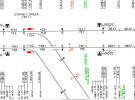
As time went on, track labelling was was also added in some places where it may be useful in identifying the tracks, such as at some junctions etc. This is usually in small print directly on the line. An example of this is at the tangle of lines in the Queenstown Rd / Stewarts Lane depot area east of Clapham Junction.

There is a lot of detail on the map, and it’s always best to zoom right in if specifically looking at an area.

There is also the London Lines map (CartoMetro site) , which shows the general track naming for the whole of the map area.

Regarding the Armstrong lift, that is part of the W&City line which is shown in full, but I get the point you’re making.


I don’t know how others use the map, but I use it daily, especially as a reference, often when following comments in a forum, or whatever, made about a specific area etc.
 
Last edited:
Status
Not open for further replies.

Top