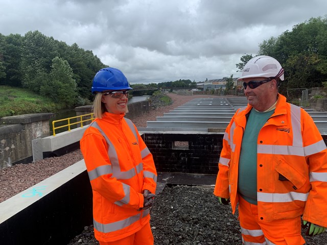
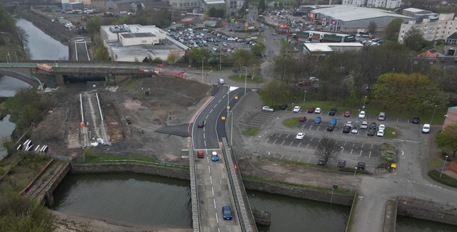
I got my notification on Monday, that after five attempts by the Design Consultants to get acceptance that the new Leven Station's railtrack, pod building and car park may flood on average every two years, The Fife Council Planners have given approval. This confirmation happened at the correct time to allow the Bawbee Bridge concrete deck to be poured.

planning.fife.gov.uk
...
To gain approval the design had to be altered so that the AfA footpath to the Station would be built above flood level to give safe egress from the Platforms and that an evacuation plan would be in place.
It is yet to be seen if SEPA will upset their Paymasters and lodge a stop notice request as part of a challenge to the Decision in the Court of Session as they are against the Station design and its acceptance that the development will flood (the platforms use up the available volume of new built environment that can be lifted clear of predicted maximum flood water height without causing knock on effect so if the Station was elsewhere the
rail lines could have been lifted clear of the predicted flood water level instead).
I submitted an objection as the seaward end of the Platforms would need to be on a curve if the Line were to be extended for Passenger Train use over to Methil, Buckhaven and onwards to rejoin the main line at Dysart due to the amount of land now being zoned for housing between Leven and Kirkcaldy.
To do this as an alteration in the future from the current design would cause much disruption and my estimate of the all in cost was £10million on top of the cost of providing lift access to the Station platform. The other alternative would have been to terminate the Platform on the Sainsbury's side of the Bawbee Bridge and extending the Platform further towards Cameron Bridge to get the required length.
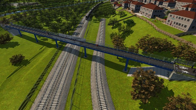
I also suggested that a consideration be given of providing or safeguarding a route for an AfA ramped bridge access to the Station Platform at its Cameron Bridge end from between the Sainburys and Pfaudler sites to serve passengers coming from that direction (getting their McDonald's) without having to walk all the way to the only Station access at the car park. Also gave and /or thoughts on a ramp down of the Iron Brig onto a path built into a wider six foot (similar to those at some Glasgow Suburban Stations) or from a cross river bridge so that there is a second access route into the Station.
In the Planner's Report of Handling (not the Decision Notice) my Objection resulted in the following entries:
'It has been confirmed by Network Rail that the track and platform layout has been designed for a potential future freight route and there would be no requirement to change the shape of the platform to accommodate this. A sketch was provided by Network Rail which demonstrates this.'
In other words, NR have basically quashed any chance of Passenger Train services being extended beyond Leven Station to serve the housing expansion towards Kirkcaldy as the cost of adaptation of the layout being built would make it unviable? This NR sketch has been removed from the Application document list but luckily it is filed in the link location provided in the above paragraph.
The second entry is:
'Consider providing or giving future route provision protection to an Access for All Footbridge between the Sainburys and Pfaudler sites to land between the twin tracks of the railway (known in the railway world as the 'Six Foot') to give a northern end access to the Station. Variations on this concept are a ramp of the Iron Brig and / or an over river connection into any such footbridge and then into the northern end of the Station. It is understood that the provision of this route is being investigated and the proposals would not prejudice a future access route to the south, however this proposal was outwith the scope of this application.'
So at least I've created some ideas there?

 www.flickr.com