• Our booking engine at tickets.railforums.co.uk (powered by TrainSplit) helps support the running of the forum with every ticket purchase! Find out more and ask any questions/give us feedback in this thread!

Railways that are now roads

Status
Not open for further replies.

Dr_Paul

Established Member
Joined
3 Sep 2013
Messages
1,359
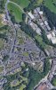
This is Holman Way in Topsham. It used to be the short branch line from the station down to the quay before closing and being converted to a road.

Not having heard of Topsham, I looked it up on the map. Following the Exmouth branch from Topsham on old and modern maps, I noticed that a short length of the Budleigh Salterton branch's track-bed has been used for the A376 in Exmouth.
 
Sponsor Post - registered members do not see these adverts; click here to register, or click here to log in
R

RailUK Forums

Cowley

Forum Staff
Staff Member
Global Moderator
Joined
15 Apr 2016
Messages
15,777
Location
Devon
Not having heard of Topsham, I looked it up on the map. Following the Exmouth branch from Topsham on old and modern maps, I noticed that a short length of the Budleigh Salterton branch's track-bed has been used for the A376 in Exmouth.
Yes that’s right. The road runs parallel to the station (I think it was being built around the time we moved to the area in 1979/80?) and
When I was a kid the viaduct that carried the Budleigh line in a sweeping curve right across the rooftops of that part of Exmouth was mostly still there.
Here’s an interesting photo from the Cornwall Railway Society website taken by Roger Winnen in 1978 showing the new station (on the right) which was built on the old platform 2, and the remains of the original station platforms 3 and 4 which is where the road is now...
EF8DA115-7119-49EC-AB3F-05FA5AAE6710.jpeg
 

Furryanimal

Member
Joined
4 Jun 2018
Messages
157
Location
Cwmbran
The A4051 -Cwmbran Drive-follows some of the route of the Newport to Blaenavon railway.The site of the Cwmbran station that was on Victoria Street is now where my Doctors surgery is.
 
Last edited:

SWTCommuter

Member
Joined
17 Oct 2009
Messages
352

Dr_Paul

Established Member
Joined
3 Sep 2013
Messages
1,359
Cwmllynfell to Cwmtwrch... I challenge any one born the wrong side of the Severn to pronounce that to my satisfaction.

I've managed to get to grips pretty well with the Welsh alphabet, but still can't quite get my tongue around words ending in 'll', such as Aberangell in my post above. Also, I made a Welsh bloke laugh when I accidentally used the Spanish 'illo' -- 'eeyo' ending when I mentioned Llandrillo.
 

gimmea50anyday

Established Member
Joined
8 Jan 2013
Messages
3,456
Location
Back Cab
Stockport Tiviot Dale - Cheshire Lines Committee. Now part of the M60 (M63) Motorway.

Tiviot dale ran alongside the M63, not underneath it. It was the road construction that damaged the tunnel under St Mary's Church. The formation can still be seen
 

gimmea50anyday

Established Member
Joined
8 Jan 2013
Messages
3,456
Location
Back Cab
[QUOTE="trebor79, post: 3984710]
The large viaduct (forgotten its name) just outside Bishop Auckland on the line to Durham.[/QUOTE]

Newton Cap Viaduct, was part of the line from Bishop Auckland via Willington and Brandon to Relly Mill on the ECML. Now a walkway.
 

gimmea50anyday

Established Member
Joined
8 Jan 2013
Messages
3,456
Location
Back Cab
The A690 between Jn 62 of the A1 and Gilesgate roundabout used to be a branch off the Leamside line and in to Durham Gilesgate station - itself now a travelodge and italian restaurant

Edit:- And @Jagdpanther has already posted this word for word on page 3!!! XD
 

SWTCommuter

Member
Joined
17 Oct 2009
Messages
352
Winterstoke Road in Weston-super-Mare follows the alignment of the original branch line from the Bristol and Exeter main line that was made redundant by the current loop line. The green space between Regent St and Alexandra Parade is the site of the original 1841 terminus station, hence the replica of the North Star broad gauge locomotive.
https://www.google.co.uk/maps/@51.3...4!1sGZoE8J4B3jB_Y3nxbD6Dmg!2e0!7i16384!8i8192

Also in Weston-super-Mare, the appropriately named Colonel Stephens Way follows the alignment of the Weston, Clevedon and Portishead Railway from the site of the old Ashcombe Road terminus.
https://www.google.co.uk/maps/@51.3...4!1sYFu7RBiIBL8U4AnTQ20Xfw!2e0!7i13312!8i6656
https://www.wcpr.org.uk/Ashcombe_Road.html
 

Greetlander

Member
Joined
3 Mar 2018
Messages
184
Location
Sydney, Australia
The last section of the Stainland Branch has been converted into a private approach road. You can see it on the attached photo. Climbs up from road level, follows the cutting past the site of Stainland box, underneath the Station Road bridge and into the site of the former station.
 

Attachments

  • B67C324C-1F35-4EC3-BF55-2AE820CA4D54.jpeg
    B67C324C-1F35-4EC3-BF55-2AE820CA4D54.jpeg
    3.2 MB · Views: 8

YorksDMU

Member
Joined
5 Jul 2019
Messages
216
Location
Beverley
On the former York to Market Weighton line, which closed on the 29th November, 1965, the station of Earswick, last stop before York from Market Weighton, is now a pub, with an indoor bowls centre near it. What was a level crossing over the line is now a roundabout between Huntington Road and Link Road which follows the course of the old line over the River Foss as far as a junction with Haxby Road which was another level crossing originally.
Hopefully the map will further help to clarify things.
885DE2FB-D795-4A56-AFAE-33E9B460B4C2.jpeg
 

A0wen

On Moderation
Joined
19 Jan 2008
Messages
7,470
- The route into Blackpool Central
- Wheathampstead By-Pass

The first one is correct, but the second one isn't. If you look at Google Earth you can see the railway went east from the end of Waddling Lane, whereas the bypass is going south-east where it crosses the bypass. The route of the railway can be followed all the way to Ayot Green.
 

A0wen

On Moderation
Joined
19 Jan 2008
Messages
7,470
I believe the A14 at Kettering from the A43 junction eastwards to near Cranford is on the old Kettering - Huntingdon line.
 

trebor79

Established Member
Joined
8 Mar 2018
Messages
4,450
A1(M) at Barton is built on a railway alignment. Cutting was widened from a single line to 102 feet.
 

d9009alycidon

Member
Joined
22 Jun 2011
Messages
842
Location
Eaglesham
The former Kilmarnock to Irvine line is now the course of the A71, I think that the original road bridge over the River Irvine was built on the abutments of the railway bridge as it was a very narrow "Bailey" type bridge that was only replaced about 10 years ago. To the west of the Merryvale Roundabout, Riverway takes up the course, with the car parks for the retail park taking up the space formerly occupied by the sidings that formed Irvine PW depot
 
Joined
20 Jul 2019
Messages
51
Isn't the road (A148) bypassing Holt town centre an old railway trackbed, just near the Holt terminus of the North Norfolk Railway.
 

theageofthetra

On Moderation
Joined
27 May 2012
Messages
3,504
Pullman Mews next to Grove Park Station in SE London is a private road that occupies part of former sidings next to the Bromley North branch. It still has a railway function as the country end of the mews forms a Network Rail track access point.
 

Bobdogs

On Moderation
Joined
19 Dec 2017
Messages
167
Location
Carmarthenshire
The Carmarthen eastern bypass (A40) is built over the line of the Llanelli Railway which ran along the Towy Valley to join the present Heart of Wales line outside Llandeillo. At Abergwilli there was a junction where the Carmarthen and Cardigan railway branched off towards Bronwydd on to what is now the Gwilli railway.
East of Sennybridge, the A40 runs over the line of the former Neath and Brecon railway for over a mile
 

duffield

Established Member
Joined
31 Jul 2013
Messages
1,357
Location
East Midlands
Yes that’s right. The road runs parallel to the station (I think it was being built around the time we moved to the area in 1979/80?) and
When I was a kid the viaduct that carried the Budleigh line in a sweeping curve right across the rooftops of that part of Exmouth was mostly still there.
Here’s an interesting photo from the Cornwall Railway Society website taken by Roger Winnen in 1978 showing the new station (on the right) which was built on the old platform 2, and the remains of the original station platforms 3 and 4 which is where the road is now...
View attachment 64586

I've got a very similar photo taken at around the same time when I was on holiday with my parents! I explored the first part of the remains of the Budleigh line but I don't remember much apart from the viaduct.

Unfortunately the photo's not been digitised and my scanner is broken so I can't post it. :'(
 

Cowley

Forum Staff
Staff Member
Global Moderator
Joined
15 Apr 2016
Messages
15,777
Location
Devon
I've got a very similar photo taken at around the same time when I was on holiday with my parents! I explored the first part of the remains of the Budleigh line but I don't remember much apart from the viaduct.

Unfortunately the photo's not been digitised and my scanner is broken so I can't post it. :'(
It’d be great to see that at some point @duffield, I recently walked from Exmouth to Budleigh along the old trackbed with @yorkie, so it’s all quite fresh in my mind.
 

duffield

Established Member
Joined
31 Jul 2013
Messages
1,357
Location
East Midlands
It’d be great to see that at some point @duffield, I recently walked from Exmouth to Budleigh along the old trackbed with @yorkie, so it’s all quite fresh in my mind.

I'm intending to buy a new printer/scanner shortly; I've just retired a few weeks ago - I'd got so used to using the excellent work facilities (we were allowed 'reasonable' personal use) so I didn't worry about my personal devices failing (also I've got to get a smartphone - mainly for realtimetrains and maps - work provided that as well!).
It's very strange and a bit scary (but a good thing) being suddenly and unexpectedly retired after 35 years!

Edit: I was only about 15 and had a really crappy camera (Kodak 126 Instamatic, or possibly -even worse quality - a compact 110, I had both at different times) - not a decent 35mm until I was 18 so don't expect too much!

I've also got a photo of Corfe Castle station from 1981 (approx), all overgrown and derelict before the Swanage Railway got there and restored it.

It would be a shame for these pre-digital photos to be lost, I must make an effort to put them online now I've got the time.

Apologies for offtopic blathering!
 
Last edited:
Joined
25 Aug 2019
Messages
265
Location
Lancaster
A rail bridge over the River Severn, part of the Criggion branch line off the Potts Line, is now used as a road bridge.

IMG_7517.jpg


IMG_7520.jpg
 

pieguyrob

Member
Joined
27 Oct 2018
Messages
571
- The route into Blackpool Central

The roads are the M55, A5230, and Yeadon Way leading to cental car park on the site of the old station.

Also at Fleetwood, the A585 Amounderness Way, takes the route of the old railway into the town.
 
Status
Not open for further replies.

Top