SlimJim1694
Member
Lewisham North Kent platforms are over the River Ravensbourne and Dartford platforms are over the River Darenth.
When I used the ferry in the 1960s when travelling to the IoW for family holidays, at least part of the station extended out over the water.Lymington Pier station is on solid ground isn’t it? Ryde Pier Head most certainly isn’t!
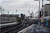
Views from the London Eye show that platforms 1 & 2 (I think that's their numbers) cross the Embankment and make it over the Thames by about one coach length!Technically, I'm not entirely sure they're actually over the river but I don't think I've ever checked in great detail. The bridge goes over part of the Embankment too.
Appears so on openstreetmap; good shout!Stranraer? Isn't the station on a pier?
Bit of trivia, those houses, Tapton Terrace, were built for the workers of the Edward Eastwood wagon works which was just north of the stationDependent on which coach you are in at Chesterfield, you will find yourself sat over the River Rother that flows under Platform 1 & 2, the River often floods the houses you can see to the rear of Platform 1
I'm open to correction but I think to be really pedantic, Hungerford Bridge is only the name of the pedestrian bridge slung alongside it (and now also one on the other side). When the railway bridge was built it replaced the old Hungerford footbridge. As far as I know, the railway bridge is simply Charing Cross Railway Bridge.' But as I said, I might be wrong.This photo (click on it to go to the larger original) shows that two platforms at Charing Cross have been extended far enough onto the bridge to just be over the Thames:
Hungerford Bridge
© Copyright N Chadwick and licensed for reuse under this Creative Commons Licence.
I'm open to correction but I think to be really pedantic, Hungerford Bridge is only the name of the pedestrian bridge slung alongside it (and now also one on the other side). When the railway bridge was built it replaced the old Hungerford footbridge. As far as I know, the railway bridge is simply Charing Cross Railway Bridge.' But as I said, I might be wrong.
What’s the one under Zurich Hauptbahnhof?
Thanks.The Sihl.
Stranraer? Isn't the station on a pier?
This photo from 1965 shows the 'pier' is of solid construction:Appears so on openstreetmap; good shout!
I did wonder if the current subway station was partially under the river. The sound of running water down there is just a bit disconcerting...IIRC the long gone Kelvinbridge station was in the river.


Cathcart is on a bridge over the river Cart (White Cart Water to be precise). Pollokshaws West stops just short of the same river.
Edit: and Paisley Gilmour Street platform ends are over it as well!

and the River Tyburn runs through a small aquaduct at the west end of the Circle line platforms at Baker Street station.Sloane Square station is directly under the River Westbourne - it passes above in an aqueduct that can clearly be seen (and heard) from the platforms.
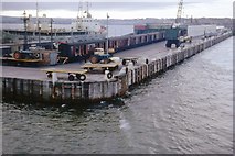
I mean we could go all panto on this but looking at pictures, it does seem that about 50% of the platform is indeed on piles extended seaward of the wall, such that at high tide there is water underneath it.No it isnt.
The platforms in St Enoch were more or less parallel to the river and, although they curved to the south, I don’t think they went far enough to be over it.Doesn't the Clyde run through (or very close to) St. Enoch station?