• Our booking engine at tickets.railforums.co.uk (powered by TrainSplit) helps support the running of the forum with every ticket purchase! Find out more and ask any questions/give us feedback in this thread!

Walking and Rambling discussion

yorkie

Forum Staff
Staff Member
Administrator
Joined
6 Jun 2005
Messages
67,891
Location
Yorkshire
Never thought of a city walk alongside a canal, but being a fan of Above and Beyond (DJ's) I would like to follow the route they took in one of their videos where they were on a canal boat sailing along...

Trouble is, all I know is it's in north London. I know where it ends...near the Olympic Stadium. But this is the start...it's a long shot but can anyone place it? Looks like it's just after a lock (they did the whole hour without using locks); so here are three screenshots of fairly bland buildings which give little clue as to their location (to me...anyway!!).

Also, the nearest tube or train station would be handy...am I asking too much (yes I know this is more like geoguessr...) :p?
Blimey you've made that difficult; not even a link! ;)

This scene can be seen at timestamp 08:50 in the video.

It's close to Hackney Wick station and lots of walking opportunities around there; indeed you can walk along the canal from there almost all the way to Angel but you can't walk along the towpath beyond towards King's Cross, due to the tunnel. Some towpaths in London can be exceptionally busy at times though, so do bear that in mind.
 
Sponsor Post - registered members do not see these adverts; click here to register, or click here to log in
R

RailUK Forums

Howardh

Established Member
Joined
17 May 2011
Messages
8,195
Blimey you've made that difficult; not even a link! ;)

This scene can be seen at timestamp 08:50 in the video.

It's close to Hackney Wick station and lots of walking opportunities around there; indeed you can walk along the canal from there almost all the way to Angel but you can't walk along the towpath beyond towards King's Cross, due to the tunnel. Some towpaths in London can be exceptionally busy at times though, so do bear that in mind.
Thanks, Hackney wick it is. Didn't think the video would have been any interest so didn't link. Thought anyone knowing the area would know the buildings and start point!
I intend to go midweek, possibly Thursday next if the weather's ok and a decent Avanti service.
 

THC

Member
Joined
21 Sep 2009
Messages
471
Location
Stuck on the GEML
There is a path (not particularly well-signed) that takes you up and over Islington tunnel should you wish to walk that far. The advice about the busy towpath is well-founded as cyclists can and do speed along it with little regard for walkers.

THC
 

32475

Member
Joined
2 Nov 2019
Messages
744
Location
Sandwich
On Sunday the Southport Ramblers A walk was a gruelling 10 miles with 2936 feet of ascent in hot sunshine from Glenridding up to Lanty's Tarn then up the north side of Grisedale to Grisedale Tarn, up St Sundays Crag and down to Glenridding via Birks. I managed to get as far as Grisedale Tarn and then decided to turn back and return on my own by the bridleway along the south side of Grisedale back to Patterdale and Glenridding, as after 17 days of radiotherapy I didn't feel up to the full walk - think I did pretty well in the circumstances for a 75 year old. Still sorry I missed out, but my health (prostate cancer treatment) comes first. The views were stupendous (loads of pics on the Southport Ramblers Facebook page). Last day of 20 days of radiotherapy tomorrow, after which I hope to get back to full fitness and lead a 9 mile walk at Eyam on 18 June.
Hats off to you S&CLER! I trust your recovery continues in pace with your determination.
 

Kite159

Veteran Member
Joined
27 Jan 2014
Messages
19,282
Location
West of Andover
There is a path (not particularly well-signed) that takes you up and over Islington tunnel should you wish to walk that far. The advice about the busy towpath is well-founded as cyclists can and do speed along it with little regard for walkers.

THC

Agreed there, and get very angry when they get forced to slow down for some narrower pinch-points (i.e. under bridges) when it's busy with other walkers or even other cyclists.

A decent towpath though, well worth the walk, even with the detour over the tunnels (Islington being the main tunnel, plus a shorter one at the western end which is easier to get round).
 

Kite159

Veteran Member
Joined
27 Jan 2014
Messages
19,282
Location
West of Andover
Last Saturday when I had a couple of hours in Yeovil in between buses (the Taunton bus departs just as the bus from Wincanton arrives) I did part of the Yeovil Country Park, starting with the riverside walk (some nice woodlands with limited views of the river) carrying on to the disused railway line walk (via Ninesprings Park). An area I wouldn't mind revisiting again to explore more of the parks.

Sunday I did the "Thames Down Link" path, starting from Tolworth station (the actual path starts in Kingston, but the first couple of miles is shared with the London Loop), some nice views of countryside as it headed towards Box Hill, although not the best weather for some of the climbs at the southern end of the path! (not helped with some cyclists thinking they are in the Tour de France in some narrower sections with limited visibility due to overgrowth). Epsom Common looked very nice [although there seemed to be a different with the route marked on the ground to what was shown on my OS Map]. Another area on my list to revisit, also to take in more of the Ashtead Common, maybe the same trip as I do the "Mole Valley Trail" from Dorking to Leatherhead which I was going to do but decided by the time I reached Box Hill station with a Victoria train due 5 minutes later to end the walk.

And today I ended up doing a 19 mile walk from Olton to Wednesbury Parkway Tram stop. Started along the Grand Union Canal along a bit which was quite smelly from some fuel spill as there was a shiny oily surface on the canal surface (and some dead fish) but some nice scenery which changed from more rural to industrial and urban decay with the old warehouses nearer the city centre. A quick walk from Bordesley Junction to the Typhoo Basin on the Digbeth Branch canal [just to link up with a walk I did last year] before taking the Birmingham and Warwick Junction Canal (part of the Grand Union) towards Salford Junction (near Spaghetti Junction for all the motorway traffic). After reaching the Birmingham and Fazeley Canal, I took the Tame Valley Canal which turned quite nice (once away from the motorways) with woodland in cuttings [with some nice old bridges]. This led into the Walsall Canal which I took north towards Wednesbury Parkway.

Towpath quality was overall excellent other than the section between Tame Bridge Parkway & the junction of the Walsall canal which was a bit rough. Although where the Tame Valley had twin towpaths, it looked like the other side was more rural and overgrown in places. Birmingham has a lot of canals! A few light spots of rain but nothing that major thankfully
 

S&CLER

Member
Joined
11 Jan 2020
Messages
785
Location
southport
I led a 9.6 mile linear walk from Wardlow Mire to Eyam via Silly Dale, Grindlow, the Barrel pub, Bretton Clough, Stoke Ford, Hazelford and Eyam Moor last Sunday, which took us 4hr 35 mins. All 12 in the group enjoyed it, Lots of pics and a route map on Southport Ramblers public Facebook page.
 

ChrisC

Established Member
Joined
7 Oct 2018
Messages
1,616
Location
Nottinghamshire
During the recent warmer weather I have not done any long walks, but quite a few walks of between 4 and 6 miles. When I say long walks, a walk of 10 miles is just about my limit these days.

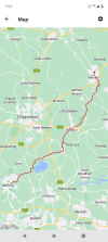
Some interesting walks local to me have been along some of the old railways to the south east of Mansfield. Being close to home I have often done short sections of the Southwell Trail as part of other walks. A few weeks ago I walked the whole length of the trail from Bilsthorpe via Farnsfield to Southwell which is around 8 miles. It‘s a very pleasant walk and unlike some old railway trails, much of it, especially between Southwell and Farnsfield, is on small embankments or on a level with the fields with good views of the surrounding countryside, rather than hidden in a cutting. Much of the trail follows the old railway that ran from Mansfield to Rolleston Junction, just south west of Newark, on the Nottingham to Lincoln line. It runs through very nice quiet rural countryside. Southwell is a small historic town always worth visiting, tucked away in rural Nottinghamshire with the beautiful Minster which is so easily overlooked in favour of the better known cathedrals. The Chapter House in the Minster with the stone carved Southwell Leaves is well with seeing.

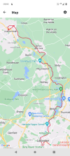
Another walk, starting in Bilsthorpe, this time behind some houses just off Eakring Road in the ex mining part of the village, I did a 5 mile walk along the railway trail to Vicar Water Country Park at Clipstone near Mansfield, an old branch to carry coal traffic away from Bilsthorpe Colliery. This trail passes through the Southern Edge of Sherwood Pines Country Park. With a long section through the forest I was expecting this to be a bit boring but actually it was very pleasant. It was very much mixed woodland with lots of birds around rather than the forestry commission conifers I was expecting. Vicar Water at the end of the walk is an interesting area developed on the site of the old Clipstone Colliery with its huge preserved headstocks nearby.
I’ve also done the walk from Blidworth to Vicar Water along the old line from Blidworth Colliery. All of these lines, in a once very industrial area are now very quiet and seem extremely rural and unspoilt.

All of the above walks along old railway tracks and therefore are linear and not circular walks but can easily be reached by bus, mainly from Mansfield but some locations can be reached by bus from Nottingham and Newark too.

During short breaks away from home during the last few months I have completed a number of interesting walks in various parts of the country. Most of these have been between 5 and 8 miles in length.

In North Yorkshire I did a great circular from Helmsley taking in Rievaulx Abbey and Rievaulx Terrace. I loved the setting of Rievaulx Abbey and Village and the sections of the walk by the River Rye.

At the end of last month I had planned a 10 day holiday in the North East of Scotland staying in a hotel in Aberdeen. This had to be cancelled due to the rail strikes during the week that I was to travel back. I had planned quite a few walks on Deeside and by the coast. Instead I quickly booked a few nights in Liverpool before the strike days and a few days in North London just after the strike days.

The weather was so good whilst in both places that I spent very little time in the cities and got out walking in the surrounding areas.

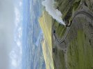
I visited Ness Botanical Gardens by bus from Liverpool over on the Wirral, although just over the border into Cheshire, just south of Neston. I really enjoyed wandering around Ness Gardens and was there for well over 2 hours as they were far more extensive than I had expected. From the gardens I turned right out of the entrance, and walked down a lane near the village of Burton onto the edge of the Dee Marshes with good views over the estuary towards Wales. I then walked north along a very well surfaced cycle route which skirted right along the edge of the marshes, stopping for a drink at The Harp in Little Neston. A lovely place to enjoy a pint sitting outside overlooking the marshes. From there I continued along the shore towards Parkgate. This section of footpath included some very difficult sections to pass along due to boggy ground on the marshes. I thought Parkgate was nice place with good ice cream for the hot day, and the history of the whole area is interesting to read. I got a bus back from Parkgate to Liverpool changing bus in Heswell.

On another day whilst in Liverpool I got the train out to Crosby and then walked up the coast to Hightown. I’d been and seen the Antony Gormley Another Place Statues in the sea near Crosby a few years back but good to see them again. I just love the location and difficult to believe it’s so close to Liverpool. I thought the walk along the cycle trail up the coast to Hightown Station was lovely but it was a hot day for walking. Interesting to see the masses of sea weathered red bricks along the shore all dumped there following the destruction of the terraced houses during the bombing of Liverpool during WW2.

Whilst in North London I visited the very interesting Battle of Britain Museum at Bentley Priory, just to the north of Stanmore. A very good museum in an impressive setting. Really friendly knowledgeable volunteers running the place and the tearoom. After visiting the museum I went for a walk on Stanmore Common and back through the Bentley Nature Reserve to Stanmore. Part of this was through a deer park along a lovely section of the London Loop Path. So rural and difficult to believe the location so close to London.
 

Kite159

Veteran Member
Joined
27 Jan 2014
Messages
19,282
Location
West of Andover
Some riverside walks from me

First up was the River Wey Navigation from Guildford towards Byfleet (finishing off with a trip towards Brooklands and some rural footpaths to New Haw). A walk best done this time of year as I would imagine in the winter time it would get quite muddy in places (or even flooded). Some beautiful Surrey countryside and when away from the sections where it runs close to main roads it was very peaceful. Certainly one I would recommend (after Byfleet you can continue along the River to reach the Thames or even turn left to follow the Basingstoke Canal to West Byfleet or even Woking

This weekend, Friday I took a bus from Chester to the village of Farndon near the English/Welsh border (with Holt on the Welsh side) to walk footpaths alongside the River Dee to Chester. A complete mixed bag of path qualities, some parts were barely passable with nettles & thorns growing well or the path being beside a field with crops growing. Add on some rather poor signage in place, one I wouldn't recommend at the southern end. The best part was north of Aldford and around Chester Meadows

Saturday was another River walk with the Weaver Navigation from Greenbank station towards Frodsham, going via Northwich town centre & Carey Park to reach the Anderton Boat Lift. After the boat lift (and a short section of the Trent & Mersey canal) it was a case of following the path. Well-marked in places and another variable in terms of quality with some sections walking along the edge of fields. After Dutton Lock paths pop up both sides of the river, I went for the 'south' path. Underneath the wonderful Dutton Viaduct (WCML) where the route was shared with bike route 5, but after the Pickerings Caravan Site the path quality fell off a cliff. Barely passable with tall weeds (the sort which are good to trying to wrap round ankles to trip you up) with a mix of thorns & nettles and steep climbs with little to hold onto. It did pick up in places, but the sort of path where you had a break from "bulldozer" mode only for another section. I'm not sure what the Northside path would have been like. Anyhow, as a result I cut my walk early at Frodsham rather than continuing towards Runcorn via Runcorn Hill & a couple of footpaths.

Highs & Lows, although it could just be a case of the best time to do those paths is early spring before rapid growth when the ground will have dried up from winter. Both had views of some lovely countryside, with some nice old bridges.

And today for a shorter walk, I did the mixed used path which ran alongside the West Midland Metro track between Black Lake & The Hawthorns. Quite nice, although one to take caution when riding a bike due to areas of broken glass.
 

Kite159

Veteran Member
Joined
27 Jan 2014
Messages
19,282
Location
West of Andover
A walk of 2 halves for me today with the disused "Nickey Line" from Harpenden towards Hemel Hempstead. Mostly decent quality path, a bit narrow in places around Redbourn. One I reckon will be quite good during the autumn months with the trees as the first section from Harpenden was mostly tree lined, and reasonably busy [which is always good to see]. Like with most disused railway paths there are parts where the old railway route has been built on or otherwise lost, the main part was in Maylands on the outskirts of Hemel Hempstead. In Hemel I followed the Water Gardens in the town centre, doing a loop via some of the moorland to reach the area of the station, before picking up the Grand Union canal.

A reasonably quality towpath and some nice woodland views (with the odd sound of a Pendo at full speed), however when I got to the Red Lion Lane (to the south of Apsley) bridge [where the towpath flips sides] the towpath was closed for improvement works. So I cut my walk short [was originally aiming for Watford to meet up where I got to last December] and headed to Apsley station for a train towards Watford [thankfully that station now enjoys 2tph on Sundays rather than the 1tph it used to have]. Just a tad annoying as it means I will need to come back to that area, but those things happen. At least there was an easy 'escape'. Not sure where abouts the next access point to the towpath would have been towards Kings Langley direction.

Decent weather for a long walk as well, not so super hot, mostly cloudy with the sun making an appearance when I was in Hemel.

Wales next weekend, I've got a few ideas, all depends if the weather plays ball
 

778

Member
Joined
4 May 2020
Messages
349
Location
Hemel Hempstead
A walk of 2 halves for me today with the disused "Nickey Line" from Harpenden towards Hemel Hempstead. Mostly decent quality path, a bit narrow in places around Redbourn. One I reckon will be quite good during the autumn months with the trees as the first section from Harpenden was mostly tree lined, and reasonably busy [which is always good to see]. Like with most disused railway paths there are parts where the old railway route has been built on or otherwise lost, the main part was in Maylands on the outskirts of Hemel Hempstead. In Hemel I followed the Water Gardens in the town centre, doing a loop via some of the moorland to reach the area of the station, before picking up the Grand Union canal.

A reasonably quality towpath and some nice woodland views (with the odd sound of a Pendo at full speed), however when I got to the Red Lion Lane (to the south of Apsley) bridge [where the towpath flips sides] the towpath was closed for improvement works. So I cut my walk short [was originally aiming for Watford to meet up where I got to last December] and headed to Apsley station for a train towards Watford [thankfully that station now enjoys 2tph on Sundays rather than the 1tph it used to have]. Just a tad annoying as it means I will need to come back to that area, but those things happen. At least there was an easy 'escape'. Not sure where abouts the next access point to the towpath would have been towards Kings Langley direction.

Decent weather for a long walk as well, not so super hot, mostly cloudy with the sun making an appearance when I was in Hemel.

Wales next weekend, I've got a few ideas, all depends if the weather plays ball
The Grand Union Canal is more scenic north of Hemel, although the section around Cassiobury park is quite nice. Another disused railway crosses the canal (Ebury Way) just south of Watford.

I have done quite a lot of disused railway walks, and I don't find them to be very scenic because they are usually enclosed by trees and hedges, and you can't see much of the surrounding countryside. The Nicky Line is probably one of the better ones. The most scenic one I have done is the Phoenix Trail (Princess Risborough - Thame).

On Saturday I did the last 7 miles of the Brampton Valley Way, into Market Harborough, the full walk being a bit to long for me. I liked the 2 tunnels, but found it slightly monotonous at times, because it was enclosed most of the way. Maybe it is more scenic going towards Northampton? Still a good walk though.
 

Kite159

Veteran Member
Joined
27 Jan 2014
Messages
19,282
Location
West of Andover
The Grand Union Canal is more scenic north of Hemel, although the section around Cassiobury park is quite nice. Another disused railway crosses the canal (Ebury Way) just south of Watford.

I have done quite a lot of disused railway walks, and I don't find them to be very scenic because they are usually enclosed by trees and hedges, and you can't see much of the surrounding countryside. The Nicky Line is probably one of the better ones. The most scenic one I have done is the Phoenix Trail (Princess Risborough - Thame).

On Saturday I did the last 7 miles of the Brampton Valley Way, into Market Harborough, the full walk being a bit to long for me. I liked the 2 tunnels, but found it slightly monotonous at times, because it was enclosed most of the way. Maybe it is more scenic going towards Northampton? Still a good walk though.
Agreed there with some old railway lines not being that scenic due to being in tree lined cuttings. I prefer canal walking as those can be quite scenic once out in the country
 

dangie

Established Member
Joined
4 May 2011
Messages
1,243
Location
Rugeley Staffordshire
Pre-Covid the wife & I spent a walking holiday in La Villa in the Italian Dolomites. Wonderful walking & scenery. This morning we booked a week in Corvara just a few miles up the valley from La Villa. We hadn’t planned any foreign holidays for this year but this was a ‘last minute’ offer from Inghams so we went for it. Just time to get the maps & guide book out.
 

Iskra

Established Member
Joined
11 Jun 2014
Messages
7,970
Location
West Riding
Did Snowdon today with 150 others from my work for a charity event. Walked the Llanberis path this time, rather than the Miners that I did earlier this year. Cloudy at the top but it was pleasant enough weather most of the way and a lot better than forecast. Was great to see and listen to the steam locos working hard on their way up the mountain as we climbed.
 

Attachments

  • IMG_2114.jpeg
    IMG_2114.jpeg
    1.4 MB · Views: 13
  • IMG_2129.jpeg
    IMG_2129.jpeg
    3.4 MB · Views: 13

High Dyke

Established Member
Joined
1 Jan 2013
Messages
4,283
Location
Yellabelly Country
Didn't post at the time, but a couple of weeks ago I continued walking the London LOOP. Restarting from Uxbridge I picked up the canal.towpath at the beginning of section 12. I combined this with section 13 to finish at Moor Park.

The weather was warm and sunny. A total contrast to the previous sections, which were completed in the rain. On the way it passes through the HS2 construction site in the Denham area.

Stopped for some refreshment at various pubs en-route. Though it is noted there are few shops in the area. However, an ice-cream was well appreciated on arrival.at Moor Park.
 

dangie

Established Member
Joined
4 May 2011
Messages
1,243
Location
Rugeley Staffordshire
Went into my local Go Outdoors yesterday to look at and maybe buy a new pair of walking boots to replace my aging Berghaus Explorer‘s. Due to bad arthritis in my feet I struggle to find comfortable boots which are both lightweight, supportive plus fairly rigid soles.

Firstly I tried a pair of Berghaus (can’t remember the model name) and didn’t like them at all. Then I tried on a pair of OEX Crusaders which were perfect. Never heard of the make before. Decided to buy them. Just for completeness while I was there I also tried on a pair of Scarpa Rush boots. These were as comfortable as the OEX’s. Now I had a dilemma. Which pair to buy? OEX or Scarpa?

So, due to my difficulty in buying suitable comfortable, supportive boots, I bought both pairs. Should keep me walking for quite a while.
 

duncanp

Established Member
Joined
16 Aug 2012
Messages
4,856
Went into my local Go Outdoors yesterday to look at and maybe buy a new pair of walking boots to replace my aging Berghaus Explorer‘s. Due to bad arthritis in my feet I struggle to find comfortable boots which are both lightweight, supportive plus fairly rigid soles.

Firstly I tried a pair of Berghaus (can’t remember the model name) and didn’t like them at all. Then I tried on a pair of OEX Crusaders which were perfect. Never heard of the make before. Decided to buy them. Just for completeness while I was there I also tried on a pair of Scarpa Rush boots. These were as comfortable as the OEX’s. Now I had a dilemma. Which pair to buy? OEX or Scarpa?

So, due to my difficulty in buying suitable comfortable, supportive boots, I bought both pairs. Should keep me walking for quite a while.

I have walking boots from Cotton Traders which have velcro fastenings, as due to age and a bad back I find lace up shoes a little difficult these days.
 

maniacmartin

Established Member
Fares Advisor
Joined
15 May 2012
Messages
5,395
Location
Croydon
Does anyone else here do footpath bashing? I've been walking every green-ink path on the orange OS maps surrounding my house for the past 10 years and aim to get all of Surrey walked in the next year or so. I plan my walks to reduce the amount of orphaned paths and double-walking of paths weather possible.
 

ChrisC

Established Member
Joined
7 Oct 2018
Messages
1,616
Location
Nottinghamshire
Does anyone else here do footpath bashing? I've been walking every green-ink path on the orange OS maps surrounding my house for the past 10 years and aim to get all of Surrey walked in the next year or so. I plan my walks to reduce the amount of orphaned paths and double-walking of paths weather possible.
I don’t think that I have intentionally been footpath bashing, but there are large areas of Nottinghamshire where I have just about walked every footpath. When I retired 8 years ago I started to do a weekly circular walk of between 5 and 8 miles, usually in a rural area of Nottinghamshire and sometimes just over the border in the eastern side of Derbyshire. Each week I plan a walk from the OS maps and where possible try to walk new paths, but as the years have gone past many of my walks now do include large sections that I will have walked previously. Sometimes walking a route in the opposite direction can make it seem like an almost completely new walk.

Most of these walks have been within a 25 mile drive from home and when I look at the OS maps it is now becoming very difficult to find walks along paths that I haven‘t already walked. I usually park in a quiet village for a circular walk but do sometimes use buses in the areas where there is still a bus service. I do find that much of Nottinghamshire, away from the city of Nottingham and the area around Mansfield is extremely rural. Quite often I can walk for around 3 hours along footpaths and never see another person.
 

THC

Member
Joined
21 Sep 2009
Messages
471
Location
Stuck on the GEML
Billericay to Witham, 22 miles in just under 8 hours. Straight into Norsey Woods before battling the hogweed and nettles to the Hanningfields, some climbing to Danbury, down to the Blackwater at Ulting and the old timber railway bridge at Wickham Bishops before passing under the A12 to finish at Witham. I am feeling quite broken! :frown:

THC
 

Attachments

  • IMG_20230716_160440184.jpg
    IMG_20230716_160440184.jpg
    5.4 MB · Views: 16
  • IMG_20230716_171915010.jpg
    IMG_20230716_171915010.jpg
    5 MB · Views: 16
  • Screenshot_20230716-171040.png
    Screenshot_20230716-171040.png
    907.5 KB · Views: 13

S&CLER

Member
Joined
11 Jan 2020
Messages
785
Location
southport
I've done 2 excellent recces of the Holmfirth area, starting near Berry Brow station and walking through woods to Meltham, then via Slate Pits Wood down to Upperthong, skirting Holmfirth on a nice track called Hill Lane, with an exit there to allow those who want to go to a pub in the village first to peel off, and then going up to Netherthong for a footpath route back to where the coach will park at the Leisure centre, for the benefit of those who want to dump their rucksacks and change their boots first. Yesterday I led an 11 mile walk in the Ruthin area for Southport Ramblers, which included a wonderfully overgrown bridleway to Bodyngharad that no horse could possibly get through. on overgrown BW near Bodyngharad, Ruthin.jpg
 

Kite159

Veteran Member
Joined
27 Jan 2014
Messages
19,282
Location
West of Andover
Billericay to Witham, 22 miles in just under 8 hours. Straight into Norsey Woods before battling the hogweed and nettles to the Hanningfields, some climbing to Danbury, down to the Blackwater at Ulting and the old timber railway bridge at Wickham Bishops before passing under the A12 to finish at Witham. I am feeling quite broken! :frown:

THC
Quite good going, I've been doing shorter walks this month so far due to the weather being changeable
 

dangie

Established Member
Joined
4 May 2011
Messages
1,243
Location
Rugeley Staffordshire
Ticks……

As far as I know while out walking I’ve only had an attached tick once. That was last year. Unfortunately I didn’t realise it was a tick until I’d scraped it off with my nail. Left me with a bit of a red leg for a while, and I know it can become quite serious. So now I’ve got a little paranoid.

Quick question. Tick Remover Tool/Tweezers. Does anyone on here either have them plus if so do you take them out with you?
 

32475

Member
Joined
2 Nov 2019
Messages
744
Location
Sandwich
Ticks……

As far as I know while out walking I’ve only had an attached tick once. That was last year. Unfortunately I didn’t realise it was a tick until I’d scraped it off with my nail. Left me with a bit of a red leg for a while, and I know it can become quite serious. So now I’ve got a little paranoid.

Quick question. Tick Remover Tool/Tweezers. Does anyone on here either have them plus if so do you take them out with you?
Get yourself one of these. They’re excellent and very easy to use.
5E0EE667-7E4C-4A71-938A-E1EE6B295A84.jpeg
 

Kite159

Veteran Member
Joined
27 Jan 2014
Messages
19,282
Location
West of Andover
With the changeable weather this month I've been doing mainly shorter walks when in Wales & Scotland on long weekends:

One highlight was the Wales Coastal Path from near Bynea station towards Llanelli via the waterfront, some beautiful views with a section of woodland where the path goes round the edge of the Wetland Centre.
Gowerton - Blackpill via the old railway line (former Heart of Wales route I believe), a decent surface throughout and once out of Gowerton where the path did use some residential routes it was traffic free. A couple old station platforms remain with info boards. Some beautiful woodland.

After that old railway route I caught a bus towards Mumbles Pier (sadly only part open) and walked the path which goes around the edge of Swansea Bay which was some nice views (and a busy path)

In Scotland the main walks were Newhaven (near the new tram terminus) towards Haymarket via the former railway line path (a couple old stations platform remain but no real info boards which hadn't been painted over), the short walk between Dunfermline City & Dunfermline Queen Margaret (where I got a bit wet as the rain popped up) via an old railway path.

I also did part of the Fife Coastal Path between Burnisland & Aberdour which was very pretty in places where it ran close to the waterfront, and also Dalmeny towards Ingliston Park & Ride via a loop of South Queensferry (for the views of the bridges) and the old railway route towards Newbridge [followed by 2 miles of walking alongside the main road as I didn't want to fork out for a bus ticket of unknown price]. This was a route of 2 halves in surface quality, tarmac then more loose dirt [where I think a cycle route for Edinburgh branched away before the path went underneath the railway line].

That part of Scotland has quite a lot of old railway routes, some longer than others. Had the weather been better, my plan was the long walk from Dunfermline to Alloa but that will have to wait for another trip.
 

THC

Member
Joined
21 Sep 2009
Messages
471
Location
Stuck on the GEML
Leicester to Loughborough, 19.6 miles. Starting in the old city before heading up the River Soar navigation towpath through Birstall, Mountsorrel and Barrow before meeting some friends who joined me for the final five miles into Loughborough.

THC
 

Attachments

  • Screenshot_20230729-091851.png
    Screenshot_20230729-091851.png
    1,019.1 KB · Views: 7

Kite159

Veteran Member
Joined
27 Jan 2014
Messages
19,282
Location
West of Andover
Another nice canal walk from Waltham Cross towards Broxbourne along the Lea Navigation (overhearing one cyclist saying he was "p***ed off the path was so busy") before switching to the New River path towards Ware. I was originally planning to continue for the last few miles to reach Hertford itself but the weather turned with the heavy rain arriving a couple of hours earlier than forecasted. Very nice once in the countryside [cuts straight through the Lea Valley Country Park] with a solid surface. New River path was a mixed quality of surface, one small detour needed near Hoddesdon as the path was closed for work

Although I think the New River Path has been cut-off between Ware & Hertford as Network Rail has closed the foot crossing it would use, and I'm not sure if there will be any sort of alternative route.
 

Top