• Our booking engine at tickets.railforums.co.uk (powered by TrainSplit) helps support the running of the forum with every ticket purchase! Find out more and ask any questions/give us feedback in this thread!

Your bits of totally useless geographical trivia please...

Status
Not open for further replies.

DarloRich

Veteran Member
Joined
12 Oct 2010
Messages
29,307
Location
Fenny Stratford
Closest from Milton Keynes is the Canvey Island-Southend area, at 70 miles (as the crow flies). Brighton stands at 88 miles. If you were to look at actual road distance, Canvey-Southend would be 85, Brighton 95-100 miles from MK.

I think Brighton is easiest by train though.

Plus is Southend truly at the seaside? Is it not on the Thames Estuary?
 
Sponsor Post - registered members do not see these adverts; click here to register, or click here to log in
R

RailUK Forums

meridian2

Member
Joined
2 Nov 2013
Messages
1,186
I think Brighton is easiest by train though.

Plus is Southend truly at the seaside? Is it not on the Thames Estuary?
When is an estuary not an estuary? Is Whitstable a seaside town or a river town? What about Minehead? I'd have guessed the Bristol Channel was Milton Keynes' nearest bit of sea, but that may say more about my geographic instincts.
 

DarloRich

Veteran Member
Joined
12 Oct 2010
Messages
29,307
Location
Fenny Stratford
When is an estuary not an estuary? Is Whitstable a seaside town or a river town? What about Minehead? I'd have guessed the Bristol Channel was Milton Keynes' nearest bit of sea, but that may say more about my geographic instincts.

tbh it is more my dislike of Southend! Why cant Whitby be closest to MK :(
 

Calthrop

Established Member
Joined
6 Dec 2015
Messages
3,307
One tends to feel that Great Britain's many coastal nooks and crannies indeed offer a fair number of potential grey areas as to what is, or isn't, the sea. For instance, re the Bristol Channel as cited by clappers: the River Severn estuary which becomes the Bristol Channel, goes -- narrowing as it does -- a long way in the opposite, inland, direction. West of what point, does this body of water qualify without doubt, as "the sea"? -- as with clappers's musing about Minehead. (Weston-Super-Mare, as per its name, clearly considers that it ranks as a seaside place.)

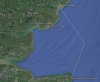
Re DarloRich's "74.5 miles": I find that the Ordnance Survey opines that Great Britain's furthest point from the sea is a little less than that distance, therefrom. O.S. offers in this context, a location just outside Coton in the Elms, near Burton-on-Trent -- giving as 70 miles, its distance from the sea: "the sea" being defined here as the most south-westerly point of the Wash, not far from Boston. Again, opinions are likely to differ as to where this particular marine inlet becomes, indubitably, the sea proper...
 
Last edited:

AlterEgo

Veteran Member
Joined
30 Dec 2008
Messages
20,258
Location
No longer here
I was always told the sea started when the water in the river became tidal. Hence Southend is definitely a seaside resort.
 

Howardh

Established Member
Joined
17 May 2011
Messages
8,191
I was always told the sea started when the water in the river became tidal. Hence Southend is definitely a seaside resort.

I agree with that, usually marked by a change in line on an O/S map. Could also argue if it's salty, it's the sea!
 

Calthrop

Established Member
Joined
6 Dec 2015
Messages
3,307
I was always told the sea started when the water in the river became tidal. Hence Southend is definitely a seaside resort.

Respectfully -- that definition can lead to absurd propositions. With the Ordnance Survey's "furthest from the sea" in my post just upthread: the article from which that info taken, includes a "rider" as follows: "to be highly technical, the nearest high tide point is on the River Trent, which is a tidal river. Using this definition, the nearest high tide point to [the place near Coton in the Elms] is at Cromwell Lock, north of Newark in Nottinghamshire, 45 miles [away]" -- and way, way inland.

(Rapid-fire discussion -- two intervening posts as I was composing this one !)
 
Last edited:

DarloRich

Veteran Member
Joined
12 Oct 2010
Messages
29,307
Location
Fenny Stratford
One tends to feel that Great Britain's many coastal nooks and crannies indeed offer a fair number of potential grey areas as to what is, or isn't, the sea. For instance, re the Bristol Channel as cited by clappers: the River Severn estuary which becomes the Bristol Channel, goes -- narrowing as it does -- a long way in the opposite, inland, direction. West of what point, does this body of water qualify without doubt, as "the sea"? -- as with clappers's musing about Minehead. (Weston-Super-Mare, as per its name, clearly considers that it ranks as a seaside place.)

I have self imposed rule of thumb. Draw a line between the two most outlying headlines and once past that line you enter the sea. In the case of Southend draw a line between Shoeburyness & Sheerness. Left of the line= estuary. Right = sea.

I am sure geographers will have a better definition.
 

Quakkerillo

Member
Joined
23 Jan 2015
Messages
553
I have self imposed rule of thumb. Draw a line between the two most outlying headlines and once past that line you enter the sea. In the case of Southend draw a line between Shoeburyness & Sheerness. Left of the line= estuary. Right = sea.

I am sure geographers will have a better definition.

I am a geographer, and in my Masters at the moment. But I also haven't learned the *exact* border, and I also don't think it's that clear in any way. Tidal movements can move up quite far upstream, so that'd move the 'sea' up into London, which is bonkers. Using the end of the river flow (mix of salt/freshwater) also doesn't work, as that would make large parts of seas where rivers with high outputs flow into suddenly 'fluviatile'.
The whole estuary where salt and freshwater mix is often seen as the border, so this would in the case of my Southend example extend both outwards into the sea during low-tide, high-output from the Thames, and inwards to London during high-tide, Low-output Thames. With that, I'd approximated the mental sea-river border to be Canvey - Allhallows, but it could also be a bit more East, depending how strict you'd be and where you'd average out the sea-river influence.
 

pemma

Veteran Member
Joined
23 Jan 2009
Messages
31,474
Location
Knutsford
This thread should be renamed "Geographical Misapprehensions No One Bothers To Check".

Before the Internet things were more difficult to check. Now the Internet does exist it contains a large volume of inaccurate information, alongside accurate information.
 

meridian2

Member
Joined
2 Nov 2013
Messages
1,186
Tidal movements can move up quite far upstream
Indeed, it would make cities like York and Nottingham coastal resorts! Before the building of weirs tidal movements could be detected even further upstream. Sea fish tolerant of high salinity water like mullet and particularly flatfish can be found many miles inland, and sturgeon are on record of travelling to central England.

Darlo's headland criterion seems about right.
 

Calthrop

Established Member
Joined
6 Dec 2015
Messages
3,307
That makes Wisbech a seaside resort and Peterborough was until 1937.

Introducing a bit of frivolity (this whole thing strikes me as one of those areas where basically "you pays your money and you takes your choice") -- as a small kid, I definitely imagined Wisbech as a seaside resort: a place on the beach; where there was an attraction involving your paying the agreed fee, to be excitingly whizzed around.
 

Ianno87

Veteran Member
Joined
3 May 2015
Messages
15,215
No, because the Thames is only tidal as far as Teddington weir a mile or so further downstream. The Thames is not tidal at Kingston.

Ah yes - I was assuming Teddington weir was 'country' side of where the river passes Kingston. Still makes most of London a seaside resort though!
 

AM9

Veteran Member
Joined
13 May 2014
Messages
14,272
Location
St Albans
The Thames has three sections in river flow terms:
a) the non-tidal river upstream of Teddington Lock, (presumably if the man-made lock wasn't there the tide would extend slightly further upstream
b) the Thames Tideway, i.e. that which acts as a river subject to flow variations caused by tides. This runs from Teddington Lock downstream to the Essex-Kent channel, (i.e. between Canvey Island and the Hoo Peninsula in North Kent.
c) the Thames Estuary, i.e. that part of the river that is where the unified flow merges with the sea movements of the North Sea. This a large area effectively starting at the eastern end of the Tideway, and extends eastwards. The Thames Estuary is characterised by large sandbanks and areas of salt marshes on London Clay paticularly on the Essex side, which are part of the river's hydrology. This greater estuary engulfs several other minor estuaries including the Crouch, Blackwater, Medway, Swale and Colne. Geology confirms that these minor estuariy marshes are continuations of London Clay deposits. It was proposed that for scientific purposes, the eastern limit of the estuary should be defined by a line drawn between North Foreland in Kent to Harwich Point (or whatever the harbour entrance is called locally), via the Kentish Knock shoal.
I have attached a .jpg of this line drawn in Google Earth. The Kentish Shoals are about 29 miles east of the Dengie Flats near Southminster in Essex. This puts the end of the pier at Southend-On-Sea about 33 miles from the nearest part of the North Sea, (at North Foreland).
This definition may be a far larger estuary than popular culture maintains, but consider the position of Whitstable, Herne Bay and Margate, which are really still at the mouth of the Thames when looked at from afar. If there was much further deposition of sand in the estuary, the Thames could embrace a Delta like many greater rivers in the world.
 

Attachments

  • Eastern Limit of Thames Estuary.jpg
    Eastern Limit of Thames Estuary.jpg
    109 KB · Views: 27

Bald Rick

Veteran Member
Joined
28 Sep 2010
Messages
29,221
Re the sea. I have a simpler definition. If it's blue on google maps satellite view, it's the sea. If it's beige, it's river.

Now, the Bristol Channel / Atlantic border is officially at a line drawn between St Govan's Head and Hartland point. I have spent many a family holiday east of that line and it was definitely the seaside. So there! (It's also blue on Google).
 

Cowley

Forum Staff
Staff Member
Global Moderator
Joined
15 Apr 2016
Messages
15,795
Location
Devon
Re the sea. I have a simpler definition. If it's blue on google maps satellite view, it's the sea. If it's beige, it's river.

Now, the Bristol Channel / Atlantic border is officially at a line drawn between St Govan's Head and Hartland point. I have spent many a family holiday east of that line and it was definitely the seaside. So there! (It's also blue on Google).

Yes. The Bristol Channel Express going to Ilfracombe just wouldn't have had the same ring to it. :)
I see Clevedon near Bristol considers itself a seaside town whereas Severn beach the other side of the Avon is obviously on the Severn which I've always considered as starting/ending once the Usk, Avon and Wye rivers have all joined.
Croyde Bay and Woolacombe feel very much like the Atlantic coast to me but once you go around the corner towards Ilfracombe, Lynmouth etc you start to see Wales and it would seem to me to be the Bristol Channel.
Interesting thread this.
 

Calthrop

Established Member
Joined
6 Dec 2015
Messages
3,307
I always liked Henry Williamson's name for the Bristol Channel (a lot of his writings, set in the areas just south of same) -- The Severn Sea.
 

AM9

Veteran Member
Joined
13 May 2014
Messages
14,272
Location
St Albans
Re the sea. I have a simpler definition. If it's blue on google maps satellite view, it's the sea. If it's beige, it's river.

Now, the Bristol Channel / Atlantic border is officially at a line drawn between St Govan's Head and Hartland point. I have spent many a family holiday east of that line and it was definitely the seaside. So there! (It's also blue on Google).

Google Maps' arbitrary colour scheme for water does not represent any definition of sea vs lake vs river etc.. Just look at the Isle of May sitting some 5 miles SE off the Fife coast at Anstruther. despite being right at the limit of the Firth of Forth estuary, it is surrounded by a (green coloured) river, yet over 32 miles WSW of that, there is a bit of blue (must be sea by your rules) off Dalgety Bay, just short of the Forth Rail Bridge. Indeed, some of the 'sea' areas on Google Maps have orthogonal shapes, hardly representative of any natural geographical feature or even just a definition of it. In practice, it just shows the edge of a particular satellite camera frame.
 

341o2

Established Member
Joined
17 Oct 2011
Messages
1,907
The double high tide in Southampton water and the Solent.

Bishop Rock lighthouse is the westernmost point of England, the Scillies are 28 miles west of Land's End.

The ARC quarries at Newlyn had England's most western rail system
 

341o2

Established Member
Joined
17 Oct 2011
Messages
1,907
When is an estuary not an estuary? Is Whitstable a seaside town or a river town? What about Minehead? I'd have guessed the Bristol Channel was Milton Keynes' nearest bit of sea, but that may say more about my geographic instincts.

I'm reminded of an episode of Have I got News for You some 20 years ago, when Hull was declared a seaside city, the main reason was apparently to enable raw sewage to be discharged into the Humber. The suggestion was that those responsible should be thrown into the river, but who would notice a few extra turds floating in the water
 

Jonny

Established Member
Joined
10 Feb 2011
Messages
2,562
The most southerly part of Scotland, part of RSPB Mull of Galloway, is pretty much 54 degrees 38 minutes of latitude, putting it slightly south of Hartlepool - and even South Gare Lighthouse, which marks the most northerly part of ceremonial Yorkshire.
 

DynamicSpirit

Established Member
Joined
12 Apr 2012
Messages
8,169
Location
SE London
Crystal Palace Triangle, is the only point in London where the boundaries of five boroughs meet. They are: Southwark; Lambeth; Lewisham; Bromley; Croydon.

Ordnance Survey election maps seems to show otherwise...
 

Attachments

  • Crystal-palace-boundaries.gif
    Crystal-palace-boundaries.gif
    122.7 KB · Views: 44

TheEdge

Established Member
Joined
29 Nov 2012
Messages
4,489
Location
Norwich
Has someone already done OS grid square SE8322. The dullest emptiest of all the grid squares.
 

Calthrop

Established Member
Joined
6 Dec 2015
Messages
3,307
Has someone already done OS grid square SE8322. The dullest emptiest of all the grid squares.

In the matter of “rather vacant featureless places with not a lot going on”: I’m indebted to the naturalist Mark Cocker in his book Crow Country, for his description of the triangle of land some three miles by three by two, south-west of Great Yarmouth, which he calls “Haddiscoe Island”: an island, in that it lies between the rivers Yare and Waveney, and the artificial waterway made in 1835, linking the two. Per the road atlas, “a great green area of nothing” – no roads, no villages. Cocker writes of the “island” as containing “very few buildings, no trees and no contours”; he continues: “there is just a single straight road going nowhere and it is unpeopled apart from three homesteads”. He goes on to mention, “this landscape has been disfigured by a regiment of monstrous electricity pylons. It is inconceivable that the Lakes or the Cotswolds would have been violated in this way... Haddiscoe...not ...considered a landscape, more a void...to be treated any old how.”

Per Mr. Cocker, a splendid place for wildlife; and from his description, one which I feel inclined to visit, just for its seeming sheer eerie “nothingness”. The “island” itself has always been railway-less; though the Norwich – Lowestoft rail route closely follows the western bank of the abovementioned artificial waterway between Reedham and Haddiscoe stations; and the remote Berney Arms station and its associated pub -- often mentioned on these Forums -- lie on the opposite side of the Yare near the area’s northernmost point.
 
Status
Not open for further replies.

Top