• Our booking engine at tickets.railforums.co.uk (powered by TrainSplit) helps support the running of the forum with every ticket purchase! Find out more and ask any questions/give us feedback in this thread!

Railways that are now roads

Status
Not open for further replies.

Jagdpanther

Member
Joined
31 Oct 2016
Messages
54
The A690 into Durham-from the A1(M) to Gilesgate roundabout is built on the alignment of a branch from the Leamside Line to Durham Gilesgate station (itself now part of a Travelodge hotel).
The A66 built on the Stainmoor line has been mentioned but another part of the line became an access road from Lartington to Cat Castle quarry beside Deepdale viaduct. Only the abutment of the viaduct remain but Lartington West signal box still stands on the side of the road by the now disused quarry entrance.
 
Sponsor Post - registered members do not see these adverts; click here to register, or click here to log in
R

RailUK Forums

Wirewiper

Member
Joined
14 Nov 2017
Messages
612
Location
BET & TQY
Parts of the A38 around Chudleigh and between Ashburton and Buckfastleigh are built on former railway alignments - in fact there is a "Chudleigh Station" named junction on the site of the old Station.

Monks Way (A382) through Bovey Tracey follows the alignment of the former Moretonhampstead Branch (which still exists as a freight line between Newton Abbot and Heathfield although - I believe - currently mothballed). The road runs immediately behind the old Bovey Tracey Station building, where the platforms would have been; the Station building now houses the town's museum.

The A374 Gdynia Way in Plymouth is also built on the alignment of part of former branch line. EDIT: just looked it up, it was the Sutton Harbour branch.

Over in Lincolnshire much of the A16 between Pinchbeck and Boston follows the route of the East Lincolnshire Railway. The station building of the former Sutterton and Algarkirk Station still stands next to the road just past the roundabout junction with the A17 and can be clearly seen, it is now in use as business premises. Another reminder of the railway is Station Road in Kirton. All along this stretch it is possible to discern minor roads crossing the A16 which would clearly have had level crossings in the past.

In Stanmore, Greater London, September Way is built on the site of the former LNWR Stanmore (latterly Stanmore Village) Station and goods yard. It is said that the road was named because Stanmore Village closed to passengers in September 1952, and to goods in September 1964.
 
Last edited:

Wirewiper

Member
Joined
14 Nov 2017
Messages
612
Location
BET & TQY
Another one - in Reading, the A33 Relief Road from the Inner Distributor Road down to about Rose Kiln Lane occupies part of the former Reading Central Goods Depot and the Coley Branch. The bridge which carries the A4 Berkeley Avenue across is originally a railway-era structure, which did not need to be rebuilt to accommodate the new road. Most of the rest of the branch up to Southcote Junction is now used as a public footpath.

Reading Central Goods Depot and the Coley Branch opened in 1908 to provide freight facilities to the South of the town, as the existing facilities to the north were inconveniently situated for a lot of companies. It was built on land which had previously been used as Canal Company warehousing and wharves. The Depot closed in June 1985, although much of it had been disused since 1969.
 

Kendalian

Member
Joined
30 Mar 2016
Messages
249
A85 east of Crianlarich.
A6071 Melrose by pass
Callander station site now a car park
 

hexagon789

Veteran Member
Joined
2 Sep 2016
Messages
15,785
Location
Glasgow
Part of the Glenfarg route (once the main routing for trains from Edinburgh to Perth) is under the M90. The railway trackbed likely made a good foundation to build the motorway on.
 

Springs Branch

Established Member
Joined
7 Nov 2013
Messages
1,430
Location
Where my keyboard has no £ key
Not a public road in the normal sense, the Leigh Guided Busway follows the route of dismantled railway between Leigh town centre and Ellenbrook.

(A little further along the same railway alignment in Eccles is a residential street named Stanier Avenue)
 

47271

Established Member
Joined
28 Apr 2015
Messages
2,983
The A94 through Coupar Angus follows the old Caledonian Main Line for a reasonable distance.
 

Wirewiper

Member
Joined
14 Nov 2017
Messages
612
Location
BET & TQY
Bing maps gives five streets named "Beeching Close". How many are disused railways?

There's a Beechings Way in Alford, Lincolnshire, that includes the former Station building, now in use as business premises. The area around is known as Beeching Industrial Estate and looks like it was built on former railway land (the East Lincolnshire Railway route between Firsby and Grimsby, including the branch line to Mablethorpe, closed in October 1970). The A1104 Station Road would have crossed the line on a level crossing here.
 

33017

Member
Joined
9 Sep 2017
Messages
273
One of the more entertaining examples is the former Mid Wales Line between (roughly) Llanstephan and Aberedw. The northern half forms part of the B4567 while the southern two miles or so is un-numbered. You drive over and under railway bridges and it's not difficult to imagine it as a railway. As an added bonus, the former Erwood station midway along this section has a cafe, art gallery, plinthed industrial diesel plus a couple of grounded clerestory coaches.
 

Calthrop

Established Member
Joined
6 Dec 2015
Messages
3,305
Bing maps gives five streets named "Beeching Close". How many are disused railways?

There's a Beechings Way in Alford, Lincolnshire, that includes the former Station building, now in use as business premises. The area around is known as Beeching Industrial Estate and looks like it was built on former railway land (the East Lincolnshire Railway route between Firsby and Grimsby, including the branch line to Mablethorpe, closed in October 1970). The A1104 Station Road would have crossed the line on a level crossing here.

I understand that in Countesthorpe, Leicestershire, there is a Beeching Close -- near the site of Countesthorpe's station, on the Rugby Midland -- Leicester line, closed w.e.f. 1 / 1 / 1962. A "pet peeve" of mine here: this closure predates the Beeching Report, which appeared early in 1963 (and presumably didn't recommend withdrawal of services on lines already closed -- unless I'm mistaken there). Many people tend to attribute "all and any" rail passenger closures in Great Britain, to "Dr. Beeching" -- I feel that the poor old devil shouldn't be blamed for stuff with which he was not in fact involved.
 

Ianno87

Veteran Member
Joined
3 May 2015
Messages
15,215
Leigh bypass
A short bit north of Selby on the former York route
The Cambridgeshire Guided Busway (the end at Cambridge North station is a standard road)
 

FGW_DID

Established Member
Joined
23 Jun 2011
Messages
2,728
Location
81E
Bing maps gives five streets named "Beeching Close". How many are disused railways?

The former Station House of Upton & Blewbury Station on the Didcot, Newbury & Southampton Railway is now a private residence, it and the new build houses that surround it are situated on ‘Beeching Close’ which itself runs off ‘Station Rd’.

Beeching Close however is a new build road and is not on the old railway alignment. (Next to it but not on it)
 
Joined
7 Dec 2012
Messages
135
Bexhill West Branch from Bexhill to Powdermill Stream - now the Hastings to Bexhill A2690 link road (even uses 2 old railways bridges in the cutting).

The link road actually goes under 3 old bridges, which are (from South to North) Woodsgate Park (https://mapstreetview.com/#u9vwt_a26l_12.a_-3g42), Ninfield Road, which was located by the London end of the old station at Sidley (https://mapstreetview.com/#u9zed_a62o_1s.a_-4g42) and Glovers Lane (https://mapstreetview.com/#ua13f_a8xk_1h.a_-2g42) Of these Woodsgate Park and Ninfield Road have both had a new deck whilst Glovers Lane still appears to be in original condition.

Paul
 

341o2

Established Member
Joined
17 Oct 2011
Messages
1,906
One "Beeching Close" is on the site of the former Halwill Junctioln station Devon
 

341o2

Established Member
Joined
17 Oct 2011
Messages
1,906
I understand that in Countesthorpe, Leicestershire, there is a Beeching Close -- near the site of Countesthorpe's station, on the Rugby Midland -- Leicester line, closed w.e.f. 1 / 1 / 1962. A "pet peeve" of mine here: this closure predates the Beeching Report, which appeared early in 1963 (and presumably didn't recommend withdrawal of services on lines already closed -- unless I'm mistaken there). Many people tend to attribute "all and any" rail passenger closures in Great Britain, to "Dr. Beeching" -- I feel that the poor old devil shouldn't be blamed for stuff with which he was not in fact involved.

Indeed, several lines were abandoned by the Big 4, principally in the 30's. the GWR closed 51 lines, LMS 102, LNER 80 and Southern 17 (passenger lines). Two of the Southern's were replaced by new lines (Ramsgate & New Romney).

Canterbury & Whitstable,
Fort Brockhurst to Lee on Solent,
Hurstbourne to Fullerton,
Basingstoke to Alton,
Brighton to Kemp Town
Botley to Bishop's Waltham
Chichester to Midhurst
Christchurch to Ringwood
Lynton & Barnstaple are all examples.

Furthermore, recommendations to close the entire former Southern network west of Salisbury and GWR west of Plymouth were thankfully not carried out

Then there were the post Beeching closures, such as Ilfracombe, Swanage and Bridport
 

randyrippley

Established Member
Joined
21 Feb 2016
Messages
5,132
.....................Then there were the post Beeching closures, such as Ilfracombe, Swanage and Bridport

Bridport wasn't a post-Beeching closure, it was a delayed Beeching closure because none of the local bus companies were prepared to run a rail replacement service over the Dorset lanes
 

krus_aragon

Established Member
Joined
10 Jun 2009
Messages
6,045
Location
North Wales
It's ROATH not 'dairy'. Don't understand why it came out like that.
I suspect you were typing by swiping across a touchscreen keyboard. Such keyboards' software tries to interpret swipes as a sequence of letters that makes a word that it's familiar with. (R is near D, o is near i, t is near r, h is near y.) Clearly it didn't know of Roath.
 

Calthrop

Established Member
Joined
6 Dec 2015
Messages
3,305
Indeed, several lines were abandoned by the Big 4, principally in the 30's. the GWR closed 51 lines, LMS 102, LNER 80 and Southern 17 (passenger lines). Two of the Southern's were replaced by new lines (Ramsgate & New Romney).

Canterbury & Whitstable,
Fort Brockhurst to Lee on Solent,
Hurstbourne to Fullerton,
Basingstoke to Alton,
Brighton to Kemp Town
Botley to Bishop's Waltham
Chichester to Midhurst
Christchurch to Ringwood
Lynton & Barnstaple are all examples.

Furthermore, recommendations to close the entire former Southern network west of Salisbury and GWR west of Plymouth were thankfully not carried out

Then there were the post Beeching closures, such as Ilfracombe, Swanage and Bridport

The ultimate first-hand Beeching mis-attribution which has come my way, was some years ago when visiting the Dean Forest preserved line -- travelling on same north of Lydney (Town), overheard a fellow-passenger claiming said line to have closed under Beeching. Er... that particular stretch of railway had its passenger service withdrawn in 1929, when "Dr.-to-be" Richard Beeching was all of sixteen years old. He might perhaps have been even then, nursing adolescent rail-holocaust fantasies; but it's generally reckoned that in properly conducted societies, thought-crime is not punishable :E ...
 

341o2

Established Member
Joined
17 Oct 2011
Messages
1,906
Padstow station site is now a car park, while Newport (IOW) has been cleared for road improvements rather like Ringwood
 

martin2345uk

Established Member
Joined
21 Sep 2011
Messages
2,056
Location
Essex
Stockport Tiviot Dale - Cheshire Lines Committee. Now part of the M60 (M63) Motorway.

I don't think the motorway was built along the alignment but just to the south of it.


The A414 in Maldon, Essex, is built on the trackbed of the Witham-Maldon branch and the Maldon-South Woodham Ferrers one.
 

muddythefish

On Moderation
Joined
13 May 2014
Messages
1,576
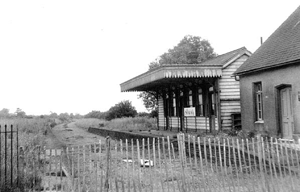
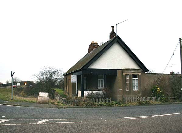
A605 Oundle bypass from Barnwell station (still in existence next to the road - see before and after below) to Oundle has been built on the former Peterborough-Northampton Nene Valley route.

barnwell_alsop(6.1967)1.jpg


barnwell_alsop(michael_lumb1.2006)4.jpg
 

Ken H

On Moderation
Joined
11 Nov 2018
Messages
6,297
Location
N Yorks
Old Furness Road in Coniston, Cumbria is built on the bit of the Coniston branch beyond the station

Think there was a goods yard there for the slate and minerals mined on the Old Man.
 

m94x

Member
Joined
6 May 2018
Messages
5
Central-Station-Great-Northern-Railway-300x183.jpg s-l300.jpg 3470121555_8cf552d381_b.jpg images.jpg l.png hqdefault.jpg Station hotel (2).jpg Dewsbury Central Station.jpg Not necessarily an entirely railway line itself, but the old Dewsbury Central Station (GNR) with the railway line running across the bridge was converted from the railway line to a newly built ring road (Dewsbury Ring Road) in the 70's. The facade of the station still exists, albeit the station itself being closed in 1964 and apparently filled in to some extent to support the ring road above it.
 

FGW_DID

Established Member
Joined
23 Jun 2011
Messages
2,728
Location
81E
Roger Dudman Way that runs right behind Oxford Station used to be former sidings and runs to the flats that are built on part of the former Oxford MPD & sidings.
Venneit Close which runs off Roger Dudman Way is the former turntable area

1D0994F1-D2BF-4E04-9196-F7FD28083CD9.jpeg
 

tomatwark

Member
Joined
22 Jan 2013
Messages
64
The Melrose by pass is the A6091

This may be a case of railway turned to road and then road turned to railway if the Borders Railway is extended to Hawick.

Kelso by pass is build on the line between Tweedmouth and the Waverley route.
 

Wirewiper

Member
Joined
14 Nov 2017
Messages
612
Location
BET & TQY
I've thought of another one (apologies if it is already in this thread):

Part of the A226 Thames Way in Northfleet and Gravesend follows the course of the Gravesend West branch. This is the same branch that at the other end was rebuilt as a temporary link to HS1.
 
Status
Not open for further replies.

Top