Ambient Sheep
Member
- Joined
- 28 Jul 2015
- Messages
- 111
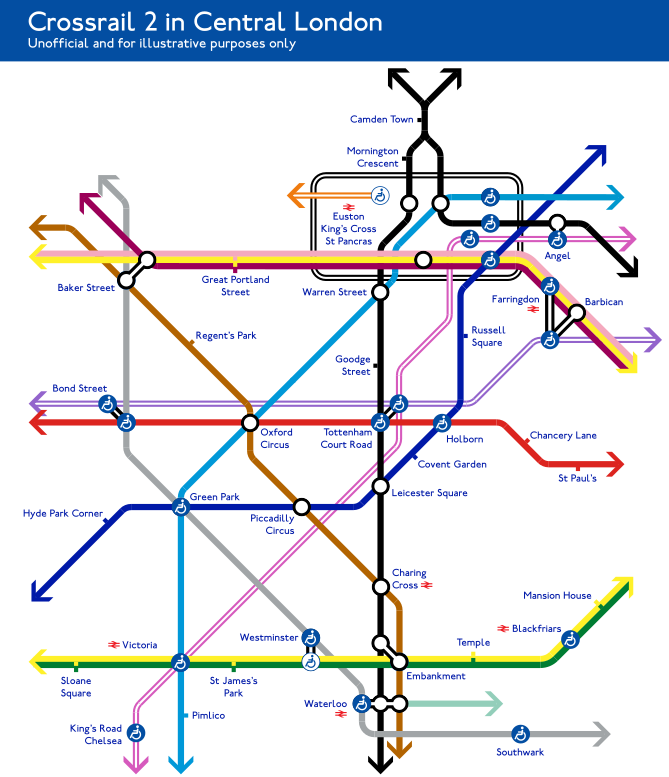
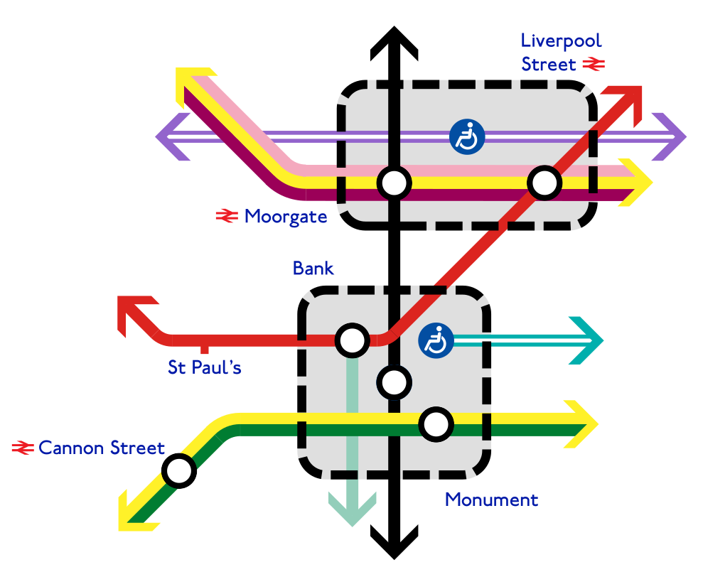
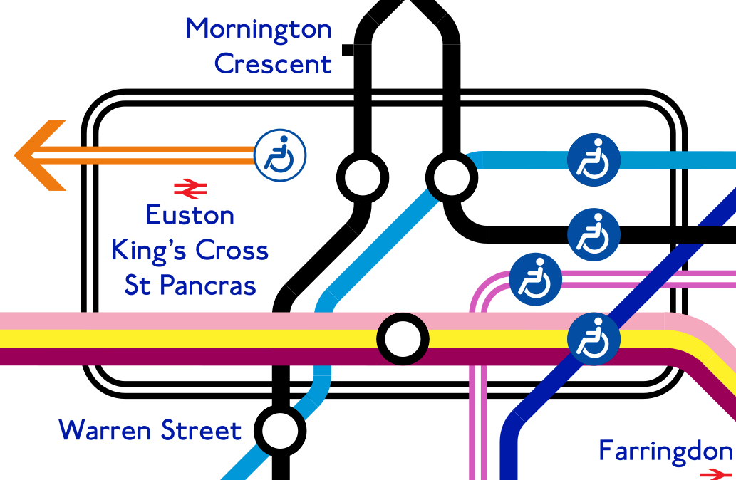
I'm loving this... great work! I quite like your interchange box idea too.
But I guess mentioning the future Northern Line split would just be evil, wouldn't it? Since (I don't think) we yet know how the colours will go you can't really do anything more anyway...
But I guess mentioning the future Northern Line split would just be evil, wouldn't it?


")