Thanks. I’m aware the weather will be clear on Friday but might still be flooding, trees on line etc, particularly as my journey is within the amber warning area.Should be clearer by Friday evening. Current advice is just to check your travel / route regularly.
-
Our new ticketing site is now live! Using either this or the original site (both powered by TrainSplit) helps support the running of the forum with every ticket purchase! Find out more and ask any questions/give us feedback in this thread!
You are using an out of date browser. It may not display this or other websites correctly.
You should upgrade or use an alternative browser.
You should upgrade or use an alternative browser.
Storm Ciarán: Weather related disruption 1/2 November
- Thread starter bramling
- Start date
- Status
- Not open for further replies.
Sponsor Post - registered members do not see these adverts; click here to register, or click here to log in
R
RailUK Forums
Thanks. I’m aware the weather will be clear on Friday but might still be flooding, trees on line etc, particularly as my journey is within the amber warning area.
Yep that's true - again its impossible to know the exact impact so I'd check the route a few times a day and the SWR website periodically just to be sure.
Don't you think it will be too late to change plans by then?Should be clearer by Friday evening. Current advice is just to check your travel / route regularly.
Don't you think it will be too late to change plans by then?
SWR are already running some shuttles on Thursday. They are also advising passengers can defer to 3rd, which suggests the expectation of a reasonably normal service.
To keep our services operating safely, we will be running an amended timetable on parts of the South Coast and in the West of England on Thursday 2nd November:
Journey planners will be fully up to date on Thursday 2 November. You should check before setting off on your journey and double check your return journey.
- London Waterloo-Weymouth services will start and terminate at Bournemouth, with an hourly rail shuttle service between Bournemouth and Weymouth
- Services from Portsmouth Harbour to London Waterloo via Basingstoke will be altered after Basingstoke, calling at Woking only, with services in the opposite direction running as normal
- London Waterloo-Salisbury services will run once every hour
- Salisbury-Exeter St Davids services will run once every two hours
- Basingstoke-Salisbury shuttle services will be suspended
- Brockenhurst-Lymington Pier services will be suspended
- Island Line services will run hourly between Shanklin and Ryde St John’s Road, with buses replacing trains between Ryde St John’s Road and Ryde Pier Head
You may wish to consider if your journey on Thursday 2 November is entirely necessary and change your travel plans. If you do decide to travel, please check before you travel and allow extra time for your journey.
If you travel on Thursday morning, you should be aware that short notice changes to services may mean return journeys are delayed or cancelled. If you have a ticket for Thursday, you will be able to use this on Wednesday 1 November or Friday 3 November instead.
Southeastern also advising again travel on Thursday until 0900: https://twitter.com/Se_Railway/status/1719701838205714785
#StormCiarán will cause disruption to our services tomorrow and severe disruption is highly likely. We strongly advise that you do not attempt to travel on "Mainline" routes before at least 09:00. More information and advice available on our website https://bit.ly/40hkKHr
Last edited:
The forecasts are certainly looking grim - the lunchtime Shipping Forecast suggesting hurricane force winds are fairly likely in the area between Devon/Cornwall and Brittany and possible in a significantly wider area than that. Fortunately it looks like the worst of it will be somewhat restricted to the coasts but still this is a brutal storm.Southern are now suggesting people work from home. Suggestions are the air pressure will be some of the lowest in decades.
Storm Ciarán: England and Channel Islands prepare for disruption https://www.bbc.co.uk/news/uk-england-67271027
Sun Chariot
Established Member
Just back from another dog walk - and the coastal wind has certainly increased in the past 3 hours at Hampshire / West Sussex border. I think my Shepherd senses the air pressure drop - he's been very clingy and fractious since mid morning.
Bantamzen
Established Member
Folk may have come across it already, but the Met Office have a YouTube channel that's quite useful for stuff like this. Every Tuesday they upload a detailed video on the forthcoming forecast, not only giving an in-depth forecast but going into explaining why they are predicting what they are, and even showing other models used. Link below if anyone is interested:
kristiang85
Established Member
- Joined
- 23 Jan 2018
- Messages
- 2,711
Thanks. I’m aware the weather will be clear on Friday but might still be flooding, trees on line etc, particularly as my journey is within the amber warning area.
There's another system coming in right after Ciaran (likely to be called Debi), but isn't getting much attention whilst Ciaron is going on, but pressures look similarly low, however the isobars won't be as packed, so we should be OK from wind, however there will be more rain. And pretty much everywhere is saturated...
As for Ciaran, models are showing a worrying trend to slightly north, which would bring stronger winds to the south coast. Hopefully it will be clearer this evening, although we won't know for sure obviously until its upon us. A lot of the main models were underestimating the speed of the jet stream, which has made this particularly difficult to read.
Sleepy
Established Member
GA will have 50mph speed restriction on East Suffolk line, Felixstowe and Clacton line tommorow.
Trainguy34
Member
I've got a concert at the O2 tomorrow night, what are the likelihoods of me being able to get back to Kent on HS1 from Stratford Int'l? The last resorts are: Midnight coach from Victoria to Canterbury (008), arriving at 2am OR hotel in Stratford and get an early morning train on Friday Morning.
Looks like GWR are already putting in plans with this in mind. I can see a number of this evening's down services are planned to terminate at Plymouth or Exeter, with a shuttle service appearing to be planned between the two. This is leading to some interesting allocations on RTT currently, with 1C92 1803 Paddington-Plymouth allocated as 2x150s from Exeter onwards—makes sense to me as if there's a train I trust to pass Dawlish unimpeded by waves and sea spray, its a 150 and not an IET.It should be fun there this evening: (High tide at 2043, plus heavy rain and 57 mph wind S.Easterly...)
It's actually been a rather pleasant day in Devon so far, the skies are currently reasonably cloud-free though I can see a very substantial bank of cloud in the distance towards the west, a clear portent of the storm to come.
Techniquest
Veteran Member
I've got a concert at the O2 tomorrow night, what are the likelihoods of me being able to get back to Kent on HS1 from Stratford Int'l? The last resorts are: Midnight coach from Victoria to Canterbury (008), arriving at 2am OR hotel in Stratford and get an early morning train on Friday Morning.
From what I've seen, I'd be booking a hotel if you can and not risking it with transport. Just in case things go wrong, personally I'd rather be tucked up in a hotel tomorrow night than risking being out in the elements on a bus/coach/train and having a thoroughly unenjoyable experience.
Taken from LNER website:-LNER running amended timetable from tomorrow afternoon, details being updated and published later today.
As a result, we are expecting disruption to LNER services until at least Saturday 4 November. Customers are advised to avoid travel by train during this period if possible.
- Services between Newcastle and Edinburgh: From 15:00 on Thursday 2 November, an hourly train service will be running between Edinburgh and Newcastle, in both directions. This will be in place until the end of service on Friday 3 November. These train services will be subject to delays of up to 40 minutes due to a speed restriction in place on this route.
- Services between Edinburgh and Aberdeen: After 10:30 on Thursday 2 November until Saturday 4 November there will be no train services operating from Edinburgh to Aberdeen, in both directions.
- We strongly advise customers to avoid travelling on Thursday 2 November and Friday 3 November. Some LNER trains will be running, but there is likely to be major disruption including severe delays, short notice cancellations and overcrowding. There may be service alterations on Saturday 4 November as we work towards reinstating our normal timetable.
- If your journey is wholly with LNER, tickets dated Wednesday 1 November, Thursday 2 November or Friday 3 November are now valid for travel on any other LNER service up to, and including, Tuesday 7 November.
Howardh
Established Member
- Joined
- 17 May 2011
- Messages
- 9,169
As an aside, flight radar site shows eastbound planes flying with the wind over the Atlantic, gaining time, and those westbound flying much further north/south to avoid!
londonmidland
Established Member
I think another thing to consider is how easily flooding can occur. After all the rain we’ve had, it won’t take much for it to be an issue again.
Techniquest
Veteran Member
I think another thing to consider is how easily flooding can occur. After all the rain we’ve had, it won’t take much for it to be an issue again.
Very true that. With the rain already had here, I'm amazed some parts of Hereford aren't flooded already. The worst of it is due overnight/tomorrow I'm told, certainly the wind is due to make a very unpleasant appearance. It was bad enough today, so it's going to be another fun month. Not!
Sleepy
Established Member
1803 cancelled Paddington to Exeter (as is 1903) so travel West from London tonight won't be much fun.Looks like GWR are already putting in plans with this in mind. I can see a number of this evening's down services are planned to terminate at Plymouth or Exeter, with a shuttle service appearing to be planned between the two. This is leading to some interesting allocations on RTT currently, with 1C92 1803 Paddington-Plymouth allocated as 2x150s from Exeter onwards—makes sense to me as if there's a train I trust to pass Dawlish unimpeded by waves and sea spray, its a 150 and not an IET.
It's actually been a rather pleasant day in Devon so far, the skies are currently reasonably cloud-free though I can see a very substantial bank of cloud in the distance towards the west, a clear portent of the storm to come.
MasterSpenny
Member
LNER have had to cancel most there services north of Edinburgh, which are two Aberdeen services and a Stirling service
#LNERUpdate Due to forecasted severe weather, the following services on 02/11 will terminate at #Edinburgh 10:00 #LondonKingsCross to #Aberdeen 14:00 #LondonKingsCross to #Aberdeen 15:00 #LondonKingsCross to #Stirling
Snow1964
Established Member
The winds are expected to be much worse near Channel Islands and Normandy. The centre of the low (the quiet eye of the storm) is currently expected to track over Devon about 3am, over Wiltshire at dawn, then track over the Chilterns towards Norfolk by mid afternoon.
Of course these things can change track, and could be nearer London or further north towards Lincolnshire. But there is a risk of low intensification and what is often called a sting jet (where very cold air 2-3 miles altitude rushes towards the lower pressure at surface).
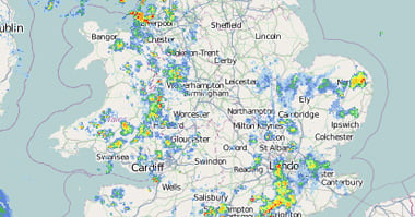
Couple of handy links, Wind and rain radar


 www.netweather.tv
Of course these things can change track, and could be nearer London or further north towards Lincolnshire. But there is a risk of low intensification and what is often called a sting jet (where very cold air 2-3 miles altitude rushes towards the lower pressure at surface).
Couple of handy links, Wind and rain radar


Weather Radar - Live UK Rainfall Radar | Netweather
Live weather radar for the UK including weather type to track whether rain, sleet or snow is falling. Updated every 5 minutes.
MP393
Member
The Heart of Wales (Shrewsbury - Swansea via Llandrindod) and Cowny Valley (Llandudno - Blaenau Ffestiniog) are closed completely tomorrow, and will remain so until at least mid morning Friday until proving runs can take place in daylight. There is also some other alterations to services between Shrewsbury & Machynlleth, and west of Carmarthen.
Russel
Established Member
The Heart of Wales (Shrewsbury - Swansea via Llandrindod) and Cowny Valley (Llandudno - Blaenau Ffestiniog) are closed completely tomorrow, and will remain so until at least mid morning Friday until proving runs can take place in daylight. There is also some other alterations to services between Shrewsbury & Machynlleth, and west of Carmarthen.
Going back to my previous post about the Conwy Valley being washed away by lunch time, it looks like TFW were thinking the same!
Overheard earlier from a XC and GW Highspeed driver at Exeter St Davids that IET's and Voyagers are to be completely barred along the Sea Wall this time, with Castle's and 150/158's and Turbo's picking up all. It certainly seems to be this way, with all services being operated by 150's and Castles currently.
 www.realtimetrains.co.uk
Appears to be this which died unfortunately...Well this took long (Exeter St Davids, On the Up):
Realtime Trains | 1A98 1904 Paignton to Exeter St Davids | 01/11/2023
Real-time train running information for 1A98 1904 departure from Paignton to Exeter St Davids on 01/11/2023. From Realtime Trains, an independent source of train running info for Great Britain.
But it’s made it past Dawlish which is more than previous IETs did in storm conditions!Overheard earlier from a XC and GW Highspeed driver at Exeter St Davids that IET's and Voyagers are to be completely barred along the Sea Wall this time, with Castle's and 150/158's and Turbo's picking up all. It certainly seems to be this way, with all services being operated by 150's and Castles currently.
Appears to be this which died unfortunately...
Realtime Trains | 1A98 1904 Paignton to Exeter St Davids | 01/11/2023
Real-time train running information for 1A98 1904 departure from Paignton to Exeter St Davids on 01/11/2023. From Realtime Trains, an independent source of train running info for Great Britain.www.realtimetrains.co.uk
Isnt west of St Austell closed anyway for resignalling work?GWR stopped running west of St Austell at 8pm. A reduced service is operating between Exeter and Plymouth
Services will resume midday tomorrow
They dont seem to have an answer to this failing, and I dont think a Yellow warning of rain is justification to scrap the service. - Amber or Red then fair enough. I did a quick check just now and LNER were happy to offer to sell me tickets for services that are not going to run.As with disruption earlier this week it seems no ticket acceptance arranged by LNER with Scotrail north of Edinburgh despite their service currently likely to run normally.
- Status
- Not open for further replies.

