Our booking engine at tickets.railforums.co.uk (powered by TrainSplit) helps support the running of the forum with every ticket purchase! Find out more and ask any questions/give us feedback in this thread!
I must say I'm very impressed! And there's me thinking that the small boats nearby may have thrown you a little as regards location ha ha. Anyway well done and over to you
You don't know how long I spent on it . When I came back to it and zoomed out I noticed the steepish hill and house on the left that you'd kept in the pic, and was reminded of the Windermere line straight away. Easy if you recognise it.
A small settlement on a main line, high bridge on the right implies hilly terrain so somewhere inland. But the West/East orientation was a red herring. Blair Atholl.
I don't think there are, but I didn't know that Wisbeach was one so I had to look through all OHLE lines on that alignment. Try this (I think it's quite hard)
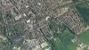
Google Maps won't let me turn labels off on my phone, so there's a red splodge instead, don't take anything from its lengh, I may or may not have lengthened it
Yes kind of, direction of the line and openish feel to the landscape plus the remains of the former RAF base buildings sort of gave it away really, not passed through for a few years now but still remember it well. See what you think about this one....
I think it's just a case of some track renewal or perhaps fresh ballast dropped recently around the time of the satellite image. A clue would be that it's a Northern operated station served only by their trains if that's of any help?
") , back to you
, back to you