-
Our booking engine at tickets.railforums.co.uk (powered by TrainSplit) helps support the running of the forum with every ticket purchase! Find out more and ask any questions/give us feedback in this thread!
You are using an out of date browser. It may not display this or other websites correctly.
You should upgrade or use an alternative browser.
You should upgrade or use an alternative browser.
Crossrail - Construction updates and progress towards opening (now expected 24 May 2022)
- Thread starter Taunton
- Start date
- Status
- Not open for further replies.

Sponsor Post - registered members do not see these adverts; click here to register, or click here to log in
R
RailUK Forums
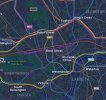
That shows the extent of the Network Area, where Network Railcards are valid - however, even after the extension which has been awarded to TfL, contactless won't be valid throughout the Area.I think one already exists in the London and the South East Map.
mattdickinson
Member
That's the map that should ultimately be uses, but it doesn't show contactless acceptance at the moment.I think one already exists in the London and the South East Map.
[QUOTE="kristiang85, post: 5656153, member: 59724"and is (for the most part) a tube map, not a map of TfL services.
[/QUOTE]
In practice it appears to be a map of TfL services that run on rails or cables. Whether that is what is should be is debatable but that is what it is and what it has been for a number of years. The one exception is that Thameslink was recently added to the map despite not being run by TfL.
[/QUOTE]
In practice it appears to be a map of TfL services that run on rails or cables. Whether that is what is should be is debatable but that is what it is and what it has been for a number of years. The one exception is that Thameslink was recently added to the map despite not being run by TfL.
kevin_roche
Member
- Joined
- 26 Feb 2019
- Messages
- 930
In this month's copy of Engineering and Technology from the IET.

Although to be fair there is some precedent in that the Waterloo & City has been on the map since the 1930s despite not being run by London Underground (or predecessor organisations) until 1994. Similarly, the Northern City Line remained on the map post transfer to British Rail, and in 1977 the North London Line from Richmond to Broad Street (later to North Woolwich) appeared on the map. Thameslink, between Kentish Tw and Elephant/London Bridge also did appear on the map from the late 1980s but was then removed.In practice it appears to be a map of TfL services that run on rails or cables. Whether that is what is should be is debatable but that is what it is and what it has been for a number of years. The one exception is that Thameslink was recently added to the map despite not being run by TfL.
The Northern line is actually quicker from Kings Cross St Pancras to London Bridge than TLRailUK, with most journeys timetabled for between 10-11 Mins, vs TLRailUK being 14/15 Mins.
When Thameslink was put on the map in January 2021, the accompanying media release said it was temporary, to support social distancing and also due to engineering works associated with the Bank upgrade.
I suppose it depends where you are coming from. If you enter the station it will be variable - given their vastness - and if you were connecting in off a National Rail services the long walking time to the tube needs to be factored in.
rd749249
Member
- Joined
- 15 Sep 2015
- Messages
- 171
Regarding Tuesday and given that trains will be running empty prior to launch, yesterday and today we were testing whether trains could have their doors inhibited as to ensure that nobody got on the trains prior to 06:30 whilst running under passenger headcodes. Whilst it is possible for the RFLI signaller to 'skip stations' as to avoid doors opening, it's a different story to both Paddington and Abbey Wood where skipping the station isn't possible. A potential solution is that drivers on Tuesday may be asked to adopt a different door mode for those first few trains, reverting to 'Auto open / manual close' after 06:30.RTT is just taking a feed of data which has some limitations.
If the operator opens the gates at the stations at 0630 and the drivers are instructed to open the doors at the first station they reach after 0630 it would be possible to do what is suggested on Twitter. (However, it would seem improbable to have passengers riding class 5 trains.)
Practically, that means that if a train is due to depart east or westbound at 06:29, it will skip that station and arrive at the next one ready to take passengers. So that means, all stations will have a train departing at 06:30 or a few minutes thereafter.
Stations will be open 10 minutes prior to the first departures to allow for access and crowd control. This is especially important for those stations with LU connections.
I calculate the first trains from 06:30 will be from Abbey Wood & Whitechapel westbound and Canary Wharf eastbound, given their departure times at always xx:x0
Also of course, Kings Cross St Pancras to London Bridge is one journey - anything involving the likes of Blackfriars, etc. will be different.I suppose it depends where you are coming from. If you enter the station it will be variable - given their vastness - and if you were connecting in off a National Rail services the long walking time to the tube needs to be factored in.
The Northern line is also substantially more frequent, especially from Kentish Town where the services have been cut back to hourly at some times of the day. I'm not sure if the May 22 changes have sorted this, but it is frankly pretty hopeless.The Northern line is actually quicker from Kings Cross St Pancras to London Bridge than TLRailUK, with most journeys timetabled for between 10-11 Mins, vs TLRailUK being 14/15 Mins.
Peter Sarf
Established Member
The basic problem is there are too many lines - shouldn't have built them !. So perhaps it is reality getting in the way. Answer is a few different maps - central section then a larger one covering greater London then another one covering out to the M25. The fact that the Elizabeth line goes all the way to Reading may or may not need to be reflected on any of those maps ?.Thameslink should now be removed from the map to keep it looking as simple as possible. Right now it’s almost overwhelming, especially for tourists.
Hiding services because they're not technically part of the underground is the opposite of being friendly to tourists.Thameslink should now be removed from the map to keep it looking as simple as possible. Right now it’s almost overwhelming, especially for tourists.
To them, Thameslink is identical to the Elizabeth line and the Overground, and not dissimilar to the sub-surface gauge parts of the Underground. Only the actual deep level stuff is obviously different to mainline stuff, but it appears on the same map, tickets work the same and it's all turn up and go.
If you've just arrived on Eurostar and are heading to a hotel near Elephant and Castle, your best option is going to be Thameslink. Why should that be hidden from the central train map, just because TfL haven't put their name to it?
Why would TfL advertise a service they don’t operate?Hiding services because they're not technically part of the underground is the opposite of being friendly to tourists.
To them, Thameslink is identical to the Elizabeth line and the Overground, and not dissimilar to the sub-surface gauge parts of the Underground. Only the actual deep level stuff is obviously different to mainline stuff, but it appears on the same map, tickets work the same and it's all turn up and go.
If you've just arrived on Eurostar and are heading to a hotel near Elephant and Castle, your best option is going to be Thameslink. Why should that be hidden from the central train map, just because TfL haven't put their name to it?
Quick reminder that this thread is about Crossrail's construction and (probably moreso now) preparations for opening - more general chat about how to improve the Tube map should go in this thread. 
DynamicSpirit
Established Member
Quick reminder that this thread is about Crossrail's construction and (probably moreso now) preparations for opening - more general chat about how to improve the Tube map should go in this thread.
After reading this, I went to open a thread to discuss the tube map - but I see there is already a thread in the tube subforum - was started last night: https://www.railforums.co.uk/threads/tfl-maps.232026/
SteelWeelApeal
Member
- Joined
- 24 Sep 2017
- Messages
- 265
What's the line speed of the central section (just out of curiosity)?
60mphWhat's the line speed of the central section (just out of curiosity)?
Another reminder that discussion on TfL Maps can be found here:
thanks
TfL Maps
New Tfl Maps released today. On the Tube map the Elizabeth Line is shown as a purple line with a white centre to distinguish it from tube line. The Barking Riverside extension is marked with a dashed line as 'opening soon' but it hasn't appeared on the Overground map yet. Thameslink lines...
www.railforums.co.uk
thanks
Snow1964
Established Member
60mph
They appear to have gone metric, all the speeds are in increments of 10km/h. The fastest is 100km/h (62mph), but there are sections limited to 80km/h, 90km/h etc
is the in cab signalling on the Cross Rail core, the same as used on LGV’s etc in europe? as I have see a sign, which is blue-Orange, and seems to point, on drivers view videos, on Cross Rail Core,and LGV’s etc in Europe. Was also wandering, what this sign means? Thanks for any info on this.
Last edited:
No, it's TrainGuard MT, which is quite different from the TVM430 system used on HS1 and the French LGVs. A moving block signalling system was required due to the desired 50 second headways and ETCS Level 2 isn't capable of providing that.is the in cab signalling on the Cross Rail core, the same as used on LGV’s etc in europe? as I have see a sign, which is blue-Orange, and seems to point, on drivers view videos, on Cross Rail Core,and LGV’s etc in Europe. Was also wandering, what this sign means? Thanks for any info on this.
swt_passenger
Veteran Member
- Joined
- 7 Apr 2010
- Messages
- 31,527
The Western SA pages covering the Westbourne Park area have translated them to mph, as you suggest there are 62, 56, and 50 speeds in mph in close proximity on the CCOS lines.They appear to have gone metric, all the speeds are in increments of 10km/h. The fastest is 100km/h (62mph), but there are sections limited to 80km/h, 90km/h etc
Elizabeth line now showing up on Apple Maps! In my view, Apple Maps shows transit lines in a much clearer and more elegant way than the Google alternative, and it’s a great chance to get a good feel of the geography of the new line.
Attachments
Thanks for this. I'm struggling to find mileages to/from Westbourne Park Junction. This junction's been in use for quite a while for trains between Old Oak Common depot and the CCOS (and presumably also by TfL trains between Ealing Broadway and Paddington). But I can't find Westbourne Park Junction on either RTT or Railmiles. However, both have Portobello Junction (London) more or less where Westbourne Park Junction is.Crossrail Central Operating Section (CCOS) which is the 'core' makes up most of the route to be used by Elizabeth line services that is not part of the Network Rail network.
It comprises Westbourne Park Junction to Abbey Wood and also the Shenfield branch up to Pudding Mill Lane junction immediately west of Stratford.
So I'm wondering is Portobello Junction being renamed Westbourne Park Junction? And what are the miles/chains to/from Westbourne Park Junction to/from Paddington (low level / TfL) if different from those to/from Portobello Junction.
Many thanks
Just a reminder this is an infrastructure thread for construction updates, thanks ")
To discuss anything else, please create a new thread (if there isn't one already)
Existing spin-off discussions include:
To discuss anything else, please create a new thread (if there isn't one already)
Existing spin-off discussions include:
Last edited:
kevin_roche
Member
- Joined
- 26 Feb 2019
- Messages
- 930
On RTT it is called Westboune Park CS https://www.realtimetrains.co.uk/search/detailed/gb-nr:WBRNPKS?stp=WVS&show=all&order=actualThanks for this. I'm struggling to find mileages to/from Westbourne Park Junction. This junction's been in use for quite a while for trains between Old Oak Common depot and the CCOS (and presumably also by TfL trains between Ealing Broadway and Paddington). But I can't find Westbourne Park Junction on either RTT or Railmiles. However, both have Portobello Junction (London) more or less where Westbourne Park Junction is.
So I'm wondering is Portobello Junction being renamed Westbourne Park Junction? And what are the miles/chains to/from Westbourne Park Junction to/from Paddington (low level / TfL) if different from those to/from Portobello Junction.
Many thanks
Looking at Google Maps it seems to be about 2000 ft from Portobello junction
Google Maps have also added Elizabeth line as the operator on the station departures section of the app. But they are still using the double arrow as station icons out West.Elizabeth line now showing up on Apple Maps! In my view, Apple Maps shows transit lines in a much clearer and more elegant way than the Google alternative, and it’s a great chance to get a good feel of the geography of the new line.
I think only on the stations that have interchange with GWRGoogle Maps have also added Elizabeth line as the operator on the station departures section of the app. But they are still using the double arrow as station icons out West.
- Status
- Not open for further replies.